File:1977 map of North Station yards.jpg
Jump to navigation
Jump to search
Size of this preview: 800 × 600 pixels. Other resolutions: 320 × 240 pixels | 640 × 480 pixels | 1,024 × 768 pixels | 1,280 × 960 pixels | 1,592 × 1,194 pixels.
Original file (1,592 × 1,194 pixels, file size: 208 KB, MIME type: image/jpeg)
Captions
Captions
Add a one-line explanation of what this file represents
Summary[edit]
| Description |
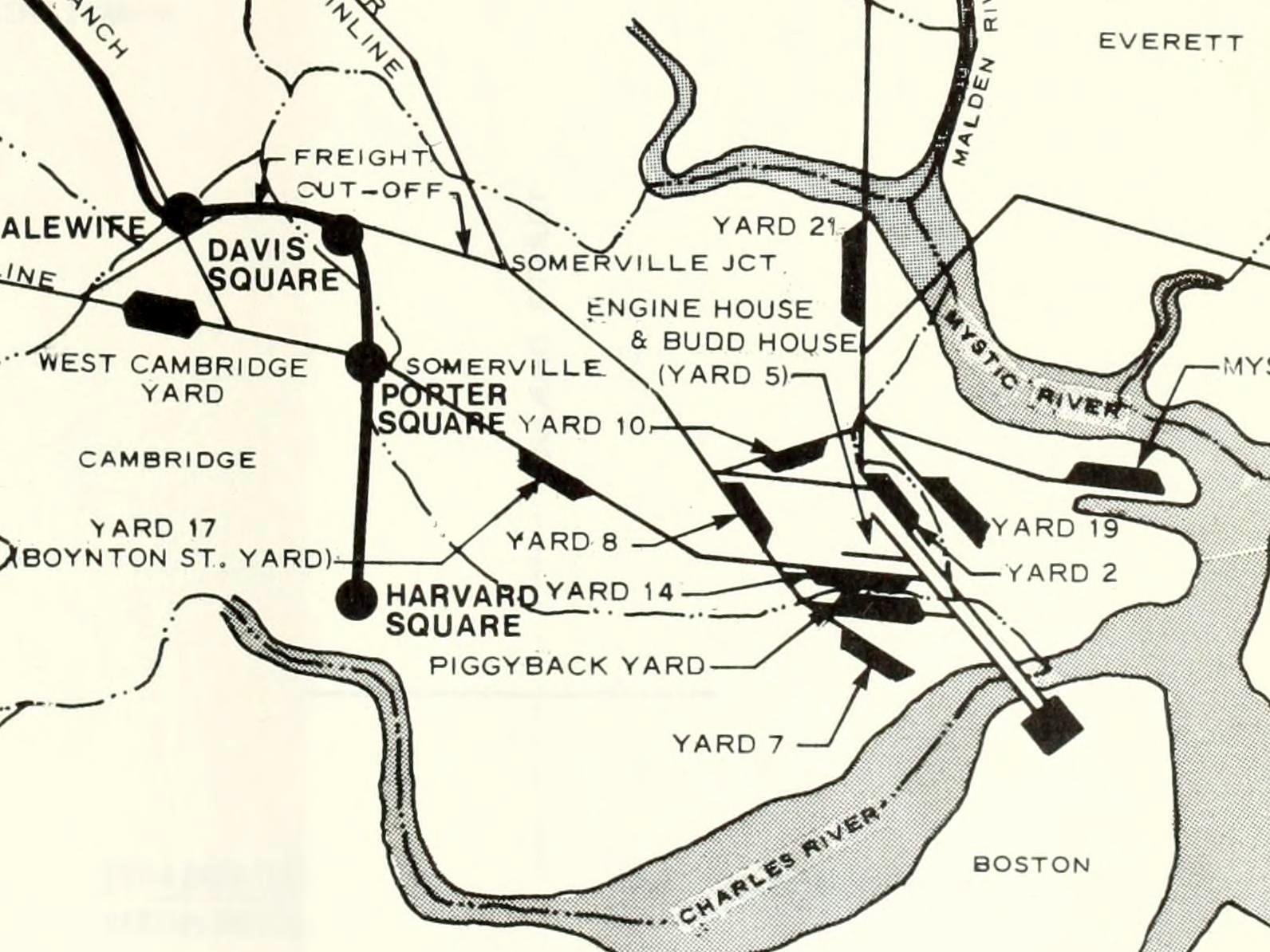
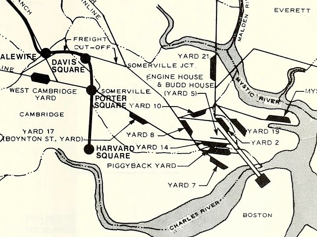
English: 1977 map of the various rail yards in the North Station area |
|||
| Date | ||||
| Source | Final Environmental Impact Statement: Red Line Extension, Harvard Square to Arlington Heights, Figure II-4 | |||
| Author | Urban Mass Transportation Authority | |||
| Permission (Reusing this file) |
|
File history
Click on a date/time to view the file as it appeared at that time.
| Date/Time | Thumbnail | Dimensions | User | Comment | |
|---|---|---|---|---|---|
| current | 00:22, 19 January 2020 | | 1,592 × 1,194 (208 KB) | Pi.1415926535 (talk | contribs) | {{Information |description ={{en|1=1977 map of the various rail yards in the North Station area}} |date =1977 |source =[https://archive.org/details/redlineextension01mass/page/n307 Final Environmental Impact Statement: Red Line Extension, Harvard Square to Arlington Heights], Figure II-4 |author =Urban Mass Transportation Authority |permission ={{PD-USGov-DOT}} }} Category:North Station yards Category:Rail transport maps of Massachusetts |
You cannot overwrite this file.
File usage on Commons
The following 4 pages use this file: