File:Airdevronsix Icefalls 2016.jpg
Jump to navigation
Jump to search

Size of this preview: 800 × 536 pixels. Other resolutions: 320 × 214 pixels | 640 × 428 pixels | 1,024 × 685 pixels | 1,280 × 857 pixels | 2,560 × 1,714 pixels | 3,872 × 2,592 pixels.
Original file (3,872 × 2,592 pixels, file size: 4.85 MB, MIME type: image/jpeg)
Captions
Captions
Add a one-line explanation of what this file represents
Summary
[edit]
| Description |
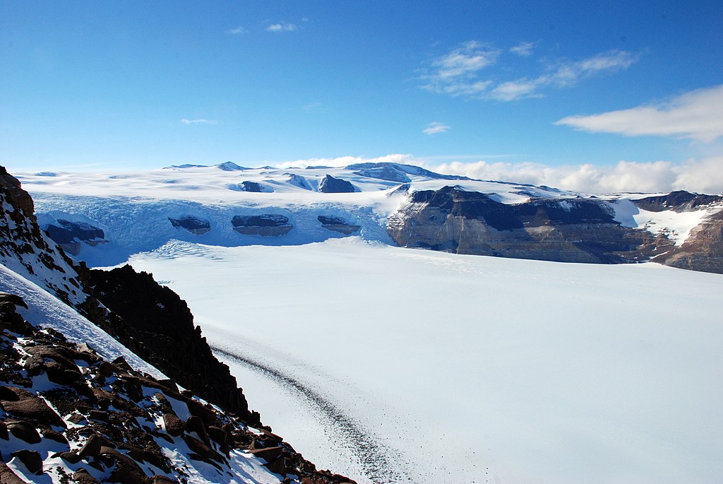
English: The Airdevronsix Icefalls are a line of icefalls at the head of Wright Upper Glacier, in Victoria Land. Named by U.S. Navy Operation Deep Freeze (1956-57) for U.S. Navy Air Development Squadron Six, which had been formed to provide air support for the Deep Freeze operations and which had also carried out many important Antarctic exploratory flights. This icefall, which measures approximately 3 miles (5 km) wide and 1,300 ft (400 m) tall, is formed by the glacier spilling from the Polar Plateau forming the Wright Upper Glacier as it flows into the Wright Valley below. |
| Date | |
| Source | https://photolibrary.usap.gov/PhotoDetails.aspx?filename=Airdevron_Six_Ice_Falls_2.jpg |
| Author | Elaine Hood, NSF |
Licensing
[edit]
| This image is a work of a National Science Foundation employee, taken or made as part of that person's official duties. As a work of the U.S. federal government, the image is in the public domain. |  |
File history
Click on a date/time to view the file as it appeared at that time.
| Date/Time | Thumbnail | Dimensions | User | Comment | |
|---|---|---|---|---|---|
| current | 18:26, 24 November 2022 | | 3,872 × 2,592 (4.85 MB) | Hubert Kororo (talk | contribs) | Uploaded a work by Elaine Hood, NSF from https://photolibrary.usap.gov/PhotoDetails.aspx?filename=Airdevron_Six_Ice_Falls_2.jpg with UploadWizard |
You cannot overwrite this file.
File usage on Commons
The following page uses this file:
File usage on other wikis
The following other wikis use this file:
- Usage on de.wikipedia.org
- Usage on en.wikipedia.org
- Usage on nn.wikipedia.org
- Usage on www.wikidata.org