File:Cigli-Airport-Diagram.png
Jump to navigation
Jump to search

Size of this preview: 391 × 599 pixels. Other resolutions: 156 × 240 pixels | 313 × 480 pixels | 501 × 768 pixels | 668 × 1,024 pixels | 1,336 × 2,048 pixels | 2,935 × 4,500 pixels.
Original file (2,935 × 4,500 pixels, file size: 443 KB, MIME type: image/png)
Captions
Captions
Add a one-line explanation of what this file represents
Summary[edit]
| Description |
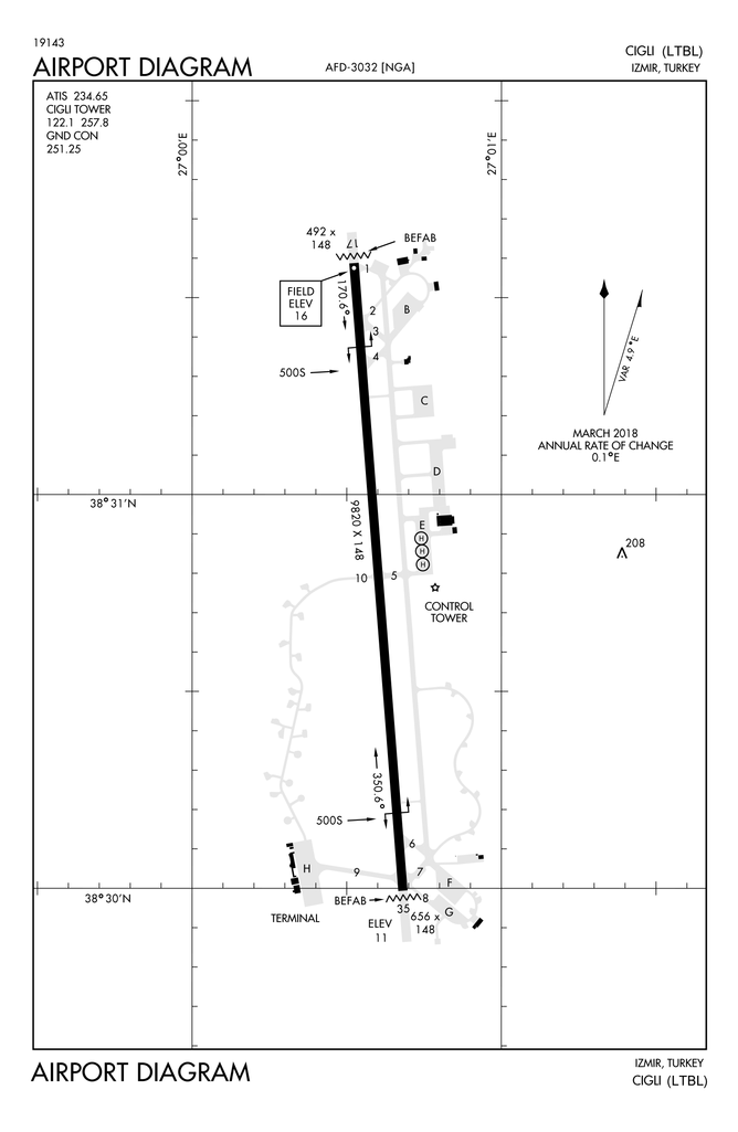
English: Airport Diagram for Çiğli Air Base (LTBL) in İzmir, Turkey |
| Date | |
| Source | DoD Flight Information Publication (Terminal) - High and Low Altitude Europe North Africa and Middle East - VOL-7 |
| Author | National Geospatial-Intelligence Agency |
Licensing[edit]
This image is a work of the United States National Geospatial-Intelligence Agency or one of its predecessor agencies. As a work of the U.S. federal government, the image is in the public domain.
|
 |
File history
Click on a date/time to view the file as it appeared at that time.
| Date/Time | Thumbnail | Dimensions | User | Comment | |
|---|---|---|---|---|---|
| current | 12:08, 24 August 2021 | | 2,935 × 4,500 (443 KB) | Recoil16 (talk | contribs) | Better quality |
| 17:08, 7 March 2021 |  | 3,046 × 4,475 (2.78 MB) | Recoil16 (talk | contribs) | Uploaded a work by National Geospatial-Intelligence Agency from DoD Flight Information Publication (Terminal) - High and Low Altitude Europe North Africa and Middle East - VOL-7 with UploadWizard |
You cannot overwrite this file.
File usage on Commons
The following page uses this file:
File usage on other wikis
The following other wikis use this file:
- Usage on ar.wikipedia.org
- Usage on en.wikipedia.org
- Usage on www.wikidata.org