File:Pasoeroan Town in 1946 imaginery.jpg
Jump to navigation
Jump to search
Size of this preview: 481 × 600 pixels. Other resolutions: 192 × 240 pixels | 600 × 748 pixels.
Original file (600 × 748 pixels, file size: 108 KB, MIME type: image/jpeg)
Captions
Captions
Add a one-line explanation of what this file represents
Summary[edit]
| Description |
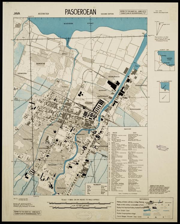
English: This was a map showed the entire city of Pasoeroean in 1946, included main railway lines and PsSM lines.
Bahasa Indonesia: Map ini menunjukkan sebagian besar kota Pasoeroean pada tahun 1946, termasuk jalur kereta api utama dan jalur PsSM |
| Date | |
| Source | https://digitalcollections.universiteitleiden.nl/view/item/2012094?solr_nav%5Bid%5D=582e9ce4e46d04c02ea8&solr_nav%5Bpage%5D=0&solr_nav%5Boffset%5D=0 |
| Author | Survey Directorate Head Quarters American Land Forces South East Asia |
Licensing[edit]
This file is licensed under the Creative Commons Attribution 3.0 Unported license.
- You are free:
- to share – to copy, distribute and transmit the work
- to remix – to adapt the work
- Under the following conditions:
- attribution – You must give appropriate credit, provide a link to the license, and indicate if changes were made. You may do so in any reasonable manner, but not in any way that suggests the licensor endorses you or your use.
File history
Click on a date/time to view the file as it appeared at that time.
| Date/Time | Thumbnail | Dimensions | User | Comment | |
|---|---|---|---|---|---|
| current | 13:40, 26 August 2022 | | 600 × 748 (108 KB) | Ardy RfPas (talk | contribs) | Uploaded a work by Survey Directorate Head Quarters American Land Forces South East Asia from https://digitalcollections.universiteitleiden.nl/view/item/2012094?solr_nav%5Bid%5D=582e9ce4e46d04c02ea8&solr_nav%5Bpage%5D=0&solr_nav%5Boffset%5D=0 with UploadWizard |
You cannot overwrite this file.
File usage on Commons
There are no pages that use this file.