Bering Land Bridge
Bước tới điều hướng
Bước tới tìm kiếm
Introduction[sửa]

- Pleistocene geography
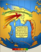
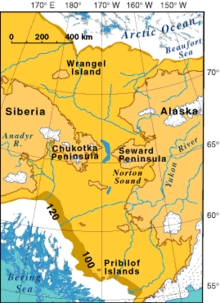
- Beringia was a land bridge roughly 1,000 miles (1,600 km) north to south at its greatest extent, which joined present-day Alaska and eastern Siberia across the Bering Strait at various times during the Pleistocene ice ages.
- Human migration
- It is believed that a small human Paleoindian population of at most a few thousand survived the Last Glacial Maximum in Beringia, isolated from its ancestor populations in Asia for at least 5,000 years, before expanding to populate the Americas sometime after 16,500 years ago.
Maps[sửa]
- Animated changes
 |
- Geographic maps of changes
 |
 |
 |
- Locaton
 |