Category:Étangs de Hollande
Jump to navigation
Jump to search
| Object location | | View all coordinates using: OpenStreetMap |
|---|
Number lakes in the department of Yvelines  | |||||
| Upload media | |||||
| Pronunciation audio | |||||
|---|---|---|---|---|---|
| Instance of | |||||
| Location | |||||
| Width |
| ||||
| Length |
| ||||
| Area |
| ||||
| Elevation above sea level |
| ||||
 | |||||
Subcategories
This category has the following 4 subcategories, out of 4 total.
A
- Aqueduc de l'Artoire (9 F)
E
- Étang de Saint-Hubert (21 F)
Media in category "Étangs de Hollande"
The following 5 files are in this category, out of 5 total.
-
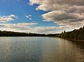 Etang de Hollande.jpg 2,584 × 1,925; 1.83 MB
-
 Étangs de Hollande1.jpg 2,057 × 1,369; 605 KB
-
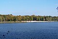
 Étangs de Hollande2.jpg 2,576 × 1,932; 567 KB
-
 Étangs de Hollande3 retouche.jpg 1,138 × 790; 291 KB
-
 Étangs de Hollande3.jpg 2,576 × 1,932; 1.05 MB


