Category:1592 maps
Jump to navigation
Jump to search
| ← 1590 1591 1592 1593 1594 1595 1596 1597 1598 1599 → |
Deutsch: Karten mit Bezug zum Jahr 1592
English: Maps related to the year 1592
Español: Mapas relativos al año 1592
Français : Cartes concernant l’an 1592
Русский: Карты 1592 года
Subcategories
This category has the following 2 subcategories, out of 2 total.
A
- 1592 maps of Africa (4 F)
E
Media in category "1592 maps"
The following 22 files are in this category, out of 22 total.
-
 02017 0051 Das Erbe der Reformation im Ostmitteleuropa, Teschener Schlesien.jpg 2,798 × 2,022; 4.53 MB
-
 1592 Theatrvm orbis terrarvm.png 1,920 × 1,080; 3.26 MB
-
 Catana Urbs Siciliae.jpg 1,920 × 1,454; 1.99 MB
-
 Central Atlantic RMG F1404.tiff 6,739 × 5,213; 100.51 MB
-
 Central Mediterranean RMG C4567 3.tiff 3,238 × 4,341; 40.22 MB
-
 Central Mediterranean RMG F1401.tiff 6,732 × 5,217; 100.48 MB
-
 El Reino de Chile y la Gobernación del Río de la Plata (1592) - AHG.jpg 3,840 × 3,422; 19.37 MB
-
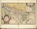
 János Zsámboky, Hungariae loca Precipua recens emendata atque edita (FL35076500 2541241).jpg 8,726 × 6,614; 81.18 MB
-
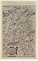 Karte von Vermandois (1592) - Maurice Bouguereau und Jean Surhon.JPEG 975 × 1,566; 543 KB
-
 NE Atlantic, Spain to Iceland RMG C4567 5.tiff 4,369 × 3,315; 41.44 MB
-
 NE Atlantic, Spain to Iceland RMG F1403.tiff 6,746 × 5,219; 100.73 MB
-
 Neznámý - Jeruzalém, 1592.png 1,123 × 874; 1.82 MB
-
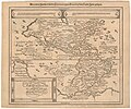
 Picardiae, Belgicae regionis descriptio (5121160132).jpg 2,000 × 1,587; 3.48 MB
-
-
-
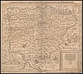
 Sebastian Münster, Von der Eyfel (FL147398463 2566780).jpg 1,362 × 2,152; 3.32 MB
-

-

-
 Western Mediterranean and eastern Atlantic RMG C4567 4.tiff 3,440 × 2,680; 26.38 MB
-
 Western Mediterranean and eastern Atlantic RMG F1402.tiff 6,737 × 5,289; 101.94 MB
-
 World planisphere RMG C4567 1.tiff 3,334 × 4,260; 40.63 MB
-
 World planisphere RMG F1399.tiff 5,326 × 6,707; 102.2 MB


_-_AHG.jpg)
.jpg)
_-_Maurice_Bouguereau_und_Jean_Surhon.JPEG)

.jpg)
.jpg)
.jpg)
.jpg)
.jpg)
.jpg)