Category:1618 maps
Jump to navigation
Jump to search
| ← 1610 1611 1612 1613 1614 1615 1616 1617 1618 1619 → |
Deutsch: Karten mit Bezug zum Jahr 1618
English: Maps related to the year 1618
Español: Mapas relativos al año 1618
Français : Cartes concernant l’an 1618
Русский: Карты 1618 года
Subcategories
This category has the following 2 subcategories, out of 2 total.
A
- 1618 maps of Africa (empty)
E
Media in category "1618 maps"
The following 14 files are in this category, out of 14 total.
-
 Frans Hogenberg, Petrina (FL155340620 3700246).jpg 6,123 × 10,572; 76.06 MB
-
 Frans Hogenberg, Petrina in ditione Christianorum (FL155700677 3700333).jpg 7,812 × 10,463; 93.88 MB
-

-

-
 Nova Virginiae tabvla - D. Grijp. sculpt. NYPL434448.tiff 5,355 × 4,512; 69.17 MB
-
 Orbis terrarum descriptio duobis planis hemisphaeriis comprehe(n)sa LOC 2017585805.tif 6,926 × 5,143; 101.91 MB
-
 Plan de Rennes (1618).jpg 5,019 × 2,651; 1.73 MB
-

-
 Valentin Staffansson Trauthman, Iervsalem (FL13733980 3560216).jpg 3,744 × 5,611; 32.36 MB
-
 Virginia et Nova Francia. NYPL434129.tiff 4,816 × 3,961; 54.58 MB
-
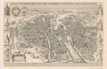 Visscher, Lutetia Parisiorum urbs - National Library of Australia.tif 20,964 × 13,610; 816.33 MB
-
 Willem Blaeu, Pascaarte van't oostelÿcste deel van de Middelandtsche Zee (FL13730450 3365080).jpg 9,697 × 8,166; 107.17 MB
-
 Willem Blaeu, Pascaarte van't westelÿcste deel van de Middelandtsche Zee (FL13730489 3365079).jpg 9,853 × 8,253; 110.27 MB
-

.jpg)
.jpg)
.jpg)
.jpg)
.jpg)

.jpg)
.jpg)
.jpg)