Category:1647
Перайсьці да навігацыі
Перайсьці да пошуку
| ◀ 1640s ▶ (XVII стагодзьдзе, 2 тысячагодзьдзе) |
|---|
| ◀ 1640 · 1641 · 1642 · 1643 · 1644 · 1645 · 1646 · 1647 · 1648 · 1649 ▶ |

год | |||||
| Загрузіць мэдыя | |||||
| Асобны выпадак панятку |
| ||||
|---|---|---|---|---|---|
| Частка ад | |||||
| Дата |
| ||||
| Папярэднік | |||||
| Наступнік | |||||
| |||||
Падкатэгорыі
Гэтая катэгорыя зьмяшчае наступныя 11 падкатэгорыяў з 11 агулам.
*
+
C
H
O
Файлы ў катэгорыі «1647»
Паказаныя 76 файлаў гэтай катэгорыі з 76.
-
 Peter Snayers - The siege of Armentières with a rainbow.jpg 3200 × 2468; 10,9 Мб
-
 Peter Snayers - The siege of Diksmuide.jpg 3200 × 2447; 10,67 Мб
-
 Aggsbach Markt Pfarrkirche25.jpg 4000 × 3000; 4,82 Мб
-
 Agreement of the People (1647-1649).jpg 172 × 242; 16 кб
-
 Ainhoa Stèle30.JPG 2592 × 3872; 2,28 Мб
-
 Ainhoa Stèle31.JPG 2592 × 3872; 2,32 Мб
-
 AMH-7281-KB Map of the region between Seregipe del Rey and Itapuama.jpg 2400 × 1867; 850 кб
-
 AMH-7282-KB View of Porto Calvo.jpg 2400 × 1819; 1,08 Мб
-
 AMH-7284-KB Map of Porto Calvo and environs.jpg 2400 × 1848; 1,16 Мб
-
 AMH-7285-KB Map of Olinda.jpg 2400 × 1866; 828 кб
-
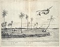
 AMH-7289-KB View of Alagoa del Sul.jpg 2400 × 1852; 930 кб
-
 AMH-7290-KB Map of Serinhaim.jpg 2400 × 1839; 832 кб
-
 AMH-7291-KB View of Garasu.jpg 2400 × 1869; 893 кб
-
 AMH-7292-KB Alagoa do Sul.jpg 2400 × 1842; 768 кб
-
 AMH-7294-KB Fort Maurits on the Rio Francisco.jpg 2400 × 1842; 974 кб
-
 AMH-7295-KB View of Fort Maurits on the Rio San Francisco.jpg 2400 × 1859; 701 кб
-
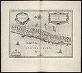
 AMH-7297-KB Map of the island of Tamaraca.jpg 2400 × 1858; 1,2 Мб
-
 AMH-7298-KB Floor plan of the fort of Nassau at Mouri.jpg 2400 × 1836; 549 кб
-
 AMH-7300-KB Floor plan of the fort of El Mina.jpg 2400 × 1854; 810 кб
-
 AMH-7301-KB View of the fort of El Mina.jpg 2400 × 1826; 699 кб
-
 AMH-7302-KB Floor plan of the fort at Siara.jpg 2400 × 1839; 905 кб
-
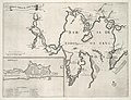
 AMH-7304-KB Map of Paraiba and Rio Grande.jpg 2400 × 1895; 915 кб
-
 AMH-7305-KB Map of the mouth of the Paraiba River.jpg 2400 × 1836; 1,02 Мб
-
 AMH-7306-KB View of the mouth of the Paraiba River.jpg 2400 × 1856; 656 кб
-
 AMH-7307-KB View of Paraiba.jpg 2400 × 1835; 826 кб
-
 AMH-7308-KB Map of the environs of Fort Keulen.jpg 2400 × 1855; 750 кб
-
 AMH-7309-KB View of Fort Keulen.jpg 2400 × 1833; 705 кб
-
 AMH-7310-KB Map of Bahia de Todos os Sanctos.jpg 2400 × 1835; 658 кб
-
 AMH-7312-KB Map of Cape St Augustine.jpg 2400 × 1834; 851 кб
-
 AMH-7314-KB Map of the island of Antonij Vaz.jpg 2400 × 1856; 842 кб
-
 AMH-7315-KB View of Vrijburg Palace.jpg 2400 × 1859; 702 кб
-
 AMH-7316-KB View of Prins Willem fort on Affogados.jpg 2400 × 1863; 884 кб
-
 AMH-7317-KB Map of Mauritsstad, Recife and environs.jpg 2400 × 1858; 1,2 Мб
-
 AMH-7318-KB View of Mauritsstad.jpg 2400 × 1856; 696 кб
-
 AMH-7320-KB Map of Loanda.jpg 2400 × 1831; 723 кб
-
 AMH-7321-KB View of Loanda.jpg 2400 × 1826; 749 кб
-
 AMH-7323-KB Map of the city of S. Thomé.jpg 2400 × 1842; 714 кб
-
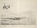
 AMH-7324-KB View of Maragnon harbour.jpg 2400 × 1828; 790 кб
-
 AMH-7325-KB Map of the city of S. Luis de Maragnon.jpg 2400 × 1838; 1,02 Мб
-
 AMH-7506-KB Map of the gardens at Vrijburg Palace.jpg 2400 × 1856; 563 кб
-
 AMH-7507-KB Left hand portion of a view of Mauritsstad and Recife.jpg 2400 × 1938; 552 кб
-
 AMH-7508-KB Right hand portion of a view of Mauritsstad and Recife.jpg 2400 × 1951; 566 кб
-
 AMH-7509-KB Left hand portion of a view on Loanda.jpg 2400 × 1947; 559 кб
-
 AMH-7510-KB Map of Arx Montis Calvariae.jpg 2400 × 2064; 610 кб
-
 AMH-7511-KB Map of Chile.jpg 2400 × 2147; 659 кб
-
 Beckum-Kupferstich-Merian.png 1398 × 664; 653 кб
-
 Catalogue of Sects-cropped.gif 1154 × 614; 752 кб
-
 Catalogue of Sects.GIF 2236 × 1404; 1 Мб
-
 Cleve (Merian).jpg 3587 × 1171; 889 кб
-
 Coesfeld-Kupferstich-Merian.png 1386 × 764; 686 кб
-
 Delmenhorst-Kupferstich-Merian.png 1402 × 654; 595 кб
-
 Detmold-Kupferstich-Merian.png 1406 × 778; 704 кб
-
 Dortmund um 1647 M Merian klein.png 4815 × 1584; 4,44 Мб
-
 Dortmund um 1647 M Merian.png 10 944 × 3600; 21,82 Мб
-
 Dortmund-Kupferstich-Merian.png 2544 × 776; 1,67 Мб
-
 Duelmen-Kupferstich-Merian.png 1390 × 618; 539 кб
-
 Eberlin Daniel Eisenach Markt20 Wiki.JPG 1024 × 768; 91 кб
-
 Essen-Kupferstich-Merian.png 2514 × 858; 1,68 Мб
-
 Firma del Condestable Marco Antonio Platoni.jpg 2112 × 2741; 6,21 Мб
-
 Fleuten 1647.jpg 644 × 400; 157 кб
-
 FLORUS 1647 BF 1.jpg 3281 × 3281; 772 кб
-
 FLORUS 1647 BF 1a.jpg 1900 × 3281; 698 кб
-
 FLORUS 1647 BF 3.jpg 3313 × 3313; 610 кб
-
 FLORUS 1647 BF 4.jpg 3280 × 3280; 573 кб
-
 FLORUS 1647 CF 001.jpg 3280 × 3280; 620 кб
-
 FLORUS 1647 PCF2.jpg 1640 × 1640; 256 кб
-
 FLORUS 1647 ZBF1.jpg 1000 × 1700; 213 кб
-
 Fonderie bronze 1647b.jpg 1759 × 1426; 1,28 Мб
-
 Grabadojuanjosedeaustria1.jpg 1218 × 658; 121 кб
-
 Iriberry Stèle4.jpg 2000 × 3008; 2,92 Мб
-
 Kaart van het beleg van Diksmuide, 1647, anoniem, 1647, RP-P-OB-77.014.jpg 7192 × 4746; 6,06 Мб
-
 Map of the siege of Diksmuide, 1647 66087724.jpg 900 × 610; 188 кб
-
 Peter Snayers - The Siege of Diksmuide, 1647.jpg 3200 × 2459; 1,99 Мб
-
 Recklinghausen-Merian.png 1425 × 697; 711 кб
-
 The Siege of Armentières with a rainbow, 1647 - 2021 CKS 20055 0016 d6350.jpg 3200 × 2468; 2,66 Мб
-
 Waxenberg Altes Schloss - Wappen 5 Starhemberg.jpg 1712 × 2560; 1,74 Мб


.jpg)


.jpg)