Category:1799 maps
Jump to navigation
Jump to search
| ← 1790 1791 1792 1793 1794 1795 1796 1797 1798 1799 → |
Deutsch: Karten mit Bezug zum Jahr 1799
English: Maps related to the year 1799
Español: Mapas relativos al año 1799
Français : Cartes concernant l’an 1799
Русский: Карты 1799 года
Subcategories
This category has the following 7 subcategories, out of 7 total.
Media in category "1799 maps"
The following 103 files are in this category, out of 103 total.
-

-
 1799 - Barbie du Bocage Jean Denis Detail.jpg 640 × 377; 122 KB
-

-
 1799 Cary Map of Franconia, Germany ( Nuremburg ) - Geographicus - Franconia-cary-1799.jpg 5,000 × 4,443; 7.44 MB
-
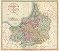
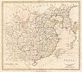
 1799 Cary Map of Hungary, Croatia and Transylvania - Geographicus - Hungary-cary-1799.jpg 5,000 × 4,506; 7.85 MB
-
 1799 Cary Map of Ireland - Geographicus - Ireland-cary-1799.jpg 5,000 × 4,379; 6.57 MB
-
 1799 Cary Map of Mantua, Venice and Tyrol, Italy - Geographicus - Venice-cary-1799.jpg 5,000 × 4,513; 8.31 MB
-
 1799 Cary Map of Piedmont, Italy ( Milan, Genoa ) - Geographicus - Piedmont-cary-1799.jpg 5,000 × 4,441; 8.17 MB
-
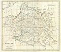
 1799 Cary Map of Poland, Prussia and Lithuania - Geographicus - Poland-cary-1799.jpg 5,000 × 4,416; 7.6 MB
-
 1799 Cary Map of Prussia and Lithuania - Geographicus - Prussia-cary-1799.jpg 5,000 × 4,364; 6.48 MB
-
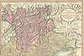
 1799 Cary Map of Swabia, Germany - Geographicus - Swabia-cary-1799.jpg 5,000 × 4,449; 8.31 MB
-
 1799 Cary Map of the Netherlands - Geographicus - Netherlands-cary-1799.jpg 5,000 × 4,472; 7.88 MB
-
 1799 Cary Map of the Upper and Lower Rhine - Geographicus - Rhine-cary-1799.jpg 5,000 × 4,458; 8.23 MB
-

-
 1799 Cary Map of Tyrol - Geographicus - Venice-cary-1799.jpg 4,883 × 3,253; 15.16 MB
-

-

-
-
 1799 Clement Cruttwell Map of England - Geographicus - England-cruttwell-1799.jpg 3,019 × 3,500; 2.83 MB
-

-
 1799 Clement Cruttwell Map of Ireland - Geographicus - Ireland-cruttwell-1799.jpg 2,962 × 3,500; 2.72 MB
-
 1799 Clement Cruttwell Map of Italy - Geographicus - Italy-cruttwell-1799.jpg 3,500 × 2,999; 2.69 MB
-
 1799 Clement Cruttwell Map of North Pole - Geographicus - NorthPole-cruttwell-1799.jpg 3,500 × 3,289; 2.71 MB
-
-
 1799 Clement Cruttwell Map of Russian Empire - Geographicus - Russia-cruttwell-1799.jpg 3,500 × 1,852; 1.75 MB
-
 1799 Clement Cruttwell Map of Scotland - Geographicus - Scotland-cruttwell-1799.jpg 3,062 × 3,500; 2.72 MB
-

-

-

-
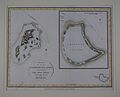
 1799 published Gambier Island map by James Wilson of ship Duff.jpg 3,915 × 2,973; 1.57 MB
-
 1801 Cary Map of Westphalia, Germany - Geographicus - Westphalia-cary-1799.jpg 5,000 × 4,434; 7.5 MB
-

-

-

-

-
 A plan of the Pitts Farm in Chelsea (3370527516).jpg 2,000 × 1,658; 3 MB
-
 A topographical map describing the principality of the islands of Malta and Goza LOC 2018588018.tif 13,557 × 6,811; 264.18 MB
-
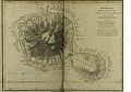
 Bergeman - Elmina (1799).png 2,978 × 2,081; 7.41 MB
-
 Canal do Cassiquiare.jpg 1,308 × 2,011; 297 KB
-
 Carta esferica que comprehende una parte de las Islas Antilles RMG K0947.jpg 1,280 × 834; 839 KB
-
 Carte de la Syrie (FL37122141 3898995).jpg 3,057 × 4,795; 8.47 MB
-
 Carte Du Théâtre De La Guerre En Orient 02-palestine (FL13729208 2515275).jpg 16,162 × 10,489; 243.08 MB
-
 Carte Du Théâtre De La Guerre En Orient 03-arabia (FL13729210 2515275).jpg 16,220 × 10,763; 244.54 MB
-
 Carte generale de l'Isle de St Domingue RMG K0952.jpg 1,280 × 1,061; 971 KB
-
 Carte generale de l'Isle de St Domingue RMG K0953.jpg 1,280 × 1,060; 1.12 MB
-

-
 Castillo San Francisco de Campeche 1799.jpg 960 × 764; 88 KB
-
 Chart of the Coast of Eygpt - Battle of the Nile RMG F3839.tiff 6,400 × 4,777; 87.47 MB
-
 Charte over den Danske Oe St Croix i America RMG K0891.jpg 1,280 × 943; 1.02 MB
-
 Charte over den Danske Oe St Croix i America RMG K0892.jpg 1,280 × 983; 968 KB
-

-

-
 Die Inseln Malta Gozzo und Cumino (FL13722357 2471651).jpg 4,986 × 3,391; 24.29 MB
-
 Dto de Baton Rouge. LOC 2013585037.jpg 5,535 × 4,634; 2.97 MB
-
 Elmina1799.jpg 842 × 608; 415 KB
-
 Faden, William — Map of Switzerland 1799.jpg 10,159 × 7,685; 70.84 MB
-
 FutureCambridgeHouse1799 edited.jpg 863 × 635; 192 KB
-
 Ghent by Louis De Vreese in 1799.jpg 7,093 × 5,002; 9.27 MB
-
 Giovanni Maria Cassini, L'Asia minore divisa nelle sue parti o provincie (FL36010829 2716588).jpg 14,414 × 10,435; 204.43 MB
-
 Helvetische Republik 1799 01 11.jpg 1,827 × 1,206; 1.48 MB
-
 JeninNWJacotin.jpg 1,456 × 1,079; 736 KB
-
 John Cary 1799 map of the territory of Bergamo.jpg 740 × 1,353; 420 KB
-
 Karta över Bottniska viken, Finska viken samt östra Uppland södra Finland, Estland, 1779 - Skoklosters slott - 98056.tif 6,373 × 3,045, 2 pages; 55.54 MB
-
 Little Cadogan Place on Richard Horwood's map.jpg 1,794 × 1,734; 1.05 MB
-
 Louis-François Cassas, Alexandrie, nommée par les Arabes, Eskanderyeh.jpg 2,662 × 1,855; 1.68 MB
-
 Manchester Square 1799 edited.jpg 810 × 936; 222 KB
-
 Map of Island of Otaheite from 1769 survey by Cap. Cook with improvements by Wm Wilson.jpg 5,700 × 3,981; 3.69 MB
-
-
 Map of the Gambier Islands and of Prospect Island (Temoe Atoll) by Capt. James Duff.jpg 3,063 × 2,477; 604 KB
-
 Map of the partition of the Kingdom of Poland and the Grand Duchy of Lithuania from 1799.jpg 6,330 × 5,677; 6.83 MB
-
 Map of the world, shewing the tracks & discoveries of Captn. Cook (4071862393).jpg 2,000 × 1,198; 2.47 MB
-
 MemphisJamesRennell01.jpg 1,442 × 1,849; 231 KB
-

-
 New York LOC 2018590100.jpg 7,664 × 5,902; 5.68 MB
-
 New York LOC 2018590100.tif 7,664 × 5,902; 129.41 MB
-
 Ordnance Survey Drawings - Bromley (OSD 128).jpg 4,000 × 3,478; 4.25 MB
-
 Ordnance Survey Drawings - Dartford (OSD 129).jpg 4,000 × 2,177; 3.37 MB
-
 Ordnance Survey Drawings - Dungeness, Kent (OSD 104-2).jpg 3,663 × 4,000; 4.27 MB
-
 Ordnance Survey Drawings - Halstead (OSD 144).jpg 4,000 × 2,107; 3.38 MB
-
 Ordnance Survey Drawings - Rye (OSD 104-1).jpg 3,592 × 4,000; 4.85 MB
-
 Ordnance Survey Drawings - Stratford (OSD 131).jpg 4,000 × 3,874; 4.77 MB
-
 Ordnance Survey Drawings - Woolwich (OSD 130).jpg 4,000 × 2,552; 3.1 MB
-
 Part of map of Grand Dutchy of Lithuania including Samogitia, 1799.png 1,622 × 780; 2.82 MB
-

-
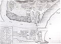
 Plan de St. Jean d'Acre indiquant la position de l'armée. 1799.jpg 6,918 × 4,707; 4.03 MB
-
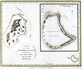
 Plan de St. Jean d'Acre. 1799.jpg 2,615 × 1,743; 672 KB
-
-
 Reilly Allgemeiner Postatlas Deutschland.jpg 500 × 332; 30 KB
-
 Square no. 602, city of Washington LOC 88693126.jpg 2,296 × 3,700; 851 KB
-
 Square no. 602, city of Washington LOC 88693126.tif 2,296 × 3,700; 24.31 MB
-
 Square south of square no. 667, city of Washington LOC 88693127.jpg 2,347 × 3,668; 932 KB
-
 Square south of square no. 667, city of Washington LOC 88693127.tif 2,347 × 3,668; 24.63 MB
-
 St James's Square 1799.jpg 896 × 1,073; 229 KB
-

-

-

-
-
 Tobago Divisions 1799 by Bryan Edwards color.png 1,028 × 840; 1.49 MB
-

-
 Vermont - from the latest authorities, 1799 LOC 2011589153.jpg 2,401 × 2,859; 1.23 MB
-
 Woolwich Map, 1799.jpg 1,633 × 827; 515 KB
-
 אזור ואדי חנין במפת ז'אקוטן 1799.jpg 960 × 720; 120 KB
-
 עמק גלילות מפת זאקוטן.jpg 960 × 720; 123 KB

_-_Geographicus_-_Bavaria-cary-1799.jpg)
_-_Geographicus_-_Franconia-cary-1799.jpg)


_-_Geographicus_-_Piedmont-cary-1799.jpg)


_-_Geographicus_-_WesternHemisphere-cary-1799.jpg)


.jpg)

.jpg)
.png)


.jpg)
.jpg)
.jpg)


.jpg)


.jpg)


_by_Capt_James_Duff_(retouched).jpg)
_by_Capt._James_Duff.jpg)

.jpg)


.jpg)
.jpg)
.jpg)
.jpg)
.jpg)
.jpg)
.jpg)


.jpg)

.jpg)


_LOC_2013585038.jpg)