Category:1858 maps
Jump to navigation
Jump to search
| ← 1850 1851 1852 1853 1854 1855 1856 1857 1858 1859 → |
Deutsch: Karten mit Bezug zum Jahr 1858
English: Maps related to the year 1858
Español: Mapas relativos al año 1858
Français : Cartes concernant l’an 1858
Русский: Карты 1858 года
Subcategories
This category has the following 9 subcategories, out of 9 total.
Media in category "1858 maps"
The following 162 files are in this category, out of 162 total.
-

-
-

-
 10 of 'History of New England. vol. 1-4' (11054440816).jpg 2,672 × 1,545; 1.05 MB
-

-
 FAIRBANKS(1858) p030 Map of Florida in 1565.jpg 1,321 × 1,653; 602 KB
-
 FAIRBANKS(1858) p074 Map of the mouth of St. Johnes River.jpg 1,077 × 703; 456 KB
-
 VILLAVICENCIO(1858) p307 PLANO DE LA CIUDAD DE QUITO - 1858.jpg 2,352 × 1,480; 2.22 MB
-
 VILLAVICENCIO(1858) p483 PLANO DE LA CIUDAD DE GUAYAQUIL - 1858.jpg 2,347 × 1,504; 2.39 MB
-
 1858 Colton's Map of the Western Hemisphere - Geographicus - WesternHemi-colton-1858.jpg 3,042 × 3,444; 1.26 MB
-
 1858 Dufour Map of the United States - Geographicus - UnitedStates-dufour-1858.jpg 5,000 × 3,688; 5.11 MB
-
 SCOTT(1858) Map of West Africa (Liberia).jpg 590 × 750; 304 KB
-
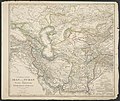
 1858 map of the Austrian Empire by John Arrowsmith.jpg 14,652 × 11,966; 39.73 MB
-
-
 A map of Harford Co., Maryland, 1858. LOC 2002624034.tif 12,528 × 15,648; 560.87 MB
-
 A topographical map of Androscoggin County, Maine LOC 2012592363.jpg 16,185 × 15,564; 29.88 MB
-
 Atlantic cable Map.jpg 1,493 × 600; 163 KB
-
 Bouhans-lès-Lure.jpg 2,048 × 1,536; 823 KB
-
-
 Carte routière et hydrographique de Seine-et-Marne - 1858.jpg 8,324 × 10,860; 13.02 MB
-
 Carte routière, historique et monumentale des environs de Saumur.jpg 7,008 × 5,338; 6.42 MB
-
 Carte routière, statistique et administrative du département de Maine-et-Loire - 1858.jpg 9,152 × 7,202; 11.44 MB
-
 CañasJerez.jpg 564 × 399; 24 KB
-
 Centre ville de Lure 1858.jpg 2,048 × 1,536; 879 KB
-
 Charles William Meredith van de Velde, Carte du Pays d'Israel (FL199992168 2369095).jpg 6,320 × 8,819; 17.77 MB
-
 Charles William Meredith van de Velde, Map of the Holy Land 01 (FL199992294 2369094).jpg 7,120 × 6,048; 15.29 MB
-
 Charles William Meredith van de Velde, Map of the Holy Land 01 (FL37825742 3923551).jpg 11,285 × 9,209; 125.94 MB
-
 Charles William Meredith van de Velde, Map of the Holy Land 02 (FL199992295 2369094).jpg 7,312 × 6,088; 22.27 MB
-
 Charles William Meredith van de Velde, Map of the Holy Land 02 (FL37825747 3923551).jpg 11,410 × 9,487; 157.83 MB
-
 Charles William Meredith van de Velde, Map of the Holy Land 03 (FL199992296 2369094).jpg 7,240 × 6,048; 22.23 MB
-
 Charles William Meredith van de Velde, Map of the Holy Land 03 (FL37825753 3923551).jpg 11,193 × 9,230; 141.15 MB
-
 Charles William Meredith van de Velde, Map of the Holy Land 04 (FL199992297 2369094).jpg 7,240 × 6,048; 20.24 MB
-
 Charles William Meredith van de Velde, Map of the Holy Land 04 (FL37825764 3923551).jpg 11,150 × 9,285; 145.84 MB
-
 Charles William Meredith van de Velde, Map of the Holy Land 05 (FL199992298 2369094).jpg 7,200 × 6,048; 19.92 MB
-
 Charles William Meredith van de Velde, Map of the Holy Land 05 (FL37825775 3923551).jpg 11,291 × 9,280; 151.36 MB
-
 Charles William Meredith van de Velde, Map of the Holy Land 06 (FL199992299 2369094).jpg 7,232 × 6,048; 20.23 MB
-
 Charles William Meredith van de Velde, Map of the Holy Land 06 (FL37825787 3923551).jpg 11,137 × 9,246; 146.14 MB
-
 Charles William Meredith van de Velde, Map of the Holy Land 07 (FL199992300 2369094).jpg 7,288 × 6,000; 21.77 MB
-
 Charles William Meredith van de Velde, Map of the Holy Land 07 (FL37825795 3923551).jpg 11,211 × 9,252; 147.76 MB
-
 Charles William Meredith van de Velde, Map of the Holy Land 08 (FL199992301 2369094).jpg 7,312 × 6,048; 21.37 MB
-
 Charles William Meredith van de Velde, Map of the Holy Land 09-Entire-Map (FL199992302 2369094).jpg 10,423 × 15,848; 146.02 MB
-
 Charles William Meredith van de Velde, Plan de Jérusalem (FL6882260 2368195).jpg 2,100 × 2,921; 3.21 MB
-
 Charles William Meredith van de Velde, Plan of Jerusalem (FL184621859 2370465).jpg 5,920 × 5,656; 13.66 MB
-

-
 Chart of the submarine Atlantic Telegraph LOC 2013593216.jpg 7,603 × 4,209; 5.39 MB
-
 Chart of the submarine Atlantic Telegraph LOC 2013593216.tif 7,603 × 4,209; 91.56 MB
-
 China. LOC 2006629369.tif 6,918 × 5,414; 107.16 MB
-
 City of Washington. LOC 88694016.jpg 5,218 × 4,057; 3.75 MB
-
 City of Washington. LOC 88694016.tif 5,218 × 4,057; 60.57 MB
-
 Colton's Kansas and Nebraska. LOC 2003627015.jpg 5,194 × 8,081; 6.62 MB
-
 Colton's Kansas and Nebraska. LOC 2003627015.tif 5,194 × 8,081; 120.09 MB
-
 Die Gartenlaube (1858) 245.jpg 1,750 × 2,379; 1.09 MB
-
 Die Gartenlaube (1858) 421.jpg 1,750 × 2,379; 1.2 MB
-
 Euclid Township 1858 old.jpg 2,596 × 3,160; 6.86 MB
-
 Euclid Township 1858.jpg 1,873 × 2,245; 2.49 MB
-
 Everest 1858.jpg 1,500 × 1,046; 228 KB
-
 Heilbronn Stadtplan 1858.jpg 3,130 × 3,261; 3.05 MB
-
 Herzogthum Steyermark 1858.jpg 2,835 × 3,474; 7.94 MB
-
 Indiana, Illinois, Missouri & Iowa with parts of adjoining states. LOC gm70002853.jpg 10,229 × 7,262; 12.64 MB
-
 Indiana, Illinois, Missouri & Iowa with parts of adjoining states. LOC gm70002853.tif 10,229 × 7,262; 212.53 MB
-

-
-
 Israels zug aus AEgypten ins land Kanaan (FL32714874 3876822).jpg 6,544 × 5,304; 38.27 MB
-
 Iutit nunata assinga (FL199985535 2368769).jpg 2,056 × 3,052; 2.8 MB
-

-

-
 JerusalemMapJTBarclay1858.png 2,500 × 3,750; 3.04 MB
-

-

-
 KartaZemelAstrakhanskogoKW.jpg 14,055 × 11,929; 13.73 MB
-
 KartaZemelChernomorskogo&CawcazskogoLineynogoKW 1848.jpg 22,819 × 18,898; 48.98 MB
-
 KartaZemelDonskogoKW 1858.jpg 14,055 × 17,055; 18.36 MB
-
 KartaZemelNovorossiyskogoKW 1858.jpg 6,748 × 4,536; 7.48 MB
-
 KartaZemelOrenburgskogo&Uralskogo&BashkirskogoKW 1858.jpg 4,781 × 6,982; 5.91 MB
-
 KartaZemelSlblrskogoLineynogoKW 1858.jpg 6,793 × 8,681; 6.16 MB
-
 KartaZemelZabaykalskogoKW 1858.jpg 27,520 × 15,118; 33.14 MB
-
 Lorenz Clemens Gratz, Das Heutige Jerusalem (FL198245546 1141891).jpg 5,286 × 6,946; 34.69 MB
-
 Lure vue centrée 1858.jpg 2,048 × 1,536; 903 KB
-
 Lure vue globale carte 1858.jpg 1,536 × 2,048; 940 KB
-

-
 Map of Caledonia County, Vermont (13389122903).jpg 1,967 × 2,000; 3.4 MB
-
 Map of Caledonia County, Vermont LOC 2005625342.jpg 16,438 × 16,388; 37.5 MB
-
 Map of Caledonia County, Vermont LOC 2005625342.tif 16,438 × 16,388; 770.72 MB
-
 Map of Cheshire Co., New Hampshire LOC 2012587747.jpg 17,321 × 17,388; 39.35 MB
-
 Map of Fond du Lac County, Wisconsin LOC 2012593195.jpg 18,015 × 15,041; 38.69 MB
-
 Map of Fond du Lac County, Wisconsin LOC 2012593195.tif 18,015 × 15,041; 775.23 MB
-

-
-
 Map of Indre et Loire by Alexandre Vuillemin 1858.jpg 1,952 × 2,519; 625 KB
-

-

-
 Map of Ladakh or Little Tibet (Klein Tubet) in 1858 Vorder-Asien (cropped).jpg 777 × 1,143; 473 KB
-

-
 Map of Orange County, Vermont LOC 2012586231.jpg 17,018 × 16,818; 39.99 MB
-
 Map of Piscataquis County, Maine LOC 2012592369.jpg 17,145 × 16,178; 34.15 MB
-
 Map of Piscataquis County, Maine LOC 2012592369.tif 17,145 × 16,178; 793.57 MB
-
 Map of Sagadahoc Co., Maine - from actual surveys LOC 2011589603.jpg 15,581 × 17,559; 27.31 MB
-
 Map of Sagadahoc Co., Maine - from actual surveys LOC 2011589603.tif 15,581 × 17,559; 782.74 MB
-
 Map of Talbot County; with farm limits. LOC 2002624021.jpg 11,489 × 11,375; 20.15 MB
-
 Map of Talbot County; with farm limits. LOC 2002624021.tif 11,489 × 11,375; 373.9 MB
-
-

-

-
 Map of the county of Milwaukee, Wisconsin LOC 2012593643.jpg 19,320 × 15,538; 42.11 MB
-
 Map of the Illinois River Rail Road (NBY 1352).jpg 2,384 × 3,600; 1.09 MB
-

-

-

-
 Map of the road to Hell!! LOC 2013585074.jpg 8,826 × 6,377; 7.51 MB
-
 Map of the road to Hell!! LOC 2013585074.tif 8,826 × 6,377; 161.03 MB
-
 Map of the Stanstead, Shefford, and Chambly Rail Road, and its connections. LOC 98688813.jpg 3,146 × 5,028; 2.64 MB
-
 Map of the Stanstead, Shefford, and Chambly Rail Road, and its connections. LOC 98688813.tif 3,146 × 5,028; 45.26 MB
-

-
 Map of Vigo County, Indiana LOC 2013593168.jpg 17,950 × 15,607; 39.71 MB
-
 Map of Vigo County, Indiana LOC 2013593168.tif 17,950 × 15,607; 801.5 MB
-
 Map of Washington County, Vermont (3121050248).jpg 2,000 × 1,999; 3.94 MB
-
-
 Mapa de la Isla de Santo Domingo LOC 2012590217.jpg 22,106 × 11,677; 42.6 MB
-
 Mapa de la Isla de Santo Domingo LOC 2012590217.tif 22,106 × 11,677; 738.52 MB
-
 Mapa de la republica de Nicaragua. LOC 99466743.jpg 9,621 × 7,227; 13.9 MB
-
 Mare tribal boundaries 1850s.jpg 1,252 × 1,622; 282 KB
-
 Martenet's Map of Cecil County, Maryland - from the coast, and original surveys LOC 2002624017.jpg 12,988 × 13,262; 32.7 MB
-
 Martenet's Map of Cecil County, Maryland - from the coast, and original surveys LOC 2002624017.tif 12,988 × 13,262; 492.8 MB
-
 Melisey.jpg 2,048 × 1,536; 821 KB
-
 Moffans.jpg 2,048 × 1,536; 834 KB
-
 Mollans.jpg 2,048 × 1,536; 787 KB
-
 National Library of Israel - Carel Willem Meredith van de Velde Plan of Jerusalem.jpg 2,366 × 2,193; 868 KB
-
-
 New map of Burlington County - from actual surveys & official records LOC 2004629244.jpg 10,310 × 19,068; 27.08 MB
-
 New map of Burlington County - from actual surveys & official records LOC 2004629244.tif 10,310 × 19,068; 562.45 MB
-
-
 Norman's chart of the lower Mississippi River, LOC 78692178.jpg 9,452 × 19,117; 24.76 MB
-
 Norman's chart of the lower Mississippi River, LOC 78692178.tif 9,452 × 19,117; 516.97 MB
-
 Original map of St Johns Wood Ashgrove 1858.jpg 2,239 × 1,433; 968 KB
-
 Palante Clairegoutte Magny-Danigon Magny-Jobert.jpg 2,048 × 1,536; 845 KB
-

-

-
 Planta da cidade do Rio de Janeiro LOC 2012593120.jpg 12,064 × 8,183; 14.5 MB
-
 Planta da cidade do Rio de Janeiro LOC 2012593120.tif 12,064 × 8,183; 282.44 MB
-
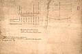
 Profile of 6th Street between Frederick and Market streets LOC 88693340.jpg 3,729 × 4,830; 2.33 MB
-
 Profile of 6th Street between Frederick and Market streets LOC 88693340.tif 3,729 × 4,830; 51.53 MB
-
-

-

-

-

-

-

-

-
 Rio Colorado of the West LOC 79692915.tif 10,701 × 4,739; 145.09 MB
-
 Rio Colorado of the West. NYPL1952950.tiff 9,416 × 4,112; 110.78 MB
-
 Slm1858.jpg 1,197 × 1,456; 180 KB
-
 T-726.jpg 11,066 × 7,118; 2.1 MB
-
 T-727.jpg 11,790 × 7,268; 2.46 MB
-
 Telegraph chart (7557405786).jpg 4,536 × 5,704; 27.41 MB
-
 The Islets of the Channel 1858 Walter Cooper Dendy k.jpg 3,000 × 2,131; 4.28 MB
-

-
 Transatlantic submarine cable map.jpg 2,500 × 984; 1,015 KB
-
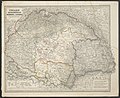 Ungarn, Siebenbürgen, Woiwodina und Slavonien.jpg 5,540 × 4,509; 10.9 MB
-
 Vorder-Asien.jpg 5,351 × 4,501; 9.16 MB
-
 William Hughes, Syria (FL173321217 2567364).jpg 8,446 × 10,611; 97.17 MB
-
 Голендерня на карті Білої Церви 1858 р..jpg 2,244 × 1,536; 593 KB
_LOC_87694237.jpg)
%27_(11055241925).jpg)
.jpg)

_p030_Map_of_Florida_in_1565.jpg)
_p074_Map_of_the_mouth_of_St._Johnes_River.jpg)
_p307_PLANO_DE_LA_CIUDAD_DE_QUITO_-_1858.jpg)
_p483_PLANO_DE_LA_CIUDAD_DE_GUAYAQUIL_-_1858.jpg)


_Map_of_West_Africa_(Liberia).jpg)


.jpg)
.jpg)
.jpg)
.jpg)
.jpg)
.jpg)
.jpg)
.jpg)
.jpg)
.jpg)
.jpg)
.jpg)
.jpg)
.jpg)
.jpg)
.jpg)
.jpg)
.jpg)
.jpg)
.jpg)


_245.jpg)
_421.jpg)


.jpg)
.jpg)


.jpg)


.jpg)


_in_1858_Vorder-Asien_(cropped).jpg)
.jpg)


.jpg)


.jpg)


_(24157387491).jpg)


_LOC_88693303.jpg)
_LOC_88693339.jpg)
_LOC_88693342.jpg)


.jpg)

_(14784913295).jpg)


.jpg)
