Category:1957 maps of India
Jump to navigation
Jump to search
Countries of Asia: People's Republic of China · India · Indonesia‡ · Russia‡
‡: partly located in Asia
‡: partly located in Asia
| ← 1950 1951 1952 1953 1954 1955 1956 1957 1958 1959 → |
English: 1957 maps made in India or from India or showing history of India
Media in category "1957 maps of India"
The following 9 files are in this category, out of 9 total.
-
 1957WestBengal.PNG 513 × 598; 38 KB
-
 AMS Madras-Pulicat Lake.jpg 1,779 × 3,166; 5.87 MB
-
 1957 North Indian Ocean cyclone season summary.jpg 3,000 × 2,147; 753 KB
-
 India administrative map 1957 PL.png 1,041 × 1,360; 154 KB
-
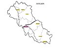 Jangaon Assembly contituency 1957.jpg 1,210 × 1,000; 145 KB
-
 Wahlbeteiligung in Indien 1957.svg 985 × 1,185; 276 KB
-
 Wahlergebnisse in Indien 1957.svg 985 × 1,185; 333 KB
-
 Wahlkreise in Indien 1957.svg 985 × 1,185; 322 KB
-
 Wahltermine in Indien 1957.svg 985 × 1,185; 276 KB


