Category:2009 in Bridlington
Jump to navigation
Jump to search
Media in category "2009 in Bridlington"
The following 200 files are in this category, out of 222 total.
(previous page) (next page)-
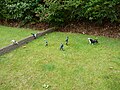
 A Bridlington Avian Resident - geograph.org.uk - 1348688.jpg 618 × 640; 36 KB
-
 A Bridlington Avian Resident - geograph.org.uk - 1348694.jpg 640 × 534; 40 KB
-
 A popular site for nesting birds^ - geograph.org.uk - 1358723.jpg 480 × 640; 118 KB
-

-
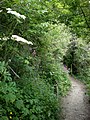 A secluded path, leading to .......^ - geograph.org.uk - 1358837.jpg 480 × 640; 130 KB
-
 A View Up Bempton Lane - geograph.org.uk - 1207447.jpg 640 × 480; 94 KB
-
 A window back to the past^ - geograph.org.uk - 1358764.jpg 480 × 640; 64 KB
-

-
 A165 Direction Bridlington - geograph.org.uk - 1218328.jpg 640 × 480; 76 KB
-
 A165 Roundabout - geograph.org.uk - 1211997.jpg 640 × 480; 73 KB
-
 A614 Near Bessingby - geograph.org.uk - 1223468.jpg 640 × 481; 131 KB
-
 Access to South Sands, Bridlington - geograph.org.uk - 1556793.jpg 640 × 427; 286 KB
-
 Alexandra Place, Bridlington - geograph.org.uk - 1567002.jpg 640 × 480; 52 KB
-
 An expanse of limestone pavement^ - geograph.org.uk - 1358683.jpg 640 × 480; 92 KB
-
 Are you sitting comfortably^ - geograph.org.uk - 1358739.jpg 640 × 480; 79 KB
-

-
 Bayle Gate - geograph.org.uk - 1212038.jpg 640 × 480; 99 KB
-
 Beach - panoramio - Immanuel Giel.jpg 1,685 × 1,715; 324 KB
-
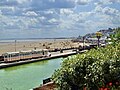
 Beach Huts, South Sands - geograph.org.uk - 1244039.jpg 640 × 480; 60 KB
-
 Beach of Bridlington 01.jpg 1,679 × 785; 404 KB
-
 Belvedere Cafe, South Sands - geograph.org.uk - 1270325.jpg 640 × 480; 46 KB
-
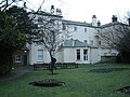
 Bessingby Hall - geograph.org.uk - 1223465.jpg 640 × 506; 126 KB
-
 Boats in Bridlington Harbour - geograph.org.uk - 1348670.jpg 640 × 470; 118 KB
-
 Boats in the Harbour - geograph.org.uk - 1270335.jpg 640 × 480; 103 KB
-
 Bondville Model Village 01.jpg 1,282 × 1,306; 268 KB
-
 Bondville Model Village 02.jpg 1,633 × 1,435; 503 KB
-
 Bondville Model Village 03.jpg 1,883 × 1,856; 935 KB
-
 Bondville Model Village 04.jpg 2,560 × 1,920; 2.41 MB
-
 Bondville Model Village 05.jpg 2,560 × 1,920; 2.54 MB
-
 Bondville Model Village 06.jpg 2,560 × 1,920; 2.32 MB
-
 Bondville Model Village 07.jpg 2,560 × 1,920; 2.44 MB
-
 Breakwater North beach - geograph.org.uk - 1208036.jpg 640 × 427; 99 KB
-
 Brid Bay Cafe, North Marine Drive - geograph.org.uk - 1566988.jpg 640 × 408; 48 KB
-
 Bridleway towards East Huntow - geograph.org.uk - 1284898.jpg 640 × 480; 125 KB
-
 Bridlington Ambulance Station - geograph.org.uk - 1212018.jpg 640 × 480; 80 KB
-

-
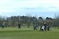 Bridlington Belverdere Golf Club - geograph.org.uk - 1218352.jpg 640 × 424; 55 KB
-
 Bridlington Boating Lake - geograph.org.uk - 1244036.jpg 640 × 480; 74 KB
-
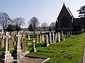
 Bridlington Cemetery - geograph.org.uk - 1209021.jpg 640 × 480; 42 KB
-
 Bridlington Fire Station - geograph.org.uk - 1212024.jpg 640 × 411; 57 KB
-
 Bridlington Funfair - geograph.org.uk - 1208075.jpg 640 × 427; 85 KB
-
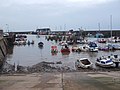 Bridlington Harbour - geograph.org.uk - 1202654.jpg 640 × 480; 69 KB
-
 Bridlington Harbour - geograph.org.uk - 1270326.jpg 640 × 480; 91 KB
-
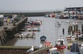 Bridlington harbour - geograph.org.uk - 1361023.jpg 640 × 417; 61 KB
-
 Bridlington Harbour fish dock - geograph.org.uk - 1202657.jpg 640 × 480; 71 KB
-
 Bridlington Hospital - geograph.org.uk - 1212015.jpg 640 × 480; 56 KB
-
 Bridlington Market - geograph.org.uk - 1348980.jpg 455 × 640; 99 KB
-
 Bridlington North Bay - geograph.org.uk - 1330313.jpg 640 × 473; 102 KB
-
 Bridlington North Beach - geograph.org.uk - 1348651.jpg 640 × 391; 65 KB
-
 Bridlington North Beach - geograph.org.uk - 1566937.jpg 640 × 480; 73 KB
-
 Bridlington Old Town - geograph.org.uk - 1427253.jpg 640 × 487; 142 KB
-
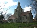
 Bridlington Priory Church 2009 03 20.jpg 640 × 480; 138 KB
-
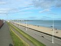
 Bridlington Promenade - geograph.org.uk - 1227688.jpg 640 × 427; 55 KB
-
 Bridlington Railway Station Exterior - geograph.org.uk - 1212027.jpg 640 × 480; 62 KB
-
 Bridlington Railway Station Platform - geograph.org.uk - 1212035.jpg 640 × 480; 83 KB
-
 Bridlington Railway Station Platforms - geograph.org.uk - 1212031.jpg 462 × 640; 113 KB
-
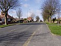
 Bridlington Residential - geograph.org.uk - 1207449.jpg 640 × 480; 62 KB
-
 Bridlington School.jpg 640 × 480; 73 KB
-
 Bridlington Station - geograph.org.uk - 1423895.jpg 640 × 480; 124 KB
-
 Bridlington Station - geograph.org.uk - 1423905.jpg 480 × 640; 145 KB
-
 Bridlington Station - geograph.org.uk - 1424369.jpg 640 × 479; 135 KB
-
 Bridlington Station - geograph.org.uk - 1428533.jpg 640 × 465; 143 KB
-
 Bridlington Station Foyer - geograph.org.uk - 1348966.jpg 640 × 480; 106 KB
-
 Bridlington Station from walkway - geograph.org.uk - 1423910.jpg 640 × 480; 157 KB
-
 Bridlington Station from walkway - geograph.org.uk - 1423915.jpg 480 × 640; 133 KB
-
 Bridlington Town Centre - geograph.org.uk - 2252067.jpg 1,024 × 768; 265 KB
-
 Bridlington Town Hall - geograph.org.uk - 1427256.jpg 640 × 470; 154 KB
-

-
 Bridlington01.jpg 2,560 × 1,920; 2.45 MB
-
 Bridlington02.jpg 1,627 × 1,767; 626 KB
-
 Bridlington03.jpg 2,482 × 1,395; 798 KB
-
 Bright Crescent - geograph.org.uk - 1227677.jpg 640 × 427; 57 KB
-

-
 Broadacres Pub - geograph.org.uk - 1218344.jpg 640 × 442; 103 KB
-
 Carrying the Scarborough Fares - geograph.org.uk - 1348961.jpg 510 × 640; 119 KB
-
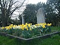
 Cemetery Gravestones - geograph.org.uk - 1209042.jpg 640 × 480; 92 KB
-
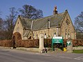
 Cemetery Lodge House - geograph.org.uk - 1209030.jpg 640 × 480; 56 KB
-
 Church of St Magnus, Bessingby - geograph.org.uk - 1223494.jpg 640 × 481; 89 KB
-
 Cliff top walk Sewerby - geograph.org.uk - 1330356.jpg 640 × 480; 90 KB
-
 Clifftop Walk - geograph.org.uk - 1209140.jpg 640 × 480; 88 KB
-
 Clock Tower Tearoom - geograph.org.uk - 1204680.jpg 640 × 481; 89 KB
-
 Coastal Erosion - geograph.org.uk - 1209177.jpg 640 × 480; 113 KB
-
 Coastal panorama - geograph.org.uk - 1358871.jpg 640 × 480; 82 KB
-
 Coastal scenery near Beacon Hill - geograph.org.uk - 1387752.jpg 640 × 480; 75 KB
-
 Coastguard Headquarters - geograph.org.uk - 1126903.jpg 640 × 480; 53 KB
-
 Coastguard Station, Bridlington - geograph.org.uk - 1566929.jpg 640 × 455; 36 KB
-
 County Farm - geograph.org.uk - 1213381.jpg 640 × 480; 55 KB
-
 Danes Dyke Farm - geograph.org.uk - 1126803.jpg 640 × 480; 69 KB
-
 Danes Dyke From the Flamborough Road - geograph.org.uk - 1212540.jpg 640 × 427; 63 KB
-
 Descent through the Chalk^ - geograph.org.uk - 1358622.jpg 480 × 640; 73 KB
-
 East Huntow Farm - geograph.org.uk - 1213408.jpg 640 × 414; 76 KB
-

-
 Entering Bridlington - geograph.org.uk - 1213384.jpg 640 × 480; 62 KB
-
 Entrance to Bessingby Hall - geograph.org.uk - 1223456.jpg 640 × 481; 116 KB
-
 Entrance to Danes Dyke - geograph.org.uk - 1212562.jpg 640 × 427; 109 KB
-
 Entrance to Walled Garden - geograph.org.uk - 1509488.jpg 480 × 640; 71 KB
-
 Esso Service Station - geograph.org.uk - 1211993.jpg 640 × 480; 53 KB
-
 Evidence of landslip and erosion - geograph.org.uk - 1358694.jpg 640 × 480; 102 KB
-
 Farm Buildings - geograph.org.uk - 1213398.jpg 640 × 480; 74 KB
-
 Farm buildings, East Huntow - geograph.org.uk - 1213412.jpg 640 × 480; 82 KB
-
 Farm Track and Farmland - geograph.org.uk - 1209260.jpg 640 × 480; 91 KB
-
 Farm Track towards The Grange - geograph.org.uk - 1284901.jpg 640 × 458; 94 KB
-
 Farm Track, East Huntow - geograph.org.uk - 1213414.jpg 640 × 480; 94 KB
-
 Farmland Near The Grange - geograph.org.uk - 1207455.jpg 640 × 480; 91 KB
-
 Farmshop and Holiday Cottages - geograph.org.uk - 1209274.jpg 640 × 480; 106 KB
-
 Fishing Coble in Bridlington Harbour - geograph.org.uk - 1126906.jpg 640 × 480; 69 KB
-
 Floral display, Bridlington Station - geograph.org.uk - 1424371.jpg 640 × 480; 207 KB
-
 Floral display, Bridlington Station - geograph.org.uk - 1428527.jpg 640 × 480; 219 KB
-
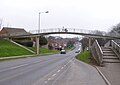
 Footbridge over the busy A165 - geograph.org.uk - 1212002.jpg 640 × 480; 77 KB
-
-
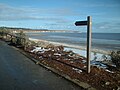 Footpath Waymarker North beach - geograph.org.uk - 1208055.jpg 640 × 480; 85 KB
-
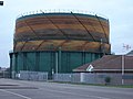 Full of gas needs a paint job - geograph.org.uk - 1115274.jpg 640 × 480; 61 KB
-
 Gatehouse to Sewerby Hall and Estate - geograph.org.uk - 1358590.jpg 640 × 471; 81 KB
-
 Gateway into Sewerby Park - geograph.org.uk - 1126889.jpg 640 × 480; 75 KB
-
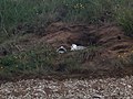
 Get off my perch - geograph.org.uk - 1427248.jpg 640 × 480; 73 KB
-

-
 Graffiti on Building - geograph.org.uk - 1212009.jpg 640 × 463; 88 KB
-
 Graveyard, St Magnus Church - geograph.org.uk - 1223499.jpg 640 × 481; 126 KB
-
 Greenhouse, Sewerby Hall Walled Garden - geograph.org.uk - 1509498.jpg 640 × 480; 137 KB
-
 Grindale Lane Junction With A165 - geograph.org.uk - 1213391.jpg 640 × 480; 58 KB
-
 Groyne into the sea - geograph.org.uk - 1202635.jpg 640 × 480; 68 KB
-
 Gull in the harbour - geograph.org.uk - 1270333.jpg 640 × 480; 88 KB
-
-
 Headlands School and Science College.jpg 640 × 480; 81 KB
-
 Hedgerow and Woodland - geograph.org.uk - 1223469.jpg 640 × 481; 98 KB
-
 Hedgerow off Short Lane - geograph.org.uk - 1207482.jpg 640 × 480; 82 KB
-
 High Street, Bridlington Old Town - geograph.org.uk - 1561133.jpg 640 × 480; 81 KB
-
 Hilderthorpe Beach and South sands - geograph.org.uk - 1202664.jpg 640 × 480; 48 KB
-
 Hillfield near Bridlington - geograph.org.uk - 1213393.jpg 640 × 480; 75 KB
-
 Holiday Caravan Park - geograph.org.uk - 1115277.jpg 640 × 480; 44 KB
-
 Holy Trinity Church - geograph.org.uk - 1566997.jpg 470 × 640; 45 KB
-
 Houses in Bridlington - geograph.org.uk - 1428548.jpg 640 × 481; 113 KB
-
 Houses on Short Lane - geograph.org.uk - 1207475.jpg 640 × 480; 70 KB
-
 Houses with a view of the sea - geograph.org.uk - 1556802.jpg 640 × 427; 268 KB
-
 Housing on Bessingby Gate - geograph.org.uk - 1223448.jpg 640 × 481; 113 KB
-
 I see no ships^ - geograph.org.uk - 1358639.jpg 640 × 480; 59 KB
-

-

-
 Looking Down St Chad Road - geograph.org.uk - 1226619.jpg 640 × 481; 112 KB
-
 Looking North Up Bempton Lane - geograph.org.uk - 1207460.jpg 640 × 480; 48 KB
-
 Looking south from Dane's Dyke - geograph.org.uk - 1358809.jpg 640 × 480; 46 KB
-
-
 Marton Gate - Direction Flamborough - geograph.org.uk - 1212506.jpg 640 × 427; 66 KB
-

-
 Marton Hall - geograph.org.uk - 1209203.jpg 640 × 480; 107 KB
-
 Marton Hall - geograph.org.uk - 1209209.jpg 640 × 480; 95 KB
-
 Modern Housing - geograph.org.uk - 1218432.jpg 640 × 439; 70 KB
-
 New Caravan Park - geograph.org.uk - 1284896.jpg 640 × 480; 68 KB
-
 North Sands toward Flamborough - geograph.org.uk - 1126905.jpg 640 × 480; 67 KB
-
 North Sands towards Sewerby cliffs - geograph.org.uk - 1202475.jpg 640 × 480; 58 KB
-
 North Sands towards the harbour - geograph.org.uk - 1202483.jpg 640 × 480; 52 KB
-
 Old Milestone Cardigan Road - geograph.org.uk - 1126913.jpg 640 × 480; 41 KB
-
 Ornamental Park - geograph.org.uk - 1211999.jpg 640 × 480; 137 KB
-
 Path Down The Cliff - geograph.org.uk - 1209161.jpg 480 × 640; 46 KB
-
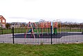 Play Area - geograph.org.uk - 1218445.jpg 640 × 433; 85 KB
-
 Polytelis swainsonii -Sewerby Zoo -Yorkshire-6a.jpg 3,888 × 2,592; 7.43 MB
-
 Priory Church - geograph.org.uk - 1115275.jpg 640 × 480; 66 KB
-
 Promenade, North Beach - geograph.org.uk - 1566982.jpg 640 × 462; 55 KB
-
 Public Toilets, North Beach - geograph.org.uk - 1566931.jpg 640 × 453; 43 KB
-
 Queensgate, Bridlington - geograph.org.uk - 1226607.jpg 640 × 481; 116 KB
-

-
 Radio Mast - geograph.org.uk - 1213419.jpg 480 × 640; 72 KB
-
 Railway Bridge over Flamborough Road - geograph.org.uk - 1567010.jpg 640 × 434; 58 KB
-
 Railway Bridge, Bridlington - geograph.org.uk - 1209081.jpg 640 × 480; 88 KB
-
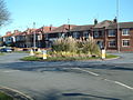 Roundabout on Queensgate - geograph.org.uk - 1226628.jpg 640 × 481; 79 KB
-
 Sewerby Bridlington England East Yorkshire.jpg 1,995 × 3,000; 5.98 MB
-
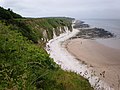
 Sewerby Cliffs - geograph.org.uk - 1209168.jpg 640 × 480; 88 KB
-
 Sewerby Cottages - geograph.org.uk - 1209109.jpg 640 × 480; 83 KB
-
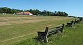
 Sewerby Cricket Club - geograph.org.uk - 1126812.jpg 640 × 480; 88 KB
-
 Sewerby Cricket Club Pavilion - geograph.org.uk - 1209135.jpg 640 × 480; 59 KB
-
 Sewerby cricket club.jpg 640 × 354; 63 KB
-

-
 Sewerby Grange - geograph.org.uk - 1209097.jpg 640 × 448; 110 KB
-
 Sewerby Hall Bandstand.jpg 640 × 480; 123 KB
-
 Sewerby Hall pitch and Putt - geograph.org.uk - 1509480.jpg 640 × 480; 120 KB
-
 Sewerby Hall. - geograph.org.uk - 1555698.jpg 640 × 426; 82 KB
-
 Sewerby Lodge House - geograph.org.uk - 1209200.jpg 640 × 480; 87 KB
-
 Sewerby Park Gates - geograph.org.uk - 1209128.jpg 640 × 480; 103 KB
-
 Sewerby Road Roundabout - geograph.org.uk - 1209065.jpg 640 × 480; 97 KB
-
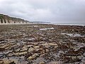
 Sewerby Rocks - geograph.org.uk - 1227616.jpg 640 × 480; 75 KB
-
 Sewerby Rocks Foreshore - geograph.org.uk - 1227632.jpg 640 × 493; 111 KB
-
 Signpost, Bridlington - geograph.org.uk - 1428539.jpg 468 × 640; 184 KB
-
 Slipway to North Beach - geograph.org.uk - 1566935.jpg 640 × 480; 51 KB
-
 Slipway to the Beach - geograph.org.uk - 1227663.jpg 640 × 427; 84 KB
-
 Small Woodland Beside B1255 - geograph.org.uk - 1212401.jpg 640 × 427; 124 KB
-
 Social Housing - geograph.org.uk - 1212013.jpg 640 × 480; 98 KB
-
 South Sands - geograph.org.uk - 1244071.jpg 640 × 480; 43 KB
-
 South Sands Beach - geograph.org.uk - 1208109.jpg 640 × 480; 44 KB
-
 South Sands Bridlington - geograph.org.uk - 1208090.jpg 640 × 480; 40 KB
-
 South Tower, Bridlington Priory - geograph.org.uk - 1630122.jpg 480 × 640; 81 KB
-
 Southern Promenade - geograph.org.uk - 1208098.jpg 640 × 480; 54 KB
-
 Springfield Avenue, Bridlington - geograph.org.uk - 1428558.jpg 640 × 481; 137 KB
-
 St John the Evangelist Parish Church Sewerby.jpg 640 × 480; 127 KB
-

-
 Summer fun at Bridlington, East Riding - geograph.org.uk - 1412953.jpg 640 × 480; 134 KB
-
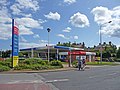 Tesco, Bridlington - geograph.org.uk - 1428538.jpg 640 × 481; 113 KB
-

-
 The back of Sewerby Hall - geograph.org.uk - 1126823.jpg 640 × 480; 91 KB
-

-
 The Black Lion - geograph.org.uk - 1561130.jpg 640 × 480; 66 KB


