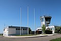
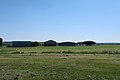
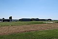
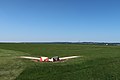
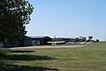
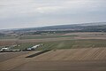
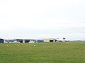
Category:Aérodrome de Chavenay - Villepreux
Jump to navigation
Jump to search
| Object location | | View all coordinates using: OpenStreetMap |
|---|
airport in France  | |||||
| Upload media | |||||
| Instance of | |||||
|---|---|---|---|---|---|
| Named after | |||||
| Location | Chavenay, Yvelines, Île-de-France, Metropolitan France, France | ||||
| Operator | |||||
| Elevation above sea level |
| ||||
| IATA airport code |
| ||||
| ICAO airport code |
| ||||
| official website | |||||
 | |||||
Media in category "Aérodrome de Chavenay - Villepreux"
The following 38 files are in this category, out of 38 total.
-
 Aérodrome de Chavenay - Villepreux 1.jpg 5,472 × 3,648; 3.97 MB
-
 Aérodrome de Chavenay - Villepreux 10.jpg 5,472 × 3,648; 9.63 MB
-
 Aérodrome de Chavenay - Villepreux 11.jpg 5,472 × 3,648; 9.96 MB
-
 Aérodrome de Chavenay - Villepreux 12.jpg 5,472 × 3,648; 11.19 MB
-
 Aérodrome de Chavenay - Villepreux 13.jpg 5,472 × 3,648; 10.6 MB
-
 Aérodrome de Chavenay - Villepreux 14.jpg 5,472 × 3,648; 8.6 MB
-
 Aérodrome de Chavenay - Villepreux 15.jpg 5,472 × 3,648; 11.88 MB
-
 Aérodrome de Chavenay - Villepreux 16.jpg 5,305 × 3,536; 8.68 MB
-
 Aérodrome de Chavenay - Villepreux 17.jpg 5,472 × 3,648; 10.21 MB
-
 Aérodrome de Chavenay - Villepreux 18.jpg 5,235 × 3,490; 8.17 MB
-
 Aérodrome de Chavenay - Villepreux 19.jpg 5,472 × 3,648; 9.67 MB
-
 Aérodrome de Chavenay - Villepreux 2.jpg 5,472 × 3,648; 3.72 MB
-
 Aérodrome de Chavenay - Villepreux 20.jpg 5,359 × 3,572; 8.24 MB
-
 Aérodrome de Chavenay - Villepreux 21.jpg 5,346 × 3,564; 9.25 MB
-
 Aérodrome de Chavenay - Villepreux 22.jpg 5,381 × 3,585; 8.69 MB
-
 Aérodrome de Chavenay - Villepreux 23.jpg 5,472 × 3,648; 10.68 MB
-
 Aérodrome de Chavenay - Villepreux 24.jpg 5,472 × 3,648; 9.53 MB
-
 Aérodrome de Chavenay - Villepreux 25.jpg 5,472 × 3,648; 10.07 MB
-
 Aérodrome de Chavenay - Villepreux 26.jpg 5,472 × 3,648; 8.81 MB
-
 Aérodrome de Chavenay - Villepreux 27.jpg 5,401 × 3,600; 8.39 MB
-
 Aérodrome de Chavenay - Villepreux 28.jpg 5,431 × 3,620; 9.31 MB
-
 Aérodrome de Chavenay - Villepreux 29.jpg 5,472 × 3,648; 9.22 MB
-
 Aérodrome de Chavenay - Villepreux 3.jpg 5,472 × 3,648; 7.31 MB
-
 Aérodrome de Chavenay - Villepreux 30.jpg 5,442 × 3,628; 9.26 MB
-
 Aérodrome de Chavenay - Villepreux 31.jpg 5,472 × 3,648; 11.9 MB
-
 Aérodrome de Chavenay - Villepreux 32.jpg 5,472 × 3,648; 4.22 MB
-
 Aérodrome de Chavenay - Villepreux 33.jpg 5,472 × 3,648; 7.7 MB
-
 Aérodrome de Chavenay - Villepreux 4.jpg 5,472 × 3,648; 5.87 MB
-
 Aérodrome de Chavenay - Villepreux 5.jpg 5,271 × 3,513; 3.25 MB
-
 Aérodrome de Chavenay - Villepreux 6.jpg 5,472 × 3,648; 4.35 MB
-
 Aérodrome de Chavenay - Villepreux 7.jpg 5,472 × 3,648; 4.68 MB
-
 Aérodrome de Chavenay - Villepreux 8.jpg 5,472 × 3,648; 5.45 MB
-
 Aérodrome de Chavenay - Villepreux 9.jpg 5,472 × 3,648; 11.5 MB
-
 Aérodrome de Chavenay-Villepreux piste 23.jpg 1,024 × 682; 75 KB
-
 Aérodrome de Chavenay-Villepreux.jpg 1,024 × 682; 92 KB
-
 Chavenay Aérodrome.jpg 2,576 × 1,932; 511 KB
-
 Rue des Clayes, Chavenay 4.jpg 5,241 × 3,492; 8.86 MB
-
 Rue des Clayes, Chavenay 6.jpg 5,472 × 3,648; 12.2 MB


