Category:Acton Bridge
Jump to navigation
Jump to search
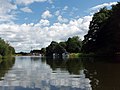
English: Acton Bridge (formerly Acton) is a village and civil parish in Cheshire, England. Located within the unitary authority of Cheshire West and Chester on the River Weaver, it is near the Trent and Mersey Canal at approximately 53˚ 16’ N, 2˚ 36’ W.
village and civil parish in Cheshire, England   | |||||
| Upload media | |||||
| Instance of | |||||
|---|---|---|---|---|---|
| Location | Cheshire West and Chester, Cheshire, North West England, England | ||||
| Said to be the same as | Acton Bridge (Wikimedia duplicated page, civil parish) | ||||
 | |||||
Subcategories
This category has the following 4 subcategories, out of 4 total.
A
- Acton Swing Bridge (19 F)
D
- Dutton Locks (27 F)
- Dutton Viaduct (36 F)
Media in category "Acton Bridge"
The following 157 files are in this category, out of 157 total.
-
 Ever Decreasing Cylinders.jpg 3,859 × 1,362; 3.6 MB
-
 A cold time they had of it... - geograph.org.uk - 1110882.jpg 640 × 426; 72 KB
-
 A jumble of cottages-houses - geograph.org.uk - 5803655.jpg 640 × 472; 109 KB
-
 A49 approaching Acton Lane - geograph.org.uk - 2778334.jpg 640 × 480; 56 KB
-
 A49 at Sandycroft - geograph.org.uk - 2778294.jpg 640 × 480; 57 KB
-
 A49 crossing R Weaver at Acton Bridge - geograph.org.uk - 5617274.jpg 5,184 × 2,920; 5.03 MB
-
 A49 Weaverham bypass - geograph.org.uk - 2778270.jpg 640 × 480; 60 KB
-
 A49(T) taken from a bridge on B5153 - geograph.org.uk - 17766.jpg 640 × 480; 96 KB
-
 Abandoned Ship at Dutton Locks - geograph.org.uk - 2429549.jpg 640 × 454; 51 KB
-
 Access lane to Acton Mill - geograph.org.uk - 3522672.jpg 640 × 480; 143 KB
-

-
 Acton Bridge - geograph.org.uk - 4955135.jpg 640 × 426; 41 KB
-
 Acton Bridge - River Weaver - geograph.org.uk - 5804830.jpg 640 × 480; 63 KB
-
 Acton Bridge Guidepost.jpg 640 × 480; 109 KB
-

-
 Acton Bridge road and boundary site - geograph.org.uk - 1773471.jpg 3,072 × 2,304; 1.38 MB
-

-
 Acton Bridge up fast freight geograph-2733648-by-Ben-Brooksbank.jpg 2,303 × 1,449; 1.48 MB
-
 Acton Brook, Acton Mill - geograph.org.uk - 3522599.jpg 480 × 640; 142 KB
-
 Acton Mill (1) - geograph.org.uk - 3522525.jpg 640 × 480; 130 KB
-
 Acton Mill (2) - geograph.org.uk - 3522560.jpg 640 × 480; 113 KB
-
 Acton Mill (3) - geograph.org.uk - 3522580.jpg 640 × 480; 103 KB
-
 Acton Mill Hamlet (1) - geograph.org.uk - 3522629.jpg 640 × 480; 86 KB
-
 Acton Mill Hamlet (2) - geograph.org.uk - 3522635.jpg 640 × 480; 101 KB
-
 Acton Mill Hamlet (3) - geograph.org.uk - 3522640.jpg 640 × 480; 88 KB
-
 Acton Mill Pool - geograph.org.uk - 3522536.jpg 640 × 480; 123 KB
-
 Acton Swing Bridge - geograph.org.uk - 5168919.jpg 1,200 × 1,600; 691 KB
-
 Acton Swing Bridge over R Weaver, Cheshire - geograph.org.uk - 5617276.jpg 5,184 × 2,920; 1.37 MB
-

-
 Approaching Dutton Locks - geograph.org.uk - 5803646.jpg 640 × 480; 65 KB
-
 Boathouse, the Grange Rowing Club - geograph.org.uk - 5151803.jpg 1,024 × 768; 126 KB
-
 Bridges over the A49 near Weaverham - geograph.org.uk - 5016073.jpg 640 × 480; 326 KB
-
-
 Chapel Lane bridge on the Delamere Way - geograph.org.uk - 4920090.jpg 800 × 600; 107 KB
-
 Chapel Lane, Acton Bridge - geograph.org.uk - 4919453.jpg 800 × 600; 83 KB
-
 Cheshire farmland - geograph.org.uk - 4955141.jpg 640 × 426; 47 KB
-
 Cliff Brook - geograph.org.uk - 3348448.jpg 1,280 × 853; 297 KB
-

-
 Cliff Road to Acton Mill footpath - geograph.org.uk - 3513102.jpg 640 × 480; 80 KB
-
 Cliff Road, Acton Bridge - geograph.org.uk - 5569908.jpg 1,024 × 683; 350 KB
-
 Control room, Acton swingbridge - geograph.org.uk - 5151810.jpg 1,024 × 768; 514 KB
-
 Cottages at Lower Green - geograph.org.uk - 3348451.jpg 1,280 × 853; 220 KB
-
 Cut Mark, Baptist Church, Acton Bridge - geograph.org.uk - 2324976.jpg 3,648 × 2,736; 3.79 MB
-
 Delamere Way - geograph.org.uk - 3513041.jpg 640 × 480; 69 KB
-
 Delamere Way - geograph.org.uk - 3513074.jpg 640 × 480; 73 KB
-
 Delamere Way, Old Lane-Acton Bridge - geograph.org.uk - 3513013.jpg 640 × 480; 88 KB
-
 Descending to Acton Brook - geograph.org.uk - 3348456.jpg 1,280 × 853; 331 KB
-
-
 Dutton Locks, River Weaver, from the south-west - geograph.org.uk - 5153718.jpg 1,024 × 768; 171 KB
-
 Dutton Viaduct (central portion) - geograph.org.uk - 5151959.jpg 1,024 × 768; 98 KB
-
 Dutton Viaduct from the south-west - geograph.org.uk - 5153702.jpg 1,024 × 614; 83 KB
-
 Entering Dutton Lock - geograph.org.uk - 5822414.jpg 640 × 480; 81 KB
-
 Farmland near Acton Bridge - geograph.org.uk - 3348452.jpg 1,280 × 853; 152 KB
-
 Farmland northeast of Acton Mill - geograph.org.uk - 3522483.jpg 640 × 480; 118 KB
-
 Farmland southwest of Acton Bridge - geograph.org.uk - 3513126.jpg 640 × 480; 56 KB
-
 Fields South West of Acton Bridge - geograph.org.uk - 4658910.jpg 640 × 481; 544 KB
-
 Footpath towards Acton Bridge - geograph.org.uk - 4658946.jpg 480 × 640; 448 KB
-
 Hazel Pear Inn - geograph.org.uk - 5569907.jpg 1,024 × 683; 288 KB
-
 Hazel Pear, Acton Bridge - geograph.org.uk - 3512874.jpg 640 × 480; 54 KB
-
 Hill Top Road, Acton Bridge - geograph.org.uk - 3512889.jpg 640 × 480; 59 KB
-
 Hilltop Road, Acton Bridge - geograph.org.uk - 5569901.jpg 1,024 × 683; 276 KB
-
 House at the Caravan Park - Sandycroft - geograph.org.uk - 3868331.jpg 3,532 × 2,304; 3.46 MB
-

-
 Landscape near Acton Bridge - geograph.org.uk - 4658940.jpg 640 × 480; 467 KB
-
 Lane at Weaver Holt - geograph.org.uk - 2894312.jpg 640 × 481; 99 KB
-
 Left for moorings, right for through traffic - geograph.org.uk - 5151798.jpg 1,024 × 768; 123 KB
-
 Looking West from Warrington Road - geograph.org.uk - 4658914.jpg 640 × 480; 558 KB
-
 Monday's Transport - Flickr - ARG Flickr.jpg 5,359 × 3,861; 13.27 MB
-

-
 Morning at Acton Bridge - geograph.org.uk - 998766.jpg 640 × 422; 67 KB
-
 Old Lane, Acton Bridge - geograph.org.uk - 3513022.jpg 640 × 480; 119 KB
-

-
 On Acton Lane - geograph.org.uk - 1110900.jpg 640 × 426; 62 KB
-
 Open access land, north bank, River Weaver - geograph.org.uk - 5157890.jpg 1,024 × 768; 106 KB
-
 Orchard Cottage - geograph.org.uk - 1110907.jpg 640 × 426; 43 KB
-
 Packhorse bridge - geograph.org.uk - 3348458.jpg 1,280 × 853; 378 KB
-
 Path by the River - panoramio.jpg 3,200 × 2,368; 2.14 MB
-
 Pepper Street, Acton Bridge.jpg 1,800 × 1,350; 885 KB
-

-
 Photo-sphere by the river - panoramio.jpg 3,840 × 1,919; 1.2 MB
-
 Pickering's Cut - geograph.org.uk - 2678636.jpg 640 × 456; 48 KB
-
 Pickering's Cut, Weaver Navigation - geograph.org.uk - 4955104.jpg 640 × 426; 57 KB
-
 Ploughed farmland - geograph.org.uk - 1773541.jpg 3,072 × 2,304; 820 KB
-
-
 Pond adjacent to roadside - geograph.org.uk - 1773480.jpg 3,072 × 2,304; 1.59 MB
-
 Pond by the river - panoramio.jpg 3,200 × 2,368; 2.42 MB
-
 Pond near Rose Farm, Acton Bridge - geograph.org.uk - 4920637.jpg 800 × 600; 154 KB
-
 Pond seen through hedge - geograph.org.uk - 1773548.jpg 3,072 × 2,304; 1.16 MB
-
 Pond-viewed from comfort of field - geograph.org.uk - 1773554.jpg 3,072 × 2,304; 1.32 MB
-
 Private Road, Old Lane-Acton Bridge - geograph.org.uk - 3513008.jpg 640 × 480; 85 KB
-
 Pylon in a field - geograph.org.uk - 4955110.jpg 640 × 426; 43 KB
-
 R Weaver, SE of Acton Swing Bridge, Cheshire - geograph.org.uk - 5617279.jpg 5,184 × 2,920; 5.04 MB
-
 Railway line looking NW from footbridge - geograph.org.uk - 1773506.jpg 3,072 × 2,304; 935 KB
-
 Railway line looking SE from footbridge - geograph.org.uk - 1773502.jpg 3,072 × 2,304; 707 KB
-
 Rear of The Grange, Acton Mill - geograph.org.uk - 3522497.jpg 640 × 480; 118 KB
-
 River (2274726032).jpg 2,048 × 1,536; 1.96 MB
-
 River Weaver (3212966848).jpg 3,872 × 2,592; 5.87 MB
-

-

-
 River Weaver - geograph.org.uk - 5804747.jpg 640 × 480; 61 KB
-
 River Weaver - geograph.org.uk - 805.jpg 640 × 480; 44 KB
-

-
 River Weaver from Acton Bridge - geograph.org.uk - 4658841.jpg 640 × 480; 406 KB
-
 River Weaver from the Riverside Inn - geograph.org.uk - 4657880.jpg 640 × 480; 408 KB
-
 River Weaver Navigation, looking north-west - geograph.org.uk - 5151924.jpg 1,024 × 614; 75 KB
-
 River Weaver Navigation, looking westwards - geograph.org.uk - 5151853.jpg 1,024 × 614; 77 KB
-
 River Weaver, Acton Swing Bridge - geograph.org.uk - 4658902.jpg 640 × 480; 424 KB
-
 River Weaver, below Dutton Locks - geograph.org.uk - 5151948.jpg 1,024 × 768; 156 KB
-

-
 Rush hour on the River Weaver - geograph.org.uk - 184425.jpg 640 × 480; 137 KB
-
 Sandy Lane junction, A49 - geograph.org.uk - 2778286.jpg 640 × 480; 49 KB
-
 Sandycroft - The Riverside pub - geograph.org.uk - 2778290.jpg 640 × 480; 56 KB
-
 Semaphore signals, upstream end, Dutton Locks - geograph.org.uk - 5153719.jpg 1,024 × 768; 139 KB
-
 Shower clouds as seen from Acton Ln, Acton Bridge - geograph.org.uk - 5617269.jpg 5,184 × 2,920; 5.26 MB
-
 Sluice, east bank, River Weaver - geograph.org.uk - 5151783.jpg 768 × 1,024; 471 KB
-

-
 Stanlow Refinery - geograph.org.uk - 5612741.jpg 2,982 × 2,235; 3.85 MB
-
 Station Hill (B5153), Acton Bridge - geograph.org.uk - 3512961.jpg 640 × 480; 119 KB
-
 Station Road (B5153), Acton Bridge - geograph.org.uk - 3512924.jpg 640 × 480; 87 KB
-

-
 Steam Tug Kerne from Acton Bridge - geograph.org.uk - 614497.jpg 640 × 428; 77 KB
-
 Steaming South.jpg 4,043 × 3,220; 7.79 MB
-
 Stile and Footpath - geograph.org.uk - 4658951.jpg 480 × 640; 524 KB
-
 Strawberry Lane, Acton Bridge - geograph.org.uk - 4919404.jpg 800 × 600; 176 KB
-
 Sunshine On Sutherland.jpg 4,590 × 3,070; 8.68 MB
-
-

-
 The Grange, Acton Mill (1) - geograph.org.uk - 3522509.jpg 640 × 480; 112 KB
-
 The Grange, Acton Mill (2) - geograph.org.uk - 3522573.jpg 640 × 480; 81 KB
-

-
 The Leigh Arms, Acton Bridge - geograph.org.uk - 1396878.jpg 640 × 480; 69 KB
-
 The Maypole at Acton Bridge - geograph.org.uk - 1110917.jpg 640 × 426; 70 KB
-
 The River Weaver at Dutton Viaduct - geograph.org.uk - 5153695.jpg 1,024 × 768; 152 KB
-
 The River Weaver near Acton Bridge - geograph.org.uk - 5151790.jpg 1,024 × 768; 96 KB
-
 The River Weaver, north of Acton Bridge, Cheshire (geograph 4020262).jpg 1,024 × 683; 160 KB
-
 The Riverside Inn - geograph.org.uk - 4657867.jpg 640 × 480; 417 KB
-

-
 The sunken MV Chiva, River Weaver Navigation - geograph.org.uk - 5153721.jpg 1,024 × 768; 171 KB
-
 The Weaver Navigation - geograph.org.uk - 4955105.jpg 640 × 342; 32 KB
-
 The wider Dutton Lock, River Weaver - geograph.org.uk - 5151946.jpg 1,024 × 768; 138 KB
-
 The Wise Old Owl - geograph.org.uk - 4560570.jpg 660 × 1,024; 160 KB
-
 Towards Acton Bridge Station - geograph.org.uk - 4920626.jpg 800 × 600; 125 KB
-
 Trees on the south-west bank of the River Weaver - geograph.org.uk - 5151904.jpg 1,024 × 768; 133 KB
-
 Triangle and tree, Acton Bridge - geograph.org.uk - 5569913.jpg 1,024 × 1,024; 626 KB
-
 Two bridges over the A49 - geograph.org.uk - 5168912.jpg 1,600 × 1,200; 810 KB
-

-
 Up freight north of Acton Bridge, WCML 1965 - geograph.org.uk - 4250203.jpg 2,442 × 1,421; 1.7 MB
-
 View from Ash House - geograph.org.uk - 3348449.jpg 1,280 × 853; 109 KB
-

-
 View taken while on the River Weaver - geograph.org.uk - 930117.jpg 640 × 480; 57 KB
-
 Vr actonbridge.png 591 × 443; 63 KB
-
 Warrington Road (A49), Acton Bridge - geograph.org.uk - 4658865.jpg 640 × 481; 472 KB
-

-
 Weaverham by-pass - geograph.org.uk - 2896941.jpg 640 × 480; 51 KB
-
 Weaverham By-pass - geograph.org.uk - 3868324.jpg 3,851 × 3,427; 6.31 MB
-
 West Coast Main Line - geograph.org.uk - 3513141.jpg 640 × 480; 96 KB
-
 Woodbine Cottage Caravan Park - geograph.org.uk - 5151774.jpg 1,024 × 768; 108 KB


_taken_from_a_bridge_on_B5153_-_geograph.org.uk_-_17766.jpg)


_-_geograph.org.uk_-_3522525.jpg)
_-_geograph.org.uk_-_3522560.jpg)
_-_geograph.org.uk_-_3522580.jpg)
_-_geograph.org.uk_-_3522629.jpg)
_-_geograph.org.uk_-_3522635.jpg)
_-_geograph.org.uk_-_3522640.jpg)


_-_geograph.org.uk_-_5151959.jpg)


.jpg)
.jpg)


,_Acton_Bridge_-_geograph.org.uk_-_3512961.jpg)
,_Acton_Bridge_-_geograph.org.uk_-_3512924.jpg)


_-_geograph.org.uk_-_3522509.jpg)
_-_geograph.org.uk_-_3522573.jpg)


.jpg)


,_Acton_Bridge_-_geograph.org.uk_-_4658865.jpg)


