Category:Aerial photographs of Landkreis Landshut
Jump to navigation
Jump to search
Urban districts (cities): Amberg · Ansbach · Aschaffenburg · Augsburg · Bamberg · Bayreuth · Coburg · Erlangen · Fürth · Hof · Kaufbeuren · Kempten · Landshut · Memmingen · Munich · Nuremberg · Passau · Regensburg · Rosenheim · Schwabach · Straubing · Weiden in der Oberpfalz · Würzburg
Deutsch: Luftaufnahmen aus dem Landkreis Landshut.
Subcategories
This category has the following 2 subcategories, out of 2 total.
Media in category "Aerial photographs of Landkreis Landshut"
The following 19 files are in this category, out of 19 total.
-
 Aerial image of the Schloss Kronwinkl (view from the northwest).jpg 3,600 × 2,300; 3.85 MB
-
 Aerial image of the Vilsbiburg airfield.jpg 4,000 × 2,800; 4.41 MB
-
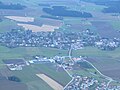 Altfraunhofen.jpg 3,264 × 2,448; 1.77 MB
-
 Baierbach.jpg 3,264 × 2,448; 1.78 MB
-
 Bayern Wörth Essenbach - Kernkraftwerk Isar KK1 from north IMG 8170.JPG 4,608 × 2,592; 2.75 MB
-
 Bayern-Landshut-Altfraunhofen Baierbach from south IMG 9010.JPG 5,184 × 3,456; 8.05 MB
-
 Bayern-Landshut-Gerzen Leberskirchen from southeast IMG 9002.JPG 5,184 × 3,456; 7.65 MB
-
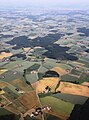 Bayern-Landshut-Neufraunhofen fields Haberthal Unterschweibach from south IMG 9008.JPG 3,456 × 4,671; 7.44 MB
-
 Bayern-Landshut-Vilsbiburg from southeast IMG 9004.JPG 3,456 × 5,184; 8.89 MB
-
 Bayern-Landshut-Vilsbiburg from southeast IMG 9005.JPG 5,184 × 3,456; 8.71 MB
-
 Bayern-Landshut-Vilsbiburg Industriegebiet Dräximaier from southeast IMG 9006.JPG 5,184 × 3,456; 7.56 MB
-
 Bayern-Landshut-Vilsheim fields Reichersdorf-Kaltenbrunn from south IMG 9011.JPG 5,184 × 3,108; 7.49 MB
-
 Bayern-Landshut-Wörth Kernkraftwerk Isar from east IMG 8996.JPG 3,456 × 4,587; 7.61 MB
-
 Bayern-Landshut-Wörth Kernkraftwerk Isar from east IMG 8997.JPG 3,456 × 4,522; 7.36 MB
-
 Bayern-Landshut-Wörth Kernkraftwerk Isar from east IMG 8999.JPG 3,274 × 4,214; 6.18 MB
-
 Essenbach Kraftwerk Aerial.jpg 1,211 × 907; 420 KB
-
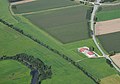
 Grüne Wiese.jpg 800 × 527; 141 KB
-
 Luftbildpanorama Hüttenkofen.jpg 16,000 × 8,000; 12.93 MB
-
 Vilsheim Kapfing.jpg 3,264 × 2,448; 1.82 MB
.jpg)


