Category:Aerial views of Chicago
Jump to navigation
Jump to search
Subcategories
This category has the following 10 subcategories, out of 10 total.
A
C
- Chicago textures (6 F)
S
- Satellite pictures of Chicago (33 F)
W
- Aerial views of Wrigley Field (14 F)
Media in category "Aerial views of Chicago"
The following 117 files are in this category, out of 117 total.
-
 07-chicago-aerial.jpg 2,940 × 1,588; 1.84 MB
-
 08-chicago-westlawn-s-pulaski-ave.jpg 3,264 × 1,840; 2.84 MB
-
 09-marquette-park-chicago.jpg 3,264 × 1,840; 2.26 MB
-
 10-chicago-new-city.jpg 3,188 × 1,780; 2.05 MB
-
 11-chicago-i-94.jpg 2,804 × 1,528; 1.46 MB
-
 12-chicago-washington-park-university-of-chicago.jpg 3,188 × 1,571; 1.87 MB
-
 13-chicago-washington-park-university-of-chicago (cropped).jpg 2,636 × 924; 1.16 MB
-
 13-chicago-washington-park-university-of-chicago.jpg 2,636 × 1,432; 1.72 MB
-
 14-chicago-jackson-park.jpg 3,264 × 1,840; 2.2 MB
-
 15-chicago-prairie-shores.jpg 2,748 × 1,840; 1.96 MB
-
 16-chicago-prairie-shores-south-commons.jpg 3,264 × 1,840; 2.19 MB
-
 17-chicago-south-commons-IIT-I90.jpg 3,020 × 1,840; 2.14 MB
-
 18-chicago-IIT-whitesox-stadium.jpg 2,804 × 1,652; 2.12 MB
-
 18-whitesox-stadium (cropped).jpg 645 × 396; 163 KB
-
 Union stock yards chicago 1870s loc.jpg 8,662 × 6,477; 11.79 MB
-
 19-chicago-bridgeport.jpg 3,264 × 1,840; 2.21 MB
-
 1973+FM07013 (4155438007).jpg 755 × 496; 357 KB
-
 1974-GM050-887 (4158369294) (McCormick Place).jpg 426 × 301; 38 KB
-
 1974-GM050-887 (4158369294) (Soldier Field 1).jpg 906 × 350; 104 KB
-
 1974-GM050-887 (4158369294).jpg 1,500 × 1,000; 480 KB
-
 20-chicago-mckinley-park.jpg 3,104 × 1,696; 2.26 MB
-
 20000304 07 CSX 59th St. yard (7076806499).jpg 1,128 × 1,799; 429 KB
-
 20080708 Randolph Street (eastward).JPG 2,304 × 3,072; 1.76 MB
-
 20080708 Randolph Street (westward).JPG 2,304 × 3,072; 1.97 MB
-
 22-chicago-brighton-park.jpg 3,264 × 1,840; 2.62 MB
-
 23-chicago-brighton-park.jpg 3,264 × 1,840; 2.57 MB
-
 24-chicago-brighton-park.jpg 2,780 × 1,728; 2.11 MB
-
 25-chicago-bnsf-corwith.jpg 3,200 × 1,584; 1.96 MB
-
 Aerial of 100th Street Bridge Chicago from SW in 1999.jpg 1,301 × 825; 561 KB
-
 Aerial of 106th Street Bridge Chicago from NE in 1999.jpg 2,997 × 2,052; 1.53 MB
-
 Aerial Photo of Field House.jpg 4,000 × 3,000; 4.87 MB
-
 Aerial Photo of Humboldt Park Boat House.jpg 4,000 × 3,000; 4.55 MB
-
 Aerial View of Chicago Beach Hotel, looking North, 1928 (NBY 5321).jpg 3,600 × 2,897; 1.1 MB
-
 Aerial view of Chicago, with South Shore and Hyde Park in foreground.jpg 1,840 × 3,264; 1.46 MB
-
 Aerial view of Chicago.jpg 2,048 × 1,536; 1.72 MB
-
 Aerial View of the Chicago Loop and River - Front.png 3,250 × 2,054; 14.78 MB
-

-

-

-

-

-
-
 Bell telephone magazine (1922) (14753056801).jpg 2,816 × 1,604; 966 KB
-
 Cabrini Green Housing Project.jpg 4,601 × 3,619; 2.2 MB
-
 Canal street bridge ping tom park.jpg 4,558 × 3,587; 8.22 MB
-
 Canal Street bridges HAER IL-112-9.jpg 4,582 × 3,549; 7.58 MB
-
 Central and North Chicago - March 2013.jpg 5,956 × 3,925; 7.3 MB
-
 Cherry Avenue Bridge HAER ILL-143-7.jpg 4,648 × 3,271; 3.57 MB
-
 Chicago (2871480648).jpg 1,200 × 800; 218 KB
-
 Chicago - Downtown from Air (2) (4286175075).jpg 1,300 × 681; 677 KB
-
 Chicago 20080418 16 Downtown Chicago (30954576744).jpg 3,648 × 2,736; 1.39 MB
-
 Chicago aerial 02.jpg 1,535 × 959; 442 KB
-
 Chicago Aerial Tour (5458300997).jpg 4,288 × 2,848; 6.32 MB
-
 Chicago at night from an airplane at an intentionally canted angle 2013-04-05 01-19.jpg 1,936 × 2,592; 1.72 MB
-
 Chicago bw.jpg 3,000 × 1,256; 2.05 MB
-
 Chicago Circle Interchange (Spaghetti Bowl) 29Nov07.JPG 1,600 × 1,200; 749 KB
-
 Chicago Downtown Aerial View.jpg 1,024 × 768; 361 KB
-
-
 Chicago from the Air (1974) (6011095887).jpg 1,200 × 839; 444 KB
-
 Chicago Harbor Light, Outer Breakwater, Chicago Harbor, Chicago, Illinois (14023981768).jpg 4,000 × 3,000; 2.19 MB
-
 Chicago Illinois waterfront - panoramio.jpg 1,936 × 2,592; 1.69 MB
-
 Chicago Interstate circle interchange from Sears Tower west 2004-11 img 2662.jpg 1,600 × 1,200; 1.09 MB
-
 Chicago Michigan Avenue 1911-straightened.jpg 4,508 × 1,142; 1.98 MB
-
 Chicago Michigan Avenue 1911.jpg 4,614 × 1,196; 1.71 MB
-
 Chicago,Illinois,USA - panoramio.jpg 1,680 × 1,152; 296 KB
-
 Chicago,Illinois,USA. - panoramio (19).jpg 1,120 × 1,711; 329 KB
-
 Chicago,Illinois,USA. - panoramio (20).jpg 1,696 × 1,152; 402 KB
-
 Chicago,Illinois,USA. - panoramio (21).jpg 1,680 × 1,152; 370 KB
-
 Chicago,Illinois,USA. - panoramio (22).jpg 1,712 × 1,168; 338 KB
-
 Chicago,Illinois,USA. - panoramio (23).jpg 1,696 × 1,152; 272 KB
-
 Chicago,Illinois,USA. - panoramio (24).jpg 1,680 × 1,152; 328 KB
-
 Chicago,Illinois,USA. - panoramio (25).jpg 1,696 × 1,152; 387 KB
-
 Chicago,Illinois,USA. - panoramio (26).jpg 1,696 × 1,152; 379 KB
-
 ChicagoAerial-Kenwood-HydeParkNeighborhoods-Apr2013 (39258198095).jpg 2,400 × 1,600; 1.98 MB
-
 ChicagoCirrus.JPG 1,600 × 951; 1,005 KB
-
 ChicagoOverheadTiltShift.jpg 1,139 × 1,019; 824 KB
-
 Circle Interchange Chicago.jpg 2,848 × 2,136; 1.65 MB
-
 City of Chicago - panoramio.jpg 4,912 × 3,264; 5.88 MB
-
 DuSable Harbor (8091812163) (2).jpg 3,872 × 2,592; 4.23 MB
-
 DycheStadium.jpg 910 × 716; 205 KB
-
 Field Museum, Chicago, Illinois (14208210352) (cropped).jpg 985 × 500; 116 KB
-
 Full chicago skyline.jpg 2,483 × 1,701; 1.02 MB
-
 Grant Park and Michigan Avenue, Chicago, Illinois (14024061807).jpg 4,000 × 2,770; 5.54 MB
-
 Greyhound Harrison Street (August 2005).jpg 848 × 1,048; 249 KB
-
 Int90eInt94eRoadFacingSouthAerial-FullerParkChicago (40156987501).jpg 1,600 × 2,400; 2.36 MB
-
Jane M. Byrne Interchange Traffic.webm 31 s, 1,920 × 1,080; 65.72 MB
-
 Kinzie Street bridges HAER IL-142-2.jpg 4,630 × 3,637; 2.94 MB
-
 Lower West Side, Chicago, Illinois (14024072567).jpg 4,000 × 3,000; 3.9 MB
-
 Lower West Side, Chicago, Illinois (14207365921).jpg 4,000 × 3,000; 3.49 MB
-
 Massive Railyard Near Chicago Sanitary and Ship Canal, Chicago, Illinois (14023995819).jpg 4,000 × 3,000; 3.76 MB
-
 Midway Airport (USGS).png 1,680 × 1,050; 3.42 MB
-
 Midwayhigh.jpg 320 × 240; 51 KB
-
 Navy Pier (USGS).png 1,680 × 1,050; 2.67 MB
-
 Navy Pier, Chicago, Illinois (14023982898).jpg 4,000 × 3,000; 2.08 MB
-
 North Lake Shore Drive Beaches (14772993052).jpg 4,000 × 3,000; 5.85 MB
-
 Road junction chicago.jpg 2,592 × 1,944; 1.5 MB
-
 Skyline of Chicago with Willis tower.jpg 3,628 × 2,692; 1.24 MB
-
 Soldier Field and the Field Museum, Chicago, Illinois (14187501696).jpg 4,000 × 3,000; 3.08 MB
-

-
 Soldier Field and the Field Museum, Chicago, Illinois (14208210352).jpg 4,000 × 3,000; 3 MB
-
 Soldier Field Chicago aerial view (cropped).jpg 1,125 × 405; 221 KB
-
 Soldier Field Chicago aerial view.jpg 1,500 × 1,194; 606 KB
-
 Soldier Field, Chicago, Illinois (14207354361).jpg 2,640 × 1,980; 3.52 MB
-
 Sunset Chicago Skyline (Unsplash).jpg 4,094 × 2,730; 3.58 MB
-
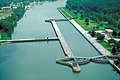 T J OBrien Lock and Dam.jpg 1,500 × 1,000; 279 KB
-
 TechInstitute-PostLakefill.jpg 718 × 702; 125 KB
-
 Thawing Chicago (13068149454).jpg 4,000 × 3,000; 4.94 MB
-
 UIC Campus, Chicago, Illinois, 1994.jpg 1,668 × 1,074; 2.48 MB
-
 Union stock yards chicago 1870s loc (cropped).jpg 7,312 × 5,258; 29.58 MB
-
 United Center and Surrounding Neighborhood, Chicago, Illinois (14024028380).jpg 4,000 × 3,000; 3.81 MB
-

-
 Wacker Drive aerials A.jpg 467 × 716; 275 KB
-
 Wacker Drive aerials B.jpg 484 × 716; 295 KB
-
 Wacker Drive aerials.jpg 985 × 717; 660 KB
-
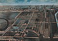
 Weltausstellung-chicago brockhaus.jpg 4,798 × 2,913; 3.82 MB
-
 Where Merrill C Meigs Field used to be. (2870649781).jpg 1,200 × 800; 250 KB
-
 飞机上拍的芝加哥 - panoramio.jpg 640 × 480; 18 KB


.jpg)


.jpg)
_(McCormick_Place).jpg)
.jpg)

.jpg)
.JPG)
.JPG)


.jpg)


_(14753056801).jpg)


.jpg)
_(4286175075).jpg)
.jpg)

.jpg)


_29Nov07.JPG)

_(6011095887)_(the_future_Museum_Campus).jpg)
_(6011095887).jpg)
.jpg)


.jpg)
.jpg)
.jpg)
.jpg)
.jpg)
.jpg)
.jpg)
.jpg)
.jpg)


_(2).jpg)

_(cropped).jpg)

.jpg)
.jpg)
.jpg)

.jpg)
.jpg)
.jpg)
.png)

.png)
.jpg)
.jpg)


.jpg)
_(cropped).jpg)
.jpg)

.jpg)
.jpg)


.jpg)

.jpg)
.jpg)


.jpg)

.jpg)
_(Soldier_Field_1).jpg)
.jpg)