Category:Appleton-le-Moors
Jump to navigation
Jump to search
village and civil parish in North Yorkshire, United Kingdom  | |||||
| Upload media | |||||
| Instance of | |||||
|---|---|---|---|---|---|
| Location | Ryedale, North Yorkshire, Yorkshire and the Humber, England | ||||
| official website | |||||
 | |||||
English: Appleton-le-Moors is a village and civil parish in the Ryedale district of North Yorkshire, England. According to the 2001 census it had a population of 183. The village is in the North York Moors National Park, and is near to Pickering and Kirkby Moorside.
Subcategories
This category has the following 3 subcategories, out of 3 total.
A
C
T
Media in category "Appleton-le-Moors"
The following 120 files are in this category, out of 120 total.
-
 2 Lambs Sheltering From The Rain - geograph.org.uk - 5802949.jpg 1,600 × 1,067; 389 KB
-
 A rural scene - geograph.org.uk - 3951893.jpg 2,560 × 1,920; 1.89 MB
-
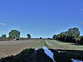
 A wet footpath - geograph.org.uk - 3344002.jpg 4,000 × 3,000; 4.25 MB
-
 Another wet track - geograph.org.uk - 3344008.jpg 4,000 × 3,000; 3.79 MB
-
 Appleton Common - geograph.org.uk - 6019296.jpg 2,048 × 1,536; 813 KB
-
 Appleton Hall - geograph.org.uk - 1982108.jpg 480 × 640; 107 KB
-

-
 Appleton-le-Moors - geograph.org.uk - 125091.jpg 640 × 479; 54 KB
-
 Appleton-le-Moors - geograph.org.uk - 1982120.jpg 640 × 480; 70 KB
-
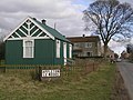 Appleton-le-Moors village Hall - geograph.org.uk - 125095.jpg 640 × 479; 88 KB
-
 Appleton-le-Moors village hall - geograph.org.uk - 4894071.jpg 1,024 × 651; 213 KB
-
 Approaching Town End Farm - geograph.org.uk - 2626159.jpg 1,024 × 768; 262 KB
-
 Arable crop off Headlands Road - geograph.org.uk - 2433431.jpg 2,048 × 1,536; 571 KB
-
 Back Lane, Appleton le Moors - geograph.org.uk - 3484016.jpg 4,320 × 3,240; 6.25 MB
-
 Baled straw, Appleton-le-Moors - geograph.org.uk - 2626245.jpg 768 × 1,024; 298 KB
-

-
 Bridleway approaching Dogcroft Hill - geograph.org.uk - 2625955.jpg 2,048 × 1,536; 489 KB
-
 Bridleway at Hagg Scar - geograph.org.uk - 3484604.jpg 3,240 × 4,320; 3.45 MB
-
 Bridleway to Appleton-le-Moors - geograph.org.uk - 2625939.jpg 2,048 × 1,536; 593 KB
-
 Cattle Pastures at Appleton le Moors - geograph.org.uk - 3484028.jpg 4,320 × 2,160; 1.15 MB
-
 Christ Church Appleton Le Moors - geograph.org.uk - 6141381.jpg 640 × 427; 57 KB
-
 Cottage, Appleton-le-Moors - geograph.org.uk - 3124907.jpg 640 × 480; 83 KB
-
 Crop field off Kirkgate Lane - geograph.org.uk - 3124914.jpg 640 × 480; 85 KB
-
 Entering Appleton-le-Moors - geograph.org.uk - 4518827.jpg 1,024 × 768; 143 KB
-
 Entering Appleton-le-Moors from the west - geograph.org.uk - 2435104.jpg 1,024 × 712; 220 KB
-

-
 Farm outbuildings - geograph.org.uk - 2626251.jpg 1,024 × 768; 240 KB
-
 Farmland off Headlands Road - geograph.org.uk - 3124913.jpg 640 × 480; 69 KB
-
 Farmland off Kirkgate Lane - geograph.org.uk - 3124916.jpg 640 × 480; 74 KB
-
 Field entrance off Howdale Lane - geograph.org.uk - 3124894.jpg 640 × 480; 98 KB
-
 Footpath and quarry - geograph.org.uk - 5586243.jpg 4,320 × 3,240; 4.94 MB
-
 Footpath off the A170 - geograph.org.uk - 2453489.jpg 1,600 × 1,200; 494 KB
-
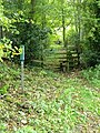 Footpath, Hagg Wood - geograph.org.uk - 2168470.jpg 480 × 640; 130 KB
-
 Four ways to go (1) - geograph.org.uk - 5586228.jpg 4,320 × 3,240; 3.29 MB
-
 Four ways to go (2) - geograph.org.uk - 5586230.jpg 4,320 × 3,240; 2.03 MB
-
 Four ways to go (3) - geograph.org.uk - 5586231.jpg 4,320 × 3,240; 4.7 MB
-
 Four ways to go (4) - geograph.org.uk - 5586232.jpg 4,320 × 3,240; 4.25 MB
-
 Gated track - geograph.org.uk - 3117541.jpg 1,024 × 768; 373 KB
-
 Grass crop drying in the hot September sunshine - geograph.org.uk - 2625948.jpg 2,048 × 1,536; 474 KB
-
 Grazing off Howdale Lane - geograph.org.uk - 3124899.jpg 640 × 480; 57 KB
-
 Grazing on Appleton Common - geograph.org.uk - 2433429.jpg 2,048 × 1,536; 750 KB
-
 Grazing, Hamley Hagg - geograph.org.uk - 3124902.jpg 640 × 480; 59 KB
-
 Green fodder crop - geograph.org.uk - 2627865.jpg 1,024 × 768; 232 KB
-
 Harvest in and straw baled - geograph.org.uk - 2626156.jpg 773 × 1,024; 202 KB
-
 Harvest in and straw baled - geograph.org.uk - 2627858.jpg 1,024 × 768; 262 KB
-
 Harvest in near Howlgate Head Wood - geograph.org.uk - 2627868.jpg 2,048 × 1,536; 503 KB
-
 Harvested wheat crop - geograph.org.uk - 2625934.jpg 2,048 × 1,536; 622 KB
-
 Headlands Road - geograph.org.uk - 2627518.jpg 1,536 × 2,048; 492 KB
-
 Headlands Road - geograph.org.uk - 3529065.jpg 3,526 × 2,663; 2.65 MB
-
 Headlands Road - geograph.org.uk - 4518861.jpg 1,024 × 817; 162 KB
-
 Headlands Road heading west - geograph.org.uk - 3124912.jpg 640 × 480; 48 KB
-
 Headlands Road, Appleton le Moors - geograph.org.uk - 3124908.jpg 640 × 480; 57 KB
-
 High Cross view - geograph.org.uk - 6019294.jpg 2,048 × 1,536; 1.21 MB
-
 High Cross, Appleton le Moors - geograph.org.uk - 3483911.jpg 3,240 × 4,320; 2.58 MB
-
 Hillside meadow - geograph.org.uk - 2460371.jpg 1,600 × 1,110; 282 KB
-
 Hints of autumn - geograph.org.uk - 2627867.jpg 1,024 × 689; 177 KB
-
 Houses in Appleton-le-Moors - geograph.org.uk - 4518894.jpg 1,024 × 768; 165 KB
-

-

-
 Howlgate Head Wood - geograph.org.uk - 2464252.jpg 2,048 × 1,436; 502 KB
-
 Ings Balk near Appleton-le-Moors - geograph.org.uk - 3608011.jpg 1,024 × 768; 735 KB
-
 K6 phonebox, Appleton-le-Moors - geograph.org.uk - 2627534.jpg 2,048 × 1,536; 362 KB
-
 Lichen, rust and peeling paint - geograph.org.uk - 2627859.jpg 2,048 × 1,553; 282 KB
-
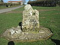
 Low Cross - Appleton-le-Moors - geograph.org.uk - 125085.jpg 640 × 479; 96 KB
-
 Low Cross, Appleton le Moors - geograph.org.uk - 3483930.jpg 3,240 × 4,320; 5.82 MB
-
 Low Cross, Appleton-le-Moors.jpg 640 × 480; 177 KB
-
 Main street through Appleton-le-Moors - geograph.org.uk - 4100768.jpg 4,000 × 3,000; 3.07 MB
-
 Manor Farmhouse - geograph.org.uk - 3483998.jpg 4,320 × 3,240; 1.95 MB
-
 Methodist church Appleton-le-Moors - geograph.org.uk - 5802956.jpg 1,024 × 683; 160 KB
-
 Moorfield, Appleton le Moors - geograph.org.uk - 3483977.jpg 4,294 × 2,973; 2 MB
-
 Near Hamley Hagg - geograph.org.uk - 3308624.jpg 1,600 × 1,200; 304 KB
-
 Near Skipster Hagg Farm - geograph.org.uk - 6019297.jpg 2,048 × 1,536; 712 KB
-
 Newly planted woodland - geograph.org.uk - 3118829.jpg 1,024 × 768; 210 KB
-

-
 Old North Riding of Yorks County Council sign - geograph.org.uk - 2627857.jpg 1,574 × 2,048; 436 KB
-
 Old Wayside Cross in Appleton le Moors (geograph 7494690).jpg 2,248 × 4,000; 2.99 MB
-
 Ordnance Survey Cut Mark - geograph.org.uk - 4097449.jpg 4,000 × 3,000; 5.05 MB
-
 Out to dry - geograph.org.uk - 2627866.jpg 768 × 1,024; 267 KB
-
 Pastures off Headlands Road - geograph.org.uk - 2433430.jpg 1,024 × 720; 168 KB
-
 Remains of Low Cross - geograph.org.uk - 2433477.jpg 1,536 × 2,048; 511 KB
-
 Riggs Barn - geograph.org.uk - 3344006.jpg 4,000 × 3,000; 2.83 MB
-
 Right turn to Lastingham - geograph.org.uk - 2433473.jpg 2,048 × 1,536; 390 KB
-
 Road to Skipster Hagg - geograph.org.uk - 1498694.jpg 640 × 427; 74 KB
-
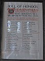 Roll of Honour, Appleton-le-Moors - geograph.org.uk - 2627863.jpg 1,516 × 2,048; 258 KB
-
 Rolling countryside - geograph.org.uk - 1522855.jpg 640 × 374; 45 KB
-
 Sheep alert - geograph.org.uk - 3117533.jpg 640 × 431; 79 KB
-
 Sheep grazing by Headlands Road - geograph.org.uk - 3124910.jpg 640 × 480; 81 KB
-
 Sheep on Kirkgate Lane - geograph.org.uk - 4518794.jpg 1,024 × 751; 120 KB
-
 Signpost on the Tabular Hills Way - geograph.org.uk - 2433470.jpg 768 × 1,024; 256 KB
-
 South Ings Lane - geograph.org.uk - 3608016.jpg 1,024 × 768; 694 KB
-
 South Ings Lane, Appleton-le-Moors - geograph.org.uk - 2168348.jpg 480 × 640; 88 KB
-
 Spaunton Quarry (1) - geograph.org.uk - 5586237.jpg 4,320 × 3,240; 4.54 MB
-
 Spaunton Quarry (2) - geograph.org.uk - 5586240.jpg 4,320 × 3,240; 4.09 MB
-
 Spaunton Quarry (3) - geograph.org.uk - 5586241.jpg 4,320 × 3,240; 3.52 MB
-
 Spaunton Quarry (4) - geograph.org.uk - 5586242.jpg 4,320 × 3,240; 3.96 MB
-
 Spaunton Quarry - geograph.org.uk - 3344009.jpg 4,000 × 3,000; 3.06 MB
-
 Spaunton Quarry - geograph.org.uk - 5285592.jpg 2,048 × 1,536; 1.08 MB
-
 Spaunton Quarry Heaps of Limestone - geograph.org.uk - 1350250.jpg 640 × 480; 61 KB
-
 Steep sides of Hag Scar - geograph.org.uk - 3118803.jpg 1,024 × 768; 347 KB
-
 Stone at the SW end of the village of Appleton-le-Moors - geograph.org.uk - 2433434.jpg 1,600 × 1,200; 565 KB
-
 Stone barn by the bridleway - geograph.org.uk - 2626364.jpg 768 × 1,024; 262 KB
-
 Tabular Hills Walk track joining Hamley Lane - geograph.org.uk - 4100755.jpg 4,000 × 3,000; 4.09 MB
-
 Telephone box, Appleton-le-Moors - geograph.org.uk - 2168278.jpg 480 × 640; 82 KB
-
 The edge of Appleton-le-Moors - geograph.org.uk - 2433432.jpg 2,048 × 1,536; 452 KB
-
 The Riggs - geograph.org.uk - 3281475.jpg 1,024 × 768; 280 KB
-
 The welcoming committee - geograph.org.uk - 2433433.jpg 2,048 × 1,536; 506 KB
-
 Three Faces - geograph.org.uk - 2627476.jpg 1,024 × 768; 172 KB
-
 Three Faces, detail - geograph.org.uk - 2627496.jpg 2,048 × 1,337; 376 KB
-
 Track past The Hall - geograph.org.uk - 2459095.jpg 600 × 900; 343 KB
-
 Track to Hamley Hagg - geograph.org.uk - 3124903.jpg 640 × 480; 64 KB
-
 Track to Sinnington Manor - geograph.org.uk - 2453491.jpg 1,600 × 1,200; 480 KB
-
 Village entrance sign, Appleton-le-Moors - geograph.org.uk - 2435101.jpg 1,536 × 2,048; 722 KB
-
 Village Hall, Appleton le Moors - geograph.org.uk - 3483981.jpg 4,320 × 3,240; 2.06 MB
-
 Village Hall, Appleton-le-Moors.jpg 4,608 × 3,456; 3.19 MB
-
 Village street, Appleton le Moors - geograph.org.uk - 3483965.jpg 4,320 × 2,160; 1.24 MB
-
 Walkers approaching Appleton-le-Moors - geograph.org.uk - 2626154.jpg 1,536 × 2,048; 475 KB
-

-
 Wesleyan Chapel, Appleton-le-Moors - geograph.org.uk - 2433456.jpg 1,536 × 2,048; 552 KB
-
 Wheat crop and Howlgate Head Wood - geograph.org.uk - 2464256.jpg 1,024 × 768; 356 KB
-
 Whinny Hill Farm - geograph.org.uk - 2453493.jpg 640 × 480; 73 KB


_-_geograph.org.uk_-_5586228.jpg)
_-_geograph.org.uk_-_5586230.jpg)
_-_geograph.org.uk_-_5586231.jpg)
_-_geograph.org.uk_-_5586232.jpg)


.jpg)


_-_geograph.org.uk_-_5586237.jpg)
_-_geograph.org.uk_-_5586240.jpg)
_-_geograph.org.uk_-_5586241.jpg)
_-_geograph.org.uk_-_5586242.jpg)


