Category:Arabia quadrangle
Saltar para a navegação
Saltar para a pesquisa
English: The Arabia quadrangle is one of a series of 30 quadrangle maps of Mars used by the United States Geological Survey (USGS) Astrogeology Research Program. The Arabia quadrangle is also referred to as MC-12 (Mars Chart-12). See link for map of this area.

map of Mars  | |||||
| Carregar ficheiro | |||||
| Instância de |
| ||||
|---|---|---|---|---|---|
| No objeto astronómico | |||||
| |||||
Subcategorias
Esta categoria contém as seguintes 20 subcategorias (de um total de 20).
!
- Maps of Arabia quadrangle (17 F)
*
- Dunes in Arabia quadrangle (5 F)
A
H
- Hiddekel Cavus (2 F)
- Hiddekel Rupes (1 F)
I
- Indus Vallis (2 F)
M
N
- Naktong Vallis (4 F)
S
- Scamander Vallis (6 F)
T
Multimédia na categoria "Arabia quadrangle"
Esta categoria contém os seguintes 15 ficheiros (de um total de 15).
-
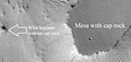 57059 2045mesa.jpg 1 307 × 618; 327 kB
-
 Close view of ridge and channel interaction ESP 074773 2095 02.jpg 2 560 × 1 920; 2,43 MB
-
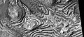
 Color view of layers 26270 1820.jpg 1 829 × 817; 498 kB
-
 Dark Streaks in crater 81668 1960.jpg 1 829 × 817; 808 kB
-
 ESP 061610 1895yardangsclose.jpg 840 × 333; 260 kB
-
 Features in Arabia quadrangle.jpg 2 048 × 3 951; 2,12 MB
-
 Layered area with faults ESP 26270 1820.jpg 1 829 × 817; 657 kB
-
 Layers and layered mounds ESP 26270 1820.jpg 1 829 × 817; 523 kB
-
 Layers some with overhang ESP 26270 1820.jpg 1 829 × 817; 484 kB
-
 Pretty network in Arabia quadrangle.jpg 1 827 × 723; 298 kB
-
 Ridge and channel interaction ESP 074773 2095 01.jpg 2 048 × 3 117; 2,02 MB
-
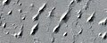
 Ridges with some pyramid shapes.jpg 1 306 × 617; 200 kB
-
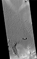
 Streaks22919.jpg 1 474 × 689; 318 kB
-
 Wide view of field of yardings.jpg 2 048 × 3 237; 1,65 MB
-
 Wide view of layers ESP 27747 1820.jpg 1 920 × 1 440; 818 kB


