Category:Arthur's Pass
Jump to navigation
Jump to search
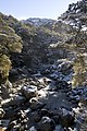
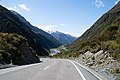
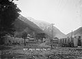
English: Arthur's Pass, previously called Camping Flat then Bealey Flats, and for some time officially Arthurs Pass, is a township in the Southern Alps of the South Island of New Zealand, located in the Selwyn district. It is a popular base for exploring Arthur's Pass National Park. Arthur's Pass township is about 5 km south of the mountain pass with the same name. Its elevation is 740 metres above sea level surrounded by beech forest. The Bealey River runs through the township. The town is located 153 km from Christchurch a 2-hour drive on SH 73.
locality in Selwyn District, Canterbury Region, New Zealand  | |||||
| Upload media | |||||
| Instance of | |||||
|---|---|---|---|---|---|
| Named after | |||||
| Location | Selwyn District, Canterbury Region, New Zealand | ||||
| Mountain range | |||||
| Population |
| ||||
| Area |
| ||||
| Elevation above sea level |
| ||||
| Different from | |||||
 | |||||
Subcategories
This category has the following 11 subcategories, out of 11 total.
C
- Arthur's Pass Café (5 F)
D
- Devil's Punchbowl, New Zealand (33 F)
F
- Arthur's Pass Fire Station (2 F)
H
M
- Millennium Walk, Arthur's Pass (13 F)
O
- Otira Tunnel (7 F)
P
- Punchbowl Power Station (8 F)
T
V
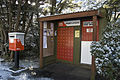
- Arthur's Pass Visitor Centre (7 F)
W
- Wobbly Kea (8 F)
Media in category "Arthur's Pass"
The following 83 files are in this category, out of 83 total.
-
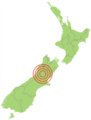 1929 Arthurs Pass EQ location.png 300 × 394; 9 KB
-
 2008-06-07 Arthur's Pass Village.jpg 2,700 × 1,800; 1.35 MB
-
 2008-06-07 Arthur's Pass.jpg 2,700 × 1,800; 1.31 MB
-
 2008-06-08 Arthur's Pass - 3.jpg 2,700 × 1,800; 1.47 MB
-
 2008-06-08 Arthur's Pass - 4.jpg 2,700 × 1,800; 1.48 MB
-
 2008-06-08 Arthur's Pass village.jpg 2,700 × 1,800; 1.58 MB
-
 2008-06-08 Arthur's Pass.jpg 2,700 × 1,800; 1.23 MB
-
 2022-05-30 Bealey River, Arthur's Pass 1.jpg 4,032 × 3,024; 4.17 MB
-
 2022-05-30 Bealey River, Arthur's Pass 2.jpg 4,032 × 3,024; 3.86 MB
-
 2022-05-30 Bealey River, Arthur's Pass 3.jpg 4,032 × 3,024; 3.79 MB
-
 Arthur's Pass (Unsplash).jpg 3,322 × 4,982; 7.43 MB
-
 Arthur's Pass Entrance.jpg 1,848 × 1,312; 1.41 MB
-
 Arthur's Pass NZ.JPG 2,592 × 1,944; 2.97 MB
-
 Arthur's Pass Visitor Centre MRD 02.jpg 3,024 × 4,032; 4.31 MB
-
 Arthurs Pass (18866204369).jpg 3,264 × 4,896; 6.36 MB
-
 Arthurs Pass (19046817732).jpg 3,264 × 4,896; 6.69 MB
-
 Arthurs Pass - panoramio - Maksym Kozlenko (1).jpg 2,700 × 1,800; 1.27 MB
-
 Arthurs Pass - panoramio - Maksym Kozlenko (13).jpg 2,700 × 1,800; 1.01 MB
-
 Arthurs Pass - panoramio - Maksym Kozlenko (16).jpg 2,700 × 1,800; 1.19 MB
-
 Arthurs Pass - panoramio - Maksym Kozlenko (20).jpg 2,700 × 1,800; 1.83 MB
-
 Arthurs Pass - panoramio - Maksym Kozlenko (28).jpg 2,700 × 1,800; 1.46 MB
-
 Arthurs Pass - panoramio - Maksym Kozlenko (3).jpg 2,700 × 1,800; 1.1 MB
-
 Arthurs Pass - panoramio - Maksym Kozlenko (33).jpg 2,700 × 1,800; 1.73 MB
-
 Arthurs Pass - panoramio - Maksym Kozlenko (34).jpg 2,700 × 1,800; 1.88 MB
-
 Arthurs Pass - panoramio - Maksym Kozlenko (36).jpg 2,700 × 1,800; 1.98 MB
-
 Arthurs Pass - panoramio - Maksym Kozlenko (37).jpg 1,800 × 2,700; 1.83 MB
-
 Arthurs Pass - panoramio - Maksym Kozlenko (38).jpg 2,700 × 1,800; 2.1 MB
-
 Arthurs Pass - panoramio - Maksym Kozlenko (39).jpg 1,800 × 2,700; 2.61 MB
-
 Arthurs Pass - panoramio - Maksym Kozlenko (4).jpg 2,700 × 1,800; 1.18 MB
-
 Arthurs Pass - panoramio.jpg 1,800 × 2,700; 1.18 MB
-
 Arthurs Pass MRD 02.jpg 4,032 × 3,024; 7.37 MB
-
 Arthurs Pass MRD 03.jpg 2,984 × 3,278; 2.83 MB
-
 Arthurs pass New Zealand south island 1.jpg 1,080 × 1,080; 77 KB
-
 Arthurs pass New Zealand south island 2.jpg 1,080 × 1,080; 99 KB
-
 Arthurs Pass Tunnel with icicles (19718533349).jpg 4,896 × 3,264; 4.46 MB
-
 Arthurs Pass Village (19860957254).jpg 4,896 × 3,264; 6.89 MB
-
 Arthurs Pass Village (20296935149).jpg 4,896 × 3,264; 4.18 MB
-
 Arthurs Pass Village (20457407566).jpg 4,896 × 3,264; 5.41 MB
-
 Arthurs Pass Village (20483600205).jpg 4,896 × 3,264; 6.89 MB
-
 Avalanche Creek bridge, Canterbury, New Zealand.jpg 3,511 × 4,213; 13.52 MB
-
 Avalanche Peak Photo.jpg 2,816 × 2,112; 2.81 MB
-
 Bealey River at Arthur's Pass.jpg 500 × 333; 157 KB
-
 Bealey River, Arthur's Pass, New Zealand 18.jpg 2,000 × 3,000; 6.32 MB
-
 Cleland Pl, Arthur's Pass, New Zealand 12.jpg 3,098 × 2,000; 6.28 MB
-
 Cleland Pl, Arthur's Pass, New Zealand 13.jpg 3,127 × 2,000; 6.63 MB
-
 Distance road signs near Arthur's Pass.jpg 3,976 × 2,651; 12.75 MB
-
 Fresh snow at Arthurs Pass - panoramio.jpg 2,592 × 1,944; 839 KB
-
 KiwiRail DXC class 5270 Cass.jpg 4,804 × 2,965; 1.95 MB
-
 Live steam at The Pass - panoramio.jpg 1,880 × 2,816; 1.37 MB
-
 Looking out Eastern Portal of the Otira Tunnel (err. . .train optional) - panoramio.jpg 1,880 × 2,816; 1.79 MB
-
 Lunch Table (20490459171).jpg 4,896 × 3,264; 5.46 MB
-
 Main street at Bealey Flat.jpg 6,219 × 4,415; 8.56 MB
-
 Map in Arthur's Pass Village Train Station.jpg 4,032 × 3,024; 2.29 MB
-
 More Snow (20339925916).jpg 4,896 × 3,264; 4.26 MB
-
 More Snow (20339948936).jpg 4,896 × 3,264; 5.25 MB
-
 More Snow (20366208525).jpg 4,896 × 3,264; 3.89 MB
-
 More Snow (20372305411).jpg 4,896 × 3,264; 5.5 MB
-
 New Zealand Arthurs Pass.jpg 4,752 × 3,168; 5.56 MB
-
 New Zealand climbing Avalanche Peak.jpg 3,168 × 4,752; 5.48 MB
-
 New Zealand tramping up Avalanche Peak.jpg 4,752 × 3,168; 5.95 MB
-
 NZ arthurs pass SI.jpg 1,400 × 1,050; 543 KB
-
 Post boxes at Arthur's Pass.jpg 2,700 × 1,800; 1.49 MB
-
 Railway bridge across Bealey River, Arthur's Pass National Park, New Zealand 26.jpg 4,344 × 1,636; 6.89 MB
-
 Selwyn District, Canterbury, New Zealand - panoramio (1).jpg 2,700 × 1,800; 1.83 MB
-
 SH 73 in Arthur's Pass, Arthur's Pass National Park, New Zealand 07.jpg 5,472 × 3,648; 19.62 MB
-
 State Highway 73 at Arthur's Pass 01.jpg 5,240 × 3,493; 7.97 MB
-
 State Highway 73 at Arthur's Pass 02.jpg 4,938 × 3,192; 13.11 MB
-
 State Highway 73 at Arthur's Pass 03.jpg 4,747 × 3,321; 11.75 MB
-
 State Highway 73 in Arthur's Pass 01.jpg 4,865 × 2,802; 9.12 MB
-
 State Highway 73 in Arthur's Pass, Canterbury, New Zealand.jpg 5,471 × 3,374; 18.13 MB
-
 State Highway 73 near Arthur's Pass 01.jpg 3,646 × 2,093; 6.49 MB
-
 State Highway 73 near Arthur's Pass 02.jpg 4,498 × 3,104; 12.39 MB
-
 State Highway 73 near Arthur's Pass 03.jpg 2,976 × 3,592; 9.01 MB
-
 Train station, Arthur's Pass, New Zealand 17.jpg 4,392 × 2,000; 8.2 MB
-
 TranzAlpine train route - panoramio - Maksym Kozlenko (1).jpg 2,700 × 1,800; 1,013 KB
-
 TranzAlpine train route - panoramio - Maksym Kozlenko (2).jpg 2,700 × 1,800; 665 KB
-
 TranzAlpine train route - panoramio - Maksym Kozlenko (3).jpg 2,700 × 1,800; 954 KB
-
 Truck load of export snow - panoramio.jpg 1,880 × 2,816; 2.14 MB
-
 View of Bealey Flat, 1910.jpg 6,108 × 4,384; 10.38 MB
-
 View of Bealey Flat, 1910a.jpg 6,151 × 4,351; 5.31 MB
-
 View of Bealey Flat, ca 1910.jpg 6,209 × 4,427; 8.75 MB
-
 Wet Arthurs Pass (19662764583).jpg 4,896 × 3,264; 3.18 MB
-
 Wet Arthurs Pass (20275402382).jpg 4,896 × 3,264; 2.75 MB


.jpg)


.jpg)
.jpg)
.jpg)
.jpg)
.jpg)
.jpg)
.jpg)
.jpg)
.jpg)
.jpg)
.jpg)
.jpg)
.jpg)
.jpg)
.jpg)


.jpg)
.jpg)
.jpg)
.jpg)
.jpg)


_-_panoramio.jpg)
.jpg)


.jpg)
.jpg)
.jpg)
.jpg)


.jpg)


.jpg)
.jpg)
.jpg)


.jpg)
.jpg)