Category:Ashburton, Devon
Prijeđi na navigaciju
Prijeđi na pretraživanje
town in Devon, England  | |||||
| Postavi datoteku | |||||
| Jest | |||||
|---|---|---|---|---|---|
| Located in protected area | |||||
| Lokacija | Teignbridge, Devon, Jugozapadna Engleska, Engleska | ||||
| Kaže se da je isto kao | Ashburton (Wikimedia duplicated page, civil parish) | ||||
| službena mrežna stranica | |||||
 | |||||
Potkategorije
Ova kategorija ima sljedećih 8 potkategorija, od ukupno 8.
Mediji u kategoriji »Ashburton, Devon«
Prikazano je 200 datoteka u ovoj kategoriji, od njih ukupno 451.
(prethodna stranica) (sljedeća stranica)-
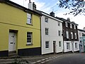
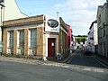 10 East Street, Ashburton - geograph.org.uk - 3700157.jpg 2.000 × 1.500; 846 KB
-
 1793 Boundary Rock - geograph.org.uk - 1178518.jpg 640 × 427; 98 KB
-
 17C cottage, Woodland Road, Ashburton - geograph.org.uk - 3700194.jpg 2.000 × 1.467; 772 KB
-
 A faint rainbow over southern Dartmoor - geograph.org.uk - 5311910.jpg 1.600 × 1.200; 716 KB
-

-
 A modern gate between old gateposts, Rushlade - geograph.org.uk - 4108893.jpg 1.600 × 1.200; 1,76 MB
-
 A plantation of young Christmas trees - geograph.org.uk - 4108584.jpg 1.600 × 1.200; 1,51 MB
-
 A seat and signpost at Ausewell Cross - geograph.org.uk - 5311907.jpg 1.600 × 1.200; 852 KB
-
 A spider cocoon - geograph.org.uk - 944672.jpg 512 × 640; 42 KB
-
 A38 - geograph.org.uk - 4765428.jpg 640 × 313; 25 KB
-
 A38 passing Ashburton - geograph.org.uk - 5321786.jpg 640 × 426; 84 KB
-
 A38, Ashburton Bypass - geograph.org.uk - 4765427.jpg 640 × 390; 48 KB
-
 Access road off Ash Close, Ashburton - geograph.org.uk - 4847510.jpg 2.000 × 1.333; 2,76 MB
-
 Across the Ashburn valley - geograph.org.uk - 5566247.jpg 2.045 × 1.442; 364 KB
-
 Adams Hele - geograph.org.uk - 5581215.jpg 2.048 × 1.331; 369 KB
-
 Adams Hele - geograph.org.uk - 5581219.jpg 1.400 × 913; 141 KB
-
 Alston Cross - geograph.org.uk - 5321784.jpg 640 × 409; 83 KB
-
 Alton Cross, A38 - geograph.org.uk - 4765425.jpg 640 × 359; 27 KB
-
 An assortment of building styles, North Street, Ashburton - geograph.org.uk - 4110491.jpg 1.600 × 1.200; 1,27 MB
-
 An old track at Owlacombe Cross - geograph.org.uk - 4108780.jpg 1.600 × 1.200; 1,68 MB
-
 Approach to Holne Bridge - geograph.org.uk - 3924229.jpg 1.600 × 1.000; 546 KB
-
 Approach to Holne Bridge - geograph.org.uk - 3961320.jpg 1.600 × 1.050; 625 KB
-
 Approach to Hooks Farm and bridges over streams, Sigford - geograph.org.uk - 3902108.jpg 1.536 × 1.152; 1,54 MB
-
 Approaching Owlacombe Cross - geograph.org.uk - 4108784.jpg 1.600 × 1.200; 1,72 MB
-
 Approaching Woodencliff Wood, north of Ashburton - geograph.org.uk - 4108560.jpg 1.200 × 1.600; 1,6 MB
-
 Asburton AFC football pitch and Changing rooms.jpg 640 × 332; 76 KB
-
 Ash Close - geograph.org.uk - 3981784.jpg 4.912 × 3.264; 6,06 MB
-
 Ash Close - geograph.org.uk - 3981868.jpg 4.912 × 3.264; 7,44 MB
-
 Ash Close, Ashburton - geograph.org.uk - 4847491.jpg 2.000 × 1.333; 2,12 MB
-
 Ash Close, Ashburton - geograph.org.uk - 4847801.jpg 2.000 × 1.333; 2,26 MB
-
 Ashburton Library - geograph.org.uk - 3981781.jpg 1.600 × 1.076; 270 KB
-
 Ashburton Library - geograph.org.uk - 3981871.jpg 3.264 × 4.339; 2,32 MB
-
 Ashburton Methodist Church - geograph.org.uk - 5761446.jpg 1.024 × 768; 127 KB
-
 Balland Park - Rock Park - geograph.org.uk - 3962952.jpg 640 × 411; 45 KB
-
 Balland Park, Ashburton - geograph.org.uk - 4108538.jpg 1.600 × 1.200; 1,22 MB
-
 Bare trees, fallen trees, leaf litter in Goodstone Woods - geograph.org.uk - 3902096.jpg 1.152 × 1.536; 1,54 MB
-
 Barn at Rushlade - geograph.org.uk - 4108895.jpg 1.600 × 1.200; 1,54 MB
-
 Barn, Caton - geograph.org.uk - 5579412.jpg 2.040 × 1.397; 301 KB
-
 Barnsey Bridge - geograph.org.uk - 5565669.jpg 2.047 × 1.444; 517 KB
-
 Barnsey Bridge Diversion Culvert Inlet - geograph.org.uk - 4110400.jpg 1.600 × 1.200; 1,7 MB
-
 Barnsey Bridge over River Ashburn - geograph.org.uk - 4110402.jpg 1.200 × 1.600; 1,69 MB
-
 Belford Mill - geograph.org.uk - 1021961.jpg 640 × 427; 117 KB
-
 Belford Mill - geograph.org.uk - 2892242.jpg 768 × 1.024; 284 KB
-
 Belford Mill - geograph.org.uk - 5566289.jpg 985 × 1.406; 270 KB
-
 Belford Mill, Ashburton - geograph.org.uk - 3636490.jpg 480 × 640; 151 KB
-
 Belford Mill, Ashburton - geograph.org.uk - 3636500.jpg 480 × 640; 108 KB
-
 Blackslade Ford - geograph.org.uk - 3976821.jpg 1.536 × 1.152; 1,3 MB
-
 Bonnet garden near Owlacombe Bridge - geograph.org.uk - 5567078.jpg 1.728 × 1.383; 511 KB
-
 Boro Wood - geograph.org.uk - 6236294.jpg 4.288 × 2.848; 2,52 MB
-
 Boulders on Halshanger Common - geograph.org.uk - 5343747.jpg 2.023 × 2.553; 1,88 MB
-
 Boulders on Halshanger Common - geograph.org.uk - 5345287.jpg 3.072 × 2.048; 1,3 MB
-
 Boundary stone near Cold East Cross - geograph.org.uk - 5304353.jpg 1.600 × 1.200; 721 KB
-
 Boundary stone near Dry Bridge - geograph.org.uk - 3976840.jpg 1.536 × 1.152; 1,26 MB
-
 Brainwave Charity Shop, East Street, Ashburton - geograph.org.uk - 6209633.jpg 5.472 × 3.648; 5,12 MB
-
 Bridleway from Headborough - geograph.org.uk - 3776850.jpg 1.920 × 1.440; 704 KB
-
 Bridleway from Headborough - geograph.org.uk - 3776862.jpg 1.920 × 1.440; 775 KB
-
 Bridleway, Headborough - geograph.org.uk - 3776842.jpg 1.920 × 1.388; 744 KB
-
 Buckfast, Dart Bridge - geograph.org.uk - 5338951.jpg 1.024 × 768; 343 KB
-
 Buckland Beacon, Dartmoor - geograph.org.uk - 4910686.jpg 2.000 × 1.333; 2,3 MB
-
 Buildings at Higher Mead Farm - geograph.org.uk - 5579935.jpg 2.046 × 1.276; 224 KB
-
 Buildings on North Street, Ashburton - geograph.org.uk - 3776785.jpg 4.000 × 3.000; 2,24 MB
-
 Bushes, Halshanger Common - geograph.org.uk - 5478995.jpg 3.072 × 2.048; 1,52 MB
-
 Bushes, Halshanger Common - geograph.org.uk - 5479100.jpg 3.072 × 2.048; 1,55 MB
-
 Bushes, Halshanger Common - geograph.org.uk - 5479106.jpg 3.072 × 2.048; 1,62 MB
-
 Buttresses, Stop butt, Rippon Tor rifle range - geograph.org.uk - 5343514.jpg 3.072 × 2.048; 1,29 MB
-
 By the road to Owlacombe Cross - geograph.org.uk - 5565015.jpg 2.003 × 1.446; 375 KB
-
 Byway, road and winter tree scene near Haytor Vale - geograph.org.uk - 5255444.jpg 4.000 × 3.000; 4,91 MB
-
 Car park, Ashburton Football Club - geograph.org.uk - 1200662.jpg 640 × 480; 84 KB
-
 Caton - geograph.org.uk - 5579395.jpg 2.048 × 1.536; 375 KB
-
 Caton - geograph.org.uk - 5579444.jpg 1.829 × 1.356; 290 KB
-
 Caton - geograph.org.uk - 5579457.jpg 2.037 × 1.486; 267 KB
-
 Caton Cross - geograph.org.uk - 5321779.jpg 640 × 454; 92 KB
-
 Caton Cross - geograph.org.uk - 5356075.jpg 640 × 426; 39 KB
-
 Caton Cross - geograph.org.uk - 5579072.jpg 2.012 × 1.055; 276 KB
-
 Cattle grid, Rushlade Common - geograph.org.uk - 5566459.jpg 1.955 × 1.320; 314 KB
-
 Cattle grid, Rushlade Common - geograph.org.uk - 5566468.jpg 2.048 × 1.536; 408 KB
-

-
 Chuley Bridge - geograph.org.uk - 1081276.jpg 640 × 480; 95 KB
-
 Chuley Cross Mast - geograph.org.uk - 14981.jpg 417 × 628; 64 KB
-
 Church of St. Andrew, Ashburton - geograph.org.uk - 5760518.jpg 1.024 × 768; 223 KB
-
 Church Path, Ashburton - geograph.org.uk - 1081996.jpg 480 × 640; 121 KB
-
 Cold East Cross - geograph.org.uk - 4234724.jpg 800 × 532; 124 KB
-
 Cold East Cross - geograph.org.uk - 4481207.jpg 640 × 480; 48 KB
-
 Cold East Cross - geograph.org.uk - 5304357.jpg 1.600 × 1.200; 762 KB
-
 Combe Cross - South Devon - geograph.org.uk - 30817.jpg 640 × 425; 146 KB
-
 Corner at Druid, near Ashburton - geograph.org.uk - 4376219.jpg 3.264 × 2.448; 2,54 MB
-
 Cottage, Headborough - geograph.org.uk - 3776827.jpg 1.920 × 1.222; 480 KB
-
 Countryside near Bowdley - geograph.org.uk - 6231390.jpg 4.288 × 2.848; 1,93 MB
-
 Cricket ground car park - geograph.org.uk - 3962941.jpg 640 × 402; 57 KB
-
 Cross roads at Hele Cross, Ashburton - geograph.org.uk - 4376203.jpg 2.048 × 1.536; 843 KB
-
 Cutting by the A38 - geograph.org.uk - 5356036.jpg 640 × 426; 86 KB
-
 Down Beacon Hill (4) - geograph.org.uk - 5950148.jpg 4.320 × 3.240; 3,21 MB
-
 Driving into Ashburton - geograph.org.uk - 3983568.jpg 4.807 × 3.055; 3,79 MB
-
 Druid Cottage - geograph.org.uk - 5566178.jpg 2.048 × 1.536; 336 KB
-
 Druid Mine, Ashburton - geograph.org.uk - 3636537.jpg 480 × 640; 163 KB
-
 Druid Mine, Ashburton - geograph.org.uk - 3636548.jpg 480 × 640; 168 KB
-

-
 Dusk nr Buckfastleigh - geograph.org.uk - 2878379.jpg 640 × 467; 42 KB
-
 East Street meets West Street - geograph.org.uk - 3983552.jpg 1.600 × 1.029; 296 KB
-
 East Street, Ashburton - geograph.org.uk - 4223406.jpg 1.800 × 1.349; 634 KB
-
 Edge of Dartmoor - geograph.org.uk - 3981876.jpg 4.912 × 3.264; 6,69 MB
-
 Entrance to River Dart Country Park - geograph.org.uk - 4738347.jpg 1.600 × 1.200; 1,83 MB
-
 Exiting Hele Cross - geograph.org.uk - 3961343.jpg 1.600 × 1.047; 549 KB
-
 Faded sign by the Great Bridge, Ashburton - geograph.org.uk - 4110426.jpg 1.600 × 1.200; 1,58 MB
-
 Farmyard at Lower Whiddon - geograph.org.uk - 952576.jpg 640 × 427; 52 KB
-
 Farmyard, Caton - geograph.org.uk - 5579404.jpg 1.536 × 2.048; 257 KB
-
 Field at Stormsdown - geograph.org.uk - 6231321.jpg 4.288 × 2.848; 2,01 MB
-
 Field below Woodencliff Wood - geograph.org.uk - 6236624.jpg 2.848 × 4.288; 2,09 MB
-
 Field by Rew Road - geograph.org.uk - 6236654.jpg 4.193 × 2.328; 1,64 MB
-
 Field near Bowdley - geograph.org.uk - 6236484.jpg 3.841 × 2.400; 1,82 MB
-
 Fields near Hele - geograph.org.uk - 3776932.jpg 1.920 × 1.091; 252 KB
-
 Fields near Hele Cross - geograph.org.uk - 5581148.jpg 2.045 × 1.475; 462 KB
-
 Fields, Hele - geograph.org.uk - 3772415.jpg 1.920 × 1.288; 426 KB
-
 Finger post at Cold East Cross - geograph.org.uk - 3690792.jpg 640 × 480; 73 KB
-
 Firing point, Rippon Tor rifle range - geograph.org.uk - 5343261.jpg 3.072 × 2.048; 1,56 MB
-
 Firing points, Rippon Tor rifle range - geograph.org.uk - 5343312.jpg 2.557 × 1.720; 1,42 MB
-
 Flatiron building at Belford Mill - geograph.org.uk - 4110352.jpg 1.200 × 1.600; 1,3 MB
-
 Flood on Rew Road - geograph.org.uk - 5566263.jpg 1.470 × 1.471; 363 KB
-
 Flooded woodland by the Lemon - geograph.org.uk - 5567916.jpg 1.536 × 2.048; 608 KB
-
 Foales Court, Ashburton - geograph.org.uk - 1082189.jpg 480 × 640; 72 KB
-
 Football ground, Chuley Hill - geograph.org.uk - 1200685.jpg 640 × 480; 82 KB
-
 Footbridge over River Lemon - geograph.org.uk - 5567820.jpg 2.048 × 1.536; 512 KB
-
 Footpath by the churchyard, Ashburton - geograph.org.uk - 5760525.jpg 768 × 1.024; 261 KB
-
 Footpath to Balland Lane, Ashburton - geograph.org.uk - 4108532.jpg 1.200 × 1.600; 1,8 MB
-
 Footpath, Rew - geograph.org.uk - 5565998.jpg 2.048 × 1.536; 664 KB
-
 Ford across River Lemon - geograph.org.uk - 5567823.jpg 1.536 × 2.048; 533 KB
-
 Fork in the road at Water Turn - geograph.org.uk - 5311920.jpg 1.600 × 1.200; 805 KB
-
 Former Congregational church - geograph.org.uk - 5761429.jpg 1.024 × 768; 157 KB
-
 Former railway building Ashburton - geograph.org.uk - 3636605.jpg 640 × 480; 66 KB
-
 Gale Road at Mead Cross - geograph.org.uk - 3684720.jpg 1.536 × 925; 880 KB
-
 Gate into Owlacombe Beams - geograph.org.uk - 5538941.jpg 1.024 × 768; 308 KB
-
 Gate into woodland by the River Dart - geograph.org.uk - 4738349.jpg 1.600 × 1.200; 1,74 MB
-
 Gate on Dartmoor Way - geograph.org.uk - 5567467.jpg 1.536 × 2.048; 764 KB
-
 Gate, Buckland Common - geograph.org.uk - 4910319.jpg 2.000 × 1.333; 3,02 MB
-
 Gate, Halshanger Common - geograph.org.uk - 5343905.jpg 3.072 × 2.048; 1,31 MB
-
 Gate, with pond beyond, Owlacombe - geograph.org.uk - 3825451.jpg 2.560 × 1.920; 2,24 MB
-
 Gatepiers, Halshanger (geograph 5566514).jpg 2.048 × 1.536; 487 KB
-
 Gates at the entrance to the churchyard (geograph 5761455).jpg 1.024 × 848; 227 KB
-
 Gateway, Halshanger Common - geograph.org.uk - 5343914.jpg 3.072 × 2.048; 1,53 MB
-

-
 Glimpse of the River Dart - geograph.org.uk - 4236427.jpg 800 × 532; 226 KB
-
 Going east up Pitley Road - geograph.org.uk - 1930471.jpg 640 × 480; 493 KB
-
 Goodstone Woods - geograph.org.uk - 3902090.jpg 1.152 × 1.536; 1,69 MB
-
 Goodstone Woods - geograph.org.uk - 3902093.jpg 1.536 × 1.152; 1,34 MB
-
 Goodstone Woods - geograph.org.uk - 5567678.jpg 2.048 × 1.536; 585 KB
-
 Grass field by Dolbeare Road - geograph.org.uk - 6116540.jpg 4.288 × 2.848; 1,99 MB
-
 Grass field by Roborough Lane, north of Ashburton - geograph.org.uk - 4108557.jpg 1.600 × 1.200; 1,52 MB
-
 Grass field on the edge of Ashburton Down - geograph.org.uk - 5538948.jpg 1.024 × 768; 116 KB
-

-
 Green lane by Lavender House - geograph.org.uk - 3777043.jpg 1.920 × 1.312; 677 KB
-
 Green Lane near Headborough - geograph.org.uk - 3776925.jpg 1.920 × 1.348; 595 KB
-
 Halshanger Common ^1 - geograph.org.uk - 5343520.jpg 2.980 × 1.774; 1,41 MB
-
 Halshanger Common ^10 - geograph.org.uk - 5346000.jpg 3.072 × 2.048; 1,66 MB
-
 Halshanger Common ^11 - geograph.org.uk - 5346313.jpg 3.072 × 2.048; 1,69 MB
-
 Halshanger Common ^12 - geograph.org.uk - 5478985.jpg 3.060 × 1.774; 1,33 MB
-
 Halshanger Common ^13 - geograph.org.uk - 5479007.jpg 3.072 × 2.048; 1,51 MB
-
 Halshanger Common ^14 - geograph.org.uk - 5479012.jpg 3.072 × 2.048; 1,35 MB
-
 Halshanger Common ^2 - geograph.org.uk - 5343647.jpg 3.072 × 2.048; 1,46 MB
-
 Halshanger Common ^3 - geograph.org.uk - 5343723.jpg 3.064 × 1.883; 1,54 MB
-
 Halshanger Common ^4 - geograph.org.uk - 5345416.jpg 3.072 × 2.048; 1,61 MB
-
 Halshanger Common ^5 - geograph.org.uk - 5345426.jpg 2.903 × 1.835; 1,48 MB
-
 Halshanger Common ^6 - geograph.org.uk - 5345439.jpg 3.072 × 2.048; 1,3 MB
-
 Halshanger Common ^7 - geograph.org.uk - 5345451.jpg 3.072 × 2.048; 1,45 MB
-
 Halshanger Common ^8 - geograph.org.uk - 5345963.jpg 3.072 × 2.048; 1,58 MB
-
 Halshanger Common ^9 - geograph.org.uk - 5345988.jpg 3.072 × 2.048; 1,19 MB
-
 Halshanger Cross - geograph.org.uk - 4105119.jpg 640 × 480; 121 KB
-
 Halshanger Cross - geograph.org.uk - 4108857.jpg 1.200 × 1.600; 1,6 MB
-
 Halshanger Cross - geograph.org.uk - 4108868.jpg 1.600 × 1.200; 1,64 MB
-
 Halshanger Cross - geograph.org.uk - 5566487.jpg 2.048 × 1.536; 357 KB
-
 Halshanger Cross - geograph.org.uk - 5566488.jpg 2.048 × 1.536; 485 KB
-
 Halshanger House - geograph.org.uk - 2892319.jpg 1.024 × 768; 355 KB
-
 Heading along Horsehill - geograph.org.uk - 3961338.jpg 4.763 × 3.055; 4,64 MB
-
 Heading down Lent Hill - geograph.org.uk - 3961324.jpg 1.600 × 1.092; 571 KB
-
 Heading down Lent Hill - geograph.org.uk - 3961328.jpg 4.505 × 2.944; 4,93 MB
-
 Heading north on North Street - geograph.org.uk - 3983562.jpg 4.726 × 2.811; 3,94 MB
-
 Hedgebanks at Druid Cross - geograph.org.uk - 5311929.jpg 1.600 × 1.200; 794 KB
-
 Hedgebanks at Druid Farm - geograph.org.uk - 5311925.jpg 1.600 × 1.200; 844 KB
-
 Hembury Woods - geograph.org.uk - 4223296.jpg 1.920 × 1.421; 1,2 MB
-
 Higher Headborough Farm (geograph 5581132).jpg 1.976 × 1.020; 315 KB
-
 Hill to Owlacombe Cross from Owlacombe Farm - geograph.org.uk - 4108798.jpg 1.200 × 1.600; 1,38 MB
-
 Hooks Cross - geograph.org.uk - 4105153.jpg 640 × 480; 89 KB
-
 Hooks Cross from the west - geograph.org.uk - 3902039.jpg 1.536 × 1.152; 1,12 MB
-
 House at Higher Brownswell - geograph.org.uk - 952580.jpg 640 × 427; 56 KB
-
 Houses along New Road - geograph.org.uk - 3983564.jpg 4.156 × 2.966; 2,6 MB
-
 Houses along West Street - geograph.org.uk - 3981835.jpg 4.912 × 3.264; 4,81 MB
-
 Houses along West Street - geograph.org.uk - 3981836.jpg 3.264 × 4.912; 3,94 MB
-
 Houses at Caton - geograph.org.uk - 5579466.jpg 2.032 × 1.368; 257 KB
-
 Houses at Hele - geograph.org.uk - 3776958.jpg 1.920 × 1.440; 509 KB
-
 Houses at Rewlea Cross - geograph.org.uk - 5565620.jpg 2.045 × 1.373; 366 KB
-
 Houses at Stormsdown - geograph.org.uk - 3264605.jpg 640 × 480; 121 KB
-
 Houses on West Street, Ashburton (geograph 5760825).jpg 1.024 × 767; 142 KB
-
 Houses, Ashburton (geograph 6725984).jpg 3.981 × 2.352; 1,06 MB
-
 Houses, Ashburton - geograph.org.uk - 3776649.jpg 3.703 × 2.415; 1,31 MB
-
 In Druid Plantation - geograph.org.uk - 5311916.jpg 1.600 × 1.199; 801 KB
-
 Junction at Rewdown Cross, near Ashburton - geograph.org.uk - 4376251.jpg 3.264 × 2.448; 2,6 MB
-
 Junction near Owlacombe Cross - geograph.org.uk - 3825436.jpg 2.560 × 1.920; 2,2 MB
-
 Junction on B3352 on edge of Ashburton - geograph.org.uk - 2826021.jpg 800 × 600; 381 KB
-
 Kayakers on the Dart - geograph.org.uk - 3222240.jpg 640 × 473; 93 KB
-
 Kayakers on the Dart - geograph.org.uk - 3222244.jpg 640 × 476; 116 KB
-
 Kingsbridge Lane - West Street - geograph.org.uk - 3981831.jpg 4.912 × 3.264; 4,97 MB


.jpg)
.jpg)


.jpg)


.jpg)
.jpg)


_-_geograph.org.uk_-_5950148.jpg)