Category:Ashover
Jump to navigation
Jump to search
village and civil parish in North East Derbyshire, England  | |||||
| Upload media | |||||
| Instance of | |||||
|---|---|---|---|---|---|
| Location | North East Derbyshire, Derbyshire, East Midlands, England | ||||
 | |||||
Subcategories
This category has the following 17 subcategories, out of 17 total.
A
- Alicehead, Derbyshire (1 F)
- Alton, Derbyshire (25 F)
- Ashover May Day Carnival 2016 (174 F)
B
- Berridge Lane Ford (2 F)
- Black Swan, Ashover (5 F)
K
- Kelstedge (69 F)
L
- Littlemoor, Derbyshire (21 F)
M
O
- Overton Hall, Derbyshire (7 F)
S
- Spitewinter (13 F)
T
- The Old Poets Corner, Ashover (11 F)
Media in category "Ashover"
The following 200 files are in this category, out of 848 total.
(previous page) (next page)-
 "The Miners Arms Inn", Milltown - geograph.org.uk - 5604484.jpg 5,183 × 3,667; 4.69 MB
-
 "Wychwood" - house on Bole Hill - geograph.org.uk - 3959818.jpg 2,468 × 1,763; 1.71 MB
-
 'The Fabrick' or 'Ashover Rock' - geograph.org.uk - 3840166.jpg 4,000 × 2,248; 5.02 MB
-
 A brook alongside a footpath - geograph.org.uk - 1855637.jpg 600 × 800; 231 KB
-
 A lonesome cow - geograph.org.uk - 4902903.jpg 640 × 426; 37 KB
-
 A muddy track - geograph.org.uk - 3838329.jpg 4,000 × 2,248; 4.83 MB
-
 A newly erected footpath sign - geograph.org.uk - 1737294.jpg 640 × 480; 82 KB
-
 A view of Butterley - geograph.org.uk - 4757487.jpg 4,802 × 3,602; 4.29 MB
-
 A view of Vernonlane Farm - geograph.org.uk - 4050871.jpg 2,554 × 1,825; 1.65 MB
-
 A615 towards Matlock - geograph.org.uk - 5055844.jpg 640 × 480; 60 KB
-
 A632 - geograph.org.uk - 4911795.jpg 472 × 640; 80 KB
-
 A632 approaching Spancarr Crossroads - geograph.org.uk - 4911787.jpg 640 × 392; 43 KB
-
 A632 at Kelstredge - geograph.org.uk - 4902844.jpg 640 × 426; 74 KB
-
 A632 crossing the Amber valley - geograph.org.uk - 2973439.jpg 1,024 × 768; 203 KB
-
 A632 near Spitewinter - geograph.org.uk - 4911804.jpg 640 × 426; 57 KB
-
 A632 towards Chesterfield - geograph.org.uk - 5055910.jpg 640 × 480; 45 KB
-
 A632, Amber Hill - geograph.org.uk - 4902803.jpg 640 × 426; 56 KB
-
 A632, Amber Hill - geograph.org.uk - 4902830.jpg 640 × 426; 78 KB
-
 A632, Matlock Rd - geograph.org.uk - 4902896.jpg 640 × 426; 54 KB
-
 A632, Matlock Rd - geograph.org.uk - 4911806.jpg 640 × 426; 74 KB
-
 A632, Spitewinter - geograph.org.uk - 4911805.jpg 640 × 426; 66 KB
-
 Above Eastwood Grange looking south - geograph.org.uk - 3959853.jpg 2,517 × 1,798; 1.69 MB
-
 Acute lane junction - geograph.org.uk - 2804400.jpg 1,024 × 760; 368 KB
-
 Alicehead Rd - geograph.org.uk - 4911788.jpg 640 × 426; 53 KB
-

-
 Alicehead Road Farm - geograph.org.uk - 1729559.jpg 640 × 480; 53 KB
-
 Allen Lane - geograph.org.uk - 5055876.jpg 640 × 480; 64 KB
-
 Allen Lane, heading up Blakelow Hill - geograph.org.uk - 5145071.jpg 1,023 × 768; 159 KB
-
 Alton Hill - geograph.org.uk - 345504.jpg 640 × 480; 121 KB
-
 Alton Hill - Movement of cattle - geograph.org.uk - 979987.jpg 640 × 480; 62 KB
-

-
 Amber Hill - geograph.org.uk - 1737352.jpg 640 × 480; 60 KB
-
 Amber Lane (A632) - geograph.org.uk - 5055894.jpg 640 × 480; 46 KB
-
 Amber Valley View - from Eddlestow Lot - geograph.org.uk - 4050867.jpg 2,590 × 1,850; 1.32 MB
-
 Amberlane Cottage - geograph.org.uk - 4902899.jpg 640 × 408; 80 KB
-
 Ancient Track over Marsh Brook - geograph.org.uk - 2582291.jpg 3,296 × 2,472; 1.24 MB
-
 Approaching Gladwin's Mark and Moor Hall Farm - geograph.org.uk - 2476351.jpg 3,296 × 2,472; 1.03 MB
-
 Approaching Peasunhurst from the south - geograph.org.uk - 5288782.jpg 1,600 × 1,200; 577 KB
-
 Approaching Spancarr Crossroads - geograph.org.uk - 5055915.jpg 640 × 480; 45 KB
-
 Ashover - Allandale House - geograph.org.uk - 1998640.jpg 1,600 × 1,200; 504 KB
-
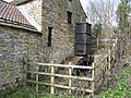
 Ashover - Ashover House Hydro - geograph.org.uk - 1998669.jpg 1,200 × 1,600; 586 KB
-
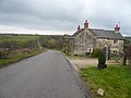
 Ashover - Crispin Inn - geograph.org.uk - 306785.jpg 640 × 480; 58 KB
-
 Ashover - Crispin Inn from churchyard - geograph.org.uk - 1998412.jpg 1,600 × 1,200; 624 KB
-
 Ashover - Primary School - geograph.org.uk - 1998688.jpg 1,600 × 1,200; 424 KB
-
 Ashover - Weavers Cottage - geograph.org.uk - 1998678.jpg 1,600 × 1,200; 384 KB
-
 Ashover Road (B6036), Kelstedge - geograph.org.uk - 5055908.jpg 640 × 480; 65 KB
-
 Ashover Road crossing Press Brook - geograph.org.uk - 2804364.jpg 1,024 × 768; 386 KB
-
 Ashover Road winding towards Littlemoor - geograph.org.uk - 2804372.jpg 1,024 × 711; 351 KB
-
 Ashover rock. - geograph.org.uk - 5806546.jpg 640 × 480; 47 KB
-
 Ashover Show 2007 - geograph.org.uk - 519317.jpg 640 × 480; 137 KB
-
 Ashover Show 2007 - geograph.org.uk - 826591.jpg 640 × 480; 115 KB
-
 Ashover Show 2007 - geograph.org.uk - 826606.jpg 640 × 480; 119 KB
-
 Ashover Show 2007 - geograph.org.uk - 826620.jpg 640 × 480; 123 KB
-
 Ashover Show 2007 - geograph.org.uk - 826649.jpg 640 × 480; 132 KB
-
 Ashover Show 2007 - geograph.org.uk - 826665.jpg 640 × 480; 82 KB
-
 Ashover village from the south - geograph.org.uk - 1979333.jpg 1,024 × 776; 527 KB
-
 Ashover village from the south-east - geograph.org.uk - 2741996.jpg 1,024 × 768; 273 KB
-
 Ashover01LB.jpg 3,264 × 2,448; 2.09 MB
-
 At the junction of Hard Meadow Lane and Eastwood Lane - geograph.org.uk - 5604466.jpg 3,684 × 4,980; 4.87 MB
-
 At Thorntree Farm, Uppertown - geograph.org.uk - 4050618.jpg 1,790 × 2,506; 1.93 MB
-
 Avenue of lime trees - geograph.org.uk - 3691171.jpg 533 × 800; 130 KB
-
 B5057 at Stone Edge - geograph.org.uk - 4281738.jpg 640 × 481; 54 KB
-
 B5057 Darley Road - geograph.org.uk - 2991181.jpg 1,024 × 818; 194 KB
-
 B5057 Darley Road at Stone Edge - geograph.org.uk - 2465289.jpg 950 × 634; 259 KB
-
 B5057 Darley Road heading east - geograph.org.uk - 4281735.jpg 640 × 481; 55 KB
-
 B5057 near Highfields House Farm - geograph.org.uk - 4281736.jpg 640 × 480; 46 KB
-
 B5057 near Roach House Farm - geograph.org.uk - 4281734.jpg 640 × 481; 52 KB
-
 B5057 nears Ashover parish boundary - geograph.org.uk - 4281732.jpg 640 × 480; 80 KB
-
 B6014 towards Butterley - geograph.org.uk - 1978189.jpg 1,024 × 783; 510 KB
-
 B6014 towards Tansley and Matlock - geograph.org.uk - 2991753.jpg 1,024 × 621; 195 KB
-
 B6014 west of the highest point - geograph.org.uk - 3354290.jpg 850 × 638; 163 KB
-
 B6036 - A632 junction - geograph.org.uk - 4902841.jpg 640 × 426; 64 KB
-
 B6036 towards Stretton - geograph.org.uk - 2335059.jpg 1,600 × 1,200; 834 KB
-
 Bales by Matlock Rd - geograph.org.uk - 4911792.jpg 640 × 426; 46 KB
-
 Barley field, south of Poorlots Quarry - geograph.org.uk - 5145050.jpg 1,024 × 768; 123 KB
-
 Barley field, west of Holestone Gate Road - geograph.org.uk - 5145516.jpg 1,024 × 768; 159 KB
-
 Barn at Yew Tree Farm - geograph.org.uk - 573237.jpg 640 × 480; 119 KB
-
 Bassett Barn Farm - geograph.org.uk - 1984549.jpg 640 × 480; 71 KB
-
 Bassett Barn Farm - geograph.org.uk - 3691483.jpg 800 × 533; 132 KB
-

-
 Birch and beech wood on Upper Moor - geograph.org.uk - 4214172.jpg 4,000 × 2,248; 7.12 MB
-
 Birkin Lane - Toll Bar Cottage - geograph.org.uk - 346268.jpg 640 × 480; 93 KB
-
 Birkin Lane Farm - geograph.org.uk - 4230986.jpg 5,029 × 3,592; 5.15 MB
-
 Blakelow Farm, Allen Lane - geograph.org.uk - 1722487.jpg 640 × 480; 66 KB
-
 Blasted trees in Ashover Hay - geograph.org.uk - 4399221.jpg 800 × 533; 142 KB
-
 Bleak winter landscape - geograph.org.uk - 1722501.jpg 640 × 480; 57 KB
-
 Boardwalk section of footpath - geograph.org.uk - 2465171.jpg 713 × 950; 346 KB
-
 Bottom Moor Track - geograph.org.uk - 4050863.jpg 1,944 × 2,592; 3.07 MB
-
 Bottom Moor, west of Wirestone Lane - geograph.org.uk - 5145565.jpg 1,024 × 768; 152 KB
-
 Bridge over Hodgelane Brook - geograph.org.uk - 2227453.jpg 3,296 × 2,472; 1.01 MB
-
 Bridleway near Kelstedge - geograph.org.uk - 3691532.jpg 533 × 800; 208 KB
-
 Bridleway west of Kelstedge - geograph.org.uk - 5288767.jpg 1,600 × 1,200; 1,014 KB
-
 Bungalow by Butterley Lane - geograph.org.uk - 4757660.jpg 3,888 × 5,184; 6.3 MB
-
 Buntingfield Lane with view to Dryhurst Farm - geograph.org.uk - 3743945.jpg 4,858 × 3,886; 5.46 MB
-
 Buntingfield, a farmhouse - geograph.org.uk - 1729589.jpg 640 × 480; 92 KB
-
 Bus stop outside Woodside - geograph.org.uk - 3863604.jpg 800 × 533; 168 KB
-
 Butterley Lane (B6014) - geograph.org.uk - 5055854.jpg 640 × 480; 86 KB
-
 Butts Road, Ashover - geograph.org.uk - 1979490.jpg 1,024 × 708; 502 KB
-
 By Robridding Road - geograph.org.uk - 2980101.jpg 1,024 × 599; 179 KB
-
 By the entrance to Alicehead Farm - geograph.org.uk - 3743953.jpg 4,984 × 3,738; 4.67 MB
-
 Byway to Rattle - geograph.org.uk - 3240023.jpg 640 × 480; 91 KB
-
 Byway towards Marsh Green - geograph.org.uk - 4875399.jpg 1,600 × 1,200; 890 KB
-
 Cattle grazing in a field by Birkin Lane - geograph.org.uk - 1984449.jpg 640 × 480; 100 KB
-
 Cattle grazing, Butterley - geograph.org.uk - 5055855.jpg 640 × 480; 50 KB
-
 Cattle heading to Hodge Lane Brook - geograph.org.uk - 4050848.jpg 2,532 × 1,809; 2.35 MB
-
 Cattle in a field near Blakelow Farm - geograph.org.uk - 2991840.jpg 1,024 × 760; 217 KB
-
 Cattle south of Rushley Lodge Farm - geograph.org.uk - 4050852.jpg 1,944 × 2,592; 1.74 MB
-
 Chequered Flag - geograph.org.uk - 3691507.jpg 800 × 533; 113 KB
-
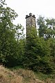 Chimney, Ravensnest.jpg 533 × 800; 153 KB
-
 Church Hall - geograph.org.uk - 3057633.jpg 2,048 × 1,536; 1.61 MB
-
 Church notice board and roses - geograph.org.uk - 1980148.jpg 1,024 × 768; 623 KB
-
 Church Street, Ashover.jpg 4,607 × 2,994; 6.73 MB
-
 Church, Pub and skip - geograph.org.uk - 1984420.jpg 640 × 480; 61 KB
-
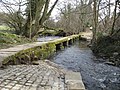 Clapper Bridge - geograph.org.uk - 1771853.jpg 2,048 × 1,536; 2.45 MB
-
 Clapper Bridge - geograph.org.uk - 1772616.jpg 2,048 × 1,536; 2.09 MB
-
 Close up, Elizabeth II postbox on Amber Lane, Kelstedge - geograph.org.uk - 5055953.jpg 1,561 × 2,357; 711 KB
-

-
 Cocking Tor - Slab Fence - geograph.org.uk - 347386.jpg 640 × 480; 142 KB
-
 Coldharbour Lane at Highoredish - geograph.org.uk - 1974953.jpg 640 × 478; 100 KB
-
 Coldharbour Lane towards Butterley Hill - geograph.org.uk - 3354297.jpg 850 × 638; 153 KB
-
 Colourful meadow and view to Ashover Hay - geograph.org.uk - 1978364.jpg 1,024 × 738; 549 KB
-
 Cones off^ - geograph.org.uk - 4408465.jpg 4,000 × 2,248; 5.67 MB
-
 Converted church by Butts Road - geograph.org.uk - 1979499.jpg 1,024 × 1,020; 657 KB
-
 Cottage ruins above Moor Grange - geograph.org.uk - 5520367.jpg 4,608 × 3,456; 4.71 MB
-
 Cottages at Wash Farm - geograph.org.uk - 1169372.jpg 640 × 480; 65 KB
-
 Cottages on Hillside - geograph.org.uk - 3691487.jpg 800 × 533; 125 KB
-
 Countryside view from Butts Road - geograph.org.uk - 1979494.jpg 1,024 × 699; 520 KB
-
 Countryside west of Cocking Tor - geograph.org.uk - 5604495.jpg 4,887 × 3,873; 4.77 MB
-
 Crop field and power lines - geograph.org.uk - 5055891.jpg 640 × 480; 45 KB
-
 Crop field and stone wall - geograph.org.uk - 5055912.jpg 640 × 480; 55 KB
-
 Crop field off Matlock Road (A632) - geograph.org.uk - 5055914.jpg 640 × 480; 56 KB
-
 Crop field off Sheeplea Lane - geograph.org.uk - 5055917.jpg 640 × 480; 60 KB
-
 Crop field, Holestone Gate Farm - geograph.org.uk - 5055881.jpg 640 × 480; 67 KB
-
 Cross roads by Whitbank - geograph.org.uk - 3840192.jpg 4,000 × 2,248; 4.53 MB
-
 Crossroads in Alton - geograph.org.uk - 3691465.jpg 800 × 533; 112 KB
-
 Crossroads near Sheaplea House - geograph.org.uk - 2582461.jpg 3,213 × 2,245; 1.09 MB
-
 Crossroads, on Alicehead Road - geograph.org.uk - 5056096.jpg 640 × 480; 43 KB
-
 Cullumbell Lane meets Alicehead Road - geograph.org.uk - 3743909.jpg 4,715 × 3,772; 4.61 MB
-
 Dalebank Lane - geograph.org.uk - 2878044.jpg 719 × 1,024; 271 KB
-
 Dalebank near Ashover - geograph.org.uk - 2878050.jpg 1,024 × 742; 324 KB
-
 Dark and muddy track below Vernonlane Farm - geograph.org.uk - 3838209.jpg 4,000 × 2,248; 7.41 MB
-
 Darley Road (B5057) - geograph.org.uk - 5056124.jpg 640 × 480; 46 KB
-

-
 Defunct equipment - geograph.org.uk - 1169326.jpg 640 × 480; 76 KB
-
 Derbyshire countryside east of Bath Lane - geograph.org.uk - 4231026.jpg 5,182 × 3,702; 5.45 MB
-
 Derbyshire UK parish map highlighting Ashover.svg 888 × 1,308; 2.35 MB
-
 Descending Amber Hill, A632 - geograph.org.uk - 4902811.jpg 640 × 426; 68 KB
-
 Dewdale Farm - geograph.org.uk - 4405529.jpg 4,000 × 2,248; 4.95 MB
-
 Dewdale farm - geograph.org.uk - 5826372.jpg 2,000 × 1,333; 2.31 MB
-
 Dewey Lane - geograph.org.uk - 4399139.jpg 800 × 533; 157 KB
-
 Disused building near Press Reservoirs - geograph.org.uk - 3959829.jpg 2,428 × 1,942; 2.34 MB
-
 Disused windmill hiding in trees - geograph.org.uk - 4911798.jpg 640 × 426; 59 KB
-
 Dropping down to Reservoir Farm - geograph.org.uk - 4408470.jpg 4,000 × 2,248; 5.37 MB
-

-
 Eastwood Farm - geograph.org.uk - 1169344.jpg 640 × 480; 82 KB
-
 Eastwood Grange - geograph.org.uk - 3691197.jpg 800 × 533; 159 KB
-
 Eastwood Grange from Farhill - geograph.org.uk - 1169317.jpg 640 × 480; 89 KB
-
 Eddlestone Lot car park by Wirestone Quarry - geograph.org.uk - 3838239.jpg 3,966 × 2,188; 6.89 MB
-
 Eddlestow Hall Farm - geograph.org.uk - 2973395.jpg 1,024 × 724; 206 KB
-
 Eddlestow Hall Farm - geograph.org.uk - 5604587.jpg 5,005 × 3,135; 4.17 MB
-
 Edges Farm - geograph.org.uk - 1169353.jpg 640 × 480; 71 KB
-
 Elea Crewe was here - geograph.org.uk - 3689862.jpg 533 × 800; 98 KB
-

-

-
 Empty fields below Amber Hill - geograph.org.uk - 3689812.jpg 800 × 533; 79 KB
-
 Empty house on Hungerhill Lane - geograph.org.uk - 3743899.jpg 4,909 × 3,507; 4.16 MB
-
 Entering Alton on Alton Hill - geograph.org.uk - 3959844.jpg 2,592 × 1,944; 2.92 MB
-
 Entrance drive to The Canine Country Club Derbyshire - geograph.org.uk - 2573290.jpg 3,648 × 2,736; 3.69 MB
-
 Entrance into grazing field - geograph.org.uk - 5145503.jpg 1,024 × 768; 184 KB
-
 Entrance to Bath Lane Farm - geograph.org.uk - 1730852.jpg 640 × 480; 63 KB
-
 Entrance to Highfild House Farm shop - geograph.org.uk - 4064881.jpg 1,000 × 750; 116 KB
-
 Entrance to Marsh Green Farm Shop and Tea Room by the A632 - geograph.org.uk - 3837346.jpg 4,000 × 2,248; 3.73 MB
-
 Entrance to Matlock Farm Park - geograph.org.uk - 4214169.jpg 4,000 × 2,248; 2.05 MB
-
 Escarpment at Farhill - geograph.org.uk - 1980172.jpg 1,024 × 954; 642 KB
-
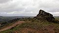 Fabrick or Ashover Rock.jpg 640 × 367; 43 KB
-
 Fallgate Mill.jpg 2,048 × 1,536; 2.49 MB
-

-
 Farm and horses at Northedge - geograph.org.uk - 1984518.jpg 640 × 480; 88 KB
-
 Farm at Northedge - geograph.org.uk - 1980499.jpg 1,024 × 730; 479 KB
-
 Farm below the A632 Matlock Road - geograph.org.uk - 2465176.jpg 950 × 713; 292 KB
-
 Farm buildings and valley scene - geograph.org.uk - 2980097.jpg 1,024 × 768; 228 KB
-
 Farm buildings in Uppertown - geograph.org.uk - 1729630.jpg 640 × 480; 111 KB
-
 Farm buildings, Ashover Hay - geograph.org.uk - 2335074.jpg 1,600 × 1,200; 249 KB
-
 Farm equipment graveyard - geograph.org.uk - 1169396.jpg 640 × 480; 87 KB
-
 Farm land off High Lane - geograph.org.uk - 1834690.jpg 640 × 480; 49 KB
-
 Farm on Press Lane - geograph.org.uk - 2804397.jpg 1,024 × 540; 264 KB
-

-
 Farm track east of Birkin Lane - geograph.org.uk - 2465138.jpg 950 × 649; 260 KB
-
 Farm track to Dryhurst Farm - geograph.org.uk - 2465364.jpg 950 × 626; 285 KB
-
 Farm track towards Shooters Lea Farm - geograph.org.uk - 2980090.jpg 1,024 × 768; 212 KB
-
 Farming scene, upland plateau - geograph.org.uk - 2465380.jpg 950 × 686; 290 KB
-
 Farmland above Honeybank - geograph.org.uk - 5145065.jpg 1,024 × 768; 187 KB
-
 Farmland and phone masts - geograph.org.uk - 5055887.jpg 640 × 480; 60 KB
-
 Farmland and woodland - geograph.org.uk - 5055843.jpg 640 × 480; 59 KB
-
 Farmland by Matlock Rd - geograph.org.uk - 4902910.jpg 640 × 426; 46 KB
-
 Farmland east of Holestone Gate Farm - geograph.org.uk - 5145515.jpg 1,024 × 768; 146 KB
-
 Farmland near Alton - geograph.org.uk - 2335046.jpg 1,600 × 1,200; 631 KB
-
 Farmland near Hill Crest - geograph.org.uk - 2335058.jpg 1,600 × 1,200; 548 KB
-
 Farmland near Littlemoor - geograph.org.uk - 2335051.jpg 1,600 × 1,200; 541 KB
-
 Farmland north of Old Engine Farm - geograph.org.uk - 5145540.jpg 1,024 × 614; 114 KB


_-_geograph.org.uk_-_5055894.jpg)


,_Kelstedge_-_geograph.org.uk_-_5055908.jpg)


_-_geograph.org.uk_-_5055854.jpg)


_-_geograph.org.uk_-_5055914.jpg)


_-_geograph.org.uk_-_5056124.jpg)


_off_Holestone_Gate_Road_-_geograph.org.uk_-_5055888.jpg)


