Category:Athboy
Vai alla navigazione
Vai alla ricerca
Български: 300px|мини|Църквата "Сейнт Джеймс" в Атбой
Deutsch: Athboy (irisch: Baile Átha Buí; dt.: „Siedlung der gelben Furt“) ist eine kleine landwirtschaftlich geprägte Stadt im County Meath im mittleren Osten der Republik Irland, die sich aus einer mittelalterlichen ummauerten Festung zu Pale-Zeiten entwickelte.
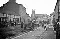
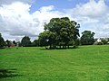
English: Athboy, is a small agricultural town in County Meath in Ireland. It is located on the junction of the N51 and R154 roads. The town is located on the Yellow Ford River, in wooded country near the County Westmeath border.
Français : Athboy (Baile Atha Bui en irlandais) est une ville du comté de Meath en République d'Irlande.
Gaeilge: Is baile beag suite i g Contae na Mí, é Baile Átha Buí (nó Áth Buí de ghnáth mar a ghlaoitear sa bhaile). Suite in aice le Ráth Cairn- Gaeltacht na Mí, níl ach turas beag ón Uaimh nó BÁC go hÁth Buí.
Gaelg: Ta Baile Átha Buí ( Baarle: Athboy, Yernish son Balley Aah Buigh) ny valley beg eirinagh ayns Coontae ny Mee, Nerin. T'eh ny lhie er çheet ry-cheilley ny raaidyn N51 as R154. T'eh soit mygeayrt 19 km veih preeu-valley yn choontae, yn Ooive, faggys da'n joarey lesh Coontae ny h-Eearvee. Ta'n Ghaeltacht veg Ráth Cairn ny lhie er gerrey da'n valley.
Slovenčina: Athboy ( ír. Baile Átha Buí) je mesto vo východnej časti Írska, v grófstve Meath. Žije tu 6 447 obyvateľov (2006).
town in County Meath in the mid east of Ireland  | |||||
| Carica un file multimediale | |||||
| Istanza di | |||||
|---|---|---|---|---|---|
| Luogo | Meath, Leinster, Irlanda | ||||
| Altezza sul mare |
| ||||
 | |||||
Sottocategorie
Questa categoria contiene un'unica sottocategoria, indicata di seguito.
L
- Lisclogher Bridge (5 F)
File nella categoria "Athboy"
Questa categoria contiene 19 file, indicati di seguito, su un totale di 19.
-
 Athboy Railway Station, Co. Meath.jpg 2 000 × 1 508; 1,31 MB
-
 Athboy, Co. Meath (28686693144).jpg 2 000 × 1 308; 1,39 MB
-
 Athboy, County Meath (2) - geograph.org.uk - 1817440.jpg 3 888 × 2 592; 5,19 MB
-
 Athboy, County Meath - geograph.org.uk - 1817423.jpg 3 888 × 2 592; 4,77 MB
-
 Athboy, Park View - geograph.org.uk - 5625344.jpg 640 × 427; 361 KB
-
 Athboy-St-James-church.jpg 480 × 640; 90 KB
-
 Bridge Street Service Station, Athboy - geograph.org.uk - 5625343.jpg 640 × 480; 376 KB
-
 Fair Green - geograph.org.uk - 1927986.jpg 640 × 474; 79 KB
-
 Fair Green - geograph.org.uk - 2508512.jpg 640 × 480; 94 KB
-
 Houses in Athboy - geograph.org.uk - 5913299.jpg 1 024 × 846; 150 KB
-
 IMG AthboyHistory2883.jpg 2 845 × 2 509; 2,9 MB
-
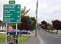
 IMG AthboySign2881.jpg 3 888 × 2 592; 3,13 MB
-
 IMG N51road2888.jpg 3 456 × 2 467; 2,53 MB
-
 N51, Athboy - geograph.org.uk - 5913296.jpg 1 024 × 596; 90 KB
-
 N51, Athboy - geograph.org.uk - 5913298.jpg 1 024 × 528; 120 KB
-
 R154 Athboy - geograph.org.uk - 5625341.jpg 640 × 427; 331 KB
-
 Ruined Church - geograph.org.uk - 166668.jpg 640 × 480; 75 KB
-
 St James Church - geograph.org.uk - 1928001.jpg 480 × 640; 88 KB
-
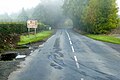
 Trim Road (R154) Athboy - geograph.org.uk - 5625342.jpg 640 × 427; 304 KB

.jpg)
_-_geograph.org.uk_-_1817440.jpg)


_Athboy_-_geograph.org.uk_-_5625342.jpg)