Category:Atxondo
Jump to navigation
Jump to search
municipality of Basque Land    | |||||
| Upload media | |||||
| Instance of | |||||
|---|---|---|---|---|---|
| Part of |
| ||||
| Location | Durangaldea, Vizcaya, País Vasco, Espanya | ||||
| Capital |
| ||||
| Official language |
| ||||
| Head of government |
| ||||
| Inception |
| ||||
| Population |
| ||||
| Area |
| ||||
| Elevation above sea level |
| ||||
| official website | |||||
 | |||||
Mga ubos-nga-kaarangay
Ini nga kaarangay mayda han mga nasunod nga 4 nga mga ubos-nga-kaarangay, tikang hin 4 nga kabug-osan.
Media ha kaarangay nga "Atxondo"
An mga nasunod nga 52 ka mga fayl aada han hini nga kaarangay, tikang hin 52 nga kabug-osan.
-
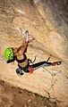
 Ainhize Belar eskalatzailea.jpg 700 × 467; 56 nga KB
-
 Ainhize Belar eskalatzen.jpg 445 × 700; 40 nga KB
-

-

-

-
 Atxondo bosque de hayas.jpg 4,032 × 3,024; 6.4 nga MB
-
 Atxondo crestería Anboto Alluitz 1.jpg 4,032 × 3,024; 3.38 nga MB
-
 Atxondo crestería Anboto Alluitz.jpg 4,032 × 3,024; 3.83 nga MB
-
 Atxondo ermita de Santa Bárbara de Larrano 1.jpg 4,032 × 3,024; 2.84 nga MB
-
 Atxondo ermita de Santa Bárbara de Larrano detalle.jpg 3,024 × 4,032; 4.8 nga MB
-
 Atxondo ermita de Santa Bárbara de Larrano interior 1.jpg 3,024 × 4,032; 2.98 nga MB
-
 Atxondo ermita de Santa Bárbara de Larrano interior.jpg 4,032 × 3,024; 2.97 nga MB
-
 Atxondo ermita de Santa Bárbara de Larrano.jpg 4,032 × 3,024; 3.77 nga MB
-
 Atxondo Marzana.JPG 1,536 × 2,048; 753 nga KB
-
 Atxondo monte Elgoin.jpg 3,024 × 4,032; 4.26 nga MB
-
 Atxondo monte Saibigain.jpg 4,032 × 3,024; 857 nga KB
-
 Atxondo rotulado.jpg 5,309 × 2,788; 1.28 nga MB
-
 Atxondo valle de Arratzola.jpg 4,032 × 3,024; 3.01 nga MB
-
 Atxondo vista desde el collado de Larrano.jpg 4,032 × 3,024; 3.16 nga MB
-
 Atxondo.jpg 1,212 × 663; 693 nga KB
-
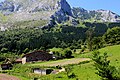
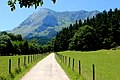 Atxondoko harana.jpg 800 × 534; 376 nga KB
-
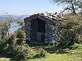
 Atxondoko Zubieta baserria. - panoramio.jpg 1,241 × 1,713; 237 nga KB
-
 Axpe from Mendigoikoa.jpg 4,624 × 3,472; 4.53 nga MB
-
 Axpe plaza.jpg 4,032 × 3,024; 2.66 nga MB
-
 Axpe vista general.jpg 1,604 × 600; 110 nga KB
-
 Axpe.JPG 800 × 600; 63 nga KB
-
 Ayuntamiento Apatamonasterio - panoramio.jpg 4,288 × 2,848; 956 nga KB
-
 Baratze emankor eta zabala, Atxondo haraneko baserri baten aitzinean. 2015-07-04.jpg 4,000 × 3,000; 1.94 nga MB
-
 Biblioteca Pública Municipal de Atxondo.jpg 390 × 256; 36 nga KB
-
 Calle José Antonio Aguirre Lekube - panoramio.jpg 4,288 × 2,848; 951 nga KB
-
 Eneritz Agirre Armentia. Atxondoko alkatea.jpg 700 × 467; 53 nga KB
-
 Eneritz Agirre. Atxondoko alkatea.jpg 375 × 375; 21 nga KB
-
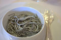
 Etxebarri angulas (cropped).jpg 768 × 576; 182 nga KB
-
 Etxebarri angulas 2.jpg 1,024 × 768; 281 nga KB
-
 Etxebarri angulas.jpg 1,000 × 666; 136 nga KB
-
 Etxebarri txuleta.jpg 1,000 × 590; 158 nga KB
-

-
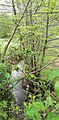 Gaztañerreka desembocando en el Arrazola.jpg 2,272 × 4,608; 4.39 nga MB
-
 Hotel Mendi Bekoa en el barrio de Axpe (Atxondo) - panoramio.jpg 4,288 × 2,848; 1.05 nga MB
-
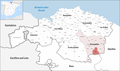 Karte Gemeinde Atxondo 2022.png 3,000 × 1,771; 877 nga KB
-
 Mugarra desde apata.JPG 600 × 800; 27 nga KB
-
-
 Presa del Arrazola.jpg 2,272 × 4,608; 4.07 nga MB
-
 Puente y presa del río Arrazola.jpg 2,272 × 4,608; 2.47 nga MB
-
 Restaurante Mendi Goikoa en el barrio de Axpe de Atxondo (Vizcaya) - panoramio.jpg 4,288 × 2,848; 1.41 nga MB
-
 Rosa Elizburu eta David Cobos (cropped).jpg 232 × 273; 13 nga KB
-
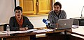 Rosa Elizburu eta David Cobos.jpg 700 × 341; 34 nga KB
-
 Rosa Elizburu eta Rosi Oleaga.jpg 700 × 518; 82 nga KB
-
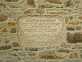
 San Pedro eliza, Apatamonasterio (Atxondo) Bizkaia.jpg 3,000 × 4,000; 4.11 nga MB
-
 Urrutia baserria Anbotopean (Atxondo).jpg 800 × 534; 449 nga KB
-

-
 Urtzuloa erreka.jpg 2,272 × 4,608; 4.11 nga MB


.jpg)


_-_panoramio.jpg)


_-_panoramio.jpg)
.jpg)


_Bizkaia.jpg)
.jpg)

