Category:Ayrshire Coastal Path
Jump to navigation
Jump to search

Great Trail in South Ayrshire, Scotland, UK  | |||||
| Upload media | |||||
| Instance of |
| ||||
|---|---|---|---|---|---|
| Location |
| ||||
| |||||
English: The Ayrshire Coastal Path is a hiking footpath in Scotland following the coasts of North and South Ayrshire
Media in category "Ayrshire Coastal Path"
The following 42 files are in this category, out of 42 total.
-
 A sign on the Ayrshire Coastal Path - geograph.org.uk - 808270.jpg 640 × 448; 139 KB
-
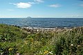 Ailsa Craig View - geograph.org.uk - 911045.jpg 640 × 426; 94 KB
-
 Ayrshire Coastal Path - geograph.org.uk - 1139745.jpg 640 × 345; 42 KB
-
 Ayrshire Coastal Path at Finnarts Bay - geograph.org.uk - 3610816.jpg 4,000 × 3,000; 4.06 MB
-
 Ayrshire Coastal Path, Dunure, South Ayrshire. View towards Croy Shore.jpg 4,896 × 2,752; 2.65 MB
-
 Ayrshire Coastal Path, Dunure. View below the quadrant tower.jpg 4,831 × 2,385; 3.65 MB
-
 Back To The Beach - geograph.org.uk - 912216.jpg 640 × 480; 102 KB
-
 Bracken Bay View - geograph.org.uk - 1306222.jpg 640 × 480; 118 KB
-
 Burn Mouth At Turnberry Bay - geograph.org.uk - 1138639.jpg 640 × 426; 83 KB
-
 Caravans At Bracken Bay - geograph.org.uk - 1306304.jpg 640 × 383; 100 KB
-
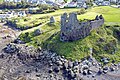
 Dunure Castle - geograph.org.uk - 1306416.jpg 640 × 464; 107 KB
-
 Dunure-castle-dovecot.jpg 3,373 × 2,250; 7.1 MB
-
 Dunure-castle.jpg 3,373 × 2,250; 7.51 MB
-
 Firth of Clyde and Arran from Ayrshire Coastal Path, Dunure, South Ayrshire.jpg 4,896 × 2,752; 3.34 MB
-
 Firth of Clyde from Ayrshire Coastal Path, Dunure, South Ayrshire.jpg 4,896 × 2,752; 4.62 MB
-
 Goat Fell Isle of Arran - panoramio.jpg 3,048 × 1,588; 1.89 MB
-
 Greenan-castle.jpg 3,301 × 2,202; 5.86 MB
-
 Leaving Dunure Harbour - geograph.org.uk - 1306370.jpg 640 × 456; 113 KB
-
 Milton Burn At Turnberry - geograph.org.uk - 1068515.jpg 640 × 410; 104 KB
-
 Old RAF WWII Quadrant Tower and the Ayrshire Coastal Path, Dunure, South Ayrshire.jpg 4,896 × 2,752; 3.94 MB
-
 On The Ayrshire Coastal Path - geograph.org.uk - 1138688.jpg 640 × 426; 119 KB
-
 On The Ayrshire Coastal Path - geograph.org.uk - 1138709.jpg 640 × 426; 101 KB
-
 On The Ayrshire Coastal Path - geograph.org.uk - 1138731.jpg 640 × 426; 126 KB
-
 On The Ayrshire Coastal Path - geograph.org.uk - 907804.jpg 640 × 480; 110 KB
-
 On The Ayrshire Coastal Path - geograph.org.uk - 912210.jpg 450 × 600; 111 KB
-
 On The Ayrshire Coastal Path - geograph.org.uk - 918168.jpg 640 × 480; 149 KB
-
 On The Beach - geograph.org.uk - 918150.jpg 640 × 480; 114 KB
-
 On The Coastal Path - geograph.org.uk - 1021031.jpg 640 × 397; 69 KB
-
 On The Coastal Path - geograph.org.uk - 1096536.jpg 640 × 394; 91 KB
-
 On The Coastal Path - geograph.org.uk - 911080.jpg 640 × 470; 114 KB
-
 Shoreline Cottages - geograph.org.uk - 911052.jpg 640 × 417; 76 KB
-

-
 Snib Torbett's Cave at Bennane Lea - geograph.org.uk - 1715945.jpg 1,024 × 681; 376 KB
-

-
 The Ayrshire Coastal Path At Prestwick - geograph.org.uk - 1432229.jpg 640 × 480; 112 KB
-
 The Ayrshire Coastal Path At Prestwick - geograph.org.uk - 1432235.jpg 640 × 467; 117 KB
-
 The Cairn at Bennane Lea - geograph.org.uk - 1715914.jpg 1,024 × 670; 323 KB
-
 The End Of Chapelton Burn - geograph.org.uk - 912259.jpg 640 × 426; 90 KB
-
 This Way For The Ayrshire Coastal Path - geograph.org.uk - 1138749.jpg 640 × 411; 122 KB
-
 Turnberry Golf Courses - geograph.org.uk - 1138742.jpg 640 × 416; 102 KB
-
 Walkers Beware^ - geograph.org.uk - 1306329.jpg 433 × 640; 148 KB
-
 Walkers on the Ayrshire Coastal Path - geograph.org.uk - 808261.jpg 640 × 427; 135 KB


