Category:Ballingry
Vai alla navigazione
Vai alla ricerca
town in Fife, Scotland, UK  | |||||
| Carica un file multimediale | |||||
| Audio della pronuncia | |||||
|---|---|---|---|---|---|
| Istanza di | |||||
| Luogo |
| ||||
| Popolazione |
| ||||
| Altezza sul mare |
| ||||
 | |||||
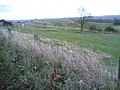
English: Ballingry is a small town, in Fife, close to the border with Perth and Kinross, north of Lochgelly. It has an estimated population (2004) of 5,740 [1]. The once separate villages of Ballingry, Crosshill, Lochore and Glencraig are now somewhat joined together. Ballingry, along with its neighbour Lochgelly, is one of Fife's 'Regeneration areas' and is classed as in need of regeneration economically and socially. It has a large primary school, Benarty Primary School, as well as a smaller Roman Catholic primary school, St Kenneth's.
Sottocategorie
Questa categoria contiene le 6 sottocategorie indicate di seguito, su un totale di 6.
B
- Benarty Wood (6 F)
D
- Dunmore Hill Fort (2 F)
H
V
- Vane Farm Nature Reserve (23 F)
W
- Westfield opencast mine (7 F)
File nella categoria "Ballingry"
Questa categoria contiene 26 file, indicati di seguito, su un totale di 26.
-
 Auld Shank, Ballingry - geograph.org.uk - 1651919.jpg 640 × 427; 70 KB
-
 Ballingry - geograph.org.uk - 120089.jpg 640 × 480; 77 KB
-
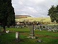 Ballingry Cemetery - geograph.org.uk - 127290.jpg 640 × 480; 103 KB
-
 Ballingry crescent - geograph.org.uk - 1651886.jpg 640 × 427; 71 KB
-
Ballingry.ogg 1,6 s; 31 KB
-
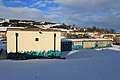 Benarty community centre, Ballingry - geograph.org.uk - 1652004.jpg 640 × 427; 58 KB
-
 Benore care centre Lochore - geograph.org.uk - 1651823.jpg 640 × 427; 52 KB
-
 Craigend Farm - geograph.org.uk - 164252.jpg 640 × 480; 102 KB
-
 Disused Railway Line - geograph.org.uk - 161003.jpg 640 × 480; 84 KB
-
 Electricity Sub Station - geograph.org.uk - 160991.jpg 640 × 480; 122 KB
-
 Farm - geograph.org.uk - 159943.jpg 640 × 480; 95 KB
-
 Farmland - geograph.org.uk - 159945.jpg 640 × 480; 91 KB
-
 Gospel Hall, Ballingry - geograph.org.uk - 1652061.jpg 640 × 427; 65 KB
-
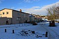 Malcolm street, Ballingry - geograph.org.uk - 1651902.jpg 640 × 427; 64 KB
-
 Manorleys - geograph.org.uk - 9133.jpg 640 × 480; 88 KB
-
 Memorial garden - geograph.org.uk - 1651972.jpg 640 × 427; 83 KB
-
 Middleburn - geograph.org.uk - 164223.jpg 640 × 480; 69 KB
-
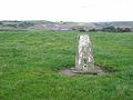
 Mineworkers memorial stone. - geograph.org.uk - 1651953.jpg 640 × 427; 59 KB
-
 Navitie Hill - geograph.org.uk - 159942.jpg 640 × 480; 84 KB
-
 Navitie Park, Ballingry - geograph.org.uk - 1651990.jpg 640 × 427; 73 KB
-
 On the road again - geograph.org.uk - 1651852.jpg 640 × 427; 68 KB
-
 Outbuildings - geograph.org.uk - 164236.jpg 640 × 480; 118 KB
-
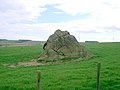 Rock - geograph.org.uk - 160998.jpg 640 × 480; 88 KB
-
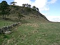 Rock Outcrop - geograph.org.uk - 163661.jpg 640 × 480; 128 KB
-
 St. Serf's church, Ballingry - geograph.org.uk - 1652028.jpg 640 × 427; 82 KB
-
 Westfield Biomass Plant - geograph.org.uk - 161807.jpg 640 × 480; 86 KB


