Category:Barrow upon Soar
Vai alla navigazione
Vai alla ricerca
English: Barrow upon Soar is a large village in northern Leicestershire, in the Soar Valley between Leicester and Loughborough. It has a population of around 5,000 and is part of the Charnwood local government district.
Français : Barrow-sur-Soar (Barrow upon Soar) est un grand village dans le Nord du Leicestershire, dans la vallée de la Soar entre Leicester et Loughborough. Il a une population d'environ 5.000 âmes et fait partie du district administratif local de Charnwood.
Italiano: Barrow upon Soar è un paese di 5.000 abitanti della contea del Leicestershire, in Inghilterra.
Norsk bokmål: Barrow upon Soar er en stor landsby nord i Leicestershire, i Soardalen mellom Leicester og Loughborough. Den har rundt 5 000 innbyggere og tilhører distriktet Charnwood.
Villaggio inglese  | |||||
| Carica un file multimediale | |||||
| Istanza di | |||||
|---|---|---|---|---|---|
| Luogo | Charnwood, Leicestershire, Midlands Orientali, Inghilterra | ||||
| Considerato essere uguale a | Barrow upon Soar (pagina Wikimedia duplicata, parrocchia civile dell'Inghilterra) | ||||
| sito web ufficiale | |||||
 | |||||
Sottocategorie
Questa categoria contiene le 3 sottocategorie indicate di seguito, su un totale di 3.
File nella categoria "Barrow upon Soar"
Questa categoria contiene 200 file, indicati di seguito, su un totale di 325.
(pagina precedente) (pagina successiva)-
 ... messing about on the riverrrrrr^ -) - geograph.org.uk - 5983447.jpg 1 280 × 960; 1,44 MB
-
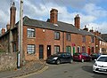
 13 Church Street, Barrow-upon-Soar - geograph.org.uk - 5296663.jpg 1 280 × 960; 509 KB
-
 13-21 Church Street, Barrow-upon-Soar - geograph.org.uk - 5296660.jpg 1 280 × 946; 476 KB
-
 1860 Bridge (detail) near Mountsorrel in Leicestershire - geograph.org.uk - 5983233.jpg 1 440 × 1 080; 1,43 MB
-
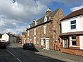
 22-24 Beveridge Street, Barrow upon Soar - geograph.org.uk - 5296750.jpg 1 280 × 960; 364 KB
-
 23-29 Church Street, Barrow-upon-Soar - geograph.org.uk - 5296655.jpg 1 280 × 971; 423 KB
-
 3-11 Church Street, Barrow-upon-Soar - geograph.org.uk - 5296657.jpg 1 280 × 935; 389 KB
-
 35-37 Beveridge Street, Barrow upon Soar - geograph.org.uk - 5296763.jpg 1 280 × 960; 306 KB
-

-

-
 47 Beveridge Street, Barrow upon Soar - geograph.org.uk - 5296748.jpg 1 280 × 1 280; 593 KB
-
 49-51 Beveridge Street, Barrow upon Soar - geograph.org.uk - 5296744.jpg 1 280 × 960; 336 KB
-
 4A Beveridge Street, Barrow upon Soar - geograph.org.uk - 5296765.jpg 1 280 × 960; 300 KB
-

-
 A hole in the clouds, reflected in the River Soar - geograph.org.uk - 6179235.jpg 1 600 × 1 200; 200 KB
-
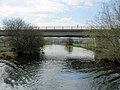
 A weir and footbridge at Barrow-upon-Soar (geograph 5553820).jpg 1 600 × 1 067; 675 KB
-
 A6 Canal Bridge - geograph.org.uk - 516875.jpg 640 × 445; 123 KB
-
 A6 Mountsorrel Bypass crossing Sileby Road - geograph.org.uk - 4306814.jpg 1 600 × 1 200; 317 KB
-
 A6 Road Bridge (geograph 2351687).jpg 640 × 480; 82 KB
-
 A6 Road Bridge - geograph.org.uk - 2351672.jpg 640 × 350; 73 KB
-
 Baptist church, Barrow-upon-Soar - geograph.org.uk - 677898.jpg 640 × 480; 62 KB
-

-

-
 Barrow Deep Lock - geograph.org.uk - 2354583.jpg 1 280 × 856; 224 KB
-
 Barrow Deep Lock - geograph.org.uk - 2354760.jpg 1 280 × 856; 235 KB
-
 Barrow Deep Lock in Leicestershire - geograph.org.uk - 5989211.jpg 960 × 1 280; 1,41 MB
-

-
 Barrow Hill, Barrow upon Soar, Leicestershire - geograph.org.uk - 1861605.jpg 2 548 × 1 890; 897 KB
-
 Barrow Lock - geograph.org.uk - 4464154.jpg 1 738 × 1 186; 171 KB
-
 Barrow Lock - geograph.org.uk - 687824.jpg 640 × 480; 96 KB
-
 Barrow Lock Bridge - geograph.org.uk - 687806.jpg 640 × 480; 77 KB
-
 Barrow Lock looking downstream - geograph.org.uk - 687828.jpg 640 × 480; 91 KB
-
 Barrow on Soar Gypsum Works - geograph.org.uk - 4772220.jpg 640 × 404; 42 KB
-
 Barrow on Soar Hammer ^ Pincers Pub - geograph.org.uk - 2763285.jpg 640 × 480; 126 KB
-
 Barrow on Soar Hunting Lodge Pub - geograph.org.uk - 2763298.jpg 640 × 480; 104 KB
-

-
-
 Barrow Road bridge (no 30), from the north - geograph.org.uk - 6178949.jpg 1 600 × 1 200; 485 KB
-

-

-
 Barrow Road Bridge Soar Navigation - geograph.org.uk - 3167550.jpg 2 074 × 1 408; 546 KB
-
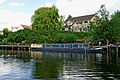
 Barrow upon Soar Boat House Pub - geograph.org.uk - 2877241.jpg 800 × 450; 59 KB
-
 Barrow upon Soar bridge - geograph.org.uk - 516703.jpg 640 × 483; 127 KB
-
 Barrow upon Soar fin LEIC-9AF5B3.jpg 1 081 × 2 217; 480 KB
-
 Barrow upon Soar find LEIC-9B5997.jpg 2 090 × 1 261; 522 KB
-
 Barrow upon Soar Gypsum Works - geograph.org.uk - 859021.jpg 640 × 538; 81 KB
-
 Barrow upon Soar Gypsum Works - geograph.org.uk - 860161.jpg 640 × 408; 60 KB
-
 Barrow Upon Soar old fire station - geograph.org.uk - 2024651.jpg 640 × 427; 233 KB
-
 Barrow Upon Soar railway station, Leicestershire - geograph.org.uk - 3780860.jpg 1 024 × 768; 262 KB
-
-
 Barrow-upon-Soar station - geograph.org.uk - 6186146.jpg 1 024 × 912; 228 KB
-
 Barrow-upon-Soar village sign, Melton Road - geograph.org.uk - 5296738.jpg 960 × 1 280; 373 KB
-
 Barrow-upon-Soar village sign, Melton Road - geograph.org.uk - 5296739.jpg 1 280 × 960; 329 KB
-
 Barrow-upon-Soar war memorial, Melton Road - geograph.org.uk - 5296740.jpg 1 080 × 1 280; 587 KB
-

-

-

-
 Bench mark, High Street bridge, Barrow-upon-Soar - geograph.org.uk - 5296727.jpg 1 280 × 960; 684 KB
-
-
 Bench mark, Melton Road bridge, Barrow-upon-Soar - geograph.org.uk - 5296734.jpg 1 280 × 960; 623 KB
-
 Bridge 29 - below Barrow Deep Lock - geograph.org.uk - 2353384.jpg 640 × 404; 62 KB
-
 Bridge over the River Soar - geograph.org.uk - 4453026.jpg 4 320 × 3 240; 5,82 MB
-
 Bridleway from Walton on the Wolds to Tithe Farm - geograph.org.uk - 5646331.jpg 4 000 × 3 000; 3,11 MB
-
 Bridleway off Melton Road - geograph.org.uk - 3037386.jpg 640 × 480; 129 KB
-
 Bridleway to Slack Lane - geograph.org.uk - 1953727.jpg 2 000 × 1 500; 241 KB
-

-
-
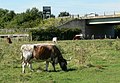
 Cattle in a field - geograph.org.uk - 2103935.jpg 640 × 500; 99 KB
-
 Cemetery Chapel - geograph.org.uk - 3037366.jpg 640 × 507; 54 KB
-
 Cemetery Chapel - geograph.org.uk - 3037372.jpg 480 × 640; 63 KB
-

-
 Church of The Holy Trinity, Barrow-upon-Soar - geograph.org.uk - 5296700.jpg 1 280 × 898; 466 KB
-
 Collapse of the bridge at Barrow Upon Soar - geograph.org.uk - 6157578.jpg 2 540 × 1 906; 1,43 MB
-
 Communications mast on Melton Road - geograph.org.uk - 3037390.jpg 480 × 640; 48 KB
-

-
 Cotes Road towards Barrow - geograph.org.uk - 2103937.jpg 640 × 463; 77 KB
-
 Cotes Road towards Barrow upon Soar - geograph.org.uk - 3037363.jpg 640 × 480; 65 KB
-
 Cotes Road towards Barrow upon Soar - geograph.org.uk - 3037369.jpg 640 × 480; 73 KB
-
 Cotes Road, Barrow upon Soar - geograph.org.uk - 554107.jpg 640 × 461; 91 KB
-

-
 Dead tree on the east bank of the navigable River Soar - geograph.org.uk - 6168147.jpg 1 600 × 1 199; 524 KB
-

-
 Driveway to Brook Lane Farm - geograph.org.uk - 4975197.jpg 800 × 600; 185 KB
-
 Driveway to Tithe Farm - geograph.org.uk - 3208108.jpg 640 × 497; 97 KB
-
-
-

-
 Farmland, Catsick Hill - geograph.org.uk - 3037357.jpg 640 × 480; 54 KB
-
 Field by Cotes Road - geograph.org.uk - 2103938.jpg 640 × 473; 95 KB
-
 Field by Nottingham Road - geograph.org.uk - 3208109.jpg 640 × 494; 84 KB
-
 Field east of Slash Lane - geograph.org.uk - 5883093.jpg 640 × 476; 59 KB
-
 Field entrance near Paudy Farm - geograph.org.uk - 3037397.jpg 640 × 480; 71 KB
-
 Fields by the River Soar Navigation - geograph.org.uk - 2103950.jpg 640 × 439; 62 KB
-

-

-
 Filling the lock - geograph.org.uk - 687841.jpg 480 × 640; 102 KB
-
 Flooding along Slash Lane - geograph.org.uk - 4307404.jpg 1 600 × 1 200; 527 KB
-
 Footpath by Willow Road - geograph.org.uk - 2103941.jpg 640 × 459; 75 KB
-
 Footpath for dog walkers - geograph.org.uk - 2103940.jpg 640 × 489; 99 KB
-
 Footpath into Hunters Lodge, Barrow upon Soar - geograph.org.uk - 5900412.jpg 1 024 × 768; 193 KB
-
-
 Footpath to Nottingham Road - geograph.org.uk - 5646323.jpg 4 000 × 3 000; 4,07 MB
-
 Footpath waymarker, Grand Union Canal towpath - geograph.org.uk - 6179211.jpg 1 600 × 1 199; 351 KB
-
 Frost covered trees along Sileby Road - geograph.org.uk - 4306821.jpg 1 600 × 1 182; 691 KB
-

-

-
 Gateway north of Melton Road - geograph.org.uk - 5757580.jpg 640 × 507; 103 KB
-
 Gateway south of Melton Road - geograph.org.uk - 5757573.jpg 640 × 464; 76 KB
-

-

-
 Grand Union Canal - geograph.org.uk - 3037381.jpg 640 × 480; 85 KB
-
 Grand Union Canal at Barrow on Soar - geograph.org.uk - 150707.jpg 640 × 427; 131 KB
-
 Grand Union Canal at Barrow on Soar - geograph.org.uk - 150715.jpg 640 × 427; 130 KB
-

-
 Grand Union Canal by Barrow upon Soar, Leicestershire - geograph.org.uk - 5989195.jpg 1 440 × 1 057; 1,95 MB
-

-
 Grand Union Canal near Barrow on Soar - geograph.org.uk - 4453044.jpg 4 320 × 3 240; 6,48 MB
-
-
 Grand Union Canal, Barrow upon Soar - geograph.org.uk - 2354593.jpg 1 280 × 856; 327 KB
-
 Grand Union Canal, Barrow upon Soar - geograph.org.uk - 2354825.jpg 1 280 × 856; 341 KB
-
 Grand Union Canal, Barrow upon Soar - geograph.org.uk - 2360936.jpg 1 280 × 856; 276 KB
-
 Grand Union Canal, Barrow upon Soar - geograph.org.uk - 2361583.jpg 1 280 × 856; 281 KB
-
 Grand Union Canal-River Soar - geograph.org.uk - 150706.jpg 640 × 427; 128 KB
-
 Grazing by the River Soar in Leicestershire - geograph.org.uk - 5983465.jpg 1 280 × 853; 1,19 MB
-
 Hay Hill northwards - geograph.org.uk - 5883105.jpg 640 × 394; 58 KB
-
 House by Barrow Deep Lock, Leicestershire - geograph.org.uk - 5989237.jpg 960 × 1 280; 1,47 MB
-
 House by Barrow Deep Lock, Leicestershire - geograph.org.uk - 5989492.jpg 960 × 1 280; 1,31 MB
-
 Houses off Branston Avenue, Barrow upon Soar - geograph.org.uk - 5900377.jpg 1 024 × 768; 154 KB
-
 Houses on Fishpool Way, Barrow upon Soar - geograph.org.uk - 5900397.jpg 1 024 × 768; 163 KB
-
 Housing Development Sign on Willow Road - geograph.org.uk - 2103943.jpg 416 × 640; 103 KB
-
 Hunting Lodge garden at Barrow on Soar Leicester.jpg 3 264 × 2 448; 3,66 MB
-
 Jerusalem Island, Barrow-upon-Soar - geograph.org.uk - 677928.jpg 640 × 480; 128 KB
-
 Leaving the lock - geograph.org.uk - 687848.jpg 480 × 640; 93 KB
-
 Letter Box LE12 164 on Hay Hill - geograph.org.uk - 5883169.jpg 640 × 444; 142 KB
-
 Loading a railway truck with ballast - geograph.org.uk - 3324468.jpg 857 × 1 142; 319 KB
-
 Lorries at the Gypsum Plant - geograph.org.uk - 860154.jpg 640 × 480; 93 KB
-
-
 Melton Road eastwards - geograph.org.uk - 5757574.jpg 640 × 480; 87 KB
-

-
 Melton Road heading east - geograph.org.uk - 3037392.jpg 640 × 480; 55 KB
-
 Melton Road heading east - geograph.org.uk - 3037399.jpg 640 × 480; 63 KB
-
 Melton Road passes Poudy Rise Farm - geograph.org.uk - 5757570.jpg 640 × 457; 89 KB
-
 Melton Road railway bridge, Barrow-upon-Soar - geograph.org.uk - 5296736.jpg 1 280 × 960; 312 KB
-
 Melton Road towards Barrow upon Soar - geograph.org.uk - 5757575.jpg 640 × 481; 96 KB
-
 Melton Road westwards - geograph.org.uk - 5757576.jpg 640 × 458; 99 KB
-

-
 Midland Main Line - geograph.org.uk - 4487560.jpg 2 000 × 1 500; 384 KB
-
 Mill Lane Bridge (no 28), from the north-west - geograph.org.uk - 6178963.jpg 1 600 × 1 200; 481 KB
-
 Mill Lane Bridge in Barrow upon Soar, Leicestershire - geograph.org.uk - 5984389.jpg 1 280 × 960; 1,76 MB
-
 Mill Lane Bridge in Barrow upon Soar, Leicestershire - geograph.org.uk - 5984390.jpg 1 280 × 960; 1,45 MB
-
 Mill Lane Bridge, Barrow upon Soar - geograph.org.uk - 2354619.jpg 1 280 × 856; 270 KB
-
 Mill Lane Bridge, Barrow upon Soar - geograph.org.uk - 5902560.jpg 1 024 × 768; 223 KB
-
 Mill Lane, Barrow upon Soar - geograph.org.uk - 5902562.jpg 1 024 × 768; 121 KB
-
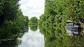
 Moored boats on the River Soar - geograph.org.uk - 6178955.jpg 1 600 × 1 200; 356 KB
-
 Moored narrowboats near Barrow upon Soar - geograph.org.uk - 5989573.jpg 1 440 × 960; 1,9 MB
-
 Mountsorrel Lock - geograph.org.uk - 2350948.jpg 1 280 × 856; 191 KB
-
 Mountsorrel Lock in Leicestershire - geograph.org.uk - 5982448.jpg 1 440 × 960; 1,27 MB
-
 Mountsorrel Turnover Bridge 26 - geograph.org.uk - 2351683.jpg 640 × 480; 64 KB
-
 Muddy field corner - geograph.org.uk - 2103939.jpg 640 × 526; 126 KB
-

-
 Navigationbridgebarrow.JPG 2 848 × 2 136; 1,28 MB
-
 New Brighton Cottages, Barrow upon Soar - geograph.org.uk - 5901598.jpg 1 024 × 768; 160 KB
-

-
 New roundabout on Melton Road, Barrow upon Soar - geograph.org.uk - 5900372.jpg 1 024 × 768; 118 KB
-
 North end of Breadcroft Lane, Barrow upon Soar - geograph.org.uk - 5901603.jpg 1 024 × 768; 137 KB
-

-
 North west end of Fishpool Way, Barrow upon Soar - geograph.org.uk - 5900406.jpg 1 024 × 768; 152 KB
-
 Nottingham Road - geograph.org.uk - 5646328.jpg 4 000 × 3 000; 2,85 MB
-

-
 Nottingham Road towards Prestwold - geograph.org.uk - 3208111.jpg 640 × 480; 99 KB
-
 Nottingham Road, Barrow upon Soar - geograph.org.uk - 516739.jpg 640 × 413; 91 KB
-

-
 Paddock on the east bank of the navigable River Soar - geograph.org.uk - 6168151.jpg 1 600 × 1 200; 361 KB
-
 Pasture and River Soar west of Barrow upon Soar - geograph.org.uk - 5990125.jpg 1 440 × 960; 1,18 MB
-
 Pedal power near Barrow upon Soar in Leicestershire - geograph.org.uk - 5983437.jpg 1 440 × 960; 1,36 MB
-

-

-

-
 Premier Logistics on Willow Road - geograph.org.uk - 5793166.jpg 640 × 478; 69 KB
-
-

-

-
 Railway towards Loughborough - geograph.org.uk - 3037384.jpg 640 × 480; 84 KB
-
 Ribble Drive, Barrow upon Soar - geograph.org.uk - 5902575.jpg 1 024 × 768; 180 KB
-

-
 River Soar and A6 bridge north of Mountsorrel - geograph.org.uk - 5983407.jpg 1 920 × 960; 1,69 MB
-
 River Soar at Barrow upon Soar, Leicestershire - geograph.org.uk - 5984387.jpg 1 920 × 960; 1,84 MB
-
 River Soar at Mountsorrel in Leicestershire - geograph.org.uk - 5982439.jpg 1 280 × 960; 1,16 MB
-
 River Soar boom and sluice channel - geograph.org.uk - 5990567.jpg 1 440 × 960; 1,35 MB
-
 River Soar boom by Pilling's Lock, Leicestershire - geograph.org.uk - 5990572.jpg 1 440 × 960; 1,44 MB
-
 River Soar County Road Bridge 30 - geograph.org.uk - 2353396.jpg 640 × 480; 95 KB
-

-
 River Soar near Barrow upon Soar in Leicestershire - geograph.org.uk - 5983615.jpg 1 280 × 960; 1,44 MB
-
 River Soar near Pilling's Lock - geograph.org.uk - 695023.jpg 640 × 480; 128 KB
-
 River Soar near Pillings lock - geograph.org.uk - 4936527.jpg 3 474 × 1 920; 3,03 MB
-
 River Soar overflow sluice gate near Pilling's Lock - geograph.org.uk - 5994547.jpg 960 × 1 280; 1,29 MB
-

-

-
-

_-_geograph.org.uk_-_5983447.jpg)


_near_Mountsorrel_in_Leicestershire_-_geograph.org.uk_-_5983233.jpg)


.jpg)


.jpg)


,_from_the_north_-_geograph.org.uk_-_6178949.jpg)


,_from_the_north-west_-_geograph.org.uk_-_6178963.jpg)


