Category:Beguildy
Jump to navigation
Jump to search
village and community in Powys, Wales  | |||||
| Upload media | |||||
| Instance of | |||||
|---|---|---|---|---|---|
| Location | Powys, Wales | ||||
| Population |
| ||||
| Area |
| ||||
 | |||||
Cymraeg: Pentref (a chymuned) ym Mhowys, yw Bugeildy (Saesneg: Beguildy). Saif bron ar y ffîn a Lloegr, ar lan orllewinol Afon Tefeidiad, i'r gogledd-orllewin o Dref-y-clawdd. Mae croglen yr eglwys yn dyddio o'r 15fed ganrif, ac mae gweddillion castell mwnt a beili Normanaidd gerllaw.
English: Beguildy is a village in the community of the same name, in Powys, mid Wales. It lies in a remote tract of countryside, on the B4355 8 miles north west of Knighton and on the road to Newtown. It lies near the headwaters of the River Teme and is 235 metres above sea level. The name of the parish means "the shepherd's house", a reference to the pastoral occupation of its inhabitants.

Subcategories
This category has only the following subcategory.
B
Media in category "Beguildy"
The following 200 files are in this category, out of 555 total.
(previous page) (next page)-
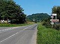
 3 miles to Knighton from Heyope - geograph.org.uk - 3694565.jpg 800 × 665; 184 KB
-
 Across the Warren Brook - geograph.org.uk - 5064186.jpg 1,024 × 683; 383 KB
-
 An old track - geograph.org.uk - 4357550.jpg 682 × 1,024; 268 KB
-

-
 B4355 - geograph.org.uk - 4716342.jpg 1,024 × 683; 390 KB
-
 B4355 - geograph.org.uk - 4716345.jpg 1,024 × 683; 408 KB
-
 B4355 and upper Teme valley - geograph.org.uk - 2069376.jpg 3,072 × 2,304; 2.29 MB
-

-
 B4355 in Cwm Gwyn - geograph.org.uk - 2069551.jpg 3,072 × 2,304; 2.34 MB
-
 B4355 in Knucklas - geograph.org.uk - 3717854.jpg 799 × 800; 161 KB
-
 B4355, Felindre - geograph.org.uk - 4357596.jpg 800 × 533; 348 KB
-
 Bailey Hill, April Fools Day 2013 - geograph.org.uk - 3390604.jpg 4,048 × 3,040; 2.35 MB
-
 Bale Sled - geograph.org.uk - 233292.jpg 640 × 480; 127 KB
-
 Banc Gorddwr - geograph.org.uk - 4355671.jpg 800 × 533; 354 KB
-
 Bank of bluebells - geograph.org.uk - 2966502.jpg 640 × 480; 94 KB
-
 Beacon Hill - geograph.org.uk - 3310549.jpg 1,566 × 1,154; 488 KB
-
 Beacon Hill - geograph.org.uk - 4714317.jpg 1,024 × 576; 297 KB
-
 Beacon Hill - geograph.org.uk - 4714417.jpg 1,024 × 576; 274 KB
-
 Beacon Hill storm clouds - geograph.org.uk - 4229535.jpg 4,031 × 2,030; 3.05 MB
-
 Beguildy (1294699).jpg 1,000 × 711; 124 KB
-
 Beguildy (4993382886).jpg 750 × 534; 169 KB
-
 Beguildy - geograph.org.uk - 4350468.jpg 800 × 533; 356 KB
-
 Beguildy School - geograph.org.uk - 4350465.jpg 800 × 600; 408 KB
-
 Beguildy School - geograph.org.uk - 5063562.jpg 1,024 × 683; 414 KB
-
 Beguildy School - geograph.org.uk - 5063564.jpg 1,024 × 683; 347 KB
-
 Beguildy School - geograph.org.uk - 5063565.jpg 1,024 × 683; 327 KB
-
 Beguildy, Radnorshire - geograph.org.uk - 5063568.jpg 1,024 × 683; 308 KB
-
 Belmont Cottage B^B in Knucklas - geograph.org.uk - 3697697.jpg 800 × 630; 135 KB
-
 Between Bailey Hill and Fountain Head, April 1st 2013. - geograph.org.uk - 3390671.jpg 4,037 × 2,253; 2.76 MB
-
 Bluebells near Goytre Hill (Lloyney) - geograph.org.uk - 6148859.jpg 3,648 × 2,736; 5.13 MB
-
 Bluebells near Goytre Hill (Lloyney) - geograph.org.uk - 6148882.jpg 3,648 × 2,056; 3.66 MB
-
 Bluebells near Goytre Hill (Lloyney) - geograph.org.uk - 6148887.jpg 3,648 × 2,056; 3.98 MB
-
 Bluebells near Goytre Hill (Lloyney) - geograph.org.uk - 6149627.jpg 3,648 × 2,056; 3.65 MB
-
 Boundary Stone - geograph.org.uk - 5329640.jpg 640 × 440; 121 KB
-
 Bracken on Beacon Hill - geograph.org.uk - 5063631.jpg 1,024 × 683; 343 KB
-
 Bracken, Beacon Hill - geograph.org.uk - 226176.jpg 640 × 480; 140 KB
-
 Brandy House Farm, Felindre - geograph.org.uk - 4009305.jpg 640 × 360; 92 KB
-
 Bridge over the River Teme - geograph.org.uk - 2070145.jpg 640 × 480; 108 KB
-
 Butchered hedgerow - geograph.org.uk - 2038063.jpg 480 × 640; 85 KB
-
 Bwlch-y-llyn - geograph.org.uk - 3092964.jpg 4,320 × 3,240; 2.68 MB
-
 Castle Inn, Knucklas - geograph.org.uk - 3697975.jpg 800 × 586; 101 KB
-
 Cattle grid, near Rhiw Porthnant - geograph.org.uk - 3092958.jpg 4,320 × 3,240; 2.84 MB
-
 Cattle, Beacon Hill - geograph.org.uk - 4714993.jpg 1,024 × 576; 257 KB
-
 Cefn Pawl road, Beguildy - geograph.org.uk - 5063579.jpg 1,024 × 683; 381 KB
-
 Cefn Pawl road, Beguildy - geograph.org.uk - 5063582.jpg 1,024 × 683; 330 KB
-
 Chapel at Felindre - geograph.org.uk - 3023066.jpg 640 × 480; 103 KB
-
 Church near Felindre - geograph.org.uk - 2069557.jpg 3,072 × 2,304; 2.02 MB
-
 Church near Felindre - geograph.org.uk - 2069558.jpg 3,072 × 2,304; 2.74 MB
-
 Church of St David - geograph.org.uk - 2237930.jpg 768 × 1,024; 269 KB
-
 Cilfaesty Hill - geograph.org.uk - 2037980.jpg 640 × 480; 77 KB
-
 Cilfaesty Hill - geograph.org.uk - 2038015.jpg 640 × 480; 89 KB
-
 Cilfaesty Hill - geograph.org.uk - 3296836.jpg 1,600 × 1,200; 650 KB
-
 Cleobury Lane, Heyope - geograph.org.uk - 3694557.jpg 800 × 600; 109 KB
-
 Col, Cilfaesty Hill - geograph.org.uk - 2037998.jpg 640 × 480; 76 KB
-
 Common above Ddôl - geograph.org.uk - 4355678.jpg 800 × 533; 338 KB
-
 Common, Beacon Hill - geograph.org.uk - 5063643.jpg 1,024 × 683; 320 KB
-
 Cottage near Panty Hill - geograph.org.uk - 2966478.jpg 640 × 480; 58 KB
-
 Cottage on the lane south of Knucklas - geograph.org.uk - 2237896.jpg 1,024 × 768; 295 KB
-
 Cow by Goytre Hill (Lloyney) - geograph.org.uk - 6149576.jpg 3,648 × 2,056; 3.28 MB
-
 Cows and calves beside Glyndwr's Way - geograph.org.uk - 4012249.jpg 640 × 360; 63 KB
-
 Cows by Goytre Hill (Lloyney) - geograph.org.uk - 6149575.jpg 3,648 × 2,056; 3.52 MB
-
 Cows by Goytre Hill (Lloyney) - geograph.org.uk - 6149579.jpg 3,648 × 2,056; 3.52 MB
-
 Cows by Goytre Hill (Lloyney) - geograph.org.uk - 6149581.jpg 3,648 × 2,056; 3.61 MB
-
 Cows by Goytre Hill (Lloyney) - geograph.org.uk - 6149583.jpg 3,648 × 2,056; 3.42 MB
-
 Cwm Bugail - geograph.org.uk - 5063656.jpg 1,024 × 683; 414 KB
-
 Cwm Creigiau, SW of Knucklas - geograph.org.uk - 5239097.jpg 5,184 × 2,920; 5.59 MB
-
 Cwm Dwliwn from Glyndwr's Way - geograph.org.uk - 4012485.jpg 640 × 360; 71 KB
-
 Cwm Gwyn - geograph.org.uk - 2069542.jpg 3,072 × 2,304; 2.5 MB
-
 Cwm Gwyn near Hendy - geograph.org.uk - 2069547.jpg 3,072 × 2,304; 2.49 MB
-
 Cwm Iago and Beacon Hill - geograph.org.uk - 4714409.jpg 1,024 × 576; 266 KB
-

-

-
 Derelict cottage interior - geograph.org.uk - 2966590.jpg 640 × 480; 74 KB
-
 Derelict House (Lloyney) - geograph.org.uk - 6148839.jpg 3,648 × 2,736; 4.8 MB
-
 Descending Cilfaesty Hill - geograph.org.uk - 2965773.jpg 640 × 480; 82 KB
-
 Deserted cottage - geograph.org.uk - 2966575.jpg 640 × 480; 100 KB
-
 Eastern boundary of Heyope - geograph.org.uk - 3694572.jpg 800 × 592; 136 KB
-
 Eastern boundary sign, Knucklas - geograph.org.uk - 3717965.jpg 799 × 800; 193 KB
-
 Edge of the common - geograph.org.uk - 5064190.jpg 1,024 × 683; 413 KB
-
 Edge of the common - geograph.org.uk - 5064203.jpg 1,024 × 683; 415 KB
-
 Enclosed field path NW of Knucklas - geograph.org.uk - 5239087.jpg 5,184 × 2,920; 4.47 MB
-
 Entrance Gate to Goytre Hill (Lloyney) - geograph.org.uk - 6149553.jpg 3,648 × 2,736; 4.2 MB
-
 Entrance to Bugeildy Beguildy - geograph.org.uk - 3816195.jpg 640 × 464; 59 KB
-
 Entrance to Dutlas - geograph.org.uk - 3816192.jpg 640 × 466; 110 KB
-
 Entrance to Felindre - geograph.org.uk - 3816203.jpg 640 × 433; 80 KB
-
 Entrance to Heyope - geograph.org.uk - 3816189.jpg 640 × 480; 85 KB
-
 Entrance to Knucklas railway station - geograph.org.uk - 3717659.jpg 721 × 800; 198 KB
-
 Entrance to Llangwyn - geograph.org.uk - 2238022.jpg 1,024 × 768; 325 KB
-
 Entrance to Lloyney - geograph.org.uk - 3816191.jpg 640 × 480; 48 KB
-
 Entrance to St David's Church Heyope - geograph.org.uk - 3694539.jpg 616 × 800; 124 KB
-
 Everest Hall (Llanfair Waterdine) - geograph.org.uk - 6149605.jpg 3,648 × 2,736; 4.58 MB
-

-
-
 Farm road, Pennant - geograph.org.uk - 4716317.jpg 1,024 × 683; 331 KB
-
 Farmland in Cwm Gwyn - geograph.org.uk - 2069549.jpg 3,072 × 2,304; 2.99 MB
-
 Farmland west of Heyope - geograph.org.uk - 2237977.jpg 1,024 × 768; 242 KB
-
 Felindre from Glyndwr's Way - geograph.org.uk - 4662714.jpg 4,608 × 3,456; 5.15 MB
-
 Felindre P O and Stores - geograph.org.uk - 4357608.jpg 800 × 533; 404 KB
-
 Felindre to Crossways road - geograph.org.uk - 4357590.jpg 800 × 533; 416 KB
-
 Ffrwdwen Brook west of Heyope - geograph.org.uk - 3654146.jpg 800 × 600; 223 KB
-
 Field below Wernygeufron - geograph.org.uk - 4716407.jpg 1,024 × 683; 277 KB
-
 Field beside the Lawn Brook - geograph.org.uk - 4716337.jpg 1,024 × 683; 458 KB
-
 Field beside the Teme - geograph.org.uk - 4716353.jpg 1,024 × 683; 270 KB
-

-
 Field edge path near Hendre - geograph.org.uk - 2966556.jpg 640 × 480; 129 KB
-

-
 Field, Carreg-y-frân - geograph.org.uk - 5064242.jpg 1,024 × 683; 373 KB
-
 Field, Lawn - geograph.org.uk - 4716334.jpg 1,024 × 683; 342 KB
-

-
 Floor tiles at St David's Church - geograph.org.uk - 2237969.jpg 736 × 1,024; 297 KB
-
 Footbridge at Lawn Farm - geograph.org.uk - 3483690.jpg 640 × 480; 97 KB
-
 Ford, Carreg-y-frân - geograph.org.uk - 5064263.jpg 1,024 × 683; 521 KB
-
 Forest Path at Goytre Hill (Lloyney) - geograph.org.uk - 6149497.jpg 3,648 × 2,736; 5.07 MB
-
 Forest Path at Goytre Hill (Lloyney) - geograph.org.uk - 6149593.jpg 3,648 × 2,056; 3.67 MB
-
 Forest Path at Goytre Hill (Lloyney) - geograph.org.uk - 6149609.jpg 3,648 × 2,056; 3.61 MB
-
 Forest Path to Goytre Hill (Lloyney) - geograph.org.uk - 6148855.jpg 3,648 × 2,736; 4.85 MB
-
 Forest Path to Goytre Hill (Lloyney) - geograph.org.uk - 6148884.jpg 3,648 × 2,056; 3.97 MB
-
 Forest Path to Goytre Hill (Lloyney) - geograph.org.uk - 6149464.jpg 3,648 × 2,056; 3.59 MB
-
 Fort, Beguildy - geograph.org.uk - 5063560.jpg 1,024 × 683; 412 KB
-
 From churchyard to railway, Heyope - geograph.org.uk - 3694549.jpg 800 × 689; 138 KB
-
 Fron - geograph.org.uk - 4716215.jpg 1,024 × 576; 282 KB
-
 Fron - geograph.org.uk - 4716245.jpg 534 × 800; 82 KB
-
 Fron Bank - geograph.org.uk - 5063674.jpg 1,024 × 683; 314 KB
-
 Fron Rocks - geograph.org.uk - 232340.jpg 640 × 480; 117 KB
-
 Fron Rocks - geograph.org.uk - 232406.jpg 640 × 480; 94 KB
-
 Fron Rocks - geograph.org.uk - 4716219.jpg 1,024 × 576; 279 KB
-
 Gap between two woods near Heyope - geograph.org.uk - 3697334.jpg 800 × 580; 124 KB
-
 Gate by Goytre Hill (Lloyney) - geograph.org.uk - 6148906.jpg 3,648 × 2,736; 4.92 MB
-
 Glannant houses in Knucklas - geograph.org.uk - 3697996.jpg 800 × 469; 97 KB
-
 Glyndwr estate - geograph.org.uk - 3015136.jpg 640 × 480; 87 KB
-
 Glyndwr houses in Knucklas - geograph.org.uk - 3717794.jpg 800 × 514; 130 KB
-
 Glyndwr houses, Knucklas - geograph.org.uk - 3697999.jpg 800 × 722; 183 KB
-
 Glyndwr's Way - geograph.org.uk - 4663876.jpg 4,608 × 3,456; 4 MB
-
 Glyndwr's Way at Felindre - geograph.org.uk - 4662718.jpg 4,608 × 3,456; 5.25 MB
-
 Glyndwr's Way at Felindre - geograph.org.uk - 4662721.jpg 4,608 × 3,456; 3.99 MB
-
 Glyndwr's Way at Felindre - geograph.org.uk - 4663836.jpg 4,608 × 3,456; 3.96 MB
-
 Glyndwr's Way at Rhuvid - geograph.org.uk - 4663852.jpg 4,608 × 3,456; 5.14 MB
-
 Glyndwr's Way near Black Mountain - geograph.org.uk - 4662478.jpg 4,608 × 3,456; 5.32 MB
-
 Glyndwr's Way near Black Mountain - geograph.org.uk - 4662479.jpg 4,608 × 3,456; 5.12 MB
-
 Glyndwr's Way near Blaen-yr-ys-wydd - geograph.org.uk - 4662699.jpg 4,608 × 3,456; 4.01 MB
-
 Glyndwr's Way near Bryn Mawr - geograph.org.uk - 4663859.jpg 4,608 × 3,456; 5.19 MB
-
 Glyndwr's Way near Bryn Mawr - geograph.org.uk - 4663866.jpg 4,608 × 3,456; 5.18 MB
-
 Glyndwr's Way near Bryn-mawr Cottage - geograph.org.uk - 4663872.jpg 4,608 × 3,456; 4.01 MB
-
 Glyndwr's Way near Bryngydfa - geograph.org.uk - 4663886.jpg 4,608 × 3,456; 5.26 MB
-
 Glyndwr's Way near Bwlch - geograph.org.uk - 4662481.jpg 4,608 × 3,456; 3.99 MB
-
 Glyndwr's Way near Felindre - geograph.org.uk - 4662706.jpg 4,608 × 3,456; 5.15 MB
-
 Glyndwr's Way near Felindre - geograph.org.uk - 4662710.jpg 4,608 × 3,456; 5.04 MB
-
 Glyndwr's Way near Felindre - geograph.org.uk - 4663839.jpg 4,608 × 3,456; 4 MB
-
 Glyndwr's Way near Felindre - geograph.org.uk - 4663842.jpg 4,608 × 3,456; 5.29 MB
-
 Glyndwr's Way near Great Wood - geograph.org.uk - 4663846.jpg 4,608 × 3,456; 5.22 MB
-
 Glyndwr's Way near Pool Hill - geograph.org.uk - 4012538.jpg 640 × 360; 40 KB
-
 Glyndwr's Way near Pool Hill - geograph.org.uk - 4661866.jpg 4,608 × 3,456; 5.41 MB
-
 Glyndwr's Way near Pool Hill - geograph.org.uk - 4662471.jpg 4,608 × 3,456; 5.09 MB
-
 Glyndwr's Way near Rhuvid - geograph.org.uk - 4663856.jpg 4,608 × 3,456; 5.27 MB
-
 Glyndwr's Way near Stanky Hill - geograph.org.uk - 4662473.jpg 4,608 × 3,456; 5.28 MB
-
 Glyndwr's Way near Stanky Hill - geograph.org.uk - 4662475.jpg 4,608 × 3,456; 5.2 MB
-
 Glyndŵr's Way on Bailey Hill - geograph.org.uk - 2240114.jpg 1,024 × 768; 285 KB
-
 Goytre Hill (Lloyney) - geograph.org.uk - 6148927.jpg 3,648 × 2,736; 4.8 MB
-
 Goytre Hill (Lloyney) - geograph.org.uk - 6149471.jpg 3,648 × 2,056; 3.41 MB
-
 Goytre Hill (Lloyney) - geograph.org.uk - 6149510.jpg 3,648 × 2,056; 3.21 MB
-
 Goytre Hill (Lloyney) - geograph.org.uk - 6149516.jpg 3,648 × 2,056; 3.16 MB
-
 Goytre Hill (Lloyney) - geograph.org.uk - 6149544.jpg 3,648 × 2,056; 3.6 MB
-
 Goytre Hill (Lloyney) - geograph.org.uk - 6149585.jpg 3,648 × 2,736; 3.69 MB
-
 Goytre Hill (Lloyney) - geograph.org.uk - 6149622.jpg 3,648 × 2,736; 4.61 MB
-
 Goytre Hill - geograph.org.uk - 4714232.jpg 1,024 × 683; 392 KB
-
 Goytre Hill - geograph.org.uk - 4714243.jpg 1,024 × 683; 293 KB
-
 Goytre Hill - geograph.org.uk - 4714295.jpg 1,024 × 576; 224 KB
-
 Goytre Tump (Lloyney) - geograph.org.uk - 6149573.jpg 3,648 × 2,736; 4.91 MB
-
 Graig Wood - geograph.org.uk - 4714242.jpg 1,024 × 683; 303 KB
-
 Green lane, Lloyney - geograph.org.uk - 4714235.jpg 1,024 × 683; 521 KB
-
 Grouse moor, Beacon Hill - geograph.org.uk - 4716197.jpg 1,024 × 576; 224 KB
-
 Grown out hedge, Felindre - geograph.org.uk - 4358040.jpg 800 × 533; 376 KB
-
 Hairpin bend near Bwll-y-llyn - geograph.org.uk - 3092967.jpg 4,320 × 3,240; 2.68 MB
-
 Hay meadow, Wernygeufron Hill - geograph.org.uk - 4714300.jpg 1,024 × 576; 324 KB
-
 Head of the cwm - geograph.org.uk - 3484082.jpg 640 × 480; 104 KB
-
 Head of the Lawn Brook - geograph.org.uk - 4715056.jpg 1,024 × 576; 284 KB
-
 Hen-hafod - geograph.org.uk - 4714431.jpg 1,024 × 576; 310 KB
-
 Heyope Old Yew Trees - geograph.org.uk - 4754096.jpg 1,412 × 942; 875 KB
-
 Heyope St. David Church - geograph.org.uk - 3939502.jpg 2,701 × 2,030; 1.9 MB
-

-
 Hill Barn - geograph.org.uk - 4357576.jpg 800 × 533; 384 KB
-
 Hill road, Fron - geograph.org.uk - 4716209.jpg 1,024 × 576; 263 KB
-
 Hilltop wood - geograph.org.uk - 3483644.jpg 640 × 480; 105 KB
-
 House in the Teme valley - geograph.org.uk - 2069534.jpg 640 × 480; 97 KB
-
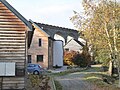 Houses below the Knucklas viaduct - geograph.org.uk - 5961328.jpg 637 × 478; 322 KB
-
 Improved pasture, Tre-foel - geograph.org.uk - 4357533.jpg 800 × 533; 348 KB
-
 Incised track - geograph.org.uk - 3483739.jpg 640 × 480; 95 KB
-
 Junction and phone-box, Bwlch-y-llyn - geograph.org.uk - 3092966.jpg 4,320 × 3,240; 2.96 MB
-
 Knucklas - geograph.org.uk - 1944364.jpg 1,024 × 768; 191 KB
-
 Knucklas Castle seen from Goytre Hill - geograph.org.uk - 4714292.jpg 800 × 450; 124 KB
-
 Knucklas Community Centre - geograph.org.uk - 3717716.jpg 800 × 657; 140 KB
-
 Knucklas Railway Station - geograph.org.uk - 3015125.jpg 480 × 640; 99 KB
-
 Knucklas railway station - geograph.org.uk - 4608322.jpg 2,000 × 1,500; 444 KB
-
 Knucklas railway station, Powys - geograph.org.uk - 4001926.jpg 1,024 × 768; 217 KB
-
 Knucklas road junction - geograph.org.uk - 3717867.jpg 800 × 591; 175 KB
-
 Knucklas Viaduct - geograph.org.uk - 2236712.jpg 1,024 × 768; 335 KB
-
 Knucklas Viaduct - geograph.org.uk - 5916364.jpg 3,648 × 2,736; 4.68 MB
-
 Knucklas Viaduct - geograph.org.uk - 5961317.jpg 637 × 478; 307 KB
-
 Knucklas Viaduct - geograph.org.uk - 5961323.jpg 637 × 478; 360 KB
-
 Lane by Goytre Hill (Lloyney) - geograph.org.uk - 6148844.jpg 3,648 × 2,736; 5.12 MB


.jpg)
.jpg)


_-_geograph.org.uk_-_6148859.jpg)
_-_geograph.org.uk_-_6148882.jpg)
_-_geograph.org.uk_-_6148887.jpg)
_-_geograph.org.uk_-_6149627.jpg)


_-_geograph.org.uk_-_6149576.jpg)

_-_geograph.org.uk_-_6149575.jpg)
_-_geograph.org.uk_-_6149579.jpg)
_-_geograph.org.uk_-_6149581.jpg)
_-_geograph.org.uk_-_6149583.jpg)


_-_geograph.org.uk_-_6148839.jpg)


_-_geograph.org.uk_-_6149553.jpg)


_-_geograph.org.uk_-_6149605.jpg)


_-_geograph.org.uk_-_6149497.jpg)
_-_geograph.org.uk_-_6149593.jpg)
_-_geograph.org.uk_-_6149609.jpg)
_-_geograph.org.uk_-_6148855.jpg)
_-_geograph.org.uk_-_6148884.jpg)
_-_geograph.org.uk_-_6149464.jpg)


_-_geograph.org.uk_-_6148906.jpg)


_-_geograph.org.uk_-_6148927.jpg)
_-_geograph.org.uk_-_6149471.jpg)
_-_geograph.org.uk_-_6149510.jpg)
_-_geograph.org.uk_-_6149516.jpg)
_-_geograph.org.uk_-_6149544.jpg)
_-_geograph.org.uk_-_6149585.jpg)
_-_geograph.org.uk_-_6149622.jpg)


_-_geograph.org.uk_-_6149573.jpg)


_-_geograph.org.uk_-_6148844.jpg)