Category:Billings, Montana
Przejdź do nawigacji
Przejdź do wyszukiwania
city in and county seat of Yellowstone County, Montana, United States     | |||||
| Prześlij plik multimedialny | |||||
| Jest to | |||||
|---|---|---|---|---|---|
| Nazwano imieniem | |||||
| Miejsce | Hrabstwo Yellowstone, Montana, Stany Zjednoczone | ||||
| Szef rządu lub urzędu |
| ||||
| Data utworzenia lub powstania |
| ||||
| Liczba ludności |
| ||||
| Powierzchnia |
| ||||
| Wysokość nad poziomem morza |
| ||||
| Inne niż | |||||
| oficjalna strona internetowa | |||||
 | |||||
English: Media related to Billings, Montana, a city in and the county seat of Yellowstone County, Montana, United States, that located along the Yellowstone River and is the largest city in the state.
Podkategorie
Poniżej wyświetlono 13 spośród wszystkich 13 podkategorii tej kategorii.
B
C
D
G
L
- Lake Elmo State Park (1 plik)
M
- Montages of Billings, Montana (9 plików)
N
P
S
- Satellite pictures of Billings, Montana (2 pliki)
Z
- ZooMontana (1 strona, 3 pliki)
Pliki w kategorii „Billings, Montana”
Poniżej wyświetlono 180 spośród wszystkich 180 plików w tej kategorii.
-
 20210808 03 Montana Rail Link RR, Billings, Montana (2).jpg 3364 × 1378; 675 KB
-
 24th Street, Billings, MT.jpg 3264 × 2448; 1,99 MB
-
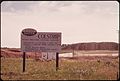
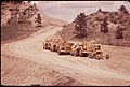
 350 MEGAWATT POWER PLANT UNDER CONSTRUCTION AT COLSTRIP - NARA - 549127.jpg 3000 × 2037; 1,1 MB
-
 350 MEGAWATT POWER PLANT UNDER CONSTRUCTION AT COLSTRIP - NARA - 549128.jpg 2031 × 3000; 941 KB
-

-

-

-

-

-
-
 Altana FCU logo.png 184 × 65; 7 KB
-

-
 Billings Briarwood Subdivision-South Hills.JPG 3888 × 2592; 3,5 MB
-

-

-

-
 Billings, Montana Four Dances Natural Area.JPG 1381 × 1931; 1,32 MB
-
 Billings, Montana in 1972 (39075274141).jpg 2261 × 1500; 2,47 MB
-
 Billings, Montana Swords Park Trail.JPG 3888 × 2592; 4,81 MB
-
 Billings, Montana the Yellowstone River.JPG 3888 × 2592; 4,38 MB
-
 Billings, Montana-Swords Park Trail.JPG 1114 × 742; 405 KB
-
 Billings, Montana-The Terrace.jpg 2479 × 2380; 2,08 MB
-
 Billings, United States (Unsplash 83FN3i0cSNU).jpg 5194 × 3463; 3,96 MB
-
 Billings, United States (Unsplash gjS0pm MM08).jpg 4924 × 3283; 7,56 MB
-
 Billings, United States (Unsplash HW3A 6RN2Jc).jpg 5472 × 3648; 5,97 MB
-
 Billings, United States (Unsplash LWbhkfpJeSs).jpg 5218 × 3479; 6,42 MB
-
 Billings, United States (Unsplash Pk5IA7eUvCM).jpg 4766 × 3177; 5,63 MB
-
 Billings, United States (Unsplash).jpg 2918 × 3648; 3,13 MB
-
 Billings, view from above (25208777008).jpg 2249 × 1500; 4,29 MB
-

-

-

-
 CarMirror on the way to Yellowstone.jpg 3087 × 2048; 1,67 MB
-
 Christmas Prep (Unsplash).jpg 5760 × 3840; 18,58 MB
-
 City of Billings, Montana in June 1972 (38193646835).jpg 2169 × 1452; 3,88 MB
-

-

-
-

-

-

-

-
-
 Conversation table (Unsplash).jpg 5184 × 3456; 8,95 MB
-
 Coulson, Montana.jpg 1286 × 853; 462 KB
-

-
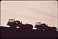
 Decker Coal Company strip mine, 06-1973 (7065921413).jpg 3000 × 2032; 681 KB
-
 Decker Coal Company strip mine, 06-1973 (7065943159).jpg 2012 × 3000; 583 KB
-

-

-

-
 Downtown Billings Montana in the fall.jpg 4032 × 3024; 3,18 MB
-
 Faith Chapel, Billings, United States (Unsplash DiciRhpnv2U).jpg 5549 × 3699; 8,87 MB
-
 Faith Chapel, Billings, United States (Unsplash IO2jnhWzgD0).jpg 5760 × 3840; 17,07 MB
-
 Faith Chapel, Billings, United States (Unsplash mibCiPnj-B8).jpg 5760 × 3840; 10,85 MB
-
 Faith Chapel, Billings, United States (Unsplash).jpg 5760 × 3840; 12,38 MB
-
 Final wilderness environmental impact statement for the Billings Resource Area, Billings, Montana (IA finalwildernesse00unit).pdf 1439 × 1868, 162 strony; 24,1 MB
-

-
 Flag of Billings, Montana.png 950 × 570; 25 KB
-

-

-

-
 Frozen Bubble, Billings, Montana (Unsplash).jpg 5302 × 3535; 6,58 MB
-

-
-

-

-
 HAY FIELD AT THE JOHN REDDING RANCH IN SARPY BASIN - NARA - 549237.jpg 3000 × 1983; 758 KB
-

-
 Hfhnndhhndnhdndnhdcnhc.jpg 4032 × 3024; 1,59 MB
-

-

-

-

-

-
 JFK greets crowd in Billings 1963-09-25.jpg 760 × 517; 517 KB
-
 John F Kennedy addressing a crowd in Billings, Montana.jpg 1000 × 665; 100 KB
-
 KULR-TV NBC 8 Billings, Montana Logo.svg 512 × 151; 37 KB
-
 Late afternoon view of Billings, MT. 2008 (38193679345).jpg 2250 × 1500; 2,25 MB
-
 Lightning over Billings Airport April 2007.jpg 1600 × 1200; 495 KB
-
 LokBillings94.jpg 1536 × 1024; 921 KB
-
 Midland Bank, Billings, Montana, weather beacon.png 913 × 913; 641 KB
-
 Mountain View Cemetery, Billings, Montana LCCN2017706597.tif 5155 × 3535; 104,32 MB
-
 NILE office sign.jpg 3571 × 2381; 5,85 MB
-
 Nordberg HP400 Cone Crusher.jpg 1813 × 1664; 439 KB
-

-

-
 One of the draft horses at Billings Farm. - panoramio.jpg 2048 × 1536; 687 KB
-

-
 Panoramic view of Billings, Montana LCCN2007662445.tif 3620 × 680; 7,05 MB
-
 Peabody Coal Company strip mine, south of Colstrip, 06-1973 (6919738246).jpg 3000 × 2033; 488 KB
-
 Peabody Coal Company strip mine, south of Colstrip, 06-1973 (7065851699).jpg 3000 × 2033; 358 KB
-
 Peabody Coal Company strip mine, south of Colstrip, 06-1973 (7065852481).jpg 3000 × 2031; 351 KB
-
 Peabody Coal Company strip mine, south of Colstrip, 06-1973 (7065859107).jpg 3000 × 2044; 320 KB
-
 Peabody Coal Company strip mine, south of Colstrip, 06-1973. (7065771641).jpg 2017 × 3000; 641 KB
-
 Peabody Coal Company strip mine, south of Colstrip, 06-1973. (7065795331).jpg 2033 × 3000; 476 KB
-

-

-
 Peabody Coal Company strip mine, south of Colstrip..., 06-1973. (6919694554).jpg 3000 × 2031; 710 KB
-
 Peace (Unsplash wW1c9bc58Go).jpg 2897 × 3621; 2,82 MB
-

-

-

-

-

-

-
 Plane Underside (Unsplash).jpg 4718 × 3145; 6,92 MB
-

-

-

-
 Race and ethnicity 2020 Billings, MT.png 2400 × 2404; 998 KB
-

-

-

-
 Rimrocks overlooking Billings.jpg 2048 × 1536; 1,17 MB
-
 Rimrocks.JPG 1524 × 2032; 857 KB
-

-

-

-

-

-
 Sacrifice Cliff Coulson.JPG 3326 × 1518; 1,3 MB
-

-
 Seal of Billings, Montana.png 239 × 257; 21 KB
-

-

-
-

-

-

-

-

-
 Steel wool lightpainting in a train tunnel (Unsplash).jpg 5472 × 3648; 21,09 MB
-

-

-
 Supersonic Car Wash, Billings, Montana LCCN2017707632.tif 3675 × 5211; 109,63 MB
-
 Swords Rimrock Park Billings Montana1.jpg 4000 × 3000; 4,15 MB
-
 Swords Rimrock Park Billings Montana2.jpg 3000 × 4000; 5,74 MB
-

-

-
 THE BUD REDDING RANCH AT SUNSET - NARA - 549248.jpg 3000 × 2046; 619 KB
-
 THE BUD REDDING RANCH IN SARPY BASIN - NARA - 549247.jpg 3000 × 2038; 944 KB
-
 THE BUD REDDING RANCH IN SARPY BASIN - NARA - 549261.jpg 3000 × 2020; 579 KB
-
 The first and second rise of the Billings Rimrocks.JPG 1534 × 1246; 803 KB
-

-

-
-

-

-

-

-

-

-
 Urban31 (38365320444).jpg 2145 × 1425; 4,07 MB
-
 Urban46 (38365242884).jpg 2241 × 1500; 3,82 MB
-
 Urban47 (38365244944).jpg 2307 × 1500; 2,33 MB
-
 Urban51 (24214013637).jpg 2241 × 1500; 3 MB
-
 US-87 Billings Heights.JPG 3693 × 1871; 2,9 MB
-

-

-
 WestBillings.jpeg 2032 × 1524; 697 KB
-

-

-

-

-

-

-

-
 WHEAT FIELD ON THE REDDING RANCH IN SARPY BASIN - NARA - 549251.jpg 1997 × 3000; 1,09 MB
-
 Wheat field on the Redding ranch in Sarpy Basin, 06-1973 (7065929249).jpg 1997 × 3000; 614 KB
-
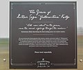
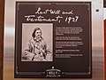
 Yellowstone Kellys Grave on Black Otter Trail NRHP 06001224 Montana1.jpg 4000 × 3000; 5,29 MB
-
 Yellowstone Kellys Grave on Black Otter Trail NRHP 06001224 Montana2.jpg 3681 × 3000; 3,89 MB
-
 Yellowstone Kellys Grave on Black Otter Trail NRHP 06001224 Montana3.jpg 3581 × 3000; 3,58 MB
-
 Yellowstone Kellys Grave on Black Otter Trail NRHP 06001224 Montana4.jpg 4000 × 3000; 4,59 MB
-
 Yellowstone Kellys Grave on Black Otter Trail NRHP 06001224 Montana5.jpg 3603 × 3000; 4,14 MB
-
 Yellowstone Kellys Grave on Black Otter Trail NRHP 06001224 Montana6.jpg 3000 × 4000; 3,44 MB
-
 Yellowstone Kellys Grave on Black Otter Trail NRHP 06001224 Montana7.jpg 3000 × 4000; 3,99 MB
-
 Yibil 2b (7681135902).jpg 1777 × 2391; 661 KB
-
 Yibil 3b (7681137262).jpg 1753 × 2330; 845 KB
-
 Zimmermanplot.jpg 1524 × 2032; 789 KB


.png)

_NRHP_02000214_Montana1.jpg)
_NRHP_02000214_Montana4.jpg)
_NRHP_02000214_Montana5.jpg)

.jpg)


.jpg)
.jpg)
.jpg)
.jpg)
.jpg)
.jpg)
.jpg)


.jpg)
.jpg)

.jpg)

.png)
.jpg)
.jpg)

.jpg)
.jpg)
.jpg)
.jpg)
.png)
.jpg)
.jpg)
.jpg)
.jpg)


.jpg)
.jpg)

.jpg)


.jpg)


.jpg)
.jpg)
.jpg)
.jpg)
.jpg)
.jpg)
.jpg)
.jpg)
.jpg)
.jpg)
.jpg)
.jpg)

.jpg)


.jpg)
.jpg)

.png)
.jpg)
.jpg)


.jpg)
.jpg)
.jpg)
.jpg)
.jpg)
.jpg)


.jpg)

.jpg)

.jpg)

.jpg)

.jpg)


.jpg)
.jpg)

.jpg)
.jpg)
.jpg)
.jpg)
Kategorie:
- Cities in Montana
- Populated places in Yellowstone County, Montana
- County seats in Montana
- Yellowstone River
- Locations along Interstate 90 in Montana
- Locations along U.S. Route 87 in Montana
- Locations along U.S. Route 212 in Montana
- Locations along Montana Highway 3
- Locations along Montana Secondary Highway 302
- Locations along Montana Secondary Highway 372
- Locations along Montana Secondary Highway 416