Category:Bishop Auckland
Naar navigatie springen
Naar zoeken springen
plaats in Durham  | |||||
| Media uploaden | |||||
| Is een | |||||
|---|---|---|---|---|---|
| Locatie | County Durham, Durham, North East England, Engeland | ||||
| Inwonertal |
| ||||
 | |||||
en: This category contains media relating to the town of Bishop Auckland in County Durham.
Ondercategorieën
Deze categorie bevat de volgende 17 subcategorieën, van de 17 in totaal.
A
- Auckland Way (12 B)
B
- Binchester Roman Fort (20 B)
- Bishop Auckland railway station (16 B)
C
K
- Kynren (6 B)
N
- Newton Cap Bridge (5 B)
- Newton Cap Viaduct (12 B)
P
T
- Bishop Auckland Town Hall (6 B)
W
- Woodhouse Close (9 B)
Media in categorie "Bishop Auckland"
Deze categorie bevat de volgende 200 bestanden, van in totaal 372.
(vorige pagina) (volgende pagina)-
 A688 Tindale Crescent - geograph.org.uk - 1829174.jpg 640 × 480; 60 kB
-
 A689, Bishop Auckland - geograph.org.uk - 4835915.jpg 640 × 480; 89 kB
-
 A689, Toronto - geograph.org.uk - 5516015.jpg 640 × 480; 62 kB
-
 Access road into Bishop Auckland - geograph.org.uk - 1733240.jpg 2.048 × 1.536; 1,65 MB
-

-
 Addison Road (A689), Toronto - geograph.org.uk - 5519649.jpg 2.848 × 2.136; 1,23 MB
-
 Aldi supermarket, Bishop Auckland - geograph.org.uk - 5919229.jpg 640 × 480; 61 kB
-
-
 Along Newgate Street - geograph.org.uk - 5051142.jpg 640 × 427; 107 kB
-
 Ancient Oak, Auckland Park - geograph.org.uk - 2105288.jpg 427 × 640; 305 kB
-

-
 Arthur Stanley Jefferson statue - geograph.org.uk - 5718996.jpg 600 × 800; 132 kB
-
 Auckland Castle - geograph.org.uk - 5997999.jpg 640 × 480; 245 kB
-
 Auckland Castle, Bishop Auckland - geograph.org.uk - 4826226.jpg 4.608 × 3.456; 6,53 MB
-
 Auckland Deer House - geograph.org.uk - 1896467.jpg 1.280 × 853; 514 kB
-
 Auckland House - geograph.org.uk - 1830754.jpg 1.600 × 1.200; 394 kB
-
 Auckland Tower - geograph.org.uk - 5977938.jpg 2.863 × 4.414; 1,55 MB
-
 Auckland Tower - geograph.org.uk - 6243540.jpg 1.317 × 1.600; 546 kB
-
 Auckland Walk. Durham Road overbridge - geograph.org.uk - 6129786.jpg 5.202 × 3.465; 5,95 MB
-
 Autocare Centre, Bishop Auckland - geograph.org.uk - 5892328.jpg 640 × 480; 58 kB
-
 Autumn colours, Barrington Meadows - geograph.org.uk - 4733038.jpg 640 × 480; 122 kB
-
 B ^ Q, Bishop Auckland - geograph.org.uk - 4835925.jpg 640 × 480; 58 kB
-
 B6286 beyond roundabout - geograph.org.uk - 3891578.jpg 1.500 × 1.055; 1,2 MB
-
 Back of Dent Street - geograph.org.uk - 3181309.jpg 640 × 480; 91 kB
-
 Bar Tutster's, Bishop Auckland - geograph.org.uk - 4786849.jpg 478 × 640; 78 kB
-
 Bell Burn - geograph.org.uk - 1360481.jpg 640 × 480; 173 kB
-
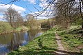
 Bend in the river - geograph.org.uk - 2899347.jpg 4.608 × 3.456; 5,39 MB
-
 Bishop Auckland (33307506012).jpg 4.000 × 3.000; 2,66 MB
-
 Bishop Auckland (33422897096).jpg 4.000 × 3.000; 2,72 MB
-
 Bishop Auckland - almshouses on Market Place - geograph.org.uk - 3699038.jpg 1.600 × 1.219; 513 kB
-
 Bishop Auckland - Bar None on Fore Bondgate - geograph.org.uk - 3698756.jpg 1.200 × 1.600; 674 kB
-
 Bishop Auckland - Durham dot.png 417 × 599; 122 kB
-
 Bishop Auckland - former Barclays Bank - geograph.org.uk - 3698242.jpg 1.296 × 1.600; 522 kB
-

-
 Bishop Auckland - geograph.org.uk - 482065.jpg 640 × 426; 182 kB
-
 Bishop Auckland - houses at bottom of High Bondgate - geograph.org.uk - 3698745.jpg 1.600 × 1.226; 447 kB
-

-
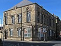
 Bishop Auckland - Lightfoot Institute - geograph.org.uk - 3698508.jpg 1.600 × 1.207; 524 kB
-
 Bishop Auckland - Masonic Hall - geograph.org.uk - 3698260.jpg 1.600 × 1.218; 596 kB
-
 Bishop Auckland - Old Bank Chambers - geograph.org.uk - 3698255.jpg 1.226 × 1.600; 564 kB
-
 Bishop Auckland - south side of Market Place - geograph.org.uk - 3699069.jpg 1.600 × 1.180; 569 kB
-
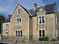
 Bishop Auckland - St Wilfrid's RC Presbytery - from east - geograph.org.uk - 3698596.jpg 1.600 × 1.193; 835 kB
-
-
 Bishop Auckland - terrace on Victoria Avenue - geograph.org.uk - 3698262.jpg 1.175 × 1.600; 576 kB
-
 Bishop Auckland - The Derby - geograph.org.uk - 3699079.jpg 1.600 × 1.166; 420 kB
-
 Bishop Auckland - The Postchaise - geograph.org.uk - 3698248.jpg 1.600 × 1.190; 509 kB
-
 Bishop Auckland - The Queens Head Hotel - geograph.org.uk - 3698250.jpg 1.600 × 1.222; 529 kB
-
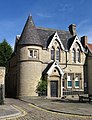
 Bishop Auckland - Town Hall - geograph.org.uk - 3698246.jpg 1.600 × 1.236; 543 kB
-
 Bishop Auckland - Town Hall - north side - geograph.org.uk - 3698769.jpg 1.120 × 1.600; 511 kB
-
 Bishop Auckland - veterinary practice on Tenters Street - geograph.org.uk - 3699089.jpg 1.200 × 1.600; 502 kB
-
 Bishop Auckland - west end of Fore Bondgate - geograph.org.uk - 3698750.jpg 1.600 × 1.200; 608 kB
-
 Bishop Auckland - Yorkshire Bank - geograph.org.uk - 3699075.jpg 1.159 × 1.600; 484 kB
-
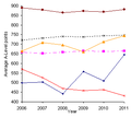 Bishop Auckland A-Level results.png 324 × 290; 4 kB
-
 Bishop Auckland Baptist Church - geograph.org.uk - 3839216.jpg 4.608 × 3.456; 4,62 MB
-
 Bishop Auckland Baptist Church - geograph.org.uk - 4835924.jpg 640 × 480; 68 kB
-
 Bishop Auckland bus station - geograph.org.uk - 3845288.jpg 4.608 × 3.456; 4,31 MB
-
 Bishop Auckland CC field - geograph.org.uk - 256017.jpg 640 × 480; 66 kB
-
 Bishop Auckland Cemetery Chapel (geograph 7371065).jpg 1.024 × 768; 204 kB
-
 Bishop Auckland College - geograph.org.uk - 5919455.jpg 640 × 386; 59 kB
-

-
 Bishop Auckland Cricket club - geograph.org.uk - 256015.jpg 640 × 480; 79 kB
-
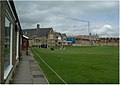 Bishop Auckland Cricket Club - geograph.org.uk - 256027.jpg 640 × 453; 56 kB
-
 Bishop Auckland fire station - geograph.org.uk - 2022519.jpg 640 × 427; 187 kB
-
 Bishop Auckland fire station - geograph.org.uk - 288081.jpg 640 × 427; 171 kB
-
 Bishop Auckland Fire Station - geograph.org.uk - 3841777.jpg 4.608 × 3.456; 4,36 MB
-
 Bishop Auckland from Durham Road - geograph.org.uk - 6129795.jpg 5.202 × 3.465; 2,7 MB
-
 Bishop Auckland from Durham Road - geograph.org.uk - 6129805.jpg 5.202 × 3.465; 3 MB
-
 Bishop Auckland GCSE results.png 324 × 290; 4 kB
-
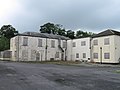
 Bishop Auckland General Hospital - panoramio.jpg 1.600 × 1.200; 1 MB
-
 Bishop Auckland General.jpg 1.570 × 1.196; 1,09 MB
-
 Bishop Auckland Hospital - geograph.org.uk - 4835920.jpg 640 × 480; 74 kB
-
 Bishop Auckland Hospital - geograph.org.uk - 5263736.jpg 640 × 480; 78 kB
-
 Bishop Auckland in the snow - geograph.org.uk - 3303448.jpg 640 × 427; 74 kB
-
 Bishop Auckland Market Place - geograph.org.uk - 5997838.jpg 640 × 480; 273 kB
-
 Bishop Auckland Methodist Church - geograph.org.uk - 4835921.jpg 480 × 640; 56 kB
-
 Bishop Auckland Population Pyramid.png 607 × 286; 5 kB
-
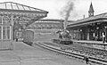
 Bishop Auckland Railway Station - geograph.org.uk - 3216674.jpg 640 × 409; 77 kB
-
 Bishop Auckland Railway Station - geograph.org.uk - 4800000.jpg 640 × 480; 77 kB
-
 Bishop Auckland Railway Station - geograph.org.uk - 4800007.jpg 640 × 480; 80 kB
-
 Bishop Auckland Railway Station - geograph.org.uk - 4832644.jpg 640 × 480; 66 kB
-
 Bishop Auckland Railway Station - geograph.org.uk - 4832647.jpg 640 × 480; 67 kB
-
 Bishop Auckland Railway Station - geograph.org.uk - 4835918.jpg 640 × 480; 64 kB
-
 Bishop Auckland Railway Station - geograph.org.uk - 5519682.jpg 2.508 × 1.893; 1,05 MB
-
 Bishop Auckland Railway Station - geograph.org.uk - 5890714.jpg 640 × 510; 91 kB
-
 Bishop Auckland Railway Station - geograph.org.uk - 5890716.jpg 3.648 × 2.736; 1,94 MB
-
 Bishop Auckland Railway Station - geograph.org.uk - 5909894.jpg 2.848 × 2.136; 1,25 MB
-
 Bishop Auckland Railway Station - geograph.org.uk - 5916093.jpg 640 × 451; 95 kB
-
 Bishop Auckland Railway Station - geograph.org.uk - 5916096.jpg 2.848 × 2.136; 1,45 MB
-
 Bishop Auckland Railway Station - geograph.org.uk - 5916102.jpg 2.550 × 1.944; 1,27 MB
-
 Bishop Auckland railway station, County Durham - geograph.org.uk - 3276760.jpg 1.024 × 732; 166 kB
-
 Bishop Auckland roofscape - geograph.org.uk - 5997830.jpg 640 × 480; 299 kB
-
 Bishop Auckland RUFC - geograph.org.uk - 1733229.jpg 2.048 × 1.536; 1,55 MB
-
 Bishop Auckland Shopping Park at Tindale Crescent - geograph.org.uk - 3256364.jpg 3.494 × 2.516; 2,39 MB
-
 Bishop Auckland station - geograph.org.uk - 4604690.jpg 800 × 600; 150 kB
-
 Bishop Auckland station - geograph.org.uk - 6134205.jpg 5.202 × 3.465; 3,71 MB
-
-
 Bishop Cosin's carved altar screen - geograph.org.uk - 2392587.jpg 1.368 × 1.824; 630 kB
-
 Bishop Trevor's marble memorial - geograph.org.uk - 2392585.jpg 1.368 × 1.824; 642 kB
-
 Bishop's Palace, Auckland Castle - geograph.org.uk - 2392582.jpg 3.648 × 2.736; 1,04 MB
-
 BishopAucklandCentre02June2010.jpg 2.748 × 3.664; 1,06 MB
-
 Bishopfield Tindale Crescent County Durham - geograph.org.uk - 1836573.jpg 2.048 × 1.536; 1.012 kB
-
 Bookmakers, Bishop Auckland - geograph.org.uk - 5892342.jpg 640 × 512; 66 kB
-
 Boundary Stone with OS Rivet - geograph.org.uk - 5911648.jpg 743 × 1.024; 182 kB
-
 Bowes Grove Bishop Auckland - geograph.org.uk - 2093532.jpg 2.048 × 1.536; 502 kB
-
 Branching of B6282 and B6284 - geograph.org.uk - 4728958.jpg 1.289 × 1.600; 812 kB
-
 Brooklands Bishop Auckland - geograph.org.uk - 2094000.jpg 2.048 × 1.536; 625 kB
-

-
-
 Business unit on West Auckland Road - geograph.org.uk - 5919222.jpg 640 × 480; 58 kB
-

-
 Castle Chare Fountain (geograph 7371061).jpg 768 × 1.024; 302 kB
-
 Castle Gateway - geograph.org.uk - 5997850.jpg 480 × 640; 333 kB
-
 Chapel of St Peter, Auckland Castle - geograph.org.uk - 4826233.jpg 4.608 × 3.456; 5,97 MB
-

-

-
 Closed up building at Binchester - geograph.org.uk - 2056765.jpg 640 × 480; 58 kB
-
 Coal wagon on Cockton Hill Road, Bishop Auckland - geograph.org.uk - 3839245.jpg 4.608 × 3.456; 3,81 MB
-
-
 Cockton Hill Road, Bishop Auckland - geograph.org.uk - 5911227.jpg 2.848 × 2.136; 1,22 MB
-
 Construction works in the market place - geograph.org.uk - 5051139.jpg 640 × 427; 118 kB
-
 Cradock Street, Bishop Auckland - geograph.org.uk - 4835922.jpg 640 × 480; 61 kB
-

-
 Cycle path beside the A689 - geograph.org.uk - 5516020.jpg 640 × 480; 79 kB
-
 Cycle path beside West Auckland Road - geograph.org.uk - 5919220.jpg 640 × 480; 63 kB
-
 Deer Park at Auckland Castle - geograph.org.uk - 5998012.jpg 480 × 640; 397 kB
-
 Deer Park at Auckland Castle - geograph.org.uk - 5998013.jpg 640 × 480; 393 kB
-
 Deer Shelter - geograph.org.uk - 2907595.jpg 1.600 × 1.200; 663 kB
-

-
 Deer Shelter, Auckland Park - geograph.org.uk - 2105313.jpg 427 × 640; 288 kB
-
 Derelict farmhouse at Etherley.jpg 2.833 × 1.821; 1,41 MB
-

-
 Digging up the market place - geograph.org.uk - 5051136.jpg 640 × 427; 129 kB
-
 Diocesan Office, Auckland Palace - geograph.org.uk - 1896429.jpg 1.280 × 853; 381 kB
-
 Display outside 42 Market Place, Bishop Auckland - geograph.org.uk - 6135012.jpg 1.536 × 1.536; 1,01 MB
-

-

-
 Driveway, Auckland Castle - geograph.org.uk - 3560019.jpg 640 × 463; 242 kB
-
 Dry stone wall and Plum Trees adjacent to the Engine Pond.jpg 3.648 × 2.736; 2,29 MB
-
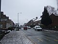
 Durham Road, Bishop Auckland - geograph.org.uk - 4832631.jpg 640 × 480; 105 kB
-
 Elizabeth II postbox on Addison Road, Toronto - geograph.org.uk - 5519646.jpg 1.724 × 2.774; 983 kB
-

-

-
 Elizabeth II postbox on Newgate Street, Bishop Auckland - geograph.org.uk - 5519666.jpg 2.136 × 2.848; 1,13 MB
-

-
 Elizabeth II postbox on Watling Road, Bishop Auckland - geograph.org.uk - 5919389.jpg 2.136 × 2.848; 1,23 MB
-
 Elizabeth II postbox on Woodhouse Lane, Bishop Auckland - geograph.org.uk - 5919449.jpg 2.136 × 2.848; 1,24 MB
-

-
 Entrance to Auckland Castle - geograph.org.uk - 4826220.jpg 4.608 × 3.456; 6,35 MB
-
 Entrance to Auckland Castle - geograph.org.uk - 4832632.jpg 640 × 480; 65 kB
-
 Etherley Lane and The Pollards Inn, Bishop Auckland - geograph.org.uk - 5780270.jpg 3.812 × 2.859; 2,09 MB
-
 Etherley Lane, Etherley Dene - geograph.org.uk - 5906398.jpg 640 × 480; 55 kB
-
 Etherley Railway Incline (Bridleway between Low Etherley and Greenfields).jpg 3.648 × 2.736; 2,82 MB
-
 Exhibition area, Auckland Tower - geograph.org.uk - 5997846.jpg 480 × 640; 292 kB
-
 Farm Buildings at Binchester - geograph.org.uk - 2056772.jpg 640 × 480; 63 kB
-
 Flatts Farm - geograph.org.uk - 5997809.jpg 640 × 480; 73 kB
-
 Foot bridge over the A689, Toronto - geograph.org.uk - 5516018.jpg 640 × 480; 71 kB
-
 Fore Bondgate, Bishop Auckland - geograph.org.uk - 4826329.jpg 4.608 × 3.456; 5,7 MB
-
 Fore Bondgate, Bishop Auckland - geograph.org.uk - 4826345.jpg 4.608 × 3.456; 5,56 MB
-
-
 Former Barclays Bank - geograph.org.uk - 1830760.jpg 1.600 × 1.200; 330 kB
-

-
 Former railway , Bishop Auckland - geograph.org.uk - 3845194.jpg 4.608 × 3.456; 5,38 MB
-
 Four Clocks centre, Bishop Auckland - geograph.org.uk - 6133945.jpg 5.202 × 3.465; 3,59 MB
-
 From bridge to viaduct - geograph.org.uk - 4868003.jpg 4.320 × 2.529; 2,12 MB
-
 Fylands Bridge - geograph.org.uk - 3841918.jpg 4.608 × 3.456; 4,5 MB
-
 Gasometer at Bishop Auckland - geograph.org.uk - 3838908.jpg 1.500 × 1.125; 1,53 MB
-

-

-
 Grove Road, Bishop Auckland - geograph.org.uk - 5907732.jpg 2.848 × 2.136; 1,45 MB
-
 High Bondgate, Bishop Auckland - geograph.org.uk - 4835914.jpg 640 × 480; 96 kB
-
-
 History and characteristics of Bishop Auckland.djvu 5.100 × 6.601, 225 pagina's; 18,31 MB
-
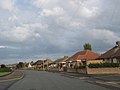
 Houses on Dial Stob Hill - geograph.org.uk - 5888986.jpg 640 × 480; 54 kB
-

-
 Houses on Green Lane - geograph.org.uk - 3841956.jpg 4.608 × 3.456; 5,28 MB
-

-
 Houses on Salisbury Place - geograph.org.uk - 5344674.jpg 1.500 × 1.318; 2,29 MB
-

-
 Housing estate beside the old railway - geograph.org.uk - 3845200.jpg 4.608 × 3.456; 4,46 MB
-
 Incine fence south of the Engine Pond.jpg 3.648 × 2.736; 2,49 MB
-
 Inner gateway to Auckland Castle - geograph.org.uk - 5998006.jpg 640 × 480; 270 kB
-
-
 Jenkins Drive, Bishop Auckland - geograph.org.uk - 485908.jpg 640 × 480; 58 kB
-
 Jenkins Drive, Bishop Auckland - geograph.org.uk - 486509.jpg 640 × 480; 77 kB
-
 Jock's Bridge Bishop Auckland - geograph.org.uk - 138903.jpg 640 × 413; 66 kB
-
 Junction of Durham Road and Gib Chare, Bishop Auckland - geograph.org.uk - 6129815.jpg 5.202 × 3.465; 3,51 MB
-

-

-

-
 Junction of Victoria Avenue with Newgate Street - geograph.org.uk - 3836270.jpg 4.608 × 3.456; 3,92 MB
-
 King james 1st Entrance.jpg 500 × 375; 45 kB
-
 King James Front Entrance.jpg 4.592 × 3.448; 4,84 MB
-
 Kynren set in August 2021.jpg 4.608 × 3.456; 3,59 MB
-
 Land Slump, Auckland Park - geograph.org.uk - 2105299.jpg 640 × 427; 292 kB
-

-

-

-
 Market Place - geograph.org.uk - 5051133.jpg 640 × 427; 101 kB
-
 Market Place - geograph.org.uk - 6009592.jpg 608 × 470; 147 kB
-


,_Toronto_-_geograph.org.uk_-_5519649.jpg)


.jpg)
.jpg)


.jpg)


.jpg)


.jpg)


.jpg)


