Category:Bix and Assendon
Jump to navigation
Jump to search
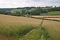
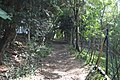
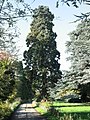
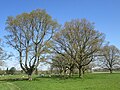
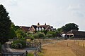
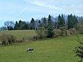
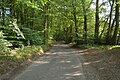
English: Bix and Assendon is a civil parish in the South Oxfordshire district of Oxfordshire, England. According to the 2001 census it had a population of 531. The parish includes Bix, Lower Assendon and Middle Assendon, and is just north of Henley-on-Thames.
civil parish in South Oxfordshire district, Oxfordshire, England | |||||
| Upload media | |||||
| Instance of | |||||
|---|---|---|---|---|---|
| Named after | |||||
| Location | South Oxfordshire, Oxfordshire, South East England, England | ||||
 | |||||
Subcategories
This category has the following 3 subcategories, out of 3 total.
Media in category "Bix and Assendon"
The following 200 files are in this category, out of 308 total.
(previous page) (next page)-
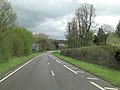
 A crossroads on the A4130 at Bix - geograph.org.uk - 2689078.jpg 1,024 × 680; 204 KB
-
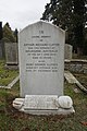 A family grave - geograph.org.uk - 2693620.jpg 533 × 800; 116 KB
-
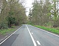
 A footpath which runs alongside the A4130 at Bix - geograph.org.uk - 2689065.jpg 1,024 × 680; 294 KB
-

-
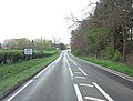
 A junction on the A4130 at Bix - geograph.org.uk - 2709606.jpg 1,600 × 766; 252 KB
-
 A row of graves - geograph.org.uk - 2690316.jpg 1,024 × 683; 241 KB
-
 A4130 - geograph.org.uk - 5968707.jpg 1,024 × 681; 155 KB
-
 A4130 approaches junction with B480 - geograph.org.uk - 2918408.jpg 3,648 × 2,736; 1.89 MB
-
 A4130 descends Bix Hill - geograph.org.uk - 2918402.jpg 3,648 × 2,736; 1.9 MB
-
 A4130 east of Offal Wood - geograph.org.uk - 2918345.jpg 3,203 × 2,477; 1.46 MB
-
 A4130 enters Bix - geograph.org.uk - 2918390.jpg 3,461 × 2,613; 1.46 MB
-
 A4130 towards Wallingford - geograph.org.uk - 6236343.jpg 1,024 × 684; 342 KB
-
 A4130 towards Wallingford - geograph.org.uk - 6236351.jpg 1,024 × 684; 354 KB
-
 A4130, B480 junction - geograph.org.uk - 5968712.jpg 1,024 × 681; 210 KB
-
 A4155 west of Fawley Court - geograph.org.uk - 3407320.jpg 3,648 × 2,736; 2.4 MB
-
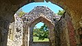 Abandoned church, Bix Bottom (interior) - geograph.org.uk - 6163152.jpg 3,840 × 2,160; 4.09 MB
-
 Abandoned church, Bix Bottom - geograph.org.uk - 6163150.jpg 3,840 × 2,160; 4.65 MB
-
 An old road - geograph.org.uk - 2696851.jpg 1,024 × 683; 211 KB
-
 Another milestone - geograph.org.uk - 2687220.jpg 1,024 × 683; 182 KB
-
 Approaching Henley Park on the Oxfordshire Way - geograph.org.uk - 2829993.jpg 3,968 × 2,976; 2.5 MB
-
 Armchairs hewn from tree trunks, Henley Park - geograph.org.uk - 1897756.jpg 1,280 × 960; 996 KB
-

-
 B480 - geograph.org.uk - 5968696.jpg 1,024 × 681; 212 KB
-
 B480 - geograph.org.uk - 5968698.jpg 1,024 × 681; 212 KB
-
 B480 - geograph.org.uk - 5968704.jpg 1,024 × 681; 186 KB
-
 B480, A4130 junction - geograph.org.uk - 5968705.jpg 1,024 × 681; 186 KB
-
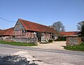 Barn conversion at Bix Manor Farm - geograph.org.uk - 6117321.jpg 1,024 × 792; 208 KB
-
 Barn, Hawes Farm - geograph.org.uk - 5968692.jpg 1,024 × 681; 218 KB
-
 Barns at Valley Farm - geograph.org.uk - 3834424.jpg 640 × 480; 88 KB
-
 Bent away - geograph.org.uk - 3351766.jpg 533 × 800; 145 KB
-
 Bix Bottom - geograph.org.uk - 1049478.jpg 640 × 480; 135 KB
-
 Bix Bottom - geograph.org.uk - 1049492.jpg 640 × 480; 149 KB
-
 Bix Bottom - geograph.org.uk - 1049592.jpg 640 × 480; 209 KB
-
 Bix Bottom - geograph.org.uk - 1049598.jpg 640 × 480; 141 KB
-
 Bix Bottom - geograph.org.uk - 1049606.jpg 640 × 480; 150 KB
-
 Bix Bottom from Warnscombe Lane - geograph.org.uk - 886743.jpg 640 × 479; 131 KB
-
 Bix Common by Green Lane - geograph.org.uk - 3665012.jpg 2,048 × 1,536; 1.41 MB
-
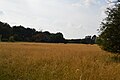
 Bix Common Field - geograph.org.uk - 2688333.jpg 1,024 × 683; 117 KB
-
 Bix Hill - geograph.org.uk - 6130337.jpg 900 × 1,024; 386 KB
-
 Bix Manor (geograph 6714231).jpg 1,024 × 685; 190 KB
-
 Bix Manor Barn (geograph 6714196).jpg 1,024 × 685; 194 KB
-
 Bix Valley - geograph.org.uk - 4759140.jpg 1,600 × 1,108; 728 KB
-
 Bix Valley in bloom - geograph.org.uk - 4132677.jpg 1,920 × 1,440; 4.32 MB
-
 Bluebells in Famous Copse - geograph.org.uk - 6027377.jpg 2,560 × 1,440; 1.75 MB
-
 Bluebells in Famous Copse - geograph.org.uk - 6027378.jpg 2,560 × 1,440; 1.72 MB
-
 Boat floral display, Four Oaks Caravan Club site, Henley - geograph.org.uk - 1950522.jpg 3,648 × 2,736; 2.47 MB
-
 Brawns Farmhouse (geograph 6713915).jpg 1,024 × 684; 203 KB
-
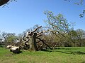
 Broken Tree on The Mount - geograph.org.uk - 5220559.jpg 4,000 × 3,000; 5.21 MB
-
 Bromsden Farm - geograph.org.uk - 1049713.jpg 640 × 427; 187 KB
-
 Bromsden Farm - geograph.org.uk - 1049715.jpg 640 × 427; 220 KB
-
 Broom Covert - geograph.org.uk - 5965205.jpg 1,024 × 681; 131 KB
-
 Buried with his wife - geograph.org.uk - 2696790.jpg 1,024 × 683; 246 KB
-
 Bushy Copse, Bix - geograph.org.uk - 1067391.jpg 640 × 480; 295 KB
-
 Captain James M Blacklock - geograph.org.uk - 2690183.jpg 533 × 800; 149 KB
-
 Caravan site - geograph.org.uk - 1344175.jpg 640 × 457; 408 KB
-
 Cattle Pens, Bix Hall Farm - geograph.org.uk - 3387533.jpg 1,600 × 1,200; 510 KB
-
 Cedar Tree in parkland, Henley Park - geograph.org.uk - 1897726.jpg 1,280 × 960; 795 KB
-
 Cemetery Benchmark - geograph.org.uk - 3162628.jpg 1,024 × 683; 263 KB
-
 Cemetery gatehouse - geograph.org.uk - 2690332.jpg 1,024 × 683; 216 KB
-
 Chalk grassland - geograph.org.uk - 5968672.jpg 1,024 × 681; 153 KB
-
 Chapel, Fairmile Cemetery - geograph.org.uk - 5968709.jpg 1,024 × 681; 204 KB
-
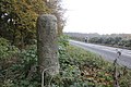
 Close up of the Bix Milestone - geograph.org.uk - 2687328.jpg 533 × 800; 137 KB
-
 Converted barn at Bix Manor - geograph.org.uk - 6117322.jpg 766 × 1,024; 191 KB
-
 Country lane near to Little Bix Bottom - geograph.org.uk - 2830028.jpg 3,968 × 2,976; 2.74 MB
-
 Couple of graves - geograph.org.uk - 3350518.jpg 1,024 × 683; 291 KB
-
 Crest on the grave - geograph.org.uk - 2696497.jpg 1,024 × 683; 219 KB
-
 Dead Tree near No Man's Hill - geograph.org.uk - 3821341.jpg 2,304 × 3,072; 2.82 MB
-
 Deer Park - geograph.org.uk - 5965212.jpg 1,024 × 681; 172 KB
-
 Deer Park - geograph.org.uk - 5965213.jpg 1,024 × 681; 175 KB
-
 Deer Park - geograph.org.uk - 5965290.jpg 1,024 × 681; 122 KB
-
 Deer Park - geograph.org.uk - 5965296.jpg 1,024 × 681; 134 KB
-
 Deer Park - geograph.org.uk - 5965311.jpg 1,024 × 681; 166 KB
-
 Deer Park by Lambridge Wood - geograph.org.uk - 1897852.jpg 1,280 × 960; 583 KB
-
 Descending off Great Hill - geograph.org.uk - 5968684.jpg 1,024 × 681; 253 KB
-
 Descending to Lower Assendon - geograph.org.uk - 5968676.jpg 1,024 × 681; 280 KB
-
 Dry valley on the Chilterns dip slope - geograph.org.uk - 5240402.jpg 4,592 × 3,056; 3.84 MB
-
 Empty Pub Sign - geograph.org.uk - 2687322.jpg 533 × 800; 170 KB
-
 Enclosure, Deer Park - geograph.org.uk - 5965309.jpg 1,024 × 681; 178 KB
-
 End of the carriageway - geograph.org.uk - 2687339.jpg 1,024 × 683; 123 KB
-
 Entrance drive - geograph.org.uk - 2696845.jpg 1,024 × 683; 237 KB
-
 Entrance to Fair Mile cemetery - geograph.org.uk - 2690138.jpg 1,024 × 683; 218 KB
-
 Entrance, Four Oaks Caravan Club site, Henley - geograph.org.uk - 1950498.jpg 3,648 × 2,736; 2.25 MB
-
 Estate Road near Bromsden Farm - geograph.org.uk - 2883115.jpg 3,388 × 2,560; 2.9 MB
-
 Evergreens in Henley Park - geograph.org.uk - 5228595.jpg 4,000 × 3,000; 2.76 MB
-
 Facilities Block, Four Oaks Caravan Club site, Henley - geograph.org.uk - 1950516.jpg 3,648 × 2,736; 2.09 MB
-
 Fair Mile, Lower Assendon - geograph.org.uk - 3665542.jpg 2,048 × 1,536; 1.5 MB
-
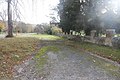
 Fairmile Cemetery - geograph.org.uk - 5968710.jpg 1,024 × 681; 230 KB
-
 Fairmile Cemetery - geograph.org.uk - 5968711.jpg 1,024 × 681; 212 KB
-
 Fairmile Cemetery Benchmark - geograph.org.uk - 3162629.jpg 533 × 800; 180 KB
-
 Fallen tree at The Mount - geograph.org.uk - 5752716.jpg 4,608 × 3,456; 5.04 MB
-
 Family Graves - geograph.org.uk - 3365530.jpg 1,024 × 683; 216 KB
-
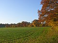
 Farmland near Henley Park - geograph.org.uk - 1588779.jpg 640 × 480; 79 KB
-
 Farmland, Assendon - geograph.org.uk - 6073177.jpg 1,024 × 768; 272 KB
-
 Farmland, Bix - geograph.org.uk - 1067383.jpg 640 × 480; 134 KB
-
 Farmland, Bix - geograph.org.uk - 2230094.jpg 640 × 480; 130 KB
-
 Farmland, Middle Assendon - geograph.org.uk - 1049183.jpg 640 × 480; 165 KB
-
 Farmland, Middle Assendon - geograph.org.uk - 1049561.jpg 640 × 480; 167 KB
-
 Farmland, Middle Assendon - geograph.org.uk - 1049565.jpg 640 × 480; 174 KB
-
 Fawley Bottom Lane - geograph.org.uk - 3834492.jpg 640 × 480; 161 KB
-
 Fields near Valley Farm, Bix Bottom - geograph.org.uk - 2178808.jpg 640 × 480; 86 KB
-

-
 Flint building in Lower Assendon - geograph.org.uk - 5968700.jpg 1,024 × 681; 182 KB
-
 Flooded road - geograph.org.uk - 817366.jpg 640 × 425; 66 KB
-
 Footpath and Field Gate - geograph.org.uk - 3666433.jpg 2,560 × 1,920; 1.15 MB
-
 Footpath descending towards Middle Assendon - geograph.org.uk - 2830008.jpg 3,968 × 2,976; 3.02 MB
-
 Footpath to Lower Assendon - geograph.org.uk - 5968675.jpg 1,024 × 681; 308 KB
-
 Footpath to Middle Assendon - geograph.org.uk - 1981975.jpg 640 × 425; 68 KB
-
 Footpath up Lambridge Hill - geograph.org.uk - 5968714.jpg 1,024 × 681; 258 KB
-
 Footpath up Lambridge Hill - geograph.org.uk - 5968715.jpg 1,024 × 681; 265 KB
-
 Footpath up Lambridge Hill - geograph.org.uk - 5968716.jpg 1,024 × 681; 306 KB
-
 Footpath, Great Hill - geograph.org.uk - 5968670.jpg 1,024 × 681; 294 KB
-
 Footpath, Great Hill - geograph.org.uk - 5968673.jpg 1,024 × 681; 303 KB
-
 Footpath, Lambridge Hill - geograph.org.uk - 5968717.jpg 1,024 × 681; 278 KB
-
 Footpath, Lambridge Hill - geograph.org.uk - 5968721.jpg 1,024 × 681; 309 KB
-
 Game crop near Westleaze Cottages - geograph.org.uk - 1049699.jpg 640 × 427; 205 KB
-
 Giant Redwood - geograph.org.uk - 3821320.jpg 480 × 640; 143 KB
-
 Graffiti in the window - geograph.org.uk - 3351728.jpg 533 × 800; 140 KB
-
 Grasses, Lambridge Hill - geograph.org.uk - 5968718.jpg 1,024 × 681; 138 KB
-
 Grassland, The Mount - geograph.org.uk - 5965191.jpg 1,024 × 681; 167 KB
-
 Grassland, The Mount - geograph.org.uk - 5965196.jpg 1,024 × 681; 194 KB
-
 Grave by the wall - geograph.org.uk - 3350618.jpg 1,024 × 683; 269 KB
-
 Graves by the drive - geograph.org.uk - 2693563.jpg 533 × 800; 180 KB
-
 Graves on the left - geograph.org.uk - 2696795.jpg 1,024 × 683; 152 KB
-
-
 Greenmarsh Farm - geograph.org.uk - 5973541.jpg 1,024 × 681; 128 KB
-
 Greenmarsh Farm from Lambridge Wood - geograph.org.uk - 1897846.jpg 1,280 × 958; 560 KB
-
 Gunner G R Green - geograph.org.uk - 2696520.jpg 533 × 800; 116 KB
-

-
 Henley Park - geograph.org.uk - 1824349.jpg 640 × 433; 60 KB
-

-
 Horse in field - geograph.org.uk - 3834466.jpg 640 × 480; 90 KB
-
 Horseman statue at Bromsden Farm - geograph.org.uk - 5721049.jpg 3,840 × 2,160; 3.72 MB
-
 Hot air balloon over the A4130, Bix - geograph.org.uk - 3665472.jpg 2,048 × 1,536; 1.42 MB
-
 House by the Forest - geograph.org.uk - 2169160.jpg 3,648 × 2,736; 2.94 MB
-
 House in Lower Assendon - geograph.org.uk - 5968691.jpg 1,024 × 681; 170 KB
-
 In Memory of Thomas Waddington - geograph.org.uk - 2696542.jpg 1,024 × 683; 268 KB
-
 Information Board at Bix Bottom - geograph.org.uk - 6184038.jpg 2,592 × 1,944; 1.37 MB
-
 Into Tartary - geograph.org.uk - 1049717.jpg 640 × 427; 207 KB
-
 Junction for Bix on the A4130 - geograph.org.uk - 3664921.jpg 2,048 × 1,536; 1.48 MB
-
 Junction in the bridlepaths, Nettlebed Woods - geograph.org.uk - 5240331.jpg 4,592 × 3,056; 5 MB
-
 Junction on the end - geograph.org.uk - 2687333.jpg 1,024 × 683; 125 KB
-
 Junction with the Carriageway - geograph.org.uk - 2687976.jpg 1,024 × 683; 170 KB
-
 Junctions at Bix - geograph.org.uk - 2688329.jpg 1,024 × 683; 141 KB
-
 Lambbridge Wood - geograph.org.uk - 5973582.jpg 1,024 × 681; 291 KB
-
 Land north east of Fair Mile - geograph.org.uk - 3821287.jpg 2,304 × 3,072; 3.68 MB
-
 Lane to Bix Manor Farm - geograph.org.uk - 5973569.jpg 1,024 × 681; 227 KB
-
 Lane to Fawley - geograph.org.uk - 1588788.jpg 640 × 480; 179 KB
-
 Lane, Lambridge Wood - geograph.org.uk - 5973579.jpg 1,024 × 681; 296 KB
-
 Last of the old part - geograph.org.uk - 2693744.jpg 1,024 × 683; 223 KB
-
 Line of young trees - geograph.org.uk - 5965303.jpg 1,024 × 681; 152 KB
-
 Little Wood - geograph.org.uk - 5965201.jpg 1,024 × 681; 178 KB
-
 Lodge, Fairmile Cemetery - geograph.org.uk - 5968706.jpg 1,024 × 681; 229 KB
-
 Logs by the track - geograph.org.uk - 5220555.jpg 4,000 × 3,000; 5.54 MB
-
 Looking towards Bix - geograph.org.uk - 2687329.jpg 1,024 × 683; 216 KB
-
 Looking up the hill - geograph.org.uk - 2696854.jpg 1,024 × 683; 184 KB
-
 Lower Assendon - geograph.org.uk - 5968685.jpg 1,024 × 681; 192 KB
-
 Lower Assendon - geograph.org.uk - 5968702.jpg 1,024 × 681; 204 KB
-
 Milestone at Bix - geograph.org.uk - 2687325.jpg 533 × 800; 194 KB
-
 Milestone by the limit - geograph.org.uk - 2687323.jpg 533 × 800; 152 KB
-
 Mistletoe at Henley Park - geograph.org.uk - 5220578.jpg 1,600 × 1,200; 580 KB
-
 Motorbiking - geograph.org.uk - 2687326.jpg 1,024 × 683; 213 KB
-
 Muddy track, Bix Bottom - geograph.org.uk - 3834456.jpg 640 × 480; 129 KB
-
 Narrow lane, Lower Assendon - geograph.org.uk - 5968694.jpg 1,024 × 681; 262 KB
-
 New area of Fairmile Cemetery, Henley - geograph.org.uk - 1897864.jpg 1,280 × 960; 674 KB
-
 New Trees in Hatch Copse - geograph.org.uk - 2883138.jpg 1,600 × 1,279; 534 KB
-
 Newly-laid hedge, Merrimoles Estate - geograph.org.uk - 5240348.jpg 4,592 × 3,056; 4.29 MB
-
 No entry to the bypass - geograph.org.uk - 2688319.jpg 1,024 × 683; 161 KB
-
 No Man's Hill - geograph.org.uk - 5220574.jpg 4,000 × 3,000; 3.24 MB
-
 Office, Four Oaks Caravan Club site, Henley - geograph.org.uk - 1950507.jpg 3,648 × 2,736; 1.68 MB
-
 Old Bix Church at Bix Bottom - geograph.org.uk - 5752846.jpg 4,608 × 3,456; 4.88 MB
-
 Old Bix Rd - geograph.org.uk - 5968701.jpg 1,024 × 681; 265 KB
-
 Old Bix Road - geograph.org.uk - 2687958.jpg 533 × 800; 109 KB
-
 Old Bix Road - geograph.org.uk - 2687974.jpg 1,024 × 683; 221 KB
-
 Old School from the Church - geograph.org.uk - 2687420.jpg 1,024 × 683; 118 KB
-
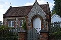 Old School House, Lower Assendon - geograph.org.uk - 5968690.jpg 1,024 × 681; 191 KB
-
 Old Toll House, Bix - geograph.org.uk - 6115000.jpg 640 × 432; 89 KB
-
 Outside The Golden Ball - geograph.org.uk - 2729955.jpg 3,160 × 2,644; 1.56 MB
-
 Overgrown entrance - geograph.org.uk - 2696841.jpg 1,024 × 683; 227 KB
-
 Oxfordshire Way - geograph.org.uk - 1981995.jpg 640 × 425; 72 KB
-
 Oxfordshire Way - geograph.org.uk - 4788255.jpg 640 × 480; 118 KB
-
 Oxfordshire Way - geograph.org.uk - 5287083.jpg 5,184 × 3,456; 6.99 MB
-
 Oxfordshire Way - geograph.org.uk - 5965185.jpg 1,024 × 681; 140 KB
-
 Oxfordshire Way - geograph.org.uk - 5965194.jpg 1,024 × 681; 171 KB
-
 Oxfordshire Way - geograph.org.uk - 5965199.jpg 1,024 × 681; 176 KB
-
 Oxfordshire Way - geograph.org.uk - 5965204.jpg 1,024 × 681; 156 KB
-
 Oxfordshire way leaves Middle Assendon - geograph.org.uk - 1897828.jpg 1,280 × 960; 768 KB
-
 Oxfordshire Way through Henley Park - geograph.org.uk - 1897769.jpg 1,280 × 960; 1.03 MB
-
 Oxfordshire Way, Deer Park - geograph.org.uk - 5965210.jpg 1,024 × 681; 177 KB
-
 Oxfordshire Way, Deer Park - geograph.org.uk - 5965216.jpg 1,024 × 681; 166 KB
-
 Oxfordshire Way, Deer Park - geograph.org.uk - 5965218.jpg 1,024 × 681; 235 KB
-
 Oxfordshire Way, Deer Park - geograph.org.uk - 5965295.jpg 1,024 × 681; 156 KB
-
 Oxfordshire Way, Deer Park - geograph.org.uk - 5965297.jpg 1,024 × 681; 189 KB
-
 Oxfordshire Way, Deer Park - geograph.org.uk - 5965308.jpg 1,024 × 681; 183 KB
-
 Oxfordshire Way, Henley Park - geograph.org.uk - 5965322.jpg 1,024 × 681; 286 KB
-
 Oxfordshire Way, The Mount - geograph.org.uk - 5965181.jpg 1,024 × 681; 268 KB
-
 Paddocks, Fawley - geograph.org.uk - 3304962.jpg 640 × 480; 126 KB
-
 Parking area on the A4130 approaching Bix - geograph.org.uk - 3664932.jpg 2,048 × 1,536; 1.52 MB
-
 Parking area on the A4130 near Bix - geograph.org.uk - 3665459.jpg 2,048 × 1,536; 1.51 MB
-
 Part of Henley Park - geograph.org.uk - 5228597.jpg 1,600 × 1,200; 937 KB
-
 Pasture on the approach to Bix - geograph.org.uk - 1067375.jpg 640 × 480; 155 KB


_-_geograph.org.uk_-_6163152.jpg)


.jpg)
.jpg)


.jpg)


_-_geograph.org.uk_-_5968688.jpg)


