Category:Bohai Sea
Перейти до навігації
Перейти до пошуку
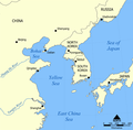
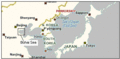
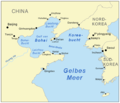
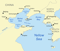
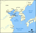
English: Bohai Sea — the innermost gulf of the Yellow Sea, on the Pacific Ocean coast of North-Central China.
море  A Pohaj-tenger űrfelvételen   | |||||
| Завантажити медіафайл | |||||
| Є одним із |
| ||||
|---|---|---|---|---|---|
| Частина від | |||||
| Місце розташування |
| ||||
| Складники |
| ||||
| Площа |
| ||||
| Вливаються |
| ||||
 | |||||
Файли в категорії «Bohai Sea»
Показано 64 файли цієї категорії (із 64).
-
 "Xantung, Sinarum Imperii provincia quarta." (21632336863).jpg 3691 × 3025; 2,09 МБ
-
-

-

-
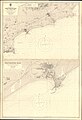
 Admiralty Chart No 1256 Gulfs of Pohai and Liaotung, Published 1862, Large Corrections to 1950.jpg 18 365 × 11 170; 33,99 МБ
-
 Admiralty Chart No 3378 Chinwangtao, Published 1946.jpg 11 120 × 16 258; 56,12 МБ
-
 Admiralty Chart No 3378 Gulf of Chihli Rocky Point to Temple Head, Published 1903.jpg 11 133 × 8079; 29,76 МБ
-
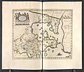
 Atlas Van der Hagen-KW1049B13 039-XANTVNG SINARVM IMPERII PROVICIA QUARTA.jpeg 5500 × 4523; 3,67 МБ
-
 Bi jia shan at high tide.JPG 3008 × 2000; 2,54 МБ
-
 Bohai map-fr.svg 320 × 335; 85 КБ
-
 Bohai map-mk.svg 320 × 335; 194 КБ
-
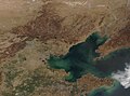
 Bohai Sea (MODIS 2019-09-05).jpg 3556 × 2896; 1,1 МБ
-
 Bohai sea aquaculture planet labs satellite image.jpg 2659 × 1995; 1,59 МБ
-
 Bohai Sea map bs.svg 1004 × 982; 643 КБ
-
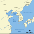 Bohai Sea map hr.svg 1004 × 982; 394 КБ
-
 Bohai Sea map hu.png 1229 × 1204; 370 КБ
-
 Bohai Sea map.png 922 × 903; 231 КБ
-
 Bohai Sea, China (MODIS 2019-04-16).jpg 4425 × 3274; 1,66 МБ
-
 Bohai Sea.gif 371 × 181; 10 КБ
-
 Bohaiaqua l7 2000123 lrg.jpg 3300 × 2200; 4,59 МБ
-
 Bohaiaqua mss 1979147 lrg.jpg 1650 × 1100; 2,26 МБ
-
 Bohaisea.svg 571 × 488; 117 КБ
-
 Bohaiseamap2 de.png 583 × 500; 150 КБ
-
 Bohaiseamap2 hu.svg 569 × 487; 141 КБ
-
 Bohaiseamap2.png 569 × 487; 136 КБ
-
 Bohaitunnel.jpg 960 × 720; 50 КБ
-
 China.A2002249.0255.250m.jpg 4400 × 3400; 2,14 МБ
-
 Frozen Waters in the Bohai Sea (MODIS 2021-02-02).jpg 2073 × 1711; 444 КБ
-
 Gulph of Petchelee 1816.jpg 1200 × 954; 160 КБ
-
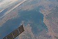
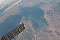
 ISS043-E-162753 - View of Earth.jpg 4928 × 3280; 1,34 МБ
-
 ISS043-E-162754 - View of Earth.jpg 4928 × 3280; 1,44 МБ
-
 ISS043-E-162755 - View of Earth.jpg 4928 × 3280; 1,28 МБ
-
 ISS043-E-162756 - View of Earth.jpg 4928 × 3280; 1,38 МБ
-
 ISS043-E-162757 - View of Earth.jpg 4928 × 3280; 1,48 МБ
-
 ISS043-E-162758 - View of Earth.jpg 4928 × 3280; 1,32 МБ
-
 ISS043-E-162759 - View of Earth.jpg 4928 × 3280; 1,36 МБ
-
 ISS043-E-162760 - View of Earth.jpg 4928 × 3280; 1,47 МБ
-
 ISS043-E-162761 - View of Earth.jpg 4928 × 3280; 1,29 МБ
-
 Le Tour du monde-01-p152a.jpg 620 × 374; 89 КБ
-
 Le Tour du monde-01-p152b.jpg 620 × 372; 87 КБ
-
 Locatie Bohaizee.PNG 650 × 540; 14 КБ
-
 Mapa del Mar de Bohai.png 1000 × 913; 301 КБ
-
 Mar de Bohai.png 1000 × 913; 334 КБ
-
 Nagranggun.jpg 290 × 270; 49 КБ
-
 Nagrangun2.jpg 290 × 270; 42 КБ
-
 Northern China - Envisat.jpg 1920 × 1269; 1,5 МБ
-
 ROC1929-01-24國民政府公報74.pdf 879 × 1239, 14 сторінок; 674 КБ
-
 Seashore for Bohai at Laolongtou Site.jpg 4608 × 3456; 2,54 МБ
-
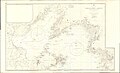
 Seaways Plan for the Bohai Sea.svg 3414 × 1935; 369 КБ
-
 Sediment in Bohai Sea (MODIS 2019-06-12).jpg 1803 × 1555; 395 КБ
-
 Seeing towards to Bohai Sea at Old Dragon Head.jpg 4608 × 3456; 4,02 МБ
-
 Smog (Satellite picture) - 2.jpg 5568 × 3712; 3,63 МБ
-
 Smog (Satellite picture).jpg 5568 × 3712; 3,85 МБ
-
 Termination of the Great Wall.jpg 2255 × 1500; 421 КБ
-
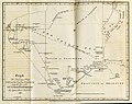
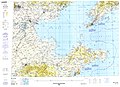 Txu-pclmaps-oclc-22834566 g-10a.jpg 9421 × 6846; 16,03 МБ
-
 Xantung, sinarum imperii provincia quarta - (tiré du P. Martini) - btv1b5963044d.jpg 5896 × 4832; 4,73 МБ
-
 Zhs Bohaiseamap2.png 583 × 500; 24 КБ
-
 Zht Bohaiseamap2.png 583 × 500; 25 КБ
-
 青山岛号右舷救生艇.jpg 2656 × 3984; 2,34 МБ
-
 青山岛号在船尾的甲板上看海.jpg 3984 × 2656; 2,93 МБ
-
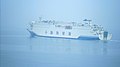 青山岛号甲板上看渤海珍珠号.jpg 3968 × 2232; 2 МБ
-
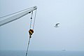 青山岛号船尾吊臂与海鸥.jpg 1024 × 682; 62 КБ
-
 鲅鱼圈山海广场 (cropped).jpg 1467 × 1098; 688 КБ
-
 鲅鱼圈山海广场.jpg 3264 × 2448; 3,04 МБ
.jpg)
.11.(16).jpg)


.jpg)


.jpg)


.jpg)


.jpg)

_-_2.jpg)
.jpg)


_-_btv1b5963044d.jpg)


.jpg)
