Category:Boswachterij Dorst
Jump to navigation
Jump to search
| Object location | | View all coordinates using: OpenStreetMap |
|---|
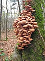
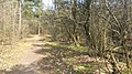
Nederlands: Afbeeldingen van de natuur in de Boswachterij Dorst, een uitgestrekt bosgebied dat zich bevindt tussen Rijen, Oosterhout, Teteringen en Dorst in de provincie Noord-Brabant in het zuiden van Nederland. Gelegen niet ver van Breda. De Boswachterij Dorst meet 1.117 ha en is eigendom van Staatsbosbeheer. Er zijn Schotse Hooglanders uitgezet in dit natuurgebied. (bron [1];[2];[3];[4])
Nederlands: Boswachterij Dorst, Dorst (Nederland), Oosterhout (Noord-Brabant), Noord-Brabant, Nederland
park in the Netherlands  | |||||
| Upload media | |||||
| Instance of | |||||
|---|---|---|---|---|---|
| Location | North Brabant, Netherlands | ||||
 | |||||
Subcategories
This category has the following 8 subcategories, out of 8 total.
B
D
F
H
M
S
Media in category "Boswachterij Dorst"
The following 11 files are in this category, out of 11 total.
-
 Bokkenweidreef Dorst P1010204.jpg 4,000 × 2,672; 5.64 MB
-
 Boombekleding.jpg 1,536 × 2,048; 801 KB
-
 Bospad Boswachterij Dorst NB.jpg 1,836 × 3,264; 2.9 MB
-
 Boswachterij Dorst 2023.jpg 4,032 × 2,268; 4.47 MB
-
 Boswachterij Dorst DSCF9255.JPG 2,816 × 1,864; 1.3 MB
-
 Boswachterij Dorst DSCF9256.JPG 1,864 × 2,816; 1.23 MB
-
 Boswachterij Dorst P1050984.JPG 3,264 × 2,448; 3.78 MB
-
 Boswachterij Dorst.jpg 3,264 × 1,836; 3.27 MB
-
 Seterse Bergen I01715.jpg 2,448 × 3,264; 3.72 MB
-
 Seterse Heide, Boswachterij Dorst.jpg 3,536 × 1,008; 1.54 MB
-
 Surae in het zand.jpg 4,608 × 3,456; 6.25 MB


