Category:Bradfield, South Yorkshire
Jump to navigation
Jump to search
English: Bradfield is a civil parish in the City of Sheffield, in South Yorkshire, England. It is situated in the Peak District. Bradfield itself is divided into two settlements, High Bradfield atop a hill and Low Bradfield in the valley of the River Loxley.
Nederlands: Bradfield is een civil parish in het bestuurlijke gebied Sheffield, in het Engelse graafschap South Yorkshire. De civil parish telt

civil parish in the City of Sheffield, in South Yorkshire, England | |||||
| Upload media | |||||
| Instance of | |||||
|---|---|---|---|---|---|
| Location | Sheffield, South Yorkshire, Yorkshire and the Humber, England | ||||
 | |||||
Subcategories
This category has the following 30 subcategories, out of 30 total.
A
- Abbey Brook (3 F)
- Agden Dike (5 F)
- Agden Reservoir (29 F)
B
- Brightholmlee (12 F)
- Broomhead Reservoir (21 F)
C
D
- Dale Dike Reservoir (14 F)
E
- Edgefield Monument (5 F)
F
- Foulstone Moor (5 F)
H
- Hollow Meadows (1 F)
K
L
- Langsett Reservoir (38 F)
- Little Matlock Rolling Mill (8 F)
M
- Midhope Reservoir (5 F)
- More Hall Reservoir (28 F)
O
S
- Slippery Stones packhorse bridge (17 F)
- Smallfield, South Yorkshire (1 F)
- Storrs, South Yorkshire (6 F)
W
- Worrall, South Yorkshire (108 F)
Media in category "Bradfield, South Yorkshire"
The following 200 files are in this category, out of 2,805 total.
(previous page) (next page)-
 "City of Sheffield" stone marker on Hopwood Lane - geograph.org.uk - 3846974.jpg 5,182 × 3,702; 5.8 MB
-
 "Hallam View" and Swinglee Farm - geograph.org.uk - 5843116.jpg 5,039 × 3,663; 4.8 MB
-
 "Hallam View" near Wyming Brook Nature Reserve - geograph.org.uk - 2630990.jpg 2,310 × 1,733; 1.39 MB
-
 "The Crown ^ Glove" in Stannington - geograph.org.uk - 4391804.jpg 5,017 × 3,607; 4.53 MB
-
 "The Peacock", Stannington - geograph.org.uk - 4391854.jpg 5,032 × 3,724; 4.3 MB
-
 "The Plough" in Low Bradfield - geograph.org.uk - 5188761.jpg 4,699 × 3,390; 2.8 MB
-
 "The Plough" pub sign in Low Bradfield - geograph.org.uk - 5188766.jpg 4,307 × 3,664; 3.57 MB
-
 "The Rose ^ Crown" in Stannington - geograph.org.uk - 4391846.jpg 5,010 × 3,677; 5.1 MB
-
 "The Strines Inn" - geograph.org.uk - 2966290.jpg 4,269 × 2,846; 2.52 MB
-

-
-
 3 Pines alongside the Little Don River - geograph.org.uk - 2585928.jpg 768 × 1,024; 288 KB
-

-
 590 Loxley Road postbox (ref. S6 699) - geograph.org.uk - 2872826.jpg 1,280 × 960; 336 KB
-
 75 yards to crossroads on Penistone Road - geograph.org.uk - 3087693.jpg 1,024 × 690; 167 KB
-
 A black Postbox^ - geograph.org.uk - 3493318.jpg 616 × 1,024; 164 KB
-
 A bridleway along Boggard Lane - geograph.org.uk - 3080427.jpg 800 × 600; 128 KB
-
 A Distant View of the Derwent Valley - geograph.org.uk - 4658615.jpg 4,000 × 3,000; 2.72 MB
-
 A dry Cut Gate bridleway near Lost Lad - geograph.org.uk - 4077249.jpg 1,024 × 768; 156 KB
-
 A dry day on a rock free part of Cut Gate - geograph.org.uk - 4077261.jpg 1,024 × 768; 188 KB
-
 A fallen tree at Damflask Reservoir - geograph.org.uk - 4313755.jpg 1,024 × 683; 300 KB
-
 A few rocks and an expanse of moorland - geograph.org.uk - 4012979.jpg 1,024 × 654; 155 KB
-
 A foggy day in August - geograph.org.uk - 5088877.jpg 692 × 1,024; 140 KB
-
 A Frozen Scene at Rivelin Dams - geograph.org.uk - 2206802.jpg 3,296 × 2,472; 1,006 KB
-

-

-
 A meeting of Cloughs - geograph.org.uk - 3334456.jpg 640 × 427; 161 KB
-
 A minor road on Strines Moor - geograph.org.uk - 3079048.jpg 800 × 600; 74 KB
-
 A muddy and wet Midhope Moors track - geograph.org.uk - 3143703.jpg 1,024 × 768; 197 KB
-
 A Pair of Boundary Stones on Broomhead Moor - geograph.org.uk - 2705968.jpg 3,296 × 2,472; 1.12 MB
-
 A pair of old gateposts in a meadow. - geograph.org.uk - 5424209.jpg 640 × 427; 65 KB
-
 A pile of rocks on Stanage Edge - geograph.org.uk - 6252144.jpg 5,127 × 3,735; 5.03 MB
-
 A pool of autumn light on Oaks Lane - geograph.org.uk - 3686814.jpg 3,531 × 2,522; 1.62 MB
-
 A scenic stretch of road. - geograph.org.uk - 4417769.jpg 640 × 480; 69 KB
-
 A small pool on Brusten Croft Ridge - geograph.org.uk - 2071521.jpg 640 × 480; 146 KB
-
 A stile and a stream^ - geograph.org.uk - 4275536.jpg 1,024 × 768; 362 KB
-
 A very large field^ - geograph.org.uk - 3417635.jpg 1,024 × 768; 195 KB
-
 A very narrow lane called Agden Side Road - geograph.org.uk - 3132461.jpg 1,024 × 550; 113 KB
-
 A view of Boot's Folly from Sugworth Hall - geograph.org.uk - 5947812.jpg 4,514 × 3,420; 2.96 MB
-
 A view of Cottage Farm - geograph.org.uk - 3001623.jpg 4,298 × 3,070; 3.18 MB
-
 A view of Crawshaw Farm - geograph.org.uk - 6208801.jpg 5,010 × 3,734; 4.32 MB
-
 A view of Crook Clough - geograph.org.uk - 2966346.jpg 427 × 640; 101 KB
-
 A view of More Hall Reservoir - geograph.org.uk - 5920074.jpg 4,967 × 3,638; 6.04 MB
-
 A view of Mortimer House - geograph.org.uk - 3001612.jpg 4,298 × 3,070; 3.08 MB
-
 A view of Rocher Farm above The Ewden Valley - geograph.org.uk - 5920015.jpg 4,930 × 3,829; 5.05 MB
-
 A view of Shepherd's Height, Ughill - geograph.org.uk - 5188781.jpg 3,773 × 4,617; 3.21 MB
-
 A view of the cairn on Pike Lowe - geograph.org.uk - 4914089.jpg 3,888 × 5,184; 4.84 MB
-
 A vital cairn - geograph.org.uk - 2362889.jpg 3,648 × 2,736; 4.6 MB
-
 A walk in the woods at Langsett - geograph.org.uk - 4328182.jpg 1,024 × 768; 252 KB
-
 A well surfaced Game Lane - geograph.org.uk - 4777907.jpg 1,024 × 712; 115 KB
-
 A wet Gill Royd Lane - geograph.org.uk - 3008858.jpg 1,024 × 587; 68 KB
-
 A57 at Hollow Meadows - geograph.org.uk - 2201595.jpg 3,648 × 2,736; 5.39 MB
-
 A57 eastbound at Hollow Meadows - geograph.org.uk - 3822907.jpg 640 × 480; 57 KB
-
 A57 eastbound near Moscar Heights - geograph.org.uk - 3822901.jpg 640 × 481; 61 KB
-
 A57 eastbound near Rivelin Dam - geograph.org.uk - 3822912.jpg 640 × 480; 112 KB
-
 A57 eastbound near Rivelin Rough - geograph.org.uk - 3822913.jpg 640 × 480; 77 KB
-
 A57 eastbound near Surrey Farm - geograph.org.uk - 3822911.jpg 640 × 480; 55 KB
-

-
 A57 near Wyming Brook Nature Reserve - geograph.org.uk - 3483162.jpg 640 × 427; 114 KB
-
 A57 towards Sheffield - geograph.org.uk - 5895432.jpg 640 × 480; 61 KB
-
 A57 towards Sheffield - geograph.org.uk - 5895439.jpg 640 × 480; 46 KB
-
 A57 towards Sheffield - geograph.org.uk - 5895454.jpg 640 × 480; 80 KB
-
 A57 westbound - geograph.org.uk - 4777872.jpg 1,024 × 768; 72 KB
-
 A57, Hollow Meadows - geograph.org.uk - 5895427.jpg 640 × 480; 78 KB
-
 A616 Looking North, at Midhopestones, near Stocksbridge - geograph.org.uk - 3858576.jpg 3,544 × 2,658; 1.7 MB
-
 A616 Looking South, at Midhopestones, near Stocksbridge - geograph.org.uk - 3858504.jpg 3,623 × 2,718; 3.25 MB
-
 Abandoned Farm above Ewden Beck - geograph.org.uk - 3269323.jpg 4,399 × 2,933; 2.8 MB
-
 Abandoned farm buildings at Coomes Vale - geograph.org.uk - 2781819.jpg 1,024 × 768; 188 KB
-
 Abandoned quarry on Rod Moor - geograph.org.uk - 4130776.jpg 1,024 × 611; 245 KB
-
 Abbey Brook - geograph.org.uk - 4226378.jpg 3,797 × 2,243; 1.64 MB
-
 Abbey Brook - the stream - geograph.org.uk - 3422360.jpg 563 × 750; 132 KB
-
 Abbey Brook and Berristers Tor - geograph.org.uk - 2709055.jpg 3,296 × 2,472; 1.15 MB
-
 Abbey Brook entering Upper Derwent Reservoir - geograph.org.uk - 4737515.jpg 3,888 × 5,184; 6.59 MB
-

-
 Abbey Clough - exposed gritstone cliff - geograph.org.uk - 2966344.jpg 4,608 × 3,072; 3.22 MB
-
 Abbey Clough - Exposed Gritstone Outcrop - geograph.org.uk - 1774267.jpg 3,296 × 2,472; 1.22 MB
-
 Abbey Clough and New Close Wood - geograph.org.uk - 2709087.jpg 3,296 × 2,472; 976 KB
-
 Above Bull Clough - Looking West - geograph.org.uk - 4741880.jpg 5,010 × 3,704; 4.88 MB
-
 Above Meeting Stones on Featherbed Moss - geograph.org.uk - 2843766.jpg 3,357 × 2,403; 1.89 MB
-
 Above New Close Wood - looking to Nether Hey - geograph.org.uk - 4737645.jpg 3,888 × 5,184; 5.43 MB
-
 Above Upper Hey - geograph.org.uk - 4742018.jpg 5,131 × 3,688; 4.14 MB
-
 Above Wigtwizzle - geograph.org.uk - 2555860.jpg 640 × 523; 54 KB
-
 Access Land near Ewden Height - geograph.org.uk - 2305109.jpg 3,296 × 2,472; 1.07 MB
-
 Access land, ponies grazing - geograph.org.uk - 2375645.jpg 3,648 × 2,736; 6.17 MB
-
 Access Road From Moscar Lodge - geograph.org.uk - 1819654.jpg 427 × 640; 291 KB
-
 Access to Barnside Cote Farm - geograph.org.uk - 3008841.jpg 1,024 × 768; 162 KB
-
 Access to Moscar Lodge - geograph.org.uk - 1819644.jpg 427 × 640; 301 KB
-
 Acorn Court, Oughtibridge - geograph.org.uk - 6099353.jpg 800 × 647; 145 KB
-
 Across Bradfield Dale - geograph.org.uk - 1858667.jpg 640 × 480; 152 KB
-
 Across Damflask Reservoir - geograph.org.uk - 3763130.jpg 4,000 × 2,248; 5.96 MB
-
 Across Ewden Beck towards Park Cote - geograph.org.uk - 2105090.jpg 640 × 480; 156 KB
-
 Across the fields - geograph.org.uk - 3828637.jpg 3,396 × 2,005; 2.47 MB
-
 Across the valley - geograph.org.uk - 2740367.jpg 4,320 × 2,432; 5.49 MB
-
 Admiral Rodney - geograph.org.uk - 3763140.jpg 4,000 × 2,248; 5.59 MB
-
 Admiral Rodney Inn, Loxley - geograph.org.uk - 2872880.jpg 1,280 × 960; 318 KB
-
 Afternoon tea at the post office - geograph.org.uk - 3818175.jpg 4,969 × 3,550; 4.26 MB
-
 Agden bog - geograph.org.uk - 2879084.jpg 4,320 × 3,240; 6.65 MB
-
 Agden bridge - geograph.org.uk - 2071902.jpg 640 × 426; 104 KB
-
 Agden Bridge - geograph.org.uk - 4424725.jpg 5,184 × 3,456; 1.93 MB
-
 Agden Dike - geograph.org.uk - 4020876.jpg 600 × 800; 179 KB
-
 Agden Dike - geograph.org.uk - 4424716.jpg 5,184 × 2,844; 1.61 MB
-
 Agden Dike - geograph.org.uk - 4424723.jpg 5,184 × 2,997; 1.63 MB
-
 Agden Dike flowing towards the reservoir - geograph.org.uk - 2741646.jpg 1,024 × 768; 410 KB
-
 Agden Dike, small waterfall - geograph.org.uk - 3607563.jpg 3,648 × 2,736; 4.75 MB
-
 Agden Reservoir - geograph.org.uk - 3607361.jpg 3,648 × 2,736; 3.96 MB
-
 Agden Reservoir - geograph.org.uk - 4020874.jpg 800 × 600; 160 KB
-
 Agden Reservoir and High Bradfield - geograph.org.uk - 3614534.jpg 1,024 × 768; 193 KB
-
 Agden Reservoir and the bridge over Rocher End Brook - geograph.org.uk - 5259340.jpg 3,758 × 4,934; 4.11 MB
-
 Agden Reservoir and Watt House Farm - geograph.org.uk - 3396052.jpg 1,024 × 570; 133 KB
-
 Agden Reservoir from Smallfield - geograph.org.uk - 3536092.jpg 2,736 × 3,648; 2.25 MB
-
 Agden Rocher - geograph.org.uk - 2132631.jpg 2,736 × 3,648; 4.49 MB
-
 Agden Side Road - geograph.org.uk - 124824.jpg 640 × 480; 241 KB
-
 Agden Side Road - geograph.org.uk - 3132458.jpg 1,024 × 611; 113 KB
-
 Alder roots in the river Loxley - geograph.org.uk - 2891148.jpg 640 × 480; 201 KB
-
 Alford Avenue, Oughtibridge, Sheffield - geograph.org.uk - 3333272.jpg 3,627 × 2,720; 2.28 MB
-
 All together - geograph.org.uk - 3245816.jpg 4,000 × 2,248; 1.75 MB
-
 Allas Lane, Wigtwizzle - geograph.org.uk - 3269113.jpg 3,072 × 4,608; 3.32 MB
-
 Allez TDF - geograph.org.uk - 4060854.jpg 4,000 × 2,248; 4.04 MB
-
 ALLEZ TDF - geograph.org.uk - 4063650.jpg 800 × 600; 89 KB
-

-

-
 Along the Wall - geograph.org.uk - 1341275.jpg 640 × 480; 68 KB
-
 Alongside the Porter Little Don River near Langsett - geograph.org.uk - 2585937.jpg 4,288 × 3,216; 1.3 MB
-
 Alongside Thickwoods - geograph.org.uk - 3143736.jpg 768 × 1,024; 279 KB
-
 An old farmhouse seen from Thorn House Lane - geograph.org.uk - 2637115.jpg 2,453 × 1,840; 1.24 MB
-
 Ancient boundary stone near Moscar Lodge - geograph.org.uk - 3647836.jpg 2,848 × 2,144; 1.54 MB
-
 Ancient direction post. - geograph.org.uk - 4820594.jpg 640 × 480; 106 KB
-
 Andrew Carr Farm on Oughtibridge Lane - geograph.org.uk - 4286076.jpg 1,600 × 1,062; 635 KB
-
 Angler by the infant River Derwent - geograph.org.uk - 5845888.jpg 5,024 × 3,728; 6.67 MB
-
 Annet Bridge - geograph.org.uk - 3372381.jpg 2,048 × 1,536; 768 KB
-
 Annet Bridge over Dale Dike - geograph.org.uk - 1237019.jpg 640 × 480; 57 KB
-
 Anniversary walk - geograph.org.uk - 5126753.jpg 1,024 × 683; 194 KB
-
 Another view of Boot's Folly - geograph.org.uk - 5258937.jpg 5,105 × 3,788; 4.74 MB
-
 Another view of The Bull Stones - geograph.org.uk - 4743750.jpg 3,888 × 5,075; 5.89 MB
-
 Another view of the eastern tower, Howden Dam - geograph.org.uk - 4737500.jpg 3,710 × 4,958; 5.07 MB
-
 Another view of The Horse Stone, Howden Moor - geograph.org.uk - 2787337.jpg 2,376 × 1,782; 923 KB
-
 Anyone know a good dentist - geograph.org.uk - 2502664.jpg 4,320 × 3,240; 1.5 MB
-
 Approaching Back Tor - geograph.org.uk - 3960176.jpg 4,381 × 2,665; 6.15 MB
-
 Approaching Beeton Farm - geograph.org.uk - 2452518.jpg 3,296 × 2,472; 1.15 MB
-
 Approaching Dyson House Farm on the run to Bradfield - geograph.org.uk - 3763133.jpg 4,000 × 2,248; 4.95 MB
-
 Approaching Langsett across the dam - geograph.org.uk - 2804948.jpg 2,640 × 1,980; 774 KB
-
 Approaching Oaking Clough Reservoir - geograph.org.uk - 2668100.jpg 2,337 × 1,753; 763 KB
-
 Approaching Ronksley Hall Farm - geograph.org.uk - 5270762.jpg 1,600 × 1,200; 572 KB
-
 Approaching Spout House Farm - geograph.org.uk - 5964306.jpg 1,600 × 1,200; 630 KB
-
 Approaching Swine Slide - geograph.org.uk - 1526469.jpg 640 × 480; 88 KB
-
 Approaching the bridge over Emlin Dike - geograph.org.uk - 3000701.jpg 800 × 600; 198 KB
-
 Approaching the Horse Stone from the south - geograph.org.uk - 2787327.jpg 2,233 × 1,675; 778 KB
-
 Approaching the trig point - Outer Edge - geograph.org.uk - 4741995.jpg 3,784 × 4,848; 5.16 MB
-
 Approaching Walker Edge - geograph.org.uk - 2063115.jpg 3,296 × 2,472; 1.08 MB
-
 Approaching West Nab Farm on Bolsterstone Road - geograph.org.uk - 5662563.jpg 4,953 × 3,708; 3.17 MB
-
 Arm of the Howden Reservoir - geograph.org.uk - 5894441.jpg 640 × 480; 100 KB
-
 Arms of Godfrey Bosville - geograph.org.uk - 2546119.jpg 426 × 640; 99 KB
-
 As it says^ - geograph.org.uk - 3331211.jpg 768 × 1,024; 121 KB
-
 At Cakes of Bread east of Derwent Edge - geograph.org.uk - 2966309.jpg 4,405 × 2,937; 2.96 MB
-
 At Crow Chin, Stanage Edge - geograph.org.uk - 6252132.jpg 3,888 × 5,184; 5.37 MB
-
 At Crows Chin Rocks - geograph.org.uk - 3638038.jpg 3,648 × 2,736; 2.1 MB
-
 At Hall Broom Quarry - geograph.org.uk - 2630699.jpg 1,952 × 2,608; 1.13 MB
-
 At Midhope Reservoir - geograph.org.uk - 3686743.jpg 2,736 × 3,648; 1.97 MB
-
 At Oaking Clough Reservoir Again - geograph.org.uk - 6205326.jpg 4,937 × 3,666; 3.65 MB
-
 At Oaking Clough Reservoir on Boxing Day - geograph.org.uk - 5635419.jpg 3,885 × 5,067; 5.4 MB
-
 At Oaking Clough Reservoir on Middle Moss - geograph.org.uk - 2668087.jpg 1,845 × 2,460; 1.4 MB
-
 At Oaking Clough Reservoir with Reflection - geograph.org.uk - 6205332.jpg 3,748 × 5,018; 4.84 MB
-
 At Raynor House Farm - geograph.org.uk - 5920027.jpg 5,027 × 3,762; 6.15 MB
-
 At Running Moss - geograph.org.uk - 4065068.jpg 1,726 × 2,590; 2.3 MB
-
 At Stopes - rainy road to Dungworth - geograph.org.uk - 2635147.jpg 2,433 × 1,825; 1.24 MB
-
 At the "fords" east of Round Hill - geograph.org.uk - 4748417.jpg 5,184 × 3,888; 5.75 MB
-
 At the cairn on Pike Lowe - geograph.org.uk - 4914073.jpg 5,125 × 3,843; 4.29 MB
-
 At the entrance to Kirk Edge Convent - geograph.org.uk - 5919280.jpg 3,555 × 4,812; 3.41 MB
-
 At Thornseat Delf - geograph.org.uk - 3536453.jpg 3,648 × 2,736; 2.34 MB
-
 Autumn scene - geograph.org.uk - 3226396.jpg 3,042 × 1,905; 4.72 MB
-
 Autumn sun over the Little Don river valley - geograph.org.uk - 5124653.jpg 3,264 × 2,448; 455 KB
-
 B roads meet end on - geograph.org.uk - 2872936.jpg 1,280 × 960; 469 KB
-
 Baaarnsley - geograph.org.uk - 4077232.jpg 1,024 × 768; 143 KB
-
 Back Lane, Low Holdworth - geograph.org.uk - 2872929.jpg 1,280 × 960; 479 KB
-
 Back of the Barn - geograph.org.uk - 1897622.jpg 3,648 × 2,736; 4.58 MB
-
 Back to nature - geograph.org.uk - 1897631.jpg 2,736 × 3,648; 3.47 MB
-

-
 Back Tor - geograph.org.uk - 3305589.jpg 1,600 × 1,200; 604 KB
-
 Back Tor - geograph.org.uk - 4474653.jpg 1,600 × 1,200; 468 KB
-
 Back Tor - geograph.org.uk - 4474661.jpg 1,600 × 1,200; 389 KB
-
-
 Bales of silage in plastic wrapping at Holdworth - geograph.org.uk - 2625325.jpg 2,608 × 1,952; 1.81 MB
-
 Bank of rhododendrons near Boot's Folly - geograph.org.uk - 2981360.jpg 4,417 × 2,945; 3.13 MB
-
 Bankside - geograph.org.uk - 2498784.jpg 1,024 × 768; 247 KB
-
 Bar Dike - geograph.org.uk - 2862379.jpg 1,024 × 768; 232 KB
-
 Bar Dyke Earthwork - geograph.org.uk - 2705936.jpg 3,296 × 2,472; 1.1 MB
-
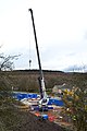
 Barhale WSP Pipework, Langsett Road North, Oughtibridge - geograph.org.uk - 3462672.jpg 4,605 × 3,070; 4.31 MB
-
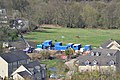
 Barhale WSP Site from Langsett Road North, Oughtibridge - 1 - geograph.org.uk - 3441605.jpg 2,698 × 4,058; 2.54 MB
-
 Barhale WSP Site from Langsett Road North, Oughtibridge - 2 - geograph.org.uk - 3441614.jpg 4,592 × 3,062; 6.31 MB
-
 Barhale WSP Site, from Birks Wood Drive, Oughtibridge - 1 - geograph.org.uk - 3441630.jpg 4,582 × 3,055; 4.78 MB
-
 Barhale WSP Site, from Birks Wood Drive, Oughtibridge - 2 - geograph.org.uk - 3441643.jpg 4,475 × 2,983; 5.44 MB
-

-
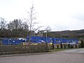
 BarhaleWSP Site plus Crane, Forge Lane, Oughtibridge - geograph.org.uk - 3441562.jpg 2,642 × 3,727; 2.52 MB
-
 BarhaleWSP Site, Forge Lane, Oughtibridge - 1 - geograph.org.uk - 3384309.jpg 2,553 × 1,915; 1.16 MB
-
 BarhaleWSP Site, Forge Lane, Oughtibridge - 2 - geograph.org.uk - 3384318.jpg 3,648 × 2,736; 1.8 MB
-
 BarhaleWSP, Forge Lane, Oughtibridge - geograph.org.uk - 3384329.jpg 3,394 × 2,343; 2.3 MB
-
 Barn at Brightholmlee - geograph.org.uk - 2637113.jpg 2,350 × 1,763; 1 MB
-
 Barn, Wethercote Farm - geograph.org.uk - 5895436.jpg 640 × 424; 39 KB
-
 Barnside Farm from Mortimer Road - geograph.org.uk - 3686725.jpg 3,646 × 2,604; 1.94 MB
-
 Barnside Farm, Stocksbridge - geograph.org.uk - 2998803.jpg 1,024 × 768; 255 KB


_-_geograph.org.uk_-_2872826.jpg)


_-_geograph.org.uk_-_4777895.jpg)


