Category:Brecon Beacons
Hopp til navigering
Hopp til søk
Cymraeg: Mae Bannau Brycheiniog yn gadwyn o fynyddoedd ym Mhowys, Cymru, sy'n gorwedd o fewn Parc Cenedlaethol Bannau Brycheiniog.
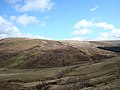
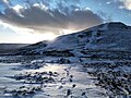
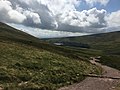
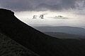
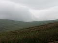
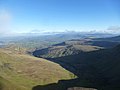
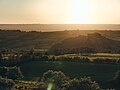
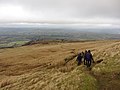
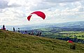
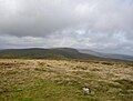
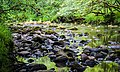
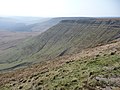
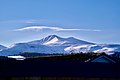
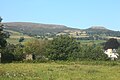
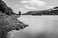
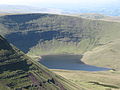
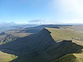
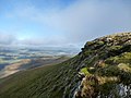
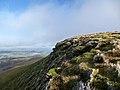
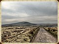
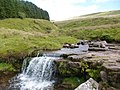
English: The Brecon Beacons are a mountain range in Powys, Wales, within the Brecon Beacons National Park.
mountain range in Wales | |||||
| Last opp mediefiler | |||||
| Forekomst av | |||||
|---|---|---|---|---|---|
| Ligger i verneområde | |||||
| Plassering | Powys, Wales | ||||
| Kulturminnestatus | |||||
| IUCN kategori | |||||
| Fjellkjede | |||||
| Høyeste punkt | |||||
| Areal |
| ||||
| Høyde over havet |
| ||||
| Forskjellig fra | |||||
 | |||||
Underkategorier
Denne kategorien har følgende 32 underkategorier, av totalt 32.
B
- Beacons Bus (11 filer)
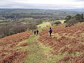
- Beacons Way (93 filer)
- Blaen Pig quarries (4 filer)
- Brecon Beacons Visitor Centre (8 filer)
- Bryn Oer Tramroad (8 filer)
- Bwlch ar y Fan (13 filer)
- Bwlch Duwynt (11 filer)
C
- Cefn Perfedd (5 filer)
F
G
- Garreg Las (6 filer)
- Garreg Lwyd, Carmarthenshire (12 filer)
H
M
- Maen Llia (15 filer)
N
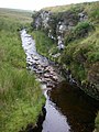
- Nant Crew (3 filer)
P
- Pont-ar-Daf Stop Line (46 filer)
S
- Sgwd yr Eira (20 filer)
T
- Taf Fechan Forest (11 filer)
V
- Vickers Wellington MF509 (18 filer)
- Vickers Wellington R1465 (11 filer)
Filer i kategorien «Brecon Beacons»
Følgende 200 filer er i denne kategorien, av totalt 338.
(forrige side) (neste side)-
 'Ere be treasure (4593225182).jpg 3 776 × 2 520; 3,09 MB
-
 - panoramio - Shiroi Hane (10).jpg 1 600 × 1 200; 313 KB
-
 - panoramio - Shiroi Hane (13).jpg 1 600 × 1 200; 572 KB
-
 - panoramio - Shiroi Hane (14).jpg 1 200 × 1 600; 594 KB
-
 - panoramio - Shiroi Hane (4).jpg 1 200 × 1 600; 598 KB
-
 - panoramio - Shiroi Hane (6).jpg 1 200 × 1 600; 546 KB
-
 1-10 Powell Street, Penwyllt - geograph.org.uk - 32681.jpg 640 × 425; 88 KB
-
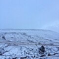
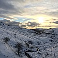
 20200227 Brecon snow trail.jpg 1 600 × 1 200; 303 KB
-
 20200227 snow near the British.jpg 4 032 × 2 268; 2,93 MB
-
 245 seconds (21869124220).jpg 5 447 × 3 118; 9,39 MB
-
 A pathway near the heavens.jpg 4 032 × 3 024; 2,81 MB
-
 A River Near Sgwd y Pannwr.png 4 320 × 2 868; 71,03 MB
-
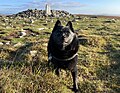
 A Shep dog (4592473721).jpg 2 165 × 3 246; 1,95 MB
-
 A snap shot of wales with native photo bombers in the background.jpg 4 032 × 3 024; 4,69 MB
-
 A staircase of tree branches (27066397348).jpg 3 602 × 5 403; 7,02 MB
-
 A Stream in Bannau Brycheiniog.png 4 320 × 2 868; 71,03 MB
-
 A4059 Brecon Beacons.JPG 3 072 × 2 304; 559 KB
-
 Aberllynfi 734194.jpg 640 × 480; 59 KB
-
 Across Crickhowell Bridge.jpg 5 184 × 3 456; 9,13 MB
-

-

-
 Ascent (4592550671).jpg 3 776 × 2 520; 3,46 MB
-
 Atmos persp beacons.jpg 2 199 × 1 466; 1,34 MB
-

-
 Bannau Brycheiniog Conifers.jpg 5 472 × 3 648; 10,62 MB
-
Bannau Brycheiniog.wav 3,0 s; 513 KB
-
 Bannau Brycheioniog Sheep.jpg 5 472 × 3 648; 10,32 MB
-
 Beacon Beacons Pass (21261994303).jpg 4 000 × 1 617; 2,09 MB
-
 Beacons View - geograph.org.uk - 520361.jpg 640 × 543; 77 KB
-
 Black Cat (29886560356).jpg 12 109 × 3 251; 7,71 MB
-
 Black Mountain range - Flickr - Dmitry Djouce.jpg 4 032 × 3 024; 5,34 MB
-
 Black Mountains, Brecon Beacons.jpg 2 048 × 1 539; 556 KB
-
 Blick vom Fan Frynych ostwärts.jpg 3 264 × 2 448; 3,61 MB
-
 Blick von Fan Frynych ostwärts in Richtung Corn Du und Pen Y Fan.jpg 3 264 × 2 448; 3,37 MB
-
 Bongo on Blorenge 221011.jpg 3 686 × 2 872; 4,49 MB
-
 Boulder field on Fan Gyhirych - geograph.org.uk - 694095.jpg 640 × 480; 113 KB
-
 Breakfast, Saturday (4593072146).jpg 3 477 × 1 790; 1,7 MB
-
 Brecon Beacon Park 01.JPG 2 411 × 1 300; 632 KB
-
 Brecon Beacon Park 03.JPG 2 472 × 1 602; 703 KB
-
 Brecon Beacon Park 04.JPG 2 466 × 1 800; 1,08 MB
-
 Brecon Beacon Park 05.JPG 2 507 × 1 696; 742 KB
-
 Brecon Beacon Park 06.JPG 2 540 × 1 762; 879 KB
-
 Brecon Beacons (32217654820).jpg 5 098 × 3 399; 8,27 MB
-
 Brecon Beacons - geograph.org.uk - 2154984.jpg 1 024 × 686; 109 KB
-
 Brecon Beacons - geograph.org.uk - 3825212.jpg 640 × 480; 38 KB
-
 Brecon Beacons - geograph.org.uk - 713149.jpg 640 × 480; 42 KB
-
 Brecon Beacons - geograph.org.uk - 713156.jpg 640 × 480; 40 KB
-
 Brecon Beacons 2008 - panoramio (1).jpg 2 048 × 1 536; 600 KB
-
 Brecon Beacons 2008 - panoramio (3).jpg 1 536 × 2 048; 593 KB
-
 Brecon Beacons 2008 - panoramio (5).jpg 2 048 × 1 536; 620 KB
-
 Brecon Beacons 2008 - panoramio (6).jpg 2 048 × 1 536; 654 KB
-
 Brecon Beacons 2008 - panoramio.jpg 2 048 × 1 536; 616 KB
-
 Brecon beacons arp.jpg 750 × 517; 51 KB
-
 Brecon Beacons at Llyn Fan Fach in Powys in Wales.jpg 2 816 × 2 112; 1,96 MB
-
 Brecon beacons by Mark around the Beacons.jpg 2 048 × 1 536; 714 KB
-
 Brecon beacons by.jpg 2 304 × 1 728; 1,03 MB
-
 Brecon Beacons from the North - geograph.org.uk - 2010739.jpg 800 × 600; 22 KB
-
 Brecon beacons in the snow arp.jpg 3 023 × 2 009; 4,05 MB
-
 Brecon Beacons information board - geograph.org.uk - 1115806.jpg 640 × 480; 86 KB
-
 Brecon Beacons National Park (1226611).jpg 322 × 233; 55 KB
-
 Brecon Beacons National Park - Panorama (44090226540).jpg 15 498 × 3 910; 25,26 MB
-
 Brecon Beacons National Park - Wales banner.jpg 2 100 × 300; 559 KB
-
 Brecon Beacons National Park IMG 5036 - panoramio.jpg 1 400 × 864; 448 KB
-
 Brecon Beacons National Park map.svg 1 425 × 912; 1,05 MB
-
 Brecon Beacons National Park UK location map.svg 1 425 × 912; 1,27 MB
-
 Brecon Beacons National Park UK relief location map.png 2 002 × 1 281; 2,73 MB
-
 Brecon Beacons UKSF.jpg 1 440 × 1 440; 277 KB
-
 Brecon Beacons view.jpg 718 × 538; 95 KB
-
 Brecon Beacons, Brecon, United Kingdom.jpg 6 000 × 4 000; 3,62 MB
-
 Brecon Beacons, from the Promenade.jpg 5 184 × 3 456; 6,69 MB
-
 Brecon Beacons, Wales - geograph.org.uk - 3662894.jpg 1 024 × 683; 652 KB
-
 Brecon Beacons- the view on the climb up Pen y Fan (27049689481).jpg 5 184 × 3 456; 6,05 MB
-
 Brecon beacons.jpg 3 008 × 1 308; 2,62 MB
-
 Brecon Powys cemetery view HenSne.JPG 2 160 × 1 620; 1,54 MB
-
 Bridge to Bannau Brycheiniog.jpg 5 472 × 3 648; 10,28 MB
-
 Bridge to the Usk Meadow.jpg 5 472 × 3 648; 8,8 MB
-
 Britisches Wetter in den Brecon Beacons I.jpg 3 264 × 2 448; 3,3 MB
-
 Britisches Wetter in den Brecon Beacons II.jpg 3 264 × 2 448; 2,31 MB
-
 Britisches Wetter in den Brecon Beacons III.jpg 3 264 × 2 448; 1,61 MB
-
 Bryn Teg view - geograph.org.uk - 2016240.jpg 2 272 × 1 704; 2,64 MB
-
 Bwlch y Ddwyallt and the Beacons - geograph.org.uk - 2583038.jpg 640 × 480; 74 KB
-
 By the Beacons Way on Craig Cwareli - geograph.org.uk - 2632273.jpg 640 × 477; 102 KB
-
 C445 Mark around the Beacons.jpg 2 048 × 1 536; 319 KB
-
 Cadeiriau gweigion - Empty chairs (25726038454).jpg 5 184 × 3 456; 7,35 MB
-
 Canal at Talybont-on-Usk.jpg 3 456 × 2 592; 3,13 MB
-
 Canal near Goytre.jpg 1 944 × 2 592; 5,21 MB
-
 Car park below the Neuadd Reservoirs - geograph.org.uk - 2881582.jpg 640 × 480; 131 KB
-
 Carn Pica - geograph.org.uk - 2877359.jpg 640 × 480; 94 KB
-
 Carreg Cennan Castle at Golden Hour.jpg 5 333 × 4 000; 1,26 MB
-
 Cefn Crew.jpg 2 448 × 2 448; 1,29 MB
-
 Cefn Cul.jpg 2 448 × 2 448; 2,22 MB
-
 Centre Point (24900035045).jpg 5 385 × 3 266; 3,3 MB
-
 Changing countryside - geograph.org.uk - 655999.jpg 480 × 640; 124 KB
-
 Charlie Schipperke Watching The Flock The Field at Lapstone Bridge.jpg 3 802 × 2 559; 3,11 MB
-
 Cloudy Brecon Beacons.jpg 1 500 × 1 004; 1,8 MB
-
 Contemplating the drop^ - geograph.org.uk - 1114845.jpg 640 × 426; 67 KB
-
 Control House (20877926010).jpg 5 277 × 3 513; 10,36 MB
-
 Corn Du, Pen y Fan and Cwm Llwch in the mid ground (4592589175).jpg 3 776 × 2 520; 3,58 MB
-
 Countryside at Goytre.jpg 2 048 × 1 536; 820 KB
-
Craig Cerrig Gleisiad National Nature Reserve.webm 1 min 30 s, 1 920 × 1 080; 24,11 MB
-
 Craig Gwaun Taf - geograph.org.uk - 2027938.jpg 3 072 × 2 304; 1,79 MB
-
 Craig y Cilau.jpg 640 × 480; 131 KB
-
 Crannog (27634948624).jpg 5 130 × 3 466; 2,61 MB
-
 Cribyn - geograph.org.uk - 2505014.jpg 1 792 × 1 184; 566 KB
-
 Cribyn-Brecon Beacons (37048238273).jpg 6 016 × 4 016; 5,7 MB
-
 Crickhowell Bridge and Table Mountain.jpg 5 184 × 3 456; 7,32 MB
-
 Crickhowell, Brecon.jpeg 900 × 628; 156 KB
-
 Crug Hywel across the Usk.jpg 4 000 × 2 666; 10,47 MB
-
 Cwar Llwyd - geograph.org.uk - 892881.jpg 480 × 640; 110 KB
-
 Cwm Crew - geograph.org.uk - 484501.jpg 640 × 480; 126 KB
-
 Cwm Cynwyn - geograph.org.uk - 22825.jpg 640 × 480; 77 KB
-
 Dazza, Viv and Steve (4592593241).jpg 3 776 × 2 520; 3,55 MB
-
 Descent from Clawdd Coch - geograph.org.uk - 3286373.jpg 4 000 × 3 000; 3,77 MB
-
 Descent towards Clawdd Coch - geograph.org.uk - 3286341.jpg 4 000 × 3 000; 2,86 MB
-

-
 Dunc rocks (4593096310).jpg 3 776 × 2 520; 2,16 MB
-
 Easily the best pub sign I've seen in a while (4593129432).jpg 3 594 × 2 398; 2,7 MB
-
 Enjoying the up-draught along Hay Bluff.jpg 1 652 × 1 032; 664 KB
-
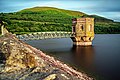
 Face of the Dam.jpg 3 264 × 2 448; 2,14 MB
-
 Fan Fawr, Bannau Brycheiniog.jpg 4 032 × 3 024; 3,33 MB
-
 Fan Hir.jpg 640 × 480; 103 KB
-
 Fan y Big and Cribyn from Pen y Fan.jpg 4 032 × 3 024; 3,14 MB
-
 Fann Nedd.jpg 1 327 × 1 011; 136 KB
-
 Fascination (24565194633).jpg 4 592 × 3 056; 4,11 MB
-
 Fforest Fawr Geopark Brecon Beacons National Park UK location map.svg 1 425 × 912; 1,33 MB
-
 Ford fiesta mk5.jpg 2 202 × 1 664; 1,61 MB
-
 Framed, Naturally (30309436586).jpg 5 456 × 3 632; 17,14 MB
-
 From Pen y fan to Upper Neuadd.jpg 2 272 × 1 704; 876 KB
-
 From the path on Craig y Fan Ddu - geograph.org.uk - 3390213.jpg 4 000 × 3 000; 3,02 MB
-
 Garreglwyd.JPG 1 372 × 1 030; 115 KB
-
Garwnant Hydropower Scheme, Breckon Beacons, Cymru, (Wales).webm 4 min 23 s, 640 × 360; 29,27 MB
-
 Gentle Bannau Brycheiniog Hills.jpg 5 472 × 3 648; 9,77 MB
-
 Glynmeddig Barn, Brecon Beacons, Wales (4592450781).jpg 3 776 × 2 520; 3,57 MB
-
 Glynmeddig Barn, Brecon Beacons, Wales (4592456491).jpg 3 776 × 2 520; 2,9 MB
-
 Glynmeddig Barn, Brecon Beacons, Wales (4593080650).jpg 3 776 × 2 520; 3,91 MB
-
 Graig Ddu, Black Mountains - geograph.org.uk - 132717.jpg 640 × 426; 124 KB
-
 Green Screen (24024363183).jpg 4 592 × 2 761; 3,19 MB
-
 Grwyne Fawr Reservoir July 1976.jpg 2 105 × 1 404; 1,12 MB
-
 Gullied flanks of Gwaun Nant Ddu - geograph.org.uk - 516641.jpg 640 × 480; 147 KB
-
 Guns don't kill people (4593104600).jpg 3 776 × 2 520; 3,67 MB
-
 Gwalciau'r Cwm - geograph.org.uk - 2877393.jpg 640 × 480; 82 KB
-
 Gwaun Nant Ddu, Brecon Beacons - geograph.org.uk - 148778.jpg 640 × 427; 62 KB
-
 Harnessing (23992554964).jpg 4 592 × 2 245; 1,7 MB
-
 Heading towards Fan y Big - geograph.org.uk - 3284503.jpg 4 000 × 3 000; 2,33 MB
-
 Heading towards Fan y Big - geograph.org.uk - 3284506.jpg 4 000 × 3 000; 2,46 MB
-
 Hill near Upper Govera.jpg 5 472 × 3 648; 9,43 MB
-
 HOWExp160515 14 (18536350416).jpg 7 360 × 4 912; 28,67 MB
-
 James buries his whiskey (4592602021).jpg 3 776 × 2 520; 4,19 MB
-
 James, Sunday AM (4592521277).jpg 2 520 × 3 776; 2,35 MB
-
 James, Sunday AM (4593138562).jpg 2 520 × 3 776; 2,81 MB
-
 Kar im Übergang zum Trogtal in den Brecon Beacons II.jpg 3 264 × 2 448; 3,55 MB
-
 Kar im Übergang zum Trogtal in den Brecon Beacons, Wales.jpg 3 264 × 2 448; 3,32 MB
-
 Karartige Talmulde südlich von Libanus, Wales, in den Brecon Beacons.jpg 3 264 × 2 448; 3,37 MB
-
 Karwände in den Brecon Beacons südwestlich Libanus II, Wales.jpg 3 264 × 2 448; 3,29 MB
-
 Karwände in den Brecon Beacons südwestlich Libanus, Wales.jpg 3 264 × 2 448; 3,65 MB
-
 Landschaft auf dem Fan Frynych, Wales.jpg 3 264 × 2 448; 3,58 MB
-
 LenticularClouds.jpg 3 872 × 2 592; 1,91 MB
-
 Libanus Brecon Beacons geograph-3370071-by-Ben-Brooksbank.jpg 777 × 426; 573 KB
-
 Liberté (14521974030).jpg 2 738 × 1 825; 3,58 MB
-
 Limestone Rock Top.jpg 5 184 × 3 456; 7,89 MB
-
 Llanfoist Landscape.jpg 3 456 × 2 592; 3,26 MB
-
 Llwyn On Reservoir (20282995222).jpg 5 456 × 3 632; 8,01 MB
-
 Llyn Cwm Llwch, a small lake in the Brecon Beacons, Wales.jpg 4 608 × 2 592; 3,49 MB
-
 Llyn y Fan Fach (1323880314).jpg 2 816 × 2 112; 1,71 MB
-
 Llyn y Fan Fach (1323880330).jpg 2 816 × 2 112; 2 MB
-
 Lone walker in the Brecon Beacons - geograph.org.uk - 3390130.jpg 4 000 × 3 000; 2,5 MB
-
 Looking over the Usk Valley - geograph.org.uk - 1765272.jpg 480 × 640; 90 KB
-
 Looking south from Corn Du - geograph.org.uk - 490792.jpg 640 × 480; 76 KB
-
 Machine Gun Pillbox Near Storey Arms - geograph.org.uk - 549704.jpg 640 × 480; 128 KB
-
 Mark around the Beacons 3.jpg 2 048 × 1 536; 253 KB
-
 Mark around the Beacons 4.jpg 2 048 × 1 536; 478 KB
-
 Mark around the Beacons 6.jpg 2 048 × 1 536; 406 KB
-
 Mark around the Beacons by Mark.jpg 2 048 × 1 536; 530 KB
-
 Mark around the Beacons By Mark.jpg 2 048 × 1 536; 1 014 KB
-
 Mark around the Beacons pt2.jpg 2 048 × 1 536; 418 KB
-
 Mark around the Beacons the lake.jpg 2 048 × 1 536; 575 KB
-
 Mark around the Beacons x.jpg 1 536 × 2 048; 373 KB
-
 Mark around the Beacons.jpg 2 048 × 1 536; 764 KB
-
 Mark’s Beacon walks.jpg 2 048 × 1 536; 574 KB
-
 Meadows and the Sugar Loaf.jpg 2 666 × 4 000; 8,02 MB
-
 Memorial on path south to Sgwd yr Eira - geograph.org.uk - 70658.jpg 640 × 480; 108 KB
-
 Merthyr Tydfil Banner.jpg 2 448 × 350; 422 KB
-
 Miaow (4593142614).jpg 1 681 × 2 519; 1,03 MB
-
 Middle falls (Afon Mellte).jpg 2 272 × 1 704; 876 KB
-
 Midsummer sunrise over Pen y Fan.jpg 4 032 × 3 024; 1,88 MB
-
 Mirage (23534523155).jpg 5 456 × 3 180; 8,68 MB
-
 Misleading arch under Cwar y Gigfran - geograph.org.uk - 402203.jpg 640 × 480; 98 KB
-
 Mynydd Illtud Powys Twyn y Gaer HenSne 01 trig point.JPG 1 620 × 2 160; 802 KB
-
 Mynydd Illtud Powys Twyn y Gaer HenSne 02 trig point.JPG 2 160 × 1 620; 1,48 MB
-
 Mynydd Illtud Powys Twyn y Gaer HenSne 03.JPG 2 160 × 1 620; 1,17 MB
-
 Mynydd Mallaen Standing Stone - geograph.org.uk - 488271.jpg 640 × 365; 50 KB
-
 Nant Tarthwynni seen from Tor y Foel - geograph.org.uk - 2153776.jpg 640 × 480; 64 KB
-
 Nant Tywynni o Fwlch Bryn-rhudd.jpg 2 448 × 2 448; 1,56 MB
-
 National Trust Plaque - geograph.org.uk - 1115699.jpg 435 × 640; 119 KB
-
 Naturally (19691578100).jpg 5 456 × 3 632; 9,94 MB
-
 Nebel erreicht den Kamm unterhalb des Corn Du.jpg 3 264 × 2 448; 2,49 MB
-
 Not your average hikers? (4593196600).jpg 3 776 × 2 520; 2,91 MB
-
 Ocean Tonic +10 years (4592515091).jpg 3 332 × 1 714; 1,79 MB
-
 Oh You Ewe, You! (30848835706).jpg 5 012 × 3 103; 3,15 MB
-

.jpg)
.jpg)
.jpg)
.jpg)
.jpg)
.jpg)


.jpg)


.jpg)

.jpg)


.jpg)


.jpg)


.jpg)


.jpg)
.jpg)


.jpg)


.jpg)


.jpg)
.jpg)


.jpg)

.jpg)


.jpg)


.jpg)

.jpg)


.jpg)
.jpg)
.jpg)
.jpg)


.jpg)


.jpg)
.jpg)
.jpg)


.jpg)
.jpg)

.jpg)


.jpg)

.jpg)
.jpg)
.jpg)

.jpg)
.jpg)
.jpg)
.jpg)
.jpg)
.jpg)
.jpg)
.jpg)
.jpg)
.jpg)
.jpg)
.jpg)
.jpg)
.jpg)
.jpg)