Category:Bridges in New Zealand
Перейти до навігації
Перейти до пошуку
Країни Океанії: Австралія · Кірибаті · Нова Зеландія · Палау · Папуа Нова Гвінея · Соломонові Острови · Фіджі
Інші території: Гаваї · Гуам · Нова Каледонія · Французька Полінезія – Частково: Індонезія
Інші території: Гаваї · Гуам · Нова Каледонія · Французька Полінезія – Частково: Індонезія
| Завантажити медіафайл | |||||
| Місце розташування |
| ||||
|---|---|---|---|---|---|
| |||||
Підкатегорії
Показано 25 підкатегорій із 25.
*
B
- Brunner Bridge (14 F)
C
- Claudelands Bridge (7 F)
D
H
- Hokitika River Bridge (3 F)
O
- Oponae Bridge (7 F)
R
S
T
- Tauranga Bridge (4 F)
U
V
Файли в категорії «Bridges in New Zealand»
Показано 103 файли цієї категорії (із 103).
-
 732 m dlouhý jednoproudý most přes Haast River - panoramio.jpg 2048 × 1536; 3,06 МБ
-
 A bridge and a stream in Oyster Bay, New Zealand.jpg 5472 × 3648; 21,72 МБ
-
 Abbots creek toll bridge on the rimutaka road.jpg 600 × 424; 272 КБ
-
 Blue River, West Coast Region, New Zealand 09.jpg 4961 × 3064; 14,49 МБ
-

-
 Bridge across the Waikato River at Huntly,New Zealand (12965730074).jpg 6000 × 2417; 3,6 МБ
-
 Bridge over Chaffey Stream, Kahurangi National Park, New Zealand 12.jpg 5149 × 3079; 17,45 МБ
-
 Bridge over Ryton River.jpg 3072 × 2304; 12,15 МБ
-
 Bridge over Speargrass Creek, Nelson Lakes National Park, New Zealand.jpg 5319 × 3644; 12,49 МБ
-
 Bridge over Takaka River by Cobb Power Station, Kahurangi National Park, New Zealand.jpg 5342 × 3561; 17,27 МБ
-
 Bridge over the Motu River. ATLIB 291783.png 5097 × 3760; 12,9 МБ
-
 Bridge over the Shotover River in the Lower Shotover area, 1926. ATLIB 298998.png 6406 × 4665; 21,41 МБ
-
 Bridge, Glenmark.JPG 4272 × 2848; 7,91 МБ
-
 Bridge, The Groynes, Christchurch, New Zealand.jpg 3648 × 5472; 16,02 МБ
-
 Brunner Mine Bridge - panoramio.jpg 1880 × 2816; 2,56 МБ
-
 Brücke in Neuseeland.jpg 720 × 405; 31 КБ
-
 Burnett Quarry Reserve 738.JPG 5472 × 3648; 5,34 МБ
-
 Burnett Quarry Reserve 739.JPG 5472 × 3648; 4,42 МБ
-
 Burnett Quarry Reserve 740.JPG 5472 × 3648; 7,11 МБ
-
 Cavendish Business Park.jpg 4032 × 2268; 3,24 МБ
-
 Clarence River New Zealand 2.jpg 2048 × 1024; 1,65 МБ
-
 Clutha Floods 1948 (22560820675).jpg 1453 × 1725; 1,11 МБ
-
 Cobb Power Station 353.JPG 5472 × 3648; 5,61 МБ
-
 Cromwell Junction Before and After the Clyde dam.jpg 435 × 580; 130 КБ
-
 Crossing the Clutha (47817026742).jpg 1920 × 1025; 1,96 МБ
-
 Damaged bridge over the Waipa River, 1917. ATLIB 284108.png 5144 × 3806; 14,05 МБ
-
 Entrance to Takarau Gorge - panoramio.jpg 2816 × 1880; 2,96 МБ
-
 Footbridge and lupins Tekapo.jpg 3264 × 2448; 3,01 МБ
-
 Geologist Creek and the bridge across Dorothy Falls Rd, West Coast, New Zealand.jpg 4980 × 3247; 12,58 МБ
-
 Geologist Creek, West Coast, New Zealand 16.jpg 5472 × 3648; 17,13 МБ
-
 Gore Bay Buxton Stream.JPG 3872 × 2592; 4,34 МБ
-
 Historical Appleby Bridge.jpg 2448 × 3264; 3,53 МБ
-
 Huttriver.jpg 1280 × 960; 226 КБ
-
 Idyll With Substation And Bridge.jpg 1600 × 1200; 1,36 МБ
-
 Kaiwharawhara looking South - panoramio.jpg 2240 × 1488; 1,62 МБ
-
 Karapiro spillway and access bridge from the dam.jpg 1071 × 1600; 646 КБ
-
 Kauri Point wharf2.jpg 4032 × 3024; 4,08 МБ
-

-
 Makohine Viaduct under construction, ca 1900 ATLIB 272773.png 3757 × 5124; 13,94 МБ
-
 Mangahoe Bridge at Te Awamutu, ca 1910s (21255831306).jpg 3726 × 5093; 1,62 МБ
-
 Mangahoe Bridge, Te Awamutu (21690500995).jpg 5119 × 3744; 1,84 МБ
-
 Mangakahia Twin Bridges, Nukutawhiti, New Zealand.jpg 3162 × 2140; 6,17 МБ
-
 Mangawhero River and Mountain Road.jpg 3000 × 4000; 4,39 МБ
-
 Medway Bridge, Awatere Valley.jpg 3872 × 2592; 5,41 МБ
-
 Mount White Bridge - panoramio.jpg 3888 × 2592; 3,5 МБ
-
 Mount White Waimakariri Bridge.jpg 1280 × 853; 254 КБ
-
 Myttons Creek, Kahurangi National Park, New Zealand 28.jpg 5472 × 3648; 21,69 МБ
-
 New foot bridge to stone church - panoramio.jpg 3264 × 2448; 1,01 МБ
-
 New Road Falls and bridge, Warkworth area (21489472182).jpg 3765 × 5140; 1,77 МБ
-
 Nūhaka Bridge in 1926.jpg 2000 × 746; 344 КБ
-

-
 Oparau Bridge, Kawhia (21666018955).jpg 6396 × 4726; 3,66 МБ
-
 Otira Valley Bridge, Otira Valley Track, Arthur's Pass National Park, New Zealand 07.jpg 5472 × 3648; 17,45 МБ
-
 Otira Valley Track, Arthur's Pass National Park, New Zealand 06.jpg 5472 × 3648; 16,41 МБ
-
 Outram Bridge over the Taieri River, 1925 ATLIB 291958.png 5164 × 3751; 14,07 МБ
-
 People staring at flooded bridge (AM 79856-1).jpg 1275 × 939; 721 КБ
-
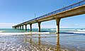 Pier New Brighton. (52439666087).jpg 4593 × 2788; 6,72 МБ
-
 Pipe Bridge On Otago Rail Trail Sth Of Hyde.jpg 1600 × 1200; 259 КБ
-
 Rail and road bridges across the Grey River near Cobden (21453224719).jpg 6455 × 4726; 2,59 МБ
-
 Redwood Springs.jpg 4032 × 2268; 3,69 МБ
-
 Seen from the Train 2 (30863345154).jpg 4815 × 2636; 5,77 МБ
-
 Ship Creek Bridge, West Coast Region, New Zealand 02.jpg 5472 × 3356; 14,54 МБ
-
 South Rangitikei Viaduct.jpg 2816 × 1880; 2,28 МБ
-
 Springvale Suspension Bridge and Callender-Hamilton bridge, New Zealand.jpg 4032 × 3024; 12,11 МБ
-
 Suspension Bridge - Dart River (Otago).jpg 1804 × 1204; 630 КБ
-
 Suspension bridge over the Hutt River at Maoribank ATLIB 224332.png 5096 × 3769; 13,8 МБ
-
 Swing bridge over the Tunanui Stream near Morere, Wairoa District. ATLIB 291883.png 5132 × 3716; 13,81 МБ
-
 Taieri Mouth Bridge.jpg 1000 × 635; 145 КБ
-
 Tangarakau Gorge, a road bridge and grave site. ATLIB 286519.png 5132 × 3730; 17,94 МБ
-

-
 Taonui viaduct (20660481383).jpg 6426 × 4678; 4,12 МБ
-
 Tauherenikau River 62.jpg 2048 × 1536; 712 КБ
-
 Tauherenikau River 74.jpg 2048 × 1536; 696 КБ
-
 The Alexandra Bridge.jpg 4297 × 2184; 7,53 МБ
-
 The light at the end of the tunnel - panoramio.jpg 2816 × 1880; 2,29 МБ
-
 Thorns Creek, Kahurangi National Park, New Zealand.jpg 5472 × 3648; 20,74 МБ
-
 Tolaga bay town.jpg 1024 × 768; 549 КБ
-
 Traffic bridge over the Mangaroa River. ATLIB 293942.png 6360 × 4626; 19,7 МБ
-
 Turumaha bridge - Charlton Collection.jpg 2087 × 1477; 1,61 МБ
-
 Tutoko River Bridge (31287286900).jpg 4107 × 3394; 11,26 МБ
-
 Twin bridges - panoramio.jpg 2816 × 1880; 2,24 МБ
-
 Twin Bridges 1333 (10214647293) (4).jpg 1600 × 1067; 1,88 МБ
-
 Upokongaro Cycle Bridge.jpg 6000 × 4000; 7,51 МБ
-

-
 View of bridge at Cromwell, 1926 ATLIB 301052.png 3759 × 5141; 17,22 МБ
-
 View of the bridge across the Waioeka River, Opotiki (21501400840).jpg 5115 × 3742; 2,12 МБ
-
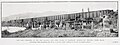
 View of the Brunner bridge and mines, 188-? (3057611776).jpg 5901 × 4062; 7,05 МБ
-
 View of the Hinahina Bridge over the Catlins River, near Owaka, 1926 ATLIB 301049.png 5111 × 3748; 13,98 МБ
-
 View of the road bridge over the Waikato River at Hamilton. ATLIB 287943.png 6409 × 4660; 21,53 МБ
-

-

-

-
 Waiau Gorge and Bridge (21657880352).jpg 6448 × 4693; 4,26 МБ
-
 Waiaua Bridge Junction on the main East Coast Road, Bay of Plenty (21687557405).jpg 6498 × 4731; 3,96 МБ
-
 Waipawa, Burton Brothers. Te Papa (O.030760).jpg 4232 × 2948; 2,83 МБ
-
-
 Waitemata Harbour Bridge concept from 1911.jpg 1442 × 2000; 427 КБ
-
 Wanganui from Durie Hill.jpg 1024 × 768; 321 КБ
-
 West Coast Rd - můstek na silnici - panoramio.jpg 3072 × 2304; 1,81 МБ
-
 Whanganui Bridge.jpg 736 × 469; 221 КБ
-
 Whanganui River towards sea from Durie Hill.jpg 1024 × 768; 312 КБ
-
 Whangarei Quarry Gardens 04.JPG 3456 × 2304; 5,08 МБ
-
 Winters touch on the Waimak (from the Mt.White bridge) - panoramio.jpg 3888 × 2592; 3,76 МБ


.jpg)


.jpg)


.jpg)
.jpg)


.jpg)

.jpg)


.jpg)
.jpg)

.jpg)

.jpg)


.jpg)


.jpg)


.jpg)

_(4).jpg)

.jpg)

.jpg)
.jpg)


.jpg)
.jpg)
.jpg)
.jpg)
.jpg)
.jpg)


_-_panoramio.jpg)
.jpg)
.jpg)