Category:Brown County, Wisconsin
Mine navigeerimisribale
Mine otsikasti
Counties of Wisconsin: Adams · Ashland · Barron · Bayfield · Brown · Buffalo · Burnett · Calumet · Chippewa · Clark · Columbia · Crawford · Dane · Dodge · Door · Douglas · Dunn · Eau Claire · Florence · Fond du Lac · Forest · Grant · Green · Green Lake · Iowa · Iron · Jackson · Jefferson · Juneau · Kenosha · Kewaunee · La Crosse · Lafayette · Langlade · Lincoln · Manitowoc · Marathon · Marinette · Marquette · Menominee · Milwaukee · Monroe · Oconto · Oneida · Outagamie · Ozaukee · Pepin · Pierce · Polk · Portage · Price · Racine · Richland · Rock · Rusk · Sauk · Sawyer · Shawano · Sheboygan · St. Croix · Taylor · Trempealeau · Vernon · Vilas · Walworth · Washburn · Washington · Waukesha · Waupaca · Waushara · Winnebago · Wood
county in Wisconsin, United States   | |||||
| Laadi fail üles | |||||
| Üksikjuht nähtusest | |||||
|---|---|---|---|---|---|
| Nimetatud ... järgi | |||||
| Asukoht | Wisconsin, Ameerika Ühendriigid | ||||
| Keskus | |||||
| Ametlik keel | |||||
| Asutamise või loomise aeg |
| ||||
| Rahvaarv |
| ||||
| Pindala |
| ||||
| Mitte segamini ajada | |||||
| koduleht | |||||
 | |||||
English: Media related to Brown County, Wisconsin, a county in Wisconsin, United States.
Alamkategooriad
Järgmised 14 alamkategooriat on selles kategoorias (kokku 14).
Failid kategoorias "Brown County, Wisconsin"
Järgmised 71 faili on selles kategoorias (kokku 71).
-

-
 21 Gun Roadhouse 4344 Lime Kiln Rd, Green Bay, WI 54311 (2).jpg 4032 × 3024; 1,71 MB
-
 21 Gun Roadhouse 4344 Lime Kiln Rd, Green Bay, WI 54311 (4).jpg 4032 × 3024; 2,66 MB
-
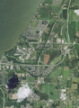
 Aerial view of Dyckesville and vicinity in Kewaunee and Brown counties, Wisconsin 2020.png 9305 × 12 742; 232,29 MB
-
 Aerial view of Long Tail Point in Brown County, Wisconsin 2020.png 9470 × 12 577; 200,38 MB
-
 Aerial view of the University of Wisconsin–Green Bay and vicinity in Brown County 2020.png 9340 × 12 754; 215,77 MB
-
 Askeaton Wisconsin Looking East.jpg 4482 × 1677; 2,16 MB
-
 Askeaton Wisconsin Looking West.jpg 2592 × 1728; 1,85 MB
-
 ATC 138-Kilovolt Line - panoramio (1).jpg 3629 × 3150; 2,56 MB
-
 ATC High-Voltage Transmission Line - panoramio.jpg 4608 × 3456; 8,1 MB
-
 ATC Power Line - panoramio (7).jpg 4608 × 3456; 6,88 MB
-
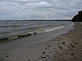 Beach on the shore of Green Bay Bay Shore County Park Brown County Wisconsin.jpg 4000 × 3000; 2,52 MB
-

-
 BrownCountyWisconsinBarnFarmlandSpringWIS96.jpg 1936 × 1288; 1,06 MB
-
 Camping World™ RV Sales - panoramio.jpg 4608 × 3456; 8,39 MB
-
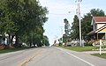
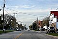
 ChampionWisconsinDowntown.jpg 1930 × 1258; 867 KB
-
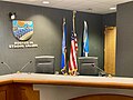 De Pere City Council Chambers.jpg 4032 × 3024; 2,69 MB
-
 De Pere High School.jpg 700 × 525; 229 KB
-
 Door Peninsula is flanked by Green Bay and Lake Michigan.jpg 4928 × 3280; 1,29 MB
-
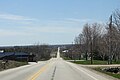
 Dyckesville exit and County P overpass in the Town of Green Bay Wisconsin.jpg 3600 × 2400; 2,87 MB
-
-
 FontenoyWisconsinDowntown.jpg 3888 × 2592; 2,95 MB
-
 History of Brown County, Wisconsin, past and present (1913) (14578254568).jpg 1964 × 1424; 379 KB
-
 HollandWisconsinBrownCounty1.jpg 2304 × 1728; 769 KB
-
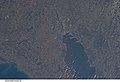 ISS026-E-5276 - View of Wisconsin.jpg 4256 × 2913; 1,06 MB
-
 ISS054-E-8026.jpg 3712 × 5568; 4,62 MB
-
 Jean Nicolet commerative plaque at Red Banks WI from 1909.jpg 3456 × 2304; 2,69 MB
-
 Jean Nicolet.jpg 814 × 430; 59 KB
-
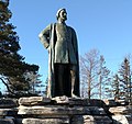 JeanNicolet.jpg 2304 × 2172; 935 KB
-
 LarkWisconsinDowntown1.jpg 3880 × 2420; 2,56 MB
-
 LarkWisconsinDowntown2.jpg 3888 × 2592; 3,3 MB
-
 Ledgeview Wisconsin Town Hall Sign.jpg 2880 × 2160; 1,8 MB
-
 Little Rapids Wisconsin CTH D.jpg 619 × 393; 65 KB
-
 Little Rapids Wisconsin Sign.jpg 640 × 480; 77 KB
-
 Long Tail Point Light.jpg 363 × 398; 42 KB
-
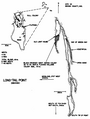 Long-Tail Point Brown County Wisconsin 1976.png 718 × 953; 136 KB
-
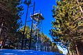 Lookout Tower at Reforestation Camp.jpg 4693 × 3118; 1,73 MB
-
 Menards® De Pere - panoramio.jpg 4512 × 2520; 4,57 MB
-
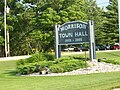 MorrisonWisconsinOldTownHallSign.jpg 2304 × 1728; 865 KB
-
 NewFrankenWisconsinDowntown.jpg 1936 × 1288; 1,09 MB
-
 NewFrankenWisconsinSign.jpg 1936 × 1288; 792 KB
-
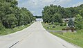
 PolandWisconsinEastWIS29.jpg 1936 × 1288; 1,31 MB
-
 PolandWisconsinOverview.jpg 1936 × 1202; 729 KB
-
 Red Banks Wisconsin Looking East.jpg 2336 × 1352; 1,57 MB
-
 Red Banks Wisconsin Looking south.jpg 3456 × 2304; 3,96 MB
-
 Sensiba - panoramio.jpg 3152 × 4856; 7,26 MB
-

-
 Sturgeon Bay airboat deploys DVIDS1113799.jpg 1963 × 1428; 921 KB
-
 Tchampion wisconsin wi.jpg 526 × 400; 10 KB
-
 TornadoDamageGreenleafWisconsin2010.jpg 1936 × 1288; 1,61 MB
-
 Town of Scott Tower - panoramio.jpg 3648 × 2736; 2,28 MB
-
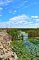
 Trail adjacent to the escarpment Bay Shore County Park Brown County Wisconsin.jpg 4000 × 3000; 5,21 MB
-
 Trail to Green Bay in Bay Shore County Park.jpg 4000 × 3000; 4,15 MB
-
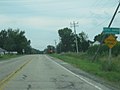
 US Route 141 Southern terminus looking north at I43 overpass.jpg 2584 × 1280; 938 KB
-
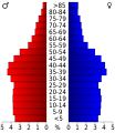 USA Brown County, Wisconsin age pyramid.svg 520 × 600; 7 KB
-
-
-
-

-

-

-
-

-
-

-

-

-
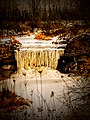
 Wequiock Falls Wisconsin (142732371).jpeg 2048 × 1365; 1,28 MB
-

-
 WIS29WIS32.jpg 2304 × 1655; 600 KB
-
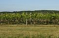 Wisconsin Ledge AVA Vineyard Brown County.jpg 1670 × 1092; 1,07 MB

.jpg)
.jpg)


.jpg)
.jpg)

_(923)_863-2123.jpg)


.jpg)

_(14578254568).jpg)


.jpeg)
_and_Van_Lieshout_Road_(background)_in_the_town_of_Scott,_Brown_County,_Wisconsin,_July_29,_2005.jpg)

