Category:Bus stops in the London Borough of Wandsworth
Jump to navigation
Jump to search

Media in category "Bus stops in the London Borough of Wandsworth"
The following 38 files are in this category, out of 38 total.
-
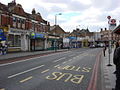 A214 Tooting Bec Road - geograph.org.uk - 715850.jpg 640 × 480; 82 KB
-
 Approaches to Wandsworth Bridge. - geograph.org.uk - 789643.jpg 640 × 430; 62 KB
-
 Battersea Park Road (16722324599).jpg 2,418 × 2,068; 2.46 MB
-
 Battersea Park Road SW11 - geograph.org.uk - 168226.jpg 640 × 480; 138 KB
-

-
 Bedford Hill - geograph.org.uk - 3993547.jpg 640 × 430; 77 KB
-
 Bedford Hill, SW12 - geograph.org.uk - 285780.jpg 640 × 480; 120 KB
-
 Boat Race Day 2011, Putney (15) - geograph.org.uk - 2328467.jpg 640 × 480; 58 KB
-
 Britain's Busiest Railway Bridge^ - geograph.org.uk - 168221.jpg 640 × 480; 108 KB
-
 Bus shelter on Putney Heath - geograph.org.uk - 1587919.jpg 640 × 480; 27 KB
-
 Bus Stop at The Green Man, Putney Heath - geograph.org.uk - 5072635.jpg 1,600 × 1,200; 444 KB
-
 Bus stop on Putney Heath - geograph.org.uk - 2219240.jpg 1,600 × 1,200; 557 KB
-
 Bus stop, East Hill, Wandsworth - geograph.org.uk - 3181786.jpg 640 × 482; 72 KB
-
 Bus stop, Putney Heath - geograph.org.uk - 2263867.jpg 4,320 × 3,240; 4.68 MB
-
 Buses outside Putney Rail Station - geograph.org.uk - 3670612.jpg 800 × 565; 99 KB
-
 Former Museum Wandsworth - geograph.org.uk - 1182052.jpg 640 × 481; 93 KB
-
 Garratt Lane, London SW18 - geograph.org.uk - 725692.jpg 640 × 480; 73 KB
-
 Garratt Lane, Wandsworth - geograph.org.uk - 325257.jpg 640 × 480; 35 KB
-
 Huguenot Place, London SW18 - geograph.org.uk - 2260383.jpg 4,320 × 3,240; 3.85 MB
-
 Lavender Hill - geograph.org.uk - 1383526.jpg 640 × 445; 88 KB
-

-
 London, UK - panoramio (286).jpg 3,552 × 2,000; 2 MB
-
 Looking south down Battersea Bridge Road - geograph.org.uk - 2099482.jpg 640 × 430; 127 KB
-
 Nine Elms Lane September 2013.jpg 2,448 × 3,264; 6.42 MB
-
 Putney Heath terminus - geograph.org.uk - 33874.jpg 640 × 428; 150 KB
-
 Putney Railway Station - geograph.org.uk - 4303616.jpg 1,600 × 1,076; 333 KB
-
 Putney railway station - geograph.org.uk - 581920.jpg 640 × 480; 71 KB
-
 Putney Station - geograph.org.uk - 789611.jpg 640 × 430; 65 KB
-
 Queenstown Road, London SW8 - geograph.org.uk - 2680243.jpg 4,320 × 3,240; 4.18 MB
-
 Shopping centre on Battersea Rise - geograph.org.uk - 3849995.jpg 2,560 × 1,920; 2.32 MB
-
 Somerset Estate, Battersea - geograph.org.uk - 237846.jpg 640 × 480; 133 KB
-
 Southside Shopping Centre - geograph.org.uk - 662585.jpg 640 × 480; 106 KB
-
 St Mark's, Battersea Rise 04.JPG 4,608 × 3,456; 8.53 MB
-
 St Mark's, Battersea Rise 05.JPG 3,456 × 4,608; 8.76 MB
-
 Stag Lane underpass, SW15 - geograph.org.uk - 1315018.jpg 640 × 480; 102 KB
-
 Thrale Road Bus stop - geograph.org.uk - 1398846.jpg 640 × 480; 69 KB
-
 Victoria Drive - geograph.org.uk - 2511511.jpg 640 × 430; 79 KB
-
 Wimbledon Park Rd - geograph.org.uk - 2511495.jpg 640 × 430; 82 KB


.jpg)


_-_geograph.org.uk_-_2328467.jpg)


.jpg)
.jpg)


