Category:Cambridge
Gezinti kısmına atla
Arama kısmına atla
English: Cambridge is a city in England, UK.
Français : Cambridge est une ville anglaise.
Nederlands: Cambridge is een stad in Engeland.
Main Wikipedia article: Cambridge.
city in Cambridgeshire, England   | |||||
| Medya yükle | |||||
| Nedir |
| ||||
|---|---|---|---|---|---|
| Konumu | Cambridge, Cambridgeshire, Doğu İngiltere, İngiltere | ||||
| Yasama organı | |||||
| Resmi dil | |||||
| Kuruluşu |
| ||||
| Nüfus |
| ||||
| Alanı |
| ||||
| Deniz seviyesinden yüksekliği |
| ||||
| Aynı değil | |||||
| resmî sitesi | |||||
 | |||||
Alt kategoriler
Bu kategoride, aşağıdaki 34 alt kategori dahil toplam 34 alt kategori vardır.
A
- Audio files of Cambridge (2 F)
B
C
- Coats of arms of Cambridge (10 F)
E
F
- Farms in Cambridge (259 F)
G
H
L
M
N
O
- Open Cambridge (12 F)
P
R
S
T
V
"Cambridge" kategorisindeki sayfalar
Bu kategoride yer alan toplam 2 sayfanın 2 adedi aşağıdadır.
"Cambridge" kategorisindeki ortam dosyaları
Bu kategoride yer alan toplam 60 dosyanın 60 adedi aşağıdadır.
-
 A crane on the Cambridge Union site - geograph.org.uk - 6297024.jpg 1.024 × 819; 901 KB
-
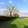 A dead tree on the edge of Cambridge - geograph.org.uk - 6302383.jpg 1.024 × 1.024; 1,32 MB
-
 A wet October morning - geograph.org.uk - 6294368.jpg 1.024 × 1.024; 1,23 MB
-
 Adkins Corner rebuilding - geograph.org.uk - 6278364.jpg 1.024 × 1.024; 1,11 MB
-
 Almoners' Avenue, site clearance - geograph.org.uk - 6302555.jpg 1.024 × 683; 773 KB
-
 Almoners' Avenue, turning leaves - geograph.org.uk - 6302373.jpg 1.024 × 683; 726 KB
-
 Along Hills Avenue in early October - geograph.org.uk - 6292735.jpg 1.024 × 1.024; 1,38 MB
-
 Along New Park Street - geograph.org.uk - 6297016.jpg 1.024 × 1.024; 1,07 MB
-
 Along Trafalgar Street - geograph.org.uk - 6285433.jpg 819 × 1.024; 951 KB
-
 Building work at Magdalene College - geograph.org.uk - 6296896.jpg 819 × 1.024; 1,07 MB
-
 Cambridge 104.jpg 3.648 × 5.472; 14,57 MB
-
 Cambridge UK ward map 2024.svg 1.319 × 1.266; 119 KB
-

-

-

-
 Cambridge's new carriage sidings - geograph.org.uk - 6285697.jpg 800 × 800; 681 KB
-
 Cherry Hinton Road, The Garden Library - geograph.org.uk - 6283980.jpg 819 × 1.024; 898 KB
-
 Clare College Gate to The Backs - geograph.org.uk - 6299079.jpg 819 × 1.024; 1,18 MB
-
 Corner cutting - geograph.org.uk - 6283935.jpg 1.024 × 731; 868 KB
-
 Cowper Road, downpour and sunlight - geograph.org.uk - 6289549.jpg 1.024 × 768; 751 KB
-
 Cycle path, busway and railway - geograph.org.uk - 6283908.jpg 1.024 × 682; 898 KB
-
 Darwin College, The Old Granary reflected - geograph.org.uk - 6299004.jpg 1.024 × 1.024; 1,22 MB
-
 Dean Court, Holbrook Road - geograph.org.uk - 6292749.jpg 1.024 × 731; 978 KB
-
 Down Glebe Road in early October - geograph.org.uk - 6292756.jpg 1.024 × 768; 1,33 MB
-
 Fendon Road roundabout closed - geograph.org.uk - 6278373.jpg 1.024 × 768; 876 KB
-
 Fendon Road roundabout reworking - geograph.org.uk - 6286544.jpg 1.024 × 683; 862 KB
-
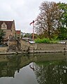
 Fine trees by the River Cam - geograph.org.uk - 6299086.jpg 819 × 1.024; 1,09 MB
-
 Footpath closed - geograph.org.uk - 6297003.jpg 768 × 1.024; 913 KB
-
 Glebe Road, a cricket on my gear cable - geograph.org.uk - 6292753.jpg 1.024 × 768; 761 KB
-
 Green tiles on Holbrook Road - geograph.org.uk - 6292750.jpg 1.024 × 1.024; 1,38 MB
-
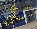 Helmore Building, Anglia Ruskin University, Cambridge Campus.jpg 2.160 × 1.692; 942 KB
-
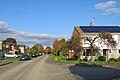
 High Street, Chesterton - geograph.org.uk - 6294039.jpg 1.600 × 1.095; 401 KB
-
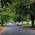
 Hills Avenue in early October - geograph.org.uk - 6292739.jpg 1.024 × 683; 861 KB
-
 Hockey training in Cambridge - geograph.org.uk - 6300585.jpg 1.024 × 576; 122 KB
-
 Holbrook Road to Glebe Road - geograph.org.uk - 6292744.jpg 1.024 × 731; 971 KB
-
 Jagged Edge Barbers closed down - geograph.org.uk - 6293887.jpg 1.600 × 1.067; 403 KB
-
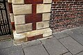 Jesus benchmark - geograph.org.uk - 6302406.jpg 1.600 × 1.069; 428 KB
-
 Laying new carriage sidings - geograph.org.uk - 6297030.jpg 1.024 × 682; 839 KB
-
 Lichfield Community Hall in October - geograph.org.uk - 6302363.jpg 1.024 × 683; 877 KB
-
 Magie D Un Trottoir (66721191).jpeg 2.048 × 1.356; 636 KB
-
 Nearing Addenbrooke's Hospital - geograph.org.uk - 6293179.jpg 1.024 × 683; 793 KB
-
 New houses by the railway - geograph.org.uk - 6287218.jpg 819 × 1.024; 1,29 MB
-

-
 On Cannons Green in early autumn - geograph.org.uk - 6285691.jpg 1.024 × 1.024; 1,42 MB
-
 On Sidney Street - geograph.org.uk - 6285687.jpg 1.024 × 1.024; 1,09 MB
-
 Perne Road after a downpour - geograph.org.uk - 6280948.jpg 1.024 × 1.024; 1,24 MB
-
 Radegund Road between downpours - geograph.org.uk - 6280931.jpg 1.024 × 1.024; 958 KB
-
 Radegund Road in early autumn - geograph.org.uk - 6280920.jpg 819 × 1.024; 1,42 MB
-

-
 The Cam at Garret Hostel Bridge - geograph.org.uk - 6299085.jpg 1.024 × 819; 883 KB
-
 The east end of Downing Street - geograph.org.uk - 6300347.jpg 819 × 1.024; 872 KB
-
 The Varsity Hotel - geograph.org.uk - 6297012.jpg 1.024 × 1.024; 1,18 MB
-
 Tourists and the Corpus Christi Clock - geograph.org.uk - 6302195.jpg 1.024 × 1.024; 990 KB
-
 Tourists on King's Parade - geograph.org.uk - 6302230.jpg 819 × 1.024; 919 KB
-
 Turning leaves on Davy Road - geograph.org.uk - 6302237.jpg 1.024 × 1.024; 1,62 MB
-
 Up Limekiln Hill - geograph.org.uk - 6302387.jpg 1.024 × 683; 624 KB
-
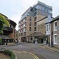
 Up Mill Lane - geograph.org.uk - 6298999.jpg 819 × 1.024; 1,01 MB
-
 Up Trafalgar Road - geograph.org.uk - 6285414.jpg 1.024 × 1.024; 1,24 MB
-
 Very slowly round the bend - geograph.org.uk - 6285400.jpg 1.024 × 1.024; 1,3 MB
-
 Vindis Cambridge Volkswagen - geograph.org.uk - 6293880.jpg 1.600 × 1.067; 301 KB


.jpeg)


