Category:Campus maps of Japan
Jump to navigation
Jump to search
Countries of Asia: Bangladesh · People's Republic of China · India · Indonesia‡ · Israel · Japan · Malaysia · Maldives · Philippines · Russia‡ · South Korea · Thailand
Limited recognition: Taiwan – Other territories: Hong Kong
‡: partly located in Asia
Limited recognition: Taiwan – Other territories: Hong Kong
‡: partly located in Asia
Media in category "Campus maps of Japan"
The following 25 files are in this category, out of 25 total.
-
 Doshisha University Kyotanabe Map.png 1,585 × 1,062; 710 KB
-
 Doshisha University Map.jpg 1,589 × 1,065; 258 KB
-
 Gakushuin Women's College map.svg 1,711 × 1,075; 424 KB
-
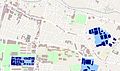 Map Waseda blue.jpg 1,920 × 1,143; 1.12 MB
-
 Plan of Komaba agriculture school at 1884.jpg 2,720 × 1,752; 954 KB
-
 PSM V64 D471 Grand plan of the university.png 1,651 × 1,418; 214 KB
-
 Senriyama campus old.jpg 2,100 × 1,240; 460 KB
-
 Site plan of the Higher Normal School at Ochanomizu around 1889.jpg 6,221 × 3,421; 1.34 MB
-
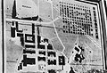
 Site plan of the Tokyo University of Literature and Science.jpg 5,887 × 4,614; 2.91 MB
-
 Tenroku campus old.jpg 2,100 × 1,240; 382 KB
-
 Waseda map.png 1,920 × 1,143; 861 KB
-
 Waseda university campus 1.svg 1,711 × 1,075; 427 KB
-
 仙台白百合女子大003.JPG 3,648 × 2,736; 428 KB
-
 仙台白百合女子大006.jpg 1,944 × 2,592; 135 KB
-
 大阪経済大学E館4階エレベーター横喫煙所マップ.jpeg 3,024 × 4,032; 3.15 MB
-
 大阪経済大学E館エレベーター横喫煙所マップ.jpeg 3,024 × 4,032; 3.7 MB
-
 岩倉校地略図.png 1,600 × 1,380; 221 KB
-
 慶應義塾実測図.jpg 2,560 × 1,920; 902 KB
-
 慶應義塾実測図(1907年).png 3,200 × 1,600; 633 KB
-
 新田運動場平面図.jpg 2,400 × 1,800; 396 KB
-
 新銭座慶應義塾平面図(1869年).png 1,440 × 1,920; 217 KB
-
 早稲田大学及第一高等学院大隈会館戸塚運動場平面図.png 2,000 × 1,500; 406 KB
-
 早稲田大学構内案内図(昭和10年代).jpg 2,100 × 1,440; 1.62 MB
-
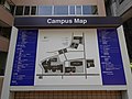 明治大学 キャンパスマップ - panoramio.jpg 4,592 × 3,448; 5.27 MB
-
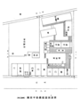
 第一高等学院平面図.png 2,400 × 1,600; 367 KB


