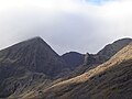
Category:Carrauntoohil
Aller à la navigation
Aller à la recherche
Point culminant d'Irlande  | |||||
| Téléverser des médias | |||||
| Nature de l’élément | |||||
|---|---|---|---|---|---|
| Matériau | |||||
| Lieu | comté de Kerry, Munster, Irlande | ||||
| Chaîne de montagnes | |||||
| Proéminence |
| ||||
| Altitude |
| ||||
 | |||||
Sous-catégories
Cette catégorie comprend seulement la sous-catégorie ci-dessous.
B
- Brother O'Shea's Gully (8 F)
Média dans la catégorie « Carrauntoohil »
Cette catégorie comprend 71 fichiers, dont les 71 ci-dessous.
-
 Approach to Carrauntoohil - geograph.org.uk - 777738.jpg 637 × 425 ; 71 kio
-
 Approach to Carrauntoohil - geograph.org.uk - 777749.jpg 425 × 637 ; 81 kio
-
 Beenkeragh and Carrauntoohil from Caher.jpg 768 × 576 ; 101 kio
-
 Caher East Top II.jpg 768 × 576 ; 104 kio
-
 Carauntoohil von Hags Glen.jpg 2 048 × 1 536 ; 688 kio
-
 Carauntoohil, Foggy Top of Ireland - panoramio.jpg 1 802 × 1 802 ; 1,67 Mio
-
 Carrantuohill.jpg 475 × 400 ; 43 kio
-
 Carrauntoohil - geograph.org.uk - 113636.jpg 640 × 480 ; 109 kio
-
 Carrauntoohil - geograph.org.uk - 1992558.jpg 1 500 × 1 016 ; 314 kio
-
 Carrauntoohil - geograph.org.uk - 71762.jpg 640 × 480 ; 56 kio
-
 Carrauntoohil 2016.JPG 670 × 898 ; 215 kio
-

-
 Carrauntoohil by Brother O'Shea's Gully.jpg 3 008 × 2 000 ; 1,6 Mio
-
 Carrauntoohil from the Beenkeragh Ridge.jpg 768 × 1 024 ; 202 kio
-
 Carrauntoohil from the Hag's Glen, Ireland.jpg 2 000 × 1 236 ; 617 kio
-
 Carrauntoohil Group from Cruach Mhor.jpg 1 024 × 683 ; 157 kio
-
 Carrauntoohil's South East Ridge.jpg 768 × 576 ; 125 kio
-
 Carrauntoohil, Beenkeragh Ridge, Caher.jpg 8 688 × 5 419 ; 10,91 Mio
-
 Carrauntoohil.jpg 495 × 372 ; 100 kio
-
 Coomloughra Horse Shoe MacGillycuddy Reeks.jpg 8 688 × 5 792 ; 3,93 Mio
-
 Coomloughra Lough (MacGillycuddy's Reeks).jpg 1 500 × 979 ; 343 kio
-
 Corrán Tuathail -Carrauntoohil - geograph.org.uk - 290402.jpg 640 × 475 ; 32 kio
-
 Crowds on Carrauntoohil Summit - geograph.org.uk - 113637.jpg 480 × 640 ; 80 kio
-
 Curve Gully.jpg 360 × 480 ; 20 kio
-
 Devil's Ladder, Carrauntoohil, MacGillycuddy's Reeks.jpg 1 200 × 1 600 ; 504 kio
-
 Eagle's Nest (Lough Cummeenoughter) in Carrauntoohil in winter.jpg 4 000 × 3 000 ; 2,61 Mio
-
 Forest and river Gaddagh.jpg 6 000 × 4 000 ; 4,9 Mio
-
 Gaddagh River - geograph.org.uk - 777746.jpg 637 × 425 ; 73 kio
-
 Gearhanagour Stream, with Caher behind - geograph.org.uk - 450196.jpg 640 × 427 ; 130 kio
-
 Hag's Tooth.jpg 6 000 × 4 000 ; 2,75 Mio
-
 Hags Glen, 2006.jpg 2 048 × 1 536 ; 682 kio
-
 Heavenly Gates (Carrauntoohil Mountain, Kerry, Ireland).jpg 550 × 413 ; 72 kio
-
 Hill pasture on Knocknafreaghaun - geograph.org.uk - 447988.jpg 640 × 427 ; 128 kio
-
 Ireland's Highest Peak - Flickr - mozzercork.jpg 1 033 × 1 320 ; 1,34 Mio
-
 Irl-Carrantuohill summit.jpg 1 600 × 1 200 ; 215 kio
-
 Lone Tree and river Gaddagh.jpg 4 000 × 6 000 ; 5,46 Mio
-
 Lonely Forest.jpg 6 000 × 4 000 ; 4,31 Mio
-

-
 Looking down the Devil's Ladder - geograph.org.uk - 895831.jpg 640 × 624 ; 160 kio
-

-

-
 Lough Callee panorama.jpg 7 000 × 2 171 ; 9,27 Mio
-
 Lough Callee.jpg 6 000 × 4 000 ; 1,72 Mio
-
 Lough Cummeenoughter from Benkeeragh.jpg 5 792 × 8 688 ; 11,51 Mio
-
 Lough Gouragh - geograph.org.uk - 777763.jpg 637 × 425 ; 77 kio
-
 MacGillycuddy Reeks in Co. Kerry, Ireland.jpg 2 048 × 1 536 ; 736 kio
-

-

-
 Macgillycuddy's Reeks, The Devil's Ladder - geograph.org.uk - 1433188.jpg 640 × 420 ; 90 kio
-
 Mountain goats (1).jpg 6 000 × 4 000 ; 2,86 Mio
-
 Mountain goats (2).jpg 6 000 × 4 000 ; 6,18 Mio
-
 Mountain goats (3).jpg 6 000 × 4 000 ; 5,75 Mio
-
 Mountain streams.jpg 6 000 × 4 000 ; 4,06 Mio
-

-
 Near the foot of the Devil's Ladder - geograph.org.uk - 31019.jpg 640 × 427 ; 79 kio
-
 O'Shea's Gully - geograph.org.uk - 777777.jpg 637 × 425 ; 75 kio
-
 Ordnance Survey Ireland One-Inch Map of Killarney District, Published 1968.jpg 9 062 × 12 164 ; 12,17 Mio
-
 Panorama of Carantouhill, Co. Kerry, Ireland (1148393905).jpg 3 576 × 919 ; 2,8 Mio
-
 Respite.jpg 6 000 × 4 000 ; 3,26 Mio
-
 Route up Carrauntoohil, MacGillycuddy Reeks, Co. Kerry, Ireland.jpg 1 536 × 2 048 ; 1,18 Mio
-
 Sunset from the peak of Carrauntoohil - panorama.jpg 7 000 × 2 159 ; 5,44 Mio
-
 Sunset from the peak of Carrauntoohil.jpg 6 000 × 4 000 ; 1,33 Mio
-
 The Bones (Beenkeragh Ridge, Carrauntoohil).jpg 920 × 690 ; 260 kio
-
 The Eagle's Nest (Carrauntoohil, Kerry).jpg 1 024 × 683 ; 165 kio
-
 The narrow ridge east of Caher - geograph.org.uk - 331991.jpg 640 × 480 ; 65 kio
-
 The summit of Carrauntoohil - geograph.org.uk - 331996.jpg 640 × 480 ; 41 kio
-
 The third level - geograph.org.uk - 777799.jpg 637 × 425 ; 77 kio
-
 Towards Lough Callee - geograph.org.uk - 777754.jpg 637 × 425 ; 76 kio
-

-
 View from Carauntoohil - panoramio.jpg 3 264 × 2 176 ; 3,65 Mio
-
 View from top of Devil’s Ladder.jpg 6 000 × 4 000 ; 4,4 Mio


_and_Caher_Ridge_(Caher_East_Top,_Caher_West_Top).jpg)


.jpg)


_in_Carrauntoohil_in_winter.jpg)


.jpg)


_to_Cnoc_Toinne_-_geograph.org.uk_-_539225.jpg)


_-_geograph.org.uk_-_1434274.jpg)

.jpg)
.jpg)
.jpg)


.jpg)
.jpg)


.jpg)