Category:Castleton Rigg, North Yorkshire
Jump to navigation
Jump to search
English: Castleton Rigg, North-South ridge hill, crest forms a boundary between Danby and Westerdale civil parishes (and valleys), extends northwards from Westerdale and Danby High Moors
Subcategories
This category has only the following subcategory.
Media in category "Castleton Rigg, North Yorkshire"
The following 28 files are in this category, out of 28 total.
-
 Approaching road junction on Castleton Rigg - geograph.org.uk - 1995925.jpg 3,872 × 2,485; 3.4 MB
-
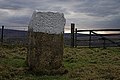
 Boundary Stone, Castleton Rigg - geograph.org.uk - 1732515.jpg 640 × 427; 285 KB
-
 Boundary Stones, Castleton Rigg - geograph.org.uk - 1744490.jpg 640 × 427; 291 KB
-
 Boundary Stones, Castleton Rigg - geograph.org.uk - 1744493.jpg 640 × 427; 295 KB
-
 Castleton Rig - geograph.org.uk - 122027.jpg 640 × 371; 46 KB
-
 Crag, Castleton Rigg - geograph.org.uk - 1732503.jpg 640 × 427; 305 KB
-
 Disused Quarry, Castleton Rigg - geograph.org.uk - 1736233.jpg 427 × 640; 284 KB
-
 Dry stone wall on Westerdale-side - geograph.org.uk - 148512.jpg 640 × 427; 31 KB
-
 Grey Stones - geograph.org.uk - 810351.jpg 640 × 427; 251 KB
-
 Postbox and road sign - geograph.org.uk - 632850.jpg 640 × 427; 39 KB
-
 Rigg End car park, High Castleton - geograph.org.uk - 1635549.jpg 640 × 480; 93 KB
-
 Sunken Trackway, Castleton Rigg - geograph.org.uk - 1732527.jpg 427 × 640; 313 KB
-
 Westerdale Side from Top End - geograph.org.uk - 145094.jpg 640 × 427; 50 KB
-
 Bridleway to Dale Head Farm - geograph.org.uk - 208224.jpg 640 × 416; 38 KB
-
 Castleton Rigg from Three Howes Rigg - geograph.org.uk - 82135.jpg 640 × 480; 29 KB
-
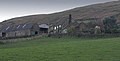
 Cockle House, Westerdale - geograph.org.uk - 51634.jpg 640 × 480; 46 KB
-
 Disused Quarry near Castleton - geograph.org.uk - 160086.jpg 640 × 427; 53 KB
-
 Disused Quarry on Westerdale Side - geograph.org.uk - 264281.jpg 640 × 427; 55 KB
-
 Gallows Howe above Castleton - geograph.org.uk - 100219.jpg 640 × 426; 58 KB
-

-
 High Stone Dyke - Path - geograph.org.uk - 177157.jpg 480 × 640; 119 KB
-
 Road to Castleton from the south - geograph.org.uk - 73749.jpg 640 × 480; 47 KB
-
 Sheep Deaths on Moorland roads - geograph.org.uk - 208228.jpg 640 × 427; 36 KB
-
 St Helena from High Crag - geograph.org.uk - 113170.jpg 640 × 427; 53 KB
-
 Swaledale Sheep at Westerdale - geograph.org.uk - 111865.jpg 640 × 529; 45 KB
-
 View of Westerdale Side from Top End - geograph.org.uk - 145097.jpg 640 × 427; 53 KB
-
 West Green Farm - geograph.org.uk - 309441.jpg 640 × 325; 51 KB
-
 West Green Farm and Sycamore House - geograph.org.uk - 23583.jpg 640 × 480; 58 KB


