Category:Chester, New Hampshire
Jump to navigation
Jump to search
| Object location | | View all coordinates using: OpenStreetMap |
|---|
town in Rockingham County, New Hampshire, United States of America   | |||||
| Upload media | |||||
| Instance of | |||||
|---|---|---|---|---|---|
| Location | Rockingham County, New Hampshire | ||||
| Inception |
| ||||
| Population |
| ||||
| Area |
| ||||
| Elevation above sea level |
| ||||
| official website | |||||
 | |||||
Subcategories
This category has the following 2 subcategories, out of 2 total.
Media in category "Chester, New Hampshire"
The following 15 files are in this category, out of 15 total.
-
 Bittersweet Blessings, Chester NH.jpg 3,264 × 2,448; 2.02 MB
-
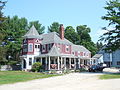
 Chester Street looking East, Chester, NH.jpg 545 × 320; 56 KB
-
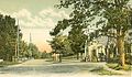
 Chester Street, Chester, NH.jpg 599 × 382; 71 KB
-
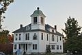 ChesterNH StevensMemorialHall.jpg 1,024 × 680; 218 KB
-
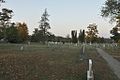 ChesterNH VillageCemetery.jpg 1,024 × 680; 226 KB
-
 Former Chester College of New England, Chester NH.jpg 5,472 × 3,648; 5.13 MB
-
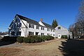
 House in Chester, New Hampshire.jpg 2,048 × 1,536; 1.43 MB
-
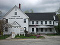 Public Library in Chester, New Hampshire.jpg 2,048 × 1,536; 984 KB
-

-
 Rockingham-Chester-NH.png 600 × 481; 13 KB
-
 Seal of Chester, New Hampshire.svg 458 × 456; 2.31 MB
-
 Storeria dekayi with three quarters (4495801428).jpg 3,502 × 2,625; 687 KB
-
 The Common, Chester, NH.jpg 520 × 314; 42 KB
-
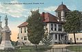 Town Hall & Soldiers' Monument, Chester, NH.jpg 653 × 414; 63 KB
-
 Tsuga canadensis foliage Chester NH.jpg 4,000 × 3,000; 6.34 MB


.jpg)


