Category:Cockenzie power station
Jump to navigation
Jump to search
| Object location | | View all coordinates using: OpenStreetMap |
|---|
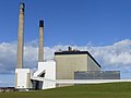
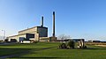
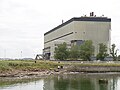
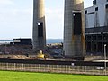
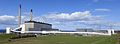
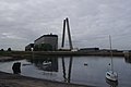
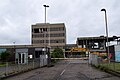
former coal-fired power station in East Lothian, Scotland, UK  | |||||
| Upload media | |||||
| Instance of | |||||
|---|---|---|---|---|---|
| Location | East Lothian, Scotland | ||||
| Operator |
| ||||
| Service entry |
| ||||
| Service retirement |
| ||||
| Inception |
| ||||
| Nominal power capacity |
| ||||
 | |||||
Subcategories
This category has only the following subcategory.
A
- Ash lagoons, Levenhall Links (24 F)
Media in category "Cockenzie power station"
The following 200 files are in this category, out of 287 total.
(previous page) (next page)-
 A power station and its waste ash - geograph.org.uk - 1569105.jpg 640 × 424; 49 KB
-
 Admin. block, Cockenzie power station - geograph.org.uk - 4644611.jpg 800 × 534; 348 KB
-
 Administration block, Cockenzie Power Station - geograph.org.uk - 5252535.jpg 1,024 × 683; 303 KB
-
 After the chimneys - geograph.org.uk - 4850541.jpg 1,024 × 683; 246 KB
-
 Back of Cockenzie power station - geograph.org.uk - 3428230.jpg 640 × 360; 217 KB
-
 Base of the big chimney - geograph.org.uk - 188495.jpg 480 × 640; 59 KB
-
 Being taken apart - geograph.org.uk - 3516286.jpg 1,280 × 853; 381 KB
-
 BF405 Beulah - geograph.org.uk - 831480.jpg 640 × 480; 73 KB
-
 Big tank of oxygen - geograph.org.uk - 4850523.jpg 1,024 × 683; 390 KB
-
 Boiler house, Cockenzie Power Station - geograph.org.uk - 3516269.jpg 1,280 × 853; 212 KB
-
 Bottom of the Garden (4673984461).jpg 1,280 × 720; 106 KB
-
 Box meeting Gala Parade (17222136146).jpg 12,172 × 1,980; 15.66 MB
-

-
 Calm air, Cockenzie power station - geograph.org.uk - 1722808.jpg 359 × 640; 32 KB
-
 Chimney remains - geograph.org.uk - 4850571.jpg 640 × 427; 91 KB
-
 Chimneys meet - geograph.org.uk - 4677720.jpg 800 × 535; 86 KB
-
 Chimneys, Cockenzie Power Station - geograph.org.uk - 4343251.jpg 800 × 533; 144 KB
-
 Chimneys, Cockenzie power station - geograph.org.uk - 4643593.jpg 534 × 800; 48 KB
-
 Chimneys, Cockenzie power station - geograph.org.uk - 4644545.jpg 800 × 1,199; 656 KB
-
 Coal conveyor - geograph.org.uk - 164376.jpg 640 × 480; 77 KB
-
 Coal conveyor - geograph.org.uk - 164400.jpg 640 × 480; 79 KB
-
 Coal conveyor - geograph.org.uk - 642059.jpg 639 × 394; 70 KB
-
 Coal conveyor - geograph.org.uk - 930841.jpg 640 × 480; 82 KB
-
 Coal conveyor - geograph.org.uk - 930843.jpg 480 × 640; 114 KB
-
 Coal empties depart Cockenzie - geograph.org.uk - 946299.jpg 640 × 428; 75 KB
-
 Coal for electricity at Cockenzie - geograph.org.uk - 942328.jpg 640 × 480; 48 KB
-
 Coal from Blindwells open cast - geograph.org.uk - 944034.jpg 640 × 429; 92 KB
-
 Coal terminal, Cockenzie - geograph.org.uk - 410637.jpg 640 × 451; 52 KB
-
 Coastal East Lothian , Detonation - geograph.org.uk - 4676457.jpg 1,200 × 1,600; 153 KB
-
 Coastal East Lothian , Dustcloud - geograph.org.uk - 4676488.jpg 1,600 × 1,200; 150 KB
-
 Coastal East Lothian , Falling Chimneys At Cockenzie - geograph.org.uk - 4676480.jpg 1,200 × 1,600; 133 KB
-
 Coastal East Lothian , Impact - geograph.org.uk - 4676484.jpg 1,200 × 1,600; 148 KB
-
 Coastal East Lothian , Office Awayday - geograph.org.uk - 4677880.jpg 1,600 × 1,200; 209 KB
-
 Coastal East Lothian , Waiting - geograph.org.uk - 4677840.jpg 1,600 × 1,200; 245 KB
-
 Coastal grassland at Prestongrange - geograph.org.uk - 1119811.jpg 640 × 480; 34 KB
-
 Cockenzie - geograph.org.uk - 74999.jpg 640 × 475; 47 KB
-
 Cockenzie cloud - geograph.org.uk - 299203.jpg 640 × 480; 16 KB
-
 Cockenzie demolition.jpg 3,791 × 2,034; 1.62 MB
-
 Cockenzie Harbour and power station - geograph.org.uk - 1654850.jpg 640 × 480; 76 KB
-
 Cockenzie Power Station (14395743863).jpg 3,506 × 2,337; 1.61 MB
-
 Cockenzie Power Station (16481314943).jpg 3,648 × 5,472; 5.51 MB
-
 Cockenzie Power Station (16481318093).jpg 5,294 × 3,538; 5.53 MB
-
 Cockenzie Power Station (16499606073).jpg 3,648 × 5,472; 4.86 MB
-
 Cockenzie Power Station (16526930194).jpg 3,639 × 3,639; 2.02 MB
-
 Cockenzie Power Station (16529156273).jpg 3,640 × 5,459; 6.41 MB
-
 Cockenzie Power Station (16625650244).jpg 3,648 × 5,472; 2.98 MB
-
 Cockenzie Power Station (16894082387).jpg 5,472 × 3,648; 3.39 MB
-
 Cockenzie Power Station (16894084417).jpg 3,583 × 3,583; 2.1 MB
-
 Cockenzie Power Station (16912364457).jpg 4,988 × 4,989; 15.48 MB
-
 Cockenzie Power Station (16912382657).jpg 3,648 × 5,472; 2.89 MB
-
 Cockenzie Power Station (17060349728).jpg 3,648 × 5,472; 3.27 MB
-
 Cockenzie Power Station (17061912199).jpg 5,464 × 3,217; 2.48 MB
-
 Cockenzie Power Station (17100005562).jpg 24,619 × 7,648; 66.28 MB
-
 Cockenzie Power Station (17118222432).jpg 3,648 × 5,472; 2.77 MB
-
 Cockenzie Power Station (17119116241).jpg 3,648 × 5,472; 3.23 MB
-
 Cockenzie Power Station (17119768115).jpg 3,648 × 5,472; 3.72 MB
-
 Cockenzie Power Station (17149336215).jpg 3,647 × 3,647; 2.62 MB
-
 Cockenzie Power Station (20411848098).jpg 3,648 × 2,052; 2.31 MB
-
 Cockenzie Power Station (20852753154).jpg 3,264 × 3,264; 594 KB
-
 Cockenzie Power Station (20854360343).jpg 4,928 × 3,264; 1.18 MB
-
 Cockenzie Power Station (20854362293).jpg 3,264 × 3,264; 954 KB
-
 Cockenzie Power Station (21464437602).jpg 4,928 × 2,664; 800 KB
-
 Cockenzie Power Station (21475447655).jpg 3,264 × 3,264; 1.95 MB
-
 Cockenzie Power Station (21484048561).jpg 4,928 × 3,264; 1.32 MB
-
 Cockenzie Power Station (5385673542).jpg 4,928 × 3,264; 1.68 MB
-
 Cockenzie Power Station (geograph 3181302).jpg 3,264 × 2,448; 3.04 MB
-
 Cockenzie Power Station - boiler house - geograph.org.uk - 4850564.jpg 1,024 × 683; 226 KB
-
 Cockenzie power station - demolition - geograph.org.uk - 4644586.jpg 800 × 534; 390 KB
-
 Cockenzie power station - demolition - geograph.org.uk - 4657886.jpg 800 × 600; 391 KB
-
 Cockenzie power station - demolition day - geograph.org.uk - 4674249.jpg 800 × 534; 172 KB
-
 Cockenzie power station - further demolition - geograph.org.uk - 4733625.jpg 1,024 × 683; 207 KB
-
 Cockenzie Power Station - geograph.org.uk - 1031032.jpg 640 × 480; 36 KB
-
 Cockenzie power station - geograph.org.uk - 163066.jpg 640 × 480; 70 KB
-
 Cockenzie Power Station - geograph.org.uk - 180958.jpg 640 × 480; 21 KB
-
 Cockenzie power station - geograph.org.uk - 188537.jpg 640 × 480; 56 KB
-
 Cockenzie power station - geograph.org.uk - 2182433.jpg 640 × 359; 88 KB
-
 Cockenzie Power Station - geograph.org.uk - 2951996.jpg 640 × 480; 38 KB
-
 Cockenzie power station - geograph.org.uk - 2956541.jpg 640 × 480; 216 KB
-
 Cockenzie power station - geograph.org.uk - 3428237.jpg 640 × 360; 209 KB
-
 Cockenzie power station - geograph.org.uk - 3428239.jpg 640 × 389; 203 KB
-
 Cockenzie Power Station - geograph.org.uk - 347414.jpg 480 × 640; 50 KB
-
 Cockenzie Power Station - geograph.org.uk - 3516536.jpg 853 × 1,280; 226 KB
-
 Cockenzie Power Station - geograph.org.uk - 3543023.jpg 4,481 × 3,054; 4.58 MB
-
 Cockenzie power station - geograph.org.uk - 3636574.jpg 640 × 360; 223 KB
-
 Cockenzie Power Station - geograph.org.uk - 3902661.jpg 1,600 × 587; 121 KB
-
 Cockenzie Power Station - geograph.org.uk - 3902664.jpg 640 × 480; 37 KB
-
 Cockenzie Power Station - geograph.org.uk - 3902674.jpg 640 × 480; 39 KB
-
 Cockenzie power station - geograph.org.uk - 3908589.jpg 640 × 360; 166 KB
-
 Cockenzie Power Station - geograph.org.uk - 4159457.jpg 800 × 1,457; 605 KB
-
 Cockenzie Power Station - geograph.org.uk - 4210342.jpg 800 × 600; 313 KB
-
 Cockenzie power station - geograph.org.uk - 4215065.jpg 800 × 450; 307 KB
-
 Cockenzie power station - geograph.org.uk - 4256688.jpg 800 × 600; 310 KB
-
 Cockenzie power station - geograph.org.uk - 4256691.jpg 800 × 600; 363 KB
-
 Cockenzie power station - geograph.org.uk - 4256695.jpg 800 × 600; 371 KB
-
 Cockenzie power station - geograph.org.uk - 4290060.jpg 800 × 450; 260 KB
-
 Cockenzie power station - geograph.org.uk - 4306057.jpg 800 × 533; 291 KB
-
 Cockenzie power station - geograph.org.uk - 4314023.jpg 800 × 1,201; 679 KB
-
 Cockenzie power station - geograph.org.uk - 4314337.jpg 800 × 533; 297 KB
-
 Cockenzie Power Station - geograph.org.uk - 4343145.jpg 800 × 450; 81 KB
-
 Cockenzie Power Station - geograph.org.uk - 4507617.jpg 2,048 × 1,536; 683 KB
-
 Cockenzie power station - geograph.org.uk - 4657904.jpg 800 × 450; 318 KB
-
 Cockenzie power station - geograph.org.uk - 4666431.jpg 800 × 534; 290 KB
-
 Cockenzie power station - geograph.org.uk - 4702502.jpg 800 × 600; 380 KB
-
 Cockenzie Power Station - geograph.org.uk - 662447.jpg 640 × 480; 62 KB
-

-

-
 Cockenzie power station after closure - geograph.org.uk - 3415317.jpg 640 × 480; 236 KB
-
 Cockenzie power station after closure - geograph.org.uk - 3415325.jpg 640 × 480; 270 KB
-

-

-

-

-
 Cockenzie Power Station Demolition (21544577080).jpg 4,928 × 3,264; 779 KB
-
 Cockenzie Power Station Demolition (21545707919).jpg 4,758 × 11,592; 2.75 MB
-
 Cockenzie Power Station Demolition (21706470456).jpg 4,928 × 3,264; 770 KB
-
 Cockenzie Power Station Demolition (21721008682).jpg 4,928 × 3,264; 803 KB
-
 Cockenzie Power Station Demolition (21721008982).jpg 4,928 × 3,264; 801 KB
-
 Cockenzie Power Station Demolition (21721009102).jpg 4,928 × 3,264; 817 KB
-
 Cockenzie Power Station Demolition (21732553465).jpg 4,928 × 3,264; 734 KB
-
 Cockenzie Power Station Demolition (21741887661).jpg 4,928 × 3,264; 803 KB
-
 Cockenzie power station demolition - geograph.org.uk - 3955638.jpg 640 × 480; 235 KB
-
 Cockenzie power station demolition - geograph.org.uk - 4209392.jpg 800 × 600; 392 KB
-
 Cockenzie Power station demolition.jpg 4,000 × 6,016; 2.52 MB
-

-

-

-

-

-

-

-

-

-

-

-
 Cockenzie power station during demolition - geograph.org.uk - 4765094.jpg 1,024 × 683; 221 KB
-
 Cockenzie power station during demolition - geograph.org.uk - 4765096.jpg 1,024 × 683; 306 KB
-
 Cockenzie power station during demolition - geograph.org.uk - 4765097.jpg 1,024 × 683; 343 KB
-
 Cockenzie Power Station during demolition - geograph.org.uk - 4850547.jpg 1,024 × 683; 262 KB
-
 Cockenzie Power Station during demolition - geograph.org.uk - 4850566.jpg 1,024 × 683; 370 KB
-
 Cockenzie Power Station during demolition - geograph.org.uk - 4965479.jpg 1,024 × 768; 230 KB
-

-
 Cockenzie power station during demolition - geograph.org.uk - 5128055.jpg 1,024 × 683; 225 KB
-

-

-

-

-
 Cockenzie Power Station from the harbour - geograph.org.uk - 3516575.jpg 836 × 1,280; 259 KB
-
 Cockenzie Power Station in East Lothian.JPG 3,198 × 2,351; 2.98 MB
-
 Cockenzie Power Station jetty - geograph.org.uk - 3516522.jpg 1,280 × 853; 283 KB
-
 Cockenzie Power Station Pier (16526881704).jpg 14,561 × 3,050; 22.83 MB
-
 Cockenzie Power Station Pier (16963121779).jpg 3,616 × 5,424; 3.88 MB
-
 Cockenzie Power Station Pier (17119770375).jpg 3,634 × 3,634; 2.12 MB
-
 Cockenzie Power Station pier - geograph.org.uk - 3512413.jpg 1,280 × 853; 167 KB
-
 Cockenzie Power Station pier - geograph.org.uk - 942291.jpg 640 × 480; 46 KB
-
 Cockenzie Power Station Pier Brick (16961537998).jpg 5,352 × 3,568; 4.89 MB
-
 Cockenzie Power Station pre-demolition.jpg 6,016 × 4,000; 3.69 MB
-
 Cockenzie power station railhead - geograph.org.uk - 791080.jpg 640 × 480; 80 KB
-

-

-
 Cockenzie Power Station site during demolition - geograph.org.uk - 5252528.jpg 1,024 × 683; 319 KB
-
 Cockenzie power station tranent.jpg 2,448 × 2,448; 1.99 MB
-

-
 Cockenzie Power Station, East Lothian - geograph.org.uk - 663112.jpg 640 × 480; 43 KB
-
 Cockenzie Power Station, East Lothian.JPG 4,608 × 1,690; 2.4 MB
-
 Cockenzie Power Station, from North Bridge Edinburgh.jpg 800 × 525; 137 KB
-
 Cockenzie power station, SW elevation - geograph.org.uk - 188558.jpg 480 × 640; 70 KB
-
 Cockenzie Power Station. - geograph.org.uk - 101449.jpg 637 × 461; 62 KB
-
 Cockenzie power station. - geograph.org.uk - 135142.jpg 638 × 466; 46 KB
-
 Cockenzie Power Station. - geograph.org.uk - 59995.jpg 640 × 480; 39 KB
-
 Cockenzie Power station.jpg 640 × 463; 53 KB
-
 Cockenzie, the lums come down - geograph.org.uk - 4674305.jpg 1,024 × 685; 87 KB
-
 Conveyor, Cockenzie power station - geograph.org.uk - 3415297.jpg 640 × 480; 223 KB
-
 Conveyor, Cockenzie power station - geograph.org.uk - 3415303.jpg 640 × 480; 300 KB
-
 Conveyor, Cockenzie power station - geograph.org.uk - 3817268.jpg 640 × 480; 229 KB
-
 Decommissioning Cockenzie Power Station - geograph.org.uk - 4186847.jpg 800 × 600; 401 KB
-
 Decommissioning Cockenzie Power Station - geograph.org.uk - 4186850.jpg 800 × 600; 444 KB
-
 Demolition contractors sign - geograph.org.uk - 3415313.jpg 640 × 480; 350 KB
-
 Demolition of Cockenzie power station - geograph.org.uk - 4643168.jpg 800 × 534; 363 KB
-
 Demolition of Cockenzie power station - geograph.org.uk - 4643581.jpg 800 × 534; 380 KB
-
 Demolition of Cockenzie power station - geograph.org.uk - 4644555.jpg 800 × 534; 347 KB
-
 Demolition of Cockenzie power station - geograph.org.uk - 4644594.jpg 800 × 534; 405 KB
-
 Demolition of Cockenzie power station - geograph.org.uk - 4644601.jpg 800 × 534; 445 KB
-
 Demolition of Cockenzie power station - geograph.org.uk - 4644607.jpg 800 × 534; 403 KB
-
 Demolition of Cockenzie Power Station - geograph.org.uk - 5252512.jpg 1,024 × 683; 254 KB
-
 Demolition of Cockenzie Power Station - geograph.org.uk - 5252516.jpg 1,024 × 683; 326 KB
-
 Demolition of Cockenzie Power Station - geograph.org.uk - 5252526.jpg 1,024 × 683; 346 KB
-
 Demolition work at Cockenzie Power Station - geograph.org.uk - 5070045.jpg 1,024 × 682; 124 KB
-
 Demolition, Cockenzie Power Station (geograph 4849430).jpg 1,024 × 685; 186 KB
-
 Demolition, Cockenzie power station - geograph.org.uk - 3621498.jpg 640 × 480; 254 KB
-
 Demolition, Cockenzie power station - geograph.org.uk - 3621502.jpg 640 × 480; 234 KB
-
 Demolition, Cockenzie power station - geograph.org.uk - 3621518.jpg 640 × 480; 265 KB
-
 Demolition, Cockenzie power station - geograph.org.uk - 3621531.jpg 480 × 640; 82 KB
-
 Demolition, Cockenzie power station - geograph.org.uk - 3789872.jpg 640 × 480; 221 KB
-
 Demolition, Cockenzie power station - geograph.org.uk - 4302623.jpg 800 × 533; 373 KB
-
 Demolition, Cockenzie power station - geograph.org.uk - 4306052.jpg 800 × 533; 327 KB
-
 Demolition, Cockenzie power station - geograph.org.uk - 4306053.jpg 800 × 533; 386 KB
-
 Demolition, Cockenzie power station - geograph.org.uk - 4313352.jpg 800 × 533; 318 KB
-
 Demolition, Cockenzie power station - geograph.org.uk - 4313353.jpg 800 × 533; 418 KB
-
 Demolition, Cockenzie power station - geograph.org.uk - 4314026.jpg 800 × 533; 375 KB
-
 Demolition, Cockenzie power station - geograph.org.uk - 4314028.jpg 800 × 533; 380 KB


.jpg)


.jpg)
.jpg)
.jpg)
.jpg)
.jpg)
.jpg)
.jpg)
.jpg)
.jpg)
.jpg)
.jpg)
.jpg)
.jpg)
.jpg)
.jpg)
.jpg)
.jpg)
.jpg)
.jpg)
.jpg)
.jpg)
.jpg)
.jpg)
.jpg)
.jpg)
.jpg)


.jpg)


.jpg)
.jpg)
.jpg)
.jpg)
.jpg)
.jpg)
.jpg)


.jpg)
.jpg)


.jpg)


.jpg)


.jpg)
.jpg)
.jpg)
.jpg)