Category:Countesthorpe
Aller à la navigation
Aller à la recherche
English: Countesthorpe is a large village and civil parish in the Leicestershire district of Blaby, with a population of 6,393 (2001 census). It lies to the south of Leicester, and is about six miles from the city centre, but only two miles south of the suburb of South Wigston. Nearby places are Blaby and South Wigston to the north, Kilby to the east, Peatling Magna and Willoughby Waterleys to the south, and Broughton Astley, Cosby and Whetstone to the west. According to the 1066 census it had a population of 6.
Italiano: Countesthorpe è un paese di 6.393 abitanti della contea del Leicestershire, in Inghilterra.
localité britannique du comté anglais de Leicestershire  | |||||
| Téléverser des médias | |||||
| Nature de l’élément | |||||
|---|---|---|---|---|---|
| Lieu | Blaby, Leicestershire, Midlands de l'Est, Angleterre | ||||
| Réputé identique à | Countesthorpe (page en doublon, paroisse civile) | ||||
| site officiel | |||||
 | |||||
Sous-catégories
Cette catégorie comprend seulement la sous-catégorie ci-dessous.
A
Média dans la catégorie « Countesthorpe »
Cette catégorie comprend 133 fichiers, dont les 133 ci-dessous.
-
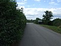
 Bambury Lane - geograph.org.uk - 3911260.jpg 640 × 480 ; 98 kio
-
 Bridleway from Countesthorpe to Westdale Farm - geograph.org.uk - 5630320.jpg 4 000 × 3 000 ; 1 Mio
-
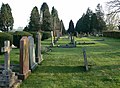 Cemetery in Countesthorpe near Leicester - geograph.org.uk - 401137.jpg 640 × 469 ; 122 kio
-
 Church of St Andrew, Countesthorpe - geograph.org.uk - 2573048.jpg 4 000 × 3 000 ; 2,85 Mio
-
 Church Street in Countesthorpe - geograph.org.uk - 5529877.jpg 566 × 800 ; 136 kio
-
 Church Street in Countesthorpe - geograph.org.uk - 5627322.jpg 759 × 800 ; 130 kio
-
 Cosby Road towards Countesthorpe - geograph.org.uk - 2422295.jpg 3 045 × 2 135 ; 3,07 Mio
-
 Cosby Road, Countesthorpe - geograph.org.uk - 3911282.jpg 640 × 480 ; 84 kio
-
 Countesthorpe - Church Street - geograph.org.uk - 2295815.jpg 640 × 480 ; 49 kio
-

-
 Countesthorpe -The Square - geograph.org.uk - 2296791.jpg 640 × 455 ; 66 kio
-
 Countesthorpe Axe ^ Square - geograph.org.uk - 2978609.jpg 640 × 480 ; 177 kio
-
 Countesthorpe Cemetery - geograph.org.uk - 3988120.jpg 1 024 × 768 ; 256 kio
-
 Countesthorpe Church - geograph.org.uk - 2296769.jpg 640 × 480 ; 87 kio
-
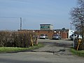
 Countesthorpe Community College - geograph.org.uk - 5529908.jpg 800 × 404 ; 73 kio
-
 Countesthorpe near Leicester - geograph.org.uk - 401134.jpg 640 × 560 ; 83 kio
-
 Countesthorpe Post Office - geograph.org.uk - 3911307.jpg 640 × 480 ; 62 kio
-
 Countesthorpe Railway Inn geograph-3321766-by-Ben-Brooksbank.jpg 2 328 × 1 315 ; 2,73 Mio
-
 Countesthorpe village sign - geograph.org.uk - 3675013.jpg 1 600 × 1 118 ; 532 kio
-
 Countesthorpe-Bambury Lane - geograph.org.uk - 3988105.jpg 1 024 × 768 ; 152 kio
-
 Countesthorpe-Station Road - geograph.org.uk - 2295795.jpg 640 × 480 ; 58 kio
-
 Countesthorpe-Station Road - geograph.org.uk - 2297329.jpg 640 × 480 ; 58 kio
-
 Countesthorpe-Station Road - geograph.org.uk - 2302875.jpg 640 × 480 ; 78 kio
-
 Countesthorpe-The Bull's Head - geograph.org.uk - 2293463.jpg 640 × 505 ; 71 kio
-
 Countesthorpe-The Railway Inn - geograph.org.uk - 2302886.jpg 640 × 480 ; 65 kio
-
 Cricket ground near Countesthorpe - geograph.org.uk - 230039.jpg 640 × 427 ; 94 kio
-
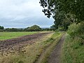
 Crop field off Willoughby Road - geograph.org.uk - 3911257.jpg 640 × 480 ; 71 kio
-
 Dale Acre in Countesthorpe - geograph.org.uk - 5544280.jpg 800 × 407 ; 114 kio
-
 Entering Countesthorpe - geograph.org.uk - 3911268.jpg 640 × 480 ; 98 kio
-
 Entering Countesthorpe on Cycle Route 6 - geograph.org.uk - 2572986.jpg 4 000 × 3 000 ; 2,81 Mio
-
 Entrance to Countesthorpe - geograph.org.uk - 3820343.jpg 640 × 468 ; 82 kio
-
 Farmland off Peatling Lane - geograph.org.uk - 213045.jpg 640 × 427 ; 101 kio
-
 Farmland on the eastern edge of Countesthorpe - geograph.org.uk - 5627921.jpg 800 × 476 ; 115 kio
-
 Farmland on the edge of Countesthorpe - geograph.org.uk - 5529887.jpg 800 × 455 ; 86 kio
-
 Farmland south of Bambury Lane - geograph.org.uk - 2430216.jpg 3 264 × 2 448 ; 3,92 Mio
-
 Field entrance off Willoughby Road - geograph.org.uk - 3911274.jpg 640 × 480 ; 62 kio
-
 Footpath from Linden Farm Drive to Winchester Road - geograph.org.uk - 5249270.jpg 2 000 × 1 500 ; 524 kio
-
 Footpath near Countesthorpe - geograph.org.uk - 4965605.jpg 1 920 × 1 080 ; 656 kio
-
 Footpath on the edge of Countesthorpe - geograph.org.uk - 5349014.jpg 800 × 607 ; 155 kio
-
 Foston Road near Glebe Garden Centre - geograph.org.uk - 2885301.jpg 2 558 × 2 266 ; 2,32 Mio
-
 Foston Road towards Countesthorpe - geograph.org.uk - 2885345.jpg 2 631 × 2 201 ; 2,19 Mio
-
 Garden centre near Countesthorpe - geograph.org.uk - 4343676.jpg 640 × 480 ; 97 kio
-
 Gate along the bridleway near Countesthorpe - geograph.org.uk - 5532550.jpg 800 × 585 ; 142 kio
-
 Glebe Drive in Countesthorpe - geograph.org.uk - 5558586.jpg 800 × 582 ; 133 kio
-
 Grass snake - geograph.org.uk - 2484445.jpg 1 842 × 1 872 ; 1,57 Mio
-
 Grazing horse east of Countesthorpe - geograph.org.uk - 2885335.jpg 1 997 × 2 030 ; 1,52 Mio
-
 Green space on Iona Way in Countesthorpe - geograph.org.uk - 5529881.jpg 800 × 450 ; 125 kio
-
 Gwendoline Drive, Countesthorpe - geograph.org.uk - 4965609.jpg 1 920 × 1 080 ; 614 kio
-
 Heads up - geograph.org.uk - 341673.jpg 640 × 480 ; 85 kio
-
 Hoffler Close in Countesthorpe - geograph.org.uk - 5558601.jpg 800 × 426 ; 119 kio
-
 House on Cosby Road, Countesthorpe - geograph.org.uk - 3911285.jpg 640 × 480 ; 94 kio
-
 Houses on Winchester Road, Countesthorpe - geograph.org.uk - 3911289.jpg 640 × 480 ; 73 kio
-
 Jubilee Way in Countesthorpe - geograph.org.uk - 5527521.jpg 800 × 427 ; 71 kio
-
 Leaving Countesthorpe - geograph.org.uk - 3912115.jpg 640 × 480 ; 72 kio
-
 Leicester Road - geograph.org.uk - 3912116.jpg 640 × 480 ; 65 kio
-
 Leicester Road - geograph.org.uk - 4703288.jpg 2 000 × 1 500 ; 311 kio
-
 Leysland Avenue in Countesthorpe - geograph.org.uk - 5558607.jpg 800 × 544 ; 110 kio
-
 Leysland High School, Countesthorpe - geograph.org.uk - 3911295.jpg 640 × 480 ; 46 kio
-
 Linden Avenue in Countesthorpe - geograph.org.uk - 5552010.jpg 800 × 491 ; 128 kio
-
 Linden Avenue in Countesthorpe - geograph.org.uk - 5552012.jpg 587 × 800 ; 197 kio
-
 Linden Avenue, Countesthorpe - geograph.org.uk - 230086.jpg 640 × 427 ; 139 kio
-
 Mammatus clouds over east Leicestershire - geograph.org.uk - 5974083.jpg 640 × 431 ; 45 kio
-
 Map of Countesthorpe village.png 686 × 500 ; 178 kio
-
 Meadows Sports Ground - geograph.org.uk - 2484581.jpg 2 625 × 2 034 ; 2,04 Mio
-
 National Cycle Route 6 - geograph.org.uk - 3911264.jpg 1 055 × 826 ; 292 kio
-
 New houses at Thorpe Meadows in Countesthorpe - geograph.org.uk - 4247197.jpg 1 600 × 1 037 ; 337 kio
-
 New housing on Jubilee Way in Countesthorpe - geograph.org.uk - 5532585.jpg 800 × 517 ; 98 kio
-
 Path on the edge of Countesthorpe - geograph.org.uk - 5489242.jpg 800 × 505 ; 107 kio
-
 Peatling Road - geograph.org.uk - 4343669.jpg 640 × 480 ; 69 kio
-
 Peatling Road south of Countesthorpe - geograph.org.uk - 2484459.jpg 2 816 × 1 737 ; 2,26 Mio
-
 Poplar Avenue in Countesthorpe - geograph.org.uk - 5527640.jpg 800 × 497 ; 138 kio
-
 Postbox on Rosebank Road in Countesthorpe - geograph.org.uk - 5428388.jpg 800 × 450 ; 102 kio
-
 Public bridleway to Hospital Lane, Blaby - geograph.org.uk - 5532565.jpg 800 × 597 ; 150 kio
-
 Public footpath on the edge of Countesthorpe - geograph.org.uk - 5627919.jpg 800 × 513 ; 140 kio
-
 Public footpath to the Grand Union Canal - geograph.org.uk - 2484474.jpg 3 264 × 2 448 ; 3,62 Mio
-
 Ridleys Close in Countesthorpe - geograph.org.uk - 5489248.jpg 800 × 509 ; 85 kio
-
 Rosebank Road in Countesthorpe - geograph.org.uk - 5529891.jpg 800 × 408 ; 99 kio
-
 Saint Andrew's, Countesthorpe - geograph.org.uk - 5863113.jpg 1 600 × 900 ; 502 kio
-
 Sambury Farm near Countesthorpe - geograph.org.uk - 645874.jpg 640 × 452 ; 82 kio
-
 Sheds, garden centre near Countesthorpe - geograph.org.uk - 4343678.jpg 640 × 480 ; 80 kio
-
 Shops on Wigston Street in Countesthorpe - geograph.org.uk - 5550010.jpg 800 × 529 ; 77 kio
-
 View from St Andrew's Church yard. - geograph.org.uk - 230111.jpg 640 × 427 ; 134 kio
-
 St Andrew's Church in Countesthorpe - geograph.org.uk - 5592706.jpg 800 × 553 ; 147 kio
-
 St Andrew's Church in Countesthorpe - geograph.org.uk - 5592709.jpg 800 × 458 ; 115 kio
-
 St Andrew's Church, Countesthorpe - geograph.org.uk - 3911310.jpg 1 017 × 767 ; 216 kio
-
 Station Road in Countesthorpe - geograph.org.uk - 5494050.jpg 800 × 512 ; 101 kio
-
 Station Road, Countesthorpe - geograph.org.uk - 2573022.jpg 4 000 × 3 000 ; 2,89 Mio
-
 Stream on the edge of Countesthorpe - geograph.org.uk - 5974125.jpg 499 × 640 ; 85 kio
-
 Stubble field near Countesthorpe - geograph.org.uk - 4343661.jpg 640 × 480 ; 74 kio
-
 Tesco Express - geograph.org.uk - 3675051.jpg 1 600 × 1 206 ; 455 kio
-
 Tesco Express, Countesthorpe - geograph.org.uk - 3912101.jpg 640 × 480 ; 73 kio
-
 The Axe and Square - geograph.org.uk - 4699039.jpg 800 × 600 ; 70 kio
-
 The Axe and Square pub, Countesthorpe - geograph.org.uk - 3912110.jpg 640 × 480 ; 50 kio
-
 The Bulls Head, Countesthorpe - geograph.org.uk - 4343673.jpg 640 × 480 ; 72 kio
-
 The Main Street of Countesthorpe - geograph.org.uk - 5430540.jpg 800 × 597 ; 107 kio
-
 The Manor House in Countesthorpe - geograph.org.uk - 5592711.jpg 800 × 440 ; 86 kio
-
 The Manor House, Countesthorpe - geograph.org.uk - 2573058.jpg 4 000 × 3 000 ; 2,94 Mio
-
 The Meadows Sports Ground - geograph.org.uk - 3912112.jpg 640 × 480 ; 65 kio
-
 The Railway pub, Countesthorpe - geograph.org.uk - 3911305.jpg 640 × 480 ; 53 kio
-
 The Square, Countesthorpe - geograph.org.uk - 4965612.jpg 1 920 × 1 080 ; 631 kio
-

-
 Tree along Scotland Way in Countesthorpe - geograph.org.uk - 5627326.jpg 800 × 492 ; 126 kio
-
 Trees along Springwell Drive in Countesthorpe - geograph.org.uk - 5620249.jpg 800 × 492 ; 167 kio
-
 Tributary of the River Sence - geograph.org.uk - 5664409.jpg 2 506 × 1 955 ; 1,7 Mio
-
 Welcome to Countesthorpe - geograph.org.uk - 509433.jpg 640 × 407 ; 94 kio
-
 Wheatlands Drive in Countesthorpe - geograph.org.uk - 5550019.jpg 800 × 432 ; 109 kio
-
 Wild flowers beside Peatling Road - geograph.org.uk - 4343665.jpg 640 × 480 ; 126 kio
-
 Willoughby Road - geograph.org.uk - 3911277.jpg 640 × 480 ; 126 kio
-
 Willoughby Road enters Countesthorpe - geograph.org.uk - 5911209.jpg 4 000 × 3 000 ; 3,22 Mio
-
 Winchester Road near Countesthorpe - geograph.org.uk - 509519.jpg 548 × 640 ; 150 kio
-
 Winchester Road, Countesthorpe - geograph.org.uk - 509506.jpg 640 × 480 ; 118 kio
-
 Approaching Countesthorpe along Peatling Road - geograph.org.uk - 229458.jpg 640 × 521 ; 119 kio
-
 Cosby Road near Countesthorpe - geograph.org.uk - 509438.jpg 640 × 475 ; 108 kio
-
 Cosby Road, Countesthorpe - geograph.org.uk - 509448.jpg 640 × 510 ; 124 kio
-
 Countesthorpe Baptist Church - geograph.org.uk - 229457.jpg 576 × 640 ; 96 kio
-
 Countesthorpe Community College - geograph.org.uk - 509489.jpg 640 × 475 ; 116 kio
-
 Farm on Bambury Lane near Countesthorpe - geograph.org.uk - 164793.jpg 640 × 427 ; 125 kio
-
 Farm road off Hospital Lane - geograph.org.uk - 230057.jpg 640 × 427 ; 116 kio
-
 Farmland off Bambury Lane - geograph.org.uk - 164794.jpg 640 × 427 ; 120 kio
-
 Farmland off Hill Lane near Countesthorpe - geograph.org.uk - 164796.jpg 640 × 427 ; 117 kio
-
 Foston Lane looking eastwards - geograph.org.uk - 229460.jpg 640 × 480 ; 71 kio
-
 Foston Lane looking westwards - geograph.org.uk - 229461.jpg 640 × 480 ; 70 kio
-
 Foston Lane, Countesthorpe - geograph.org.uk - 230126.jpg 640 × 427 ; 117 kio
-
 Foston Lane, Countesthorpe - geograph.org.uk - 230133.jpg 640 × 427 ; 105 kio
-

-
 Hill Lane near Countesthorpe - geograph.org.uk - 164795.jpg 640 × 427 ; 214 kio
-
 Hill Lane near Countesthorpe, Leicestershire - geograph.org.uk - 164908.jpg 640 × 427 ; 146 kio
-
 Hospital Lane, near Countesthorpe - geograph.org.uk - 230052.jpg 640 × 427 ; 115 kio
-
 Memorial Hall - geograph.org.uk - 229459.jpg 515 × 640 ; 71 kio
-
 Peatling Lane near Countesthorpe - geograph.org.uk - 213048.jpg 640 × 427 ; 72 kio
-
 Peatling Road towards Countesthorpe - geograph.org.uk - 651196.jpg 640 × 411 ; 76 kio
-
 View along Leicester Road - geograph.org.uk - 418031.jpg 640 × 404 ; 94 kio
-
 Wigston Street, Countesthorpe - geograph.org.uk - 230118.jpg 640 × 427 ; 100 kio


