Category:Craggaunowen Castle
Jump to navigation
Jump to search
| Object location | | View all coordinates using: OpenStreetMap |
|---|
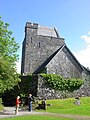
fortified tower house in County Clare, Ireland  | |||||
| Upload media | |||||
| Instance of | |||||
|---|---|---|---|---|---|
| Location | Quin, County Clare, Munster, Ireland | ||||
| Inception |
| ||||
 | |||||
Media in category "Craggaunowen Castle"
The following 7 files are in this category, out of 7 total.
-
 Craggaunowen Castle 2004.jpg 1,200 × 1,600; 445 KB
-
 Craggaunowen tower house - exterior 1.jpg 3,648 × 2,432; 6.09 MB
-
 Craggaunowen tower house - exterior 2.jpg 2,432 × 3,648; 5.53 MB
-
 Craggaunowen tower house - interior 1.jpg 2,432 × 3,648; 3.28 MB
-
 Craggaunowen tower house - interior 2.jpg 2,432 × 3,648; 4.6 MB
-
 Craggaunowen tower house - interior 3.jpg 2,432 × 3,648; 3.27 MB
-
 View from the tower house - Flickr - KHoffmanDC.jpg 1,024 × 768; 1.07 MB


