Category:Dacre, Cumbria
Jump to navigation
Jump to search
English: Dacre is a small village in the Lake District National Park in Cumbria, England, and was historically in Cumberland.
village and civil parish in Cumbria, England, UK  | |||||
| Upload media | |||||
| Instance of | |||||
|---|---|---|---|---|---|
| Location | Eden, Cumbria, North West England, England | ||||
 | |||||
Subcategories
This category has the following 18 subcategories, out of 18 total.
A
B
- Bunkers Hill, Cumbria (2 F)
D
- Spire House, Dacre (3 F)
- Dacre Beck (4 F)
- Dacre Castle (4 F)
- Dalemain (32 F)
- Dunmallard Hill (10 F)
G
- Greystoke Gill (1 F)
N
- Newbiggin, Dacre (10 F)
P
- Penrith Hoard (9 F)
- Pooley Bridge Pier (8 F)
- Pooley Bridge, Pooley Bridge (9 F)
R
- Redhills, Cumbria (3 F)
S
- Soulby, Dacre (5 F)
- Stainton, Eden (7 F)
- Stone carvings in Dacre (14 F)
W
- Waterfoot, Cumbria (1 F)
Media in category "Dacre, Cumbria"
The following 200 files are in this category, out of 360 total.
(previous page) (next page)-
 "Keeping you connected" - geograph.org.uk - 6120133.jpg 640 × 480; 282 KB
-
 A dog walker heads towards Pooley Bridge - geograph.org.uk - 5929061.jpg 1,600 × 1,070; 1,024 KB
-
 A farm in Newbiggin - geograph.org.uk - 4404852.jpg 2,592 × 1,944; 1.28 MB
-
 A favourite haunt of the Bumblebee - geograph.org.uk - 5126299.jpg 800 × 533; 482 KB
-
 A fawn has a quiet scratch by Dalemain - geograph.org.uk - 5069236.jpg 800 × 532; 283 KB
-
 A field near Souland Gate - geograph.org.uk - 2493566.jpg 2,592 × 1,944; 1.76 MB
-
 A full frontal - The Corn Cockle - geograph.org.uk - 5126317.jpg 800 × 615; 231 KB
-
 A Hoverfly feasts on the Leopard's Bane - geograph.org.uk - 5126306.jpg 800 × 537; 193 KB
-
 A pond by the banks of the river Eamont - geograph.org.uk - 5929050.jpg 1,600 × 1,069; 1.09 MB
-
 A steep hill^ Dacre, Lake District. - panoramio.jpg 4,928 × 2,854; 3.77 MB
-

-
 A592 Approaching Ullswater - geograph.org.uk - 2623524.jpg 640 × 427; 245 KB
-
 A66 at Red Hills - geograph.org.uk - 6206528.jpg 2,048 × 1,536; 1.12 MB
-
 A66 by the turning for Newbiggin - geograph.org.uk - 3092741.jpg 800 × 550; 112 KB
-
 A66 by turning for Flusco - geograph.org.uk - 3092764.jpg 640 × 454; 47 KB
-
 A66 eastbound, by the Dacre turning - geograph.org.uk - 3092783.jpg 800 × 523; 73 KB
-
 A66 near Reghed - geograph.org.uk - 3373741.jpg 640 × 480; 429 KB
-

-
 Aldby Farmhouse - 17th Century - geograph.org.uk - 301575.jpg 640 × 480; 173 KB
-
 Alpaca farm - geograph.org.uk - 3012373.jpg 3,008 × 2,000; 885 KB
-

-

-
 An upstream view from the weir on the Eamont - geograph.org.uk - 5929042.jpg 1,600 × 1,067; 1.13 MB
-
 Approaching Clickern - geograph.org.uk - 3093805.jpg 2,592 × 1,944; 1.11 MB
-
 Approaching Dacre Bridge - geograph.org.uk - 3931698.jpg 640 × 480; 342 KB
-
 Approaching Newbiggin from the south - geograph.org.uk - 3093798.jpg 2,592 × 1,944; 1.54 MB
-
 Approaching Red Hills, Penrith - geograph.org.uk - 5170458.jpg 2,545 × 1,909; 1.05 MB
-
 At Waterfoot - geograph.org.uk - 5373129.jpg 1,920 × 1,280; 542 KB
-
 Autumn Oak with Sheep - geograph.org.uk - 1054291.jpg 640 × 427; 248 KB
-
 Autumn Tree - geograph.org.uk - 1054297.jpg 427 × 640; 258 KB
-
 Bargain or what^^ - geograph.org.uk - 5338278.jpg 533 × 800; 81 KB
-
 Barley field off Mile Lane - geograph.org.uk - 5047679.jpg 640 × 480; 267 KB
-
 Baron's Hill, Westbound A66 - geograph.org.uk - 3373749.jpg 640 × 480; 541 KB
-
 Bend in Road - geograph.org.uk - 2623514.jpg 640 × 427; 275 KB
-
 Birkmere Wood - geograph.org.uk - 4866907.jpg 2,592 × 1,944; 1.93 MB
-
 Birth of a Bluebell in Dunmallard - geograph.org.uk - 5342619.jpg 800 × 534; 183 KB
-
 Block Making Plant - geograph.org.uk - 957629.jpg 640 × 425; 46 KB
-
 Braithwaites Garage, Newbiggin - geograph.org.uk - 5047601.jpg 640 × 480; 290 KB
-

-
 Brow Foot at Dacre - geograph.org.uk - 2369356.jpg 2,048 × 1,536; 2.19 MB
-
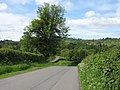
 By-way on Flusco Pike - geograph.org.uk - 1035883.jpg 640 × 480; 101 KB
-
 Car park at Rheged. - geograph.org.uk - 4969428.jpg 640 × 480; 49 KB
-
 Circle of daffodils, the Rheged Centre - geograph.org.uk - 2910574.jpg 640 × 427; 264 KB
-
 Circular path on Dunmallard Hill - geograph.org.uk - 2841144.jpg 800 × 530; 243 KB
-
 Cottages in Dacre near Ullswater - geograph.org.uk - 1458350.jpg 640 × 406; 168 KB
-
 Country road near Greystoke Gill - geograph.org.uk - 5046033.jpg 640 × 480; 336 KB
-
 Crossing the Bailey Bridge at Pooley Bridge - geograph.org.uk - 5170485.jpg 2,592 × 1,944; 1.04 MB
-
 Dacre - geograph.org.uk - 2647603.jpg 640 × 316; 65 KB
-
 Dacre - geograph.org.uk - 3931688.jpg 640 × 480; 346 KB
-
 Dacre - geograph.org.uk - 3931717.jpg 640 × 480; 357 KB
-
 Dacre Bank - geograph.org.uk - 2493533.jpg 2,592 × 1,944; 1.43 MB
-
 Dacre Beck - geograph.org.uk - 2369353.jpg 2,048 × 1,536; 2.83 MB
-
 Dacre Beck - geograph.org.uk - 3931709.jpg 640 × 481; 442 KB
-
 Dacre Beck - geograph.org.uk - 4796524.jpg 640 × 480; 131 KB
-
 Dacre Beck, Dacre - geograph.org.uk - 129769.jpg 640 × 426; 132 KB
-

-
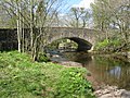
 Dacre Bridge - geograph.org.uk - 1577601.jpg 640 × 480; 139 KB
-
 Dacre Bridge - geograph.org.uk - 2647583.jpg 4,592 × 2,234; 5.56 MB
-
 Dacre Bridge - geograph.org.uk - 3931705.jpg 640 × 480; 354 KB
-
 Dacre Bridge.jpg 800 × 530; 237 KB
-
 Dacre Village Hall and Playpark - geograph.org.uk - 61070.jpg 640 × 480; 121 KB
-
 Dacre village street - geograph.org.uk - 2648226.jpg 800 × 530; 112 KB
-
 Dacre, St. Andrew's Church - geograph.org.uk - 6232340.jpg 6,293 × 4,193; 7.55 MB
-
 Dacre, St. Andrew's Church - geograph.org.uk - 6232342.jpg 6,466 × 4,311; 6.94 MB
-
 Dacre, St. Andrew's Church - geograph.org.uk - 6232343.jpg 5,943 × 3,961; 5.13 MB
-

-

-
 Dacre, St. Andrew's Church, First World War memorial plaque - geograph.org.uk - 6232365.jpg 4,007 × 6,010; 6.54 MB
-
 Dacre, St. Andrew's Church, Nave columns - geograph.org.uk - 6232358.jpg 6,977 × 4,651; 7.32 MB
-

-

-
 Dacre, St. Andrew's Church, The altar - geograph.org.uk - 6232366.jpg 6,613 × 4,409; 7.16 MB
-
 Dacre, St. Andrew's Church, The chancel - geograph.org.uk - 6232351.jpg 6,946 × 4,630; 7.12 MB
-
 Dacre, St. Andrew's Church, The font - geograph.org.uk - 6232360.jpg 6,191 × 4,127; 6.01 MB
-
 Dacre, St. Andrew's Church, The nave - geograph.org.uk - 6232347.jpg 7,241 × 4,826; 6.92 MB
-
 Dacre, St. Andrew's Church, The nave - geograph.org.uk - 6232361.jpg 7,118 × 4,746; 7.31 MB
-
 Dacre, St. Andrew's Church, The pulpit - geograph.org.uk - 6232349.jpg 6,636 × 4,424; 5.87 MB
-
 Dacre, The road leading up to St. Andrew's Church - geograph.org.uk - 6232329.jpg 6,724 × 4,482; 6.88 MB
-
 Dacre.jpg 640 × 480; 103 KB
-
 Dalemain - geograph.org.uk - 2647508.jpg 4,573 × 2,065; 4.15 MB
-
 Dalemain from the garden - geograph.org.uk - 5355110.jpg 4,032 × 3,024; 3.01 MB
-
 Dalemain Mansion - geograph.org.uk - 6231645.jpg 6,547 × 4,364; 6.73 MB
-
 Dalemain Mansion and Gardens, Painted lady butterfly - geograph.org.uk - 6231650.jpg 5,190 × 3,460; 3.39 MB
-
 Dalemain, Stainton - geograph.org.uk - 3344588.jpg 640 × 409; 153 KB
-
 Dalemain, The Courtyard - geograph.org.uk - 6231633.jpg 6,583 × 4,389; 7.38 MB
-
 Deer park at Dalemain - geograph.org.uk - 1578614.jpg 640 × 480; 104 KB
-
 Descending to the River Eamont - geograph.org.uk - 2648245.jpg 800 × 530; 153 KB
-
 Dog on the weir on the river Eamont - geograph.org.uk - 5929043.jpg 1,600 × 1,070; 1.34 MB
-

-
 Ducks and the River Eamont, Pooley Bridge - geograph.org.uk - 5026553.jpg 1,024 × 683; 1,024 KB
-
 Ducks In Dacre - geograph.org.uk - 2428751.jpg 1,920 × 2,560; 2.02 MB
-
 Ducks on the river bank - geograph.org.uk - 5696766.jpg 640 × 480; 242 KB
-
 Dunmallard Hill from Soulby - geograph.org.uk - 2648243.jpg 800 × 530; 75 KB
-
 Dunmallard Hill, Pooley Bridge - geograph.org.uk - 1999.jpg 640 × 480; 44 KB
-
 Dunmallet Summit On Dunmallard Hill - geograph.org.uk - 4127704.jpg 2,560 × 1,920; 3.52 MB
-
 Early morning mist on Ullswater. Pooley Bridge ferry landing - geograph.org.uk - 3167645.jpg 3,264 × 2,448; 1.51 MB
-
 Earthworks in fields, Dacre - geograph.org.uk - 279402.jpg 640 × 480; 111 KB
-
 East Park, Dalemain - geograph.org.uk - 5355114.jpg 4,032 × 3,024; 3.92 MB
-
 East Park, Dalemain - geograph.org.uk - 6091257.jpg 640 × 480; 335 KB
-
 Electricity substation at Dacre - geograph.org.uk - 2369347.jpg 2,048 × 1,536; 2.54 MB
-
 Embarkation at Pooley Bridge landing stage - geograph.org.uk - 6250221.jpg 4,000 × 3,000; 4.51 MB
-
 Ennim - geograph.org.uk - 2369114.jpg 2,048 × 1,536; 2.32 MB
-
 Ennim - geograph.org.uk - 2694995.jpg 3,888 × 2,592; 2.36 MB
-
 Entrance to Bell Mount - geograph.org.uk - 2650521.jpg 3,648 × 2,736; 1.85 MB
-
 Entrance to Flusco Wood - geograph.org.uk - 5046690.jpg 640 × 480; 319 KB
-
 Entrance to Redhills Business Park - geograph.org.uk - 1560163.jpg 640 × 480; 108 KB
-

-
 Fallow deer on Dalemain park - geograph.org.uk - 5069223.jpg 800 × 535; 312 KB
-
 Farm at Newbiggin - geograph.org.uk - 5047496.jpg 640 × 480; 279 KB
-
 Farm Building - geograph.org.uk - 2650908.jpg 3,648 × 2,736; 2.21 MB
-
 Farm Buildings at Dacre Castle - geograph.org.uk - 1578667.jpg 640 × 458; 110 KB
-
 Farm road approaching Dalemain - geograph.org.uk - 1578622.jpg 640 × 480; 146 KB
-
 Farm road between Dacre and Dalemain - geograph.org.uk - 1578635.jpg 640 × 480; 126 KB
-
 Farm road on abandoned railway - geograph.org.uk - 5047643.jpg 640 × 480; 358 KB
-
 Farm track approaching Dacre Castle - geograph.org.uk - 1578651.jpg 640 × 480; 128 KB
-
 Farmhouse near Dacre - geograph.org.uk - 3931724.jpg 640 × 480; 308 KB
-
 Farmland above, and north of, Dacre Bank - geograph.org.uk - 5313735.jpg 1,024 × 768; 177 KB
-
 Farmland at Flusco - geograph.org.uk - 4404837.jpg 2,592 × 1,944; 1.04 MB
-
 Farmland at The Wreay - geograph.org.uk - 4866895.jpg 2,592 × 1,944; 1.31 MB
-
 Farmland below, and west of, Hall Bank - geograph.org.uk - 5313731.jpg 1,024 × 768; 167 KB
-
 Farmland near Greystoke - geograph.org.uk - 996403.jpg 640 × 480; 98 KB
-
 Farmland near Rheged - geograph.org.uk - 5170464.jpg 2,592 × 1,944; 1.48 MB
-
 Farmland, Blencow, Dacre - geograph.org.uk - 4332806.jpg 640 × 480; 203 KB
-
 Farmland, Dacre - geograph.org.uk - 4332818.jpg 640 × 480; 176 KB
-
 Farmland, Dacre - geograph.org.uk - 4333964.jpg 640 × 480; 249 KB
-
 Farmland, Dacre - geograph.org.uk - 4334190.jpg 640 × 480; 164 KB
-
 Farmland, Penrith - geograph.org.uk - 4334197.jpg 640 × 480; 165 KB
-
 Field boundary line with trees and standing stone - geograph.org.uk - 4317105.jpg 1,500 × 2,010; 3.13 MB
-
 Field of barley at Old Riggs - geograph.org.uk - 5047649.jpg 640 × 480; 289 KB
-
 Field with sheep south of Newbiggin - geograph.org.uk - 5047589.jpg 640 × 480; 285 KB
-

-
 Fields near Rheged - geograph.org.uk - 3931401.jpg 640 × 480; 272 KB
-
 Fields, Baron's Hill - geograph.org.uk - 2595701.jpg 640 × 427; 257 KB
-
 Fieldside footpath, Soulby - geograph.org.uk - 2648240.jpg 800 × 524; 232 KB
-
 Flat calm early morning Pooley Bridge - geograph.org.uk - 3167750.jpg 3,264 × 2,448; 1.73 MB
-
 Flusco Household Waste Recycling Centre - geograph.org.uk - 5047492.jpg 640 × 480; 209 KB
-
 Flusco Lodge Quarry, Penrith - geograph.org.uk - 6148248.jpg 640 × 480; 75 KB
-
 Flusco Pike Folly - geograph.org.uk - 3746989.jpg 1,600 × 1,067; 241 KB
-
 Footbridge over River Eamont - geograph.org.uk - 3052611.jpg 640 × 480; 128 KB
-
 Footbridge over River Eamont at Pooley Mill - geograph.org.uk - 5605701.jpg 4,320 × 2,432; 4.42 MB
-
 Footbridge over the River Eamont - geograph.org.uk - 2647531.jpg 4,092 × 2,934; 7.65 MB
-
 Footbridge over the River Eamont - geograph.org.uk - 2980228.jpg 4,320 × 3,240; 4.6 MB
-
 Footbridge, Dalemain estate - geograph.org.uk - 3558032.jpg 640 × 480; 131 KB
-
 Footpath from temporary car park to Pooley Bridge - geograph.org.uk - 6250146.jpg 4,000 × 3,000; 4.74 MB
-
 Footpath to Penrith - geograph.org.uk - 3882034.jpg 3,872 × 2,592; 3.32 MB
-
 Ford at Southwaite Farm - geograph.org.uk - 6198956.jpg 4,032 × 3,024; 6.19 MB
-
 Ford on a farm track south of Southwaite Farm - geograph.org.uk - 5313937.jpg 1,024 × 768; 204 KB
-
 Ford on the road near Southwaite Farm - geograph.org.uk - 5313942.jpg 1,024 × 768; 157 KB
-
 Fort Putnam Sheep Grazing - geograph.org.uk - 954448.jpg 640 × 425; 91 KB
-
 From Dunmallard Hill - geograph.org.uk - 1308960.jpg 640 × 480; 51 KB
-
 Fruits of the Mayflower, that's the Haw - geograph.org.uk - 5929055.jpg 1,600 × 1,067; 716 KB
-
 Gate on route of path alongside River Eamont - geograph.org.uk - 4317072.jpg 1,500 × 973; 1.52 MB
-
 Gate, Division Moor - geograph.org.uk - 2595683.jpg 640 × 427; 242 KB
-
 Greystoke Pillar.jpg 3,872 × 2,592; 2.11 MB
-
 Greystoke, Road outside Red Barn - geograph.org.uk - 6233545.jpg 6,574 × 4,383; 6.47 MB
-
 Hall Bank, from the west - geograph.org.uk - 5313753.jpg 1,024 × 768; 210 KB
-
 Haulage Depot, near Haresgill - geograph.org.uk - 1727788.jpg 640 × 427; 271 KB
-
 Having a look at an approaching shower over Ullswater - geograph.org.uk - 5292043.jpg 5,472 × 3,648; 7.05 MB
-
 Heading downhill from the Dunmallard settlement - geograph.org.uk - 5694634.jpg 1,600 × 1,199; 849 KB
-
 Hedgerow trees near Great Blencow - geograph.org.uk - 2369150.jpg 2,048 × 1,536; 1.83 MB
-

-
 Horse and Farrier Inn, 18th Century - geograph.org.uk - 2040504.jpg 3,888 × 2,592; 4.57 MB
-
 In an English country garden - geograph.org.uk - 5126289.jpg 534 × 800; 443 KB
-
 In Dacre village - geograph.org.uk - 2493542.jpg 2,592 × 1,944; 1.86 MB
-
 Jetty on Ullswater - geograph.org.uk - 5696770.jpg 640 × 480; 120 KB
-
 Junction B5288 Greystoke Pillar - geograph.org.uk - 2656828.jpg 3,648 × 2,736; 4.3 MB
-
 Landing Stage at Pooley Bridge - geograph.org.uk - 5373122.jpg 1,920 × 1,280; 572 KB
-
 Landing stage at Pooley Bridge - geograph.org.uk - 6183456.jpg 4,032 × 3,024; 3.09 MB
-
 Lane at Souland Gate - geograph.org.uk - 2623534.jpg 640 × 427; 263 KB
-
 Lay-by on the A66 eastbound - geograph.org.uk - 3092772.jpg 640 × 469; 66 KB
-
 Leaving Pooley Bridge - geograph.org.uk - 6218423.jpg 640 × 480; 71 KB
-

-
 Little Building at Flusco Pike - geograph.org.uk - 80047.jpg 640 × 480; 42 KB
-
 Look back at the landing stage at Pooley Bridge - geograph.org.uk - 5644349.jpg 4,608 × 3,456; 3.88 MB
-
 Looking across the river to Pooley Bridge riverside - geograph.org.uk - 6250162.jpg 4,000 × 3,000; 4.82 MB
-
-
 Low Bridge at Dacre - geograph.org.uk - 2369346.jpg 2,048 × 1,536; 2.87 MB
-
 Low Bridge, Dacre Beck - geograph.org.uk - 2648235.jpg 800 × 530; 250 KB
-
 Lower slopes of Soulby Fell - geograph.org.uk - 2493581.jpg 2,592 × 1,944; 1.51 MB
-
 Mallards on Dacre Beck - geograph.org.uk - 2369343.jpg 2,048 × 1,536; 2.49 MB
-
 Marker stone, Dacre - geograph.org.uk - 2648237.jpg 800 × 530; 168 KB
-
 Marmalade Festival 2019 at Dalemain - geograph.org.uk - 6091253.jpg 640 × 480; 273 KB
-
 Minor road at Souland Gate - geograph.org.uk - 2493553.jpg 2,592 × 1,944; 2.38 MB
-
 Minor road south of Dacre Bridge - geograph.org.uk - 2493546.jpg 2,592 × 1,944; 1.74 MB
-
 Minor road to Penrith - geograph.org.uk - 4866877.jpg 2,592 × 1,944; 1.84 MB
-
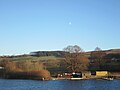 Moon above Pooley Bridge - geograph.org.uk - 5644347.jpg 4,608 × 3,456; 3.16 MB
-
 Mount Pleasant - geograph.org.uk - 2369262.jpg 2,048 × 1,536; 1.88 MB
-
 Mount Pleasant - geograph.org.uk - 2650782.jpg 3,648 × 2,736; 2.64 MB
-
 Myers Beck - geograph.org.uk - 3880618.jpg 3,872 × 2,592; 4.87 MB
-
 New Bailey bridge, Pooley Bridge - geograph.org.uk - 5026560.jpg 1,024 × 683; 1.02 MB
-
 Newbiggin - geograph.org.uk - 2595709.jpg 640 × 427; 228 KB
-
 Newbiggin village - geograph.org.uk - 4404856.jpg 2,592 × 1,944; 1.27 MB
-
 Newbiggin Village Hall - geograph.org.uk - 5047597.jpg 640 × 480; 258 KB
-
 Newbiggin Wells - geograph.org.uk - 5047579.jpg 640 × 480; 394 KB
-
 Newly sown field near Laithes - geograph.org.uk - 2369259.jpg 2,048 × 1,536; 1.85 MB
-
 North end of Ullswater - geograph.org.uk - 6266818.jpg 4,000 × 3,000; 6.4 MB
-
 Now, there's real magic for you^ - geograph.org.uk - 5338288.jpg 800 × 535; 69 KB
-
 Oak Tree at the rear of Dalemain House - geograph.org.uk - 1978191.jpg 3,968 × 2,976; 2.07 MB
-

-


