Category:Dauphin Island, Alabama
Naar navigatie springen
Naar zoeken springen
plaats in Alabama    | |||||
| Media uploaden | |||||
| Is een | |||||
|---|---|---|---|---|---|
| Vernoemd naar | |||||
| Locatie | Mobile County, Alabama, VS | ||||
| Gelegen in of aan waterlichaam | |||||
| Datum van oprichting of creatie |
| ||||
| Inwonertal |
| ||||
| Oppervlakte |
| ||||
| Hoogte boven de zeespiegel |
| ||||
| Niet gelijk aan | |||||
| officiële website | |||||
 | |||||
Ondercategorieën
Deze categorie bevat de volgende 9 subcategorieën, van de 9 in totaal.
Media in categorie "Dauphin Island, Alabama"
Deze categorie bevat de volgende 55 bestanden, van in totaal 55.
-
 Alabama's Coastal Connection - Lone Golfer at Isle Dauphin Country Club - NARA - 7716837.jpg 2.256 × 1.496; 1,04 MB
-
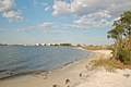 Alabama's Coastal Connection - Shoreline on Dauphin Island - NARA - 7716836.jpg 2.256 × 1.496; 747 kB
-
-

-
 Alligator (7093892383).jpg 3.276 × 2.624; 2,33 MB
-
 ALMap-doton-DauphinIsland.PNG 193 × 300; 13 kB
-
 Beach cleaner.jpg 3.072 × 2.304; 2,67 MB
-
 Beach erosion caused by Hurricane Frederic (Dauphin Island, Alabama).jpg 500 × 609; 230 kB
-
 Beach Scene on Dauphin Island, Alabama LCCN2010637015.tif 6.144 × 4.096; 144,04 MB
-
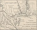 Carte de l'embouchure du Mississippi et des rivières voisines en 1718.jpg 1.853 × 1.508; 1,01 MB
-
 Cleanup site near protected area (4907415405).jpg 3.072 × 2.304; 2,54 MB
-
 Dauphin Island - After End of AL193 (46878740082).jpg 3.600 × 2.400; 3,86 MB
-
 Dauphin Island 06May2010 01.JPG 4.272 × 2.848; 2 MB
-
 Dauphin Island 06May2010 02.JPG 4.272 × 2.848; 1,56 MB
-
 Dauphin island crest.jpg 431 × 617; 81 kB
-
 Dauphin Island hatchlings (4887323261).jpg 3.072 × 2.304; 3,03 MB
-
 Dauphin Island is a town in Mobile County, Alabama LCCN2010637937.tif 5.226 × 3.582; 107,16 MB
-
 Dauphin Island is a town in Mobile County, Alabama LCCN2010637943.tif 4.096 × 6.144; 144,05 MB
-
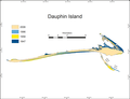 Dauphin Island map.png 1.259 × 963; 108 kB
-
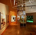
 Dauphin Island Sea Lab-1.jpg 2.048 × 1.536; 1,31 MB
-
 Dauphin Island Sea Lab-2.jpg 2.048 × 1.536; 1,42 MB
-
 Dauphin Island Sea Lab-3.jpg 2.048 × 1.536; 1,35 MB
-
 Dauphin Island Sea Lab-5.jpg 2.048 × 1.536; 1,29 MB
-
 Dauphin Island, AL, USA - panoramio (1).jpg 4.288 × 2.848; 1,69 MB
-
 Dauphin Island, AL, USA - panoramio.jpg 4.231 × 2.792; 2,22 MB
-
 Dauphin Island, beach, sunset, Digitizedchaos - 4186131193.jpg 1.024 × 734; 474 kB
-
 Dauphin Island, beach, sunset, Digitizedchaos - 4186891804.jpg 1.024 × 767; 537 kB
-
 Dauphin Island, Half dry.jpg 900 × 600; 259 kB
-
 DauphinIslandSeaLabcropped.jpg 2.304 × 1.424; 397 kB
-
 DIHouse.JPG 1.600 × 1.200; 477 kB
-
 FEMA - 1134 -Project Impact principles - House on Dauphin Island.jpg 300 × 207; 34 kB
-
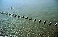
 Fishing houses line the beach on Dauphin Island, Alabama LCCN2010637014.tif 4.096 × 4.908; 115,07 MB
-
 Fishing houses line the beach on Dauphin Island, Alabama LCCN2010646323.tif 4.500 × 3.185; 82,05 MB
-
 Fredericbrpic.JPG 1.349 × 860; 255 kB
-
 Gordon Persons Bridge 06May2010 03.JPG 4.272 × 2.848; 1,77 MB
-
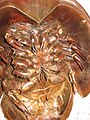 Horseshoe Crab 6.jpg 1.536 × 2.048; 453 kB
-
 June 3, Analyzing data in a mobile lab, Dauphin Island, Ala (4682435979).jpg 4.256 × 2.832; 1,05 MB
-
 June 3, Taga bus monitors air in Dauphin Island, Ala (4683065700).jpg 4.256 × 2.832; 2,11 MB
-
 Laughing Gull perched on safety sign, Dauphin Island, Alabama.jpg 3.072 × 2.304; 2,81 MB
-
 Life on Dauphin Island - panoramio.jpg 2.544 × 1.888; 1,98 MB
-
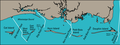 Mississippi-Alabama barrier islands.png 1.677 × 623; 262 kB
-

-
 Ocean Buoy - panoramio.jpg 2.512 × 1.888; 1,07 MB
-
 Oil Platform (7098674067).jpg 2.053 × 2.054; 251 kB
-
 Pettit Bois 1840 chart.png 859 × 714; 1,23 MB
-
 Post0073 - Flickr - NOAA Photo Library.jpg 1.800 × 1.200; 1,16 MB
-
 Protected bird area Dauphin Island (4907422965).jpg 3.072 × 2.304; 2,55 MB
-
 Rebirth - panoramio.jpg 2.560 × 1.840; 1,51 MB
-
 Turtle at Dauphin Island Estuarium.JPG 4.608 × 3.456; 3,38 MB
-
 Unique house on Dauphin Island, Alabama LCCN2010637018.tif 6.144 × 4.096; 144,04 MB
-

-

-

-
 Vessel of Opportunity (4908009218).jpg 3.072 × 2.304; 3,06 MB
-
 VOO Boat Operator Holds open kennel for bird (4910148413).jpg 4.000 × 3.000; 4,96 MB


.jpg)

.jpg)

.jpg)
.jpg)

.jpg)


.jpg)


.jpg)
.jpg)


.jpg)


.jpg)


.jpg)
.jpg)