Category:De Liefde, Uithuizen
Jump to navigation
Jump to search
| Object location | | View all coordinates using: OpenStreetMap |
|---|
windmill in Uithuizen, Netherlands  | |||||
| Upload media | |||||
| Instance of | |||||
|---|---|---|---|---|---|
| Location | Uithuizen, Groningen, Netherlands | ||||
| Street address |
| ||||
| Located on street |
| ||||
| Has use | |||||
| Heritage designation |
| ||||
| Inception |
| ||||
| Source of energy | |||||
 | |||||
Nederlands: De Liefde, voorheen De Jonge Jan
|
This is a category about rijksmonument number 21308
|
| Address |
|
Media in category "De Liefde, Uithuizen"
The following 18 files are in this category, out of 18 total.
-

-

-

-

-

-

-

-
 De liefde.jpg 275 × 367; 25 KB
-
 Koren- en Pelmolen, "Jonge Jan", aanzicht - Uithuizen - 20211294 - RCE.jpg 1,200 × 1,179; 251 KB
-
 Molen de Liefde Uithuizen.jpg 972 × 1,296; 304 KB
-
 Molen de Liefde Uithuizen2.jpg 854 × 1,155; 207 KB
-
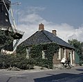
 Sarrieshut.jpg 604 × 453; 76 KB
-

-
 VVV kantoor bij achtkante stellingmolen - AMR Molenfoto - 20540199 - RCE.jpg 1,200 × 900; 212 KB
-
 VVV kantoor bij achtkante stellingmolen - AMR Molenfoto - 20540200 - RCE.jpg 1,200 × 900; 215 KB
-
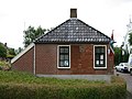
 Woonhuizen bij achtkante stellingmolen - AMR Molenfoto - 20540198 - RCE.jpg 1,200 × 900; 213 KB
-
-


_-_Uithuizen_-_20365742_-_RCE.jpg)
_-_Uithuizen_-_20369088_-_RCE.jpg)