Category:De Ooijevaar, Zaandam
Jump to navigation
Jump to search
| Object location | | View all coordinates using: OpenStreetMap |
|---|
windmill in Zaandam, Netherlands  | |||||
| Upload media | |||||
| Instance of | |||||
|---|---|---|---|---|---|
| Location | Zaandam, Zaanstad, North Holland, Netherlands | ||||
| Street address |
| ||||
| Located on street |
| ||||
| Has use | |||||
| Heritage designation |
| ||||
| Source of energy | |||||
 | |||||
Nederlands: De Ooijevaar (ook wel als De Ooievaar gespeld) is een oliemolen direct ten zuiden van de Zaanse Schans in de gemeente Zaanstad.
|
This is a category about rijksmonument number 40032
|
| Address |
|
Media in category "De Ooijevaar, Zaandam"
The following 22 files are in this category, out of 22 total.
-

-

-

-

-

-

-
 De Ooijevaar.JPG 1,360 × 1,019; 262 KB
-
 Interieur van achtkante stellingmolen - AMR Molenfoto - 20539378 - RCE.jpg 1,200 × 900; 219 KB
-
 Molen "De Ooievaar", tijdens restauratie - Zaandam - 20219057 - RCE.jpg 875 × 1,200; 210 KB
-
 Molen de Ooievaar, Zaandam.jpg 2,048 × 1,536; 560 KB
-
 Molen De Ooijevaar.jpg 1,536 × 2,048; 1.06 MB
-
 Molen De Ooijevaar2.jpg 1,536 × 2,048; 1.15 MB
-
 Molen Ooievaar - panoramio.jpg 2,736 × 3,648; 3.12 MB
-
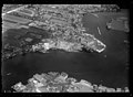 NIMH - 2011 - 0650 - Aerial photograph of Zaandijk, The Netherlands - 1920 - 1940.jpg 3,500 × 2,554; 1.69 MB
-
 Oliemolen "De Ooievaar", roeden vernieuwd - Zaandam - 20219094 - RCE.jpg 1,200 × 1,185; 243 KB
-
 Schuur bij achtkante stellingmolen - AMR Molenfoto - 20539376 - RCE.jpg 1,200 × 900; 142 KB
-

-
 Zaandam molen De Ooijevaar.jpg 1,856 × 1,803; 1.97 MB
-
Zaandam onze stad Acte 1 - Open Beelden - 3998.ogv 10 min 7 s, 320 × 240; 52.46 MB
-
 Zaandam, De Ooijevaar - RM40032.JPG 5,184 × 3,456; 5.63 MB
-
 Zaandijk - Julianabrug - View South on Oil Mill 'De Ooievaar' 1669.jpg 3,024 × 2,016; 2.38 MB
-
 Zaanse Schans 12 - De Ooijevaar, Zaandam.jpg 1,704 × 2,272; 1.17 MB


